Filters: Tags: Tucson (X)
46 results (36ms)|
Filters
Date Range
Extensions Types Contacts
Categories Tag Types Tag Schemes |
This data set contains imagery from the National Agriculture Imagery Program (NAIP). The NAIP program is administered by USDA FSA and has been established to support two main FSA strategic goals centered on agricultural production. These are, increase stewardship of America's natural resources while enhancing the environment, and to ensure commodities are procured and distributed effectively and efficiently to increase food security. The NAIP program supports these goals by acquiring and providing ortho imagery that has been collected during the agricultural growing season in the U.S. The NAIP ortho imagery is tailored to meet FSA requirements and is a fundamental tool used to support FSA farm and conservation programs....
ADMMR map collection: Monitor Mine, Claim Map; 1 in. to 2000 feet; 18 x 19 in.
This location is part of the Arizona Mineral Industry Location System (AzMILS), an inventory of mineral occurences, prospects and mine locations in Arizona. Pinal124A is located in T2S R14E Sec 31 N2 in the Hot Tamale Peak - 7.5 Min quad. This collection consists of various reports, maps, records and related materials acquired by the Arizona Department of Mines and Mineral Resources regarding mining properties in Arizona. Information was obtained by various means, including the property owners, exploration companies, consultants, verbal interviews, field visits, newspapers and publications. Some sections may be redacted for copyright. Please see the access statement.
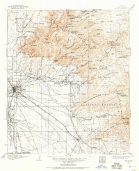
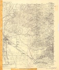
USGS Historical Quadrangle in GeoPDF.

USGS Historical Quadrangle in GeoPDF.
ADMMR map collection: Monitor Mine on Regional Geology and Index Map of Central Pinal County, Arizona; 1 in. to 6 miles; 10 x 12 in.
This data set contains imagery from the National Agriculture Imagery Program (NAIP). The NAIP program is administered by USDA FSA and has been established to support two main FSA strategic goals centered on agricultural production. These are, increase stewardship of America's natural resources while enhancing the environment, and to ensure commodities are procured and distributed effectively and efficiently to increase food security. The NAIP program supports these goals by acquiring and providing ortho imagery that has been collected during the agricultural growing season in the U.S. The NAIP ortho imagery is tailored to meet FSA requirements and is a fundamental tool used to support FSA farm and conservation programs....
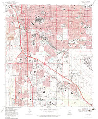
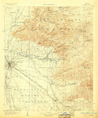
USGS Historical Quadrangle in GeoPDF.
USGS Historical Quadrangle in GeoPDF.

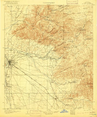
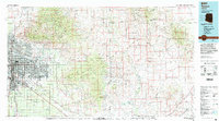
USGS Historical Quadrangle in GeoPDF.
USGS Historical Quadrangle in GeoPDF.
This dataset supercedes an earlier data release and includes all previous data in addition to data from 2019. These data represent the network-adjusted results of relative- and absolute-gravity surveys. Relative-gravity surveys were carried out using a Micro-g LaCoste D-series relative-gravity meter. The effect of solid Earth tides and ocean loading were removed from the data. Instrument drift was removed by evaluating gravity change during repeated measurements at one or more base stations. Absolute-gravity surveys were carried out using a Micro-g LaCoste, Inc. A-10 absolute-gravity meter. Vertical gradients between the different measuring heights of the absolute- and relative-gravity meters were measured using...
Categories: Data;
Types: Downloadable,
Map Service,
OGC WFS Layer,
OGC WMS Layer,
Shapefile;
Tags: Arizona,
Arizona Water Science Center,
Avra Valley,
Southwest Gravity Program,
Tucson,
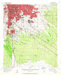
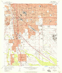
USGS Historical Quadrangle in GeoPDF.
USGS Historical Quadrangle in GeoPDF.
USGS Historical Quadrangle in GeoPDF.
Relative-gravity surveys were carried out using a ZLS Burris relative-gravity meter. The effect of solid Earth tides and ocean loading were removed from the data. Instrument drift was removed by evaluating gravity change during repeated measurements at one or more base stations. Absolute-gravity surveys were carried out using a Micro-g LaCoste, Inc. A-10 absolute-gravity meter. Vertical gradients between the different measuring heights of the absolute- and relative-gravity meters were measured using a relative-gravity meter and fully-adjustable tripod, and used to correlate the measurements between the two instruments. Relative-gravity differences and absolute-gravity data were combined using a least-squares network...
This data set contains imagery from the National Agriculture Imagery Program (NAIP). The NAIP program is administered by USDA FSA and has been established to support two main FSA strategic goals centered on agricultural production. These are, increase stewardship of America's natural resources while enhancing the environment, and to ensure commodities are procured and distributed effectively and efficiently to increase food security. The NAIP program supports these goals by acquiring and providing ortho imagery that has been collected during the agricultural growing season in the U.S. The NAIP ortho imagery is tailored to meet FSA requirements and is a fundamental tool used to support FSA farm and conservation programs....
ADMMR map collection: Monitor Mine, Claim Map; 1 in. to 1000 feet; 32 x 30 in.
Relative-gravity surveys were carried out using a ZLS Burris relative-gravity meter. The effect of solid Earth tides and ocean loading were removed from the data. Instrument drift was removed by evaluating gravity change during repeated measurements at one or more base stations. Absolute-gravity surveys were carried out using a Micro-g LaCoste, Inc. A-10 absolute-gravity meter. Vertical gradients between the different measuring heights of the absolute- and relative-gravity meters were measured using a relative-gravity meter and fully-adjustable tripod, and used to correlate the measurements between the two instruments. Relative-gravity differences and absolute-gravity data were combined using a least-squares network...
Categories: Data;
Types: Map Service,
OGC WFS Layer,
OGC WMS Layer,
OGC WMS Service;
Tags: Arizona,
Arizona Water Science Center,
Heritage,
Southwest Gravity Program,
Tucson,
USGS Historical Quadrangle in GeoPDF.
|

|
