Filters: Tags: Tuscarora (X)
15 results (54ms)|
Filters
Date Range
Extensions Types Contacts
Categories Tag Types Tag Schemes |
Mule deer in the South Tuscarora herd are part of the larger “Area 6” deer population that reside in the southern and eastern portion of this big game Management Area (MA 6). The winter range for this sub population is located along the western slopes of the Tuscarora Mountains and the Dunphy Hills. The spring migration route for this deer herd traverses north along the toe slopes of the Tuscarora Mountains on the east side and narrows to approximately 600 meters at one pinch point near the Carlin -Pete Mine area. The migration route generally spans about 30 miles to the northeast to higher elevations in the northern Tuscarora Mountains. Important stopover areas include Richmond Mountain, Jack and Little Jack Creeks,...
Categories: Data;
Types: Downloadable,
Map Service,
OGC WFS Layer,
OGC WMS Layer,
Shapefile;
Tags: Carlin,
Nevada,
Tuscarora,
USA,
animal behavior,
This data set contains imagery from the National Agriculture Imagery Program (NAIP). The NAIP program is administered by USDA FSA and has been established to support two main FSA strategic goals centered on agricultural production. These are, increase stewardship of America's natural resources while enhancing the environment, and to ensure commodities are procured and distributed effectively and efficiently to increase food security. The NAIP program supports these goals by acquiring and providing ortho imagery that has been collected during the agricultural growing season in the U.S. The NAIP ortho imagery is tailored to meet FSA requirements and is a fundamental tool used to support FSA farm and conservation programs....
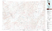
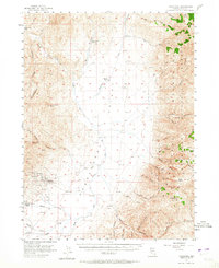
USGS Historical Quadrangle in GeoPDF.
Hanging Rock. Tuscarora sandstone at end of Sworn Mountain (A 12). Williamsport quadrangle. Maryland. No date.
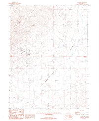
USGS Historical Quadrangle in GeoPDF.
Mule deer in the South Tuscarora herd are part of the larger “Area 6” deer population that reside in the southern and eastern portion of this big game Management Area (MA 6). The winter range for this sub population is located along the western slopes of the Tuscarora Mountains and the Dunphy Hills. The spring migration route for this deer herd traverses north along the toe slopes of the Tuscarora Mountains on the east side and narrows to approximately 600 meters at one pinch point near the Carlin -Pete Mine area. The migration route generally spans about 30 miles to the northeast to higher elevations in the northern Tuscarora Mountains. Important stopover areas include Richmond Mountain, Jack and Little Jack Creeks,...
Categories: Data;
Types: Downloadable,
Map Service,
OGC WFS Layer,
OGC WMS Layer,
Shapefile;
Tags: Carlin,
Nevada,
Tuscarora,
USA,
animal behavior,
This data set contains imagery from the National Agriculture Imagery Program (NAIP). The NAIP program is administered by USDA FSA and has been established to support two main FSA strategic goals centered on agricultural production. These are, increase stewardship of America's natural resources while enhancing the environment, and to ensure commodities are procured and distributed effectively and efficiently to increase food security. The NAIP program supports these goals by acquiring and providing ortho imagery that has been collected during the agricultural growing season in the U.S. The NAIP ortho imagery is tailored to meet FSA requirements and is a fundamental tool used to support FSA farm and conservation programs....
Hanging Rock, side view. Tuscarora sandstone at end of Sworn Mountain (A 12). Williamsport quadrangle. Maryland. No date.
This data set contains imagery from the National Agriculture Imagery Program (NAIP). The NAIP program is administered by USDA FSA and has been established to support two main FSA strategic goals centered on agricultural production. These are, increase stewardship of America's natural resources while enhancing the environment, and to ensure commodities are procured and distributed effectively and efficiently to increase food security. The NAIP program supports these goals by acquiring and providing ortho imagery that has been collected during the agricultural growing season in the U.S. The NAIP ortho imagery is tailored to meet FSA requirements and is a fundamental tool used to support FSA farm and conservation programs....
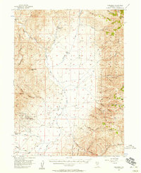
USGS Historical Quadrangle in GeoPDF.
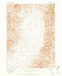
USGS Historical Quadrangle in GeoPDF.
Mule deer in the South Tuscarora herd are part of the larger “Area 6” deer population that reside in the southern and eastern portion of this big game Management Area (MA 6). The winter range for this sub population is located along the western slopes of the Tuscarora Mountains and the Dunphy Hills. The spring migration route for this deer herd traverses north along the toe slopes of the Tuscarora Mountains on the east side and narrows to approximately 600 meters at one pinch point near the Carlin -Pete Mine area. The migration route generally spans about 30 miles to the northeast to higher elevations in the northern Tuscarora Mountains. Important stopover areas include Richmond Mountain, Jack and Little Jack Creeks,...
Categories: Data;
Types: Downloadable,
Map Service,
OGC WFS Layer,
OGC WMS Layer,
Shapefile;
Tags: Carlin,
Nevada,
Tuscarora,
USA,
animal behavior,
This data set contains imagery from the National Agriculture Imagery Program (NAIP). The NAIP program is administered by USDA FSA and has been established to support two main FSA strategic goals centered on agricultural production. These are, increase stewardship of America's natural resources while enhancing the environment, and to ensure commodities are procured and distributed effectively and efficiently to increase food security. The NAIP program supports these goals by acquiring and providing ortho imagery that has been collected during the agricultural growing season in the U.S. The NAIP ortho imagery is tailored to meet FSA requirements and is a fundamental tool used to support FSA farm and conservation programs....
USGS Historical Quadrangle in GeoPDF.
|

|
