Filters: Tags: Tutuila Island (X)
8 results (1.2s)|
Filters
Date Range
Types Contacts
Categories Tag Types Tag Schemes |
This data release provides flooding extent polygons based on sea-level rise and wave-driven total water levels for the coast of American Samoa's most populated islands of Tutuila, Ofu-Olosega, and Tau. Oceanographic, coastal engineering, ecologic, and geospatial data and tools were combined to evaluate the increased risks of storm-induced coastal flooding due to climate change and sea-level rise. We followed risk-based valuation approaches to map flooding due to waves and storm surge at 10-m2 resolution along these islands coastlines for annual (1-year), 20-year, and 100-year return-interval storm events and +0.25 m, +0.50 m, +1.00 m, +1.50 m, +2.00 m, and +3.00 m sea-level rise scenarios.
Categories: Data;
Tags: CMHRP,
Climate Change,
Coastal Processes,
Coastal and Marine Hazards and Resources Program,
Earth sciences,
This data release provides flooding extent polygons and flood depth rasters (geotiffs) based on sea-level rise and wave-driven total water levels for the coast of the most populated Hawaiian, Mariana, and American Samoan Islands. Oceanographic, coastal engineering, ecologic, and geospatial data and tools were combined to evaluate the increased risks of storm-induced coastal flooding due to climate change and sea-level rise. We followed risk-based valuation approaches to map flooding due to waves and storm surge at 10 square meter resolution along these islands’ coastlines for annual (1-year), 20-year, and 100-year return-interval storm events and +0.25 m, +0.50 m, +1.00 m, +1.50 m, +2.00 m, and +3.00 m sea-level...
Categories: Data;
Tags: CMHRP,
Climate Change,
Climatology,
Coastal Processes,
Coastal and Marine Hazards and Resources Program,
Spatial surveys of water column physical properties were acquired with a conductivity-temperature-depth (CTD) profiler for four days in February 2015 and one day in July 2015 off the north coast of the island of Tutuila, American Samoa in support of a study on the coastal circulation patterns within and in the vicinity of the National Park of American Samoa.
Categories: Data;
Types: Citation,
Map Service,
OGC WFS Layer,
OGC WMS Layer,
OGC WMS Service;
Tags: CMGP,
CONDUCTIVITY,
CORAL REEFS,
Coastal and Marine Geology Program,
DENSITY,
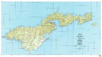
USGS Historical Quadrangle in GeoPDF.
Satellite-tracked, DGPS-equipped Lagrangian surface-current drifter deployments were conducted over 12 weeks between 14 April and 7 July 2015 at various locations within and offshore of the National Park of American Samoa study area to track surface currents. The drifters internally logged their location every 1 minute, and they transmitted their positions to satellites every 5 minutes. A drogue was attached to the drifters at 1 m below sea level in order to track the currents at that depth.
Categories: Data;
Types: Citation;
Tags: CORAL REEFS,
National Park of American Samoa,
OCEAN CURRENTS,
Ocean Circulation,
Oceans,
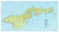
USGS Historical Quadrangle in GeoPDF.
This data release provides flood depth GeoTIFFs based on sea-level rise and wave-driven total water levels for the coast of the American Samoa’s most populated islands of Tutuila, Ofu-Olosega, and Tau. Oceanographic, coastal engineering, ecologic, and geospatial data and tools were combined to evaluate the increased risks of storm-induced coastal flooding in the populated American Samoan Islands due to climate change and sea-level rise. We followed risk-based valuation approaches to map flooding due to waves and storm surge at 10-m2 resolution along the coastlines for annual (1-year), 20-year, and 100-year return-interval storm events and +0.25 m, +0.50 m, +1.00 m, +1.50 m, +2.00 m, and +3.00 m sea-level rise scenarios.
Categories: Data;
Tags: CMHRP,
Climate Change,
Coastal Processes,
Coastal and Marine Hazards and Resources Program,
Earth sciences,
This data table includes in-situ near-shore seawater measurements of excess radon (Rn-222) and water levels collected in Faga'alu Bay, Tutuila, American Samoa.
Categories: Data;
Tags: CMHRP,
Coastal and Marine Hazards and Resources Program,
Faga'alu Bay,
Faga’alu,
Oceans,
|

|
