Filters: Tags: Tyonek (X)
15 results (65ms)|
Filters
Date Range
Contacts
Tag Types Tag Schemes
|
Cook Inlet has been recognized as the second-largest petroleum province in Alaska, second only to the North Slope. The south-central Tyonek Quadrangle is an area of significant geologic interest because it is the only location in Cook Inlet where the entire producing stratigraphy of the basin is exposed on the surface. Additionally, this area encompasses the structural boundary between the forearc basin and its sediment source rocks. To better understand the petroleum system and the geologic relationships between the exhumed arc intrusive rocks and adjacent Cenozoic stratigraphy of the Cook Inlet forearc basin, during the summer of 2010 the Alaska Division of Geological & Geophysical Surveys conducted a federally-funded...
This data set conveys information about samples collected during fieldwork in the Tyonek area of Cook Inlet. Samples were collected from outcrops for Mercury Injection Capillary Pressure (MICP) analyses.
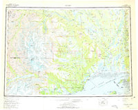
USGS Historical Quadrangle in GeoPDF.
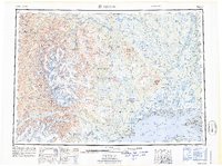
USGS Historical Quadrangle in GeoPDF.
The Tyonek area in the northwestern Cook Inlet trough is rich in petroleum, coal, geothermal, aggregate, and timber resources, but the detailed geologic mapping necessary for planning future resource development exists only in part of the area. This report and geologic map provide basic surficial-geologic information useful for exploiting those resources and planning future utility corridor developments. In addition to mapping of surficial geologic units, we provide discussion of strategraphic evidence pertaining to physiographic relations and geologic history of volcaniclastic deposits derived from ancestral Mount Spurr, multiple phases of Quaternary glacial activity, Chakachatna River valley landslide complexes...
This map shows the subcrop pattern of the Mesozoic rock units present at the top Mesozoic unconformity (also commonly referred to as the base Tertiary unconformity) in Cook Inlet basin, Alaska. The subcrop is projected onto the top Mesozoic unconformity depth surface of Cook Inlet basin, Alaska, published by Shellenbaum and others (2010). Publicly available geologic and geophysical data from multiple sources were collected, interpreted, and integrated into the subcrop map. Formation picks at the top Mesozoic unconformity were determined for 109 wells. Mesozoic horizons from two regional marine two-dimensional (2-D) seismic datasets (approximately 3,300 miles) were interpreted. Eight map units were established for...
The State of Alaska Division of Geological & Geophysical Surveys (DGGS) and Division of Oil & Gas (DOG) are currently engaged in a multi-year study of the hydrocarbon potential of the Tertiary and Mesozoic strata in Cook Inlet basin. Modal analyses and routine core analyses were performed on Tertiary and Mesozoic siltstones and sandstones collected during the 2007-2010 field seasons from six geographic areas in upper and lower Cook Inlet. The reservoir quality of Cook Inlet sandstones varies widely depending on their mineralogy, geologic age, burial depth, and depositional environment. Tuxedni and Naknek sandstones have poor reservoir quality and are likely to be of equally poor quality down dip. West Foreland sandstones...
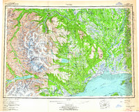
USGS Historical Quadrangle in GeoPDF.
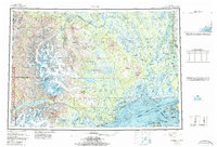
USGS Historical Quadrangle in GeoPDF.
USGS Historical Quadrangle in GeoPDF.
USGS Historical Quadrangle in GeoPDF.
USGS Historical Quadrangle in GeoPDF.

USGS Historical Quadrangle in GeoPDF.

USGS Historical Quadrangle in GeoPDF.
USGS Historical Quadrangle in GeoPDF.
|

|
