Filters
Date Range
Contacts
Tag Types
Tag Schemes
|

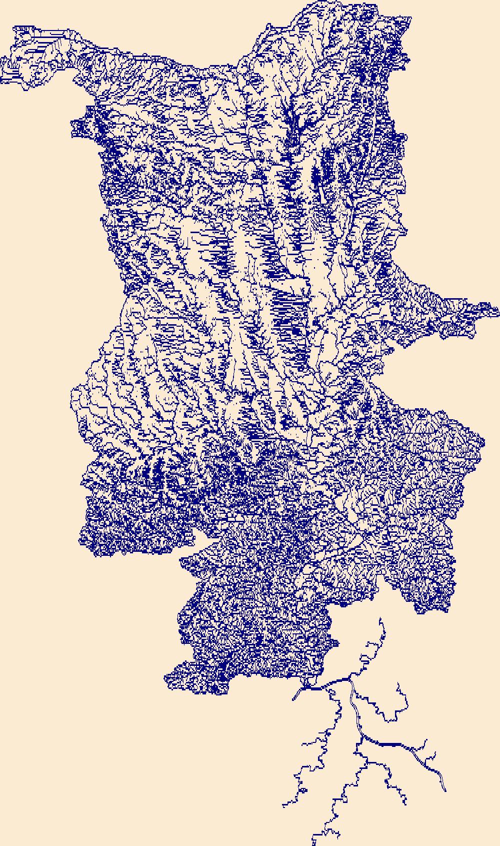
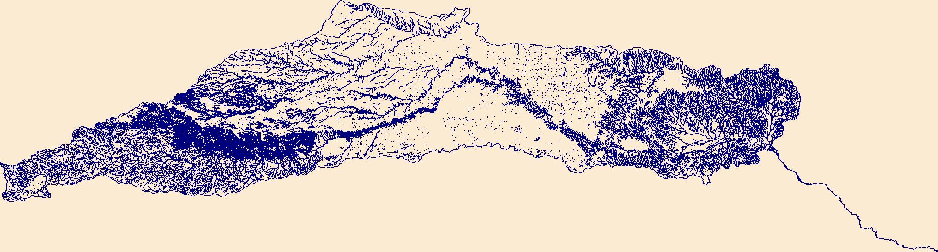
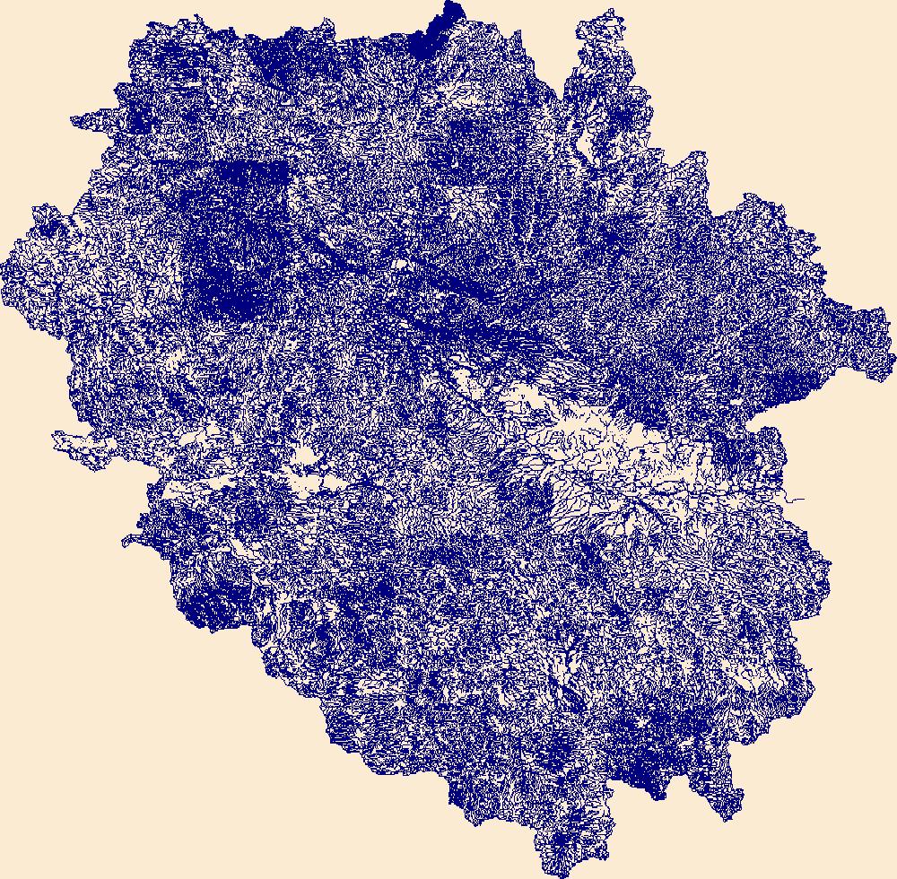
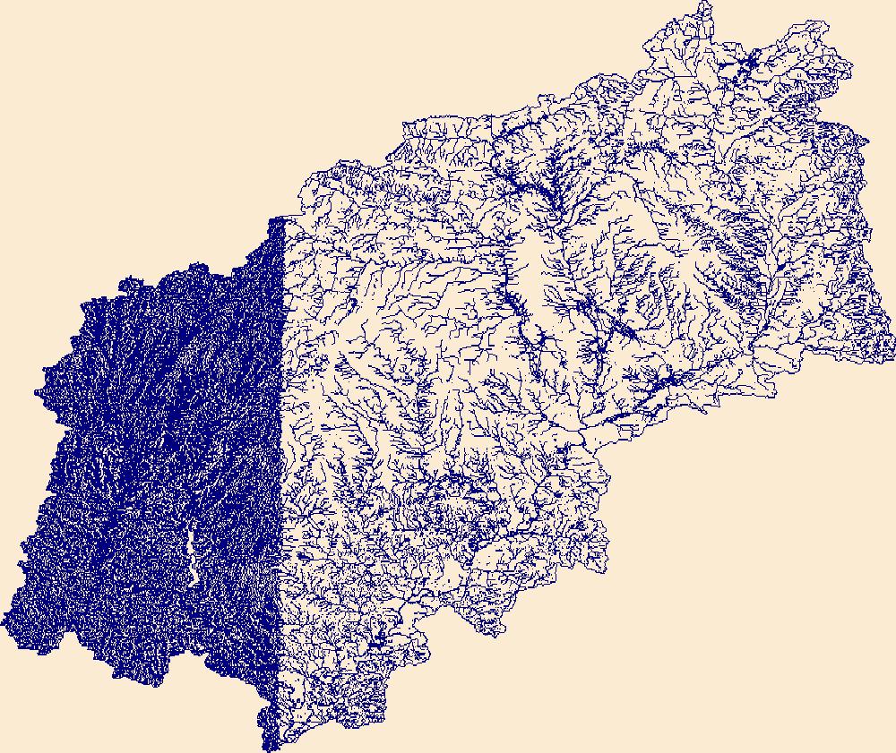
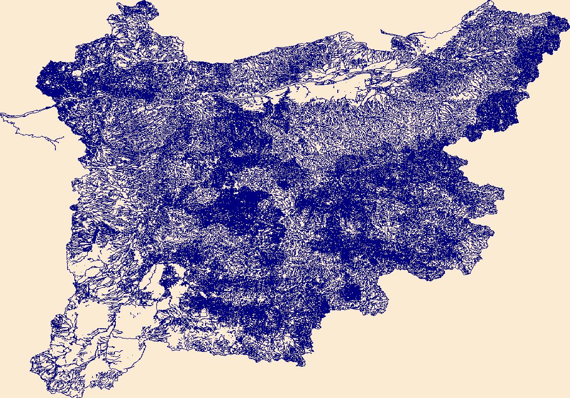
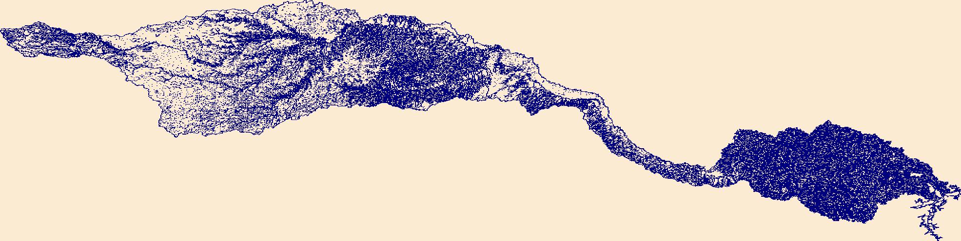
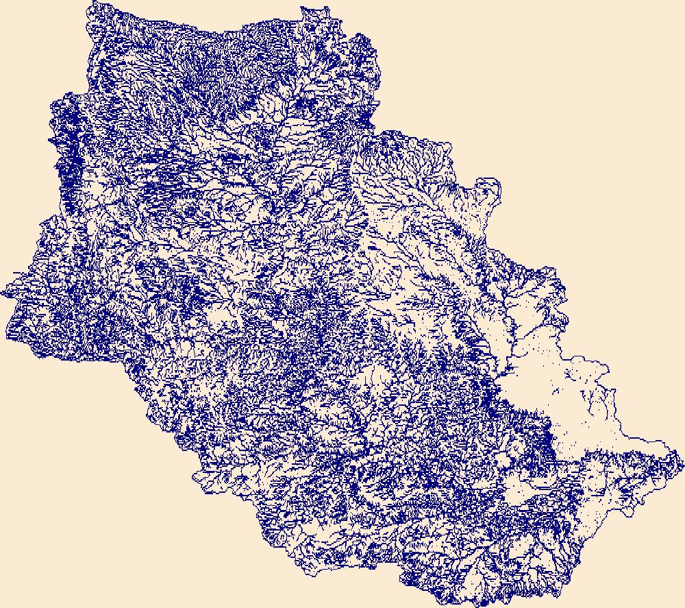
The High Resolution National Hydrography Dataset Plus (NHDPlus HR) is an integrated set of geospatial data layers, including the best available National Hydrography Dataset (NHD), the 10-meter 3D Elevation Program Digital Elevation Model (3DEP DEM), and the National Watershed Boundary Dataset (WBD). The NHDPlus HR combines the NHD, 3DEP DEMs, and WBD to create a stream network with linear referencing, feature naming, "value added attributes" (VAAs), elevation-derived catchments, and other features for hydrologic data analysis. The stream network with linear referencing is a system of data relationships applied to hydrographic systems so that one stream reach "flows" into another and "events" can be tied to and traced...
Tags: Adams County,
Adams County,
Asotin County,
Baker County,
Beaverhead County, All tags...
Benewah County,
Blaine County,
Boise County,
Camas County,
Clearwater County,
Columbia County,
Custer County,
Downloadable Data,
Elmore County,
FileGDB,
FileGDB 10.1,
Franklin County,
Garfield County,
Grant County,
HU-4 Subregion,
HU-4 Subregion,
HU4_1706,
Hydrography,
ID,
Idaho,
Idaho County,
Latah County,
Lemhi County,
Lewis County,
Lincoln County,
MT,
Mineral County,
Missoula County,
Montana,
NHDPlus HR Rasters,
NHDPlus High Resolution (NHDPlus HR),
National Hydrography Dataset (NHD),
National Hydrography Dataset Plus High Resolution (NHDPlus HR),
National Hydrography Dataset Plus High Resolution (NHDPlus HR) Current,
Nez Perce County,
OR,
Oregon,
Ravalli County,
Shoshone County,
Spokane County,
US,
Umatilla County,
Union County,
United States,
Valley County,
WA,
Walla Walla County,
Wallowa County,
Washington,
Whitman County,
base maps,
cartography,
catchments,
channels,
digital elevation models,
drainage basins,
earth sciences,
elevation,
environment,
geographic information systems,
geoscientific,
geospatial analysis,
hydrographic datasets,
hydrographic features,
hydrology,
imagery,
inland waters,
lakes,
land surface characteristics,
reservoirs,
river reaches,
rivers,
streamflow,
streamflow data,
streams,
topography,
water bodies,
water quality,
water resources,
watersheds, Fewer tags

The High Resolution National Hydrography Dataset Plus (NHDPlus HR) is an integrated set of geospatial data layers, including the best available National Hydrography Dataset (NHD), the 10-meter 3D Elevation Program Digital Elevation Model (3DEP DEM), and the National Watershed Boundary Dataset (WBD). The NHDPlus HR combines the NHD, 3DEP DEMs, and WBD to create a stream network with linear referencing, feature naming, "value added attributes" (VAAs), elevation-derived catchments, and other features for hydrologic data analysis. The stream network with linear referencing is a system of data relationships applied to hydrographic systems so that one stream reach "flows" into another and "events" can be tied to and traced...
Tags: Alamosa County,
Baca County,
Bent County,
CO,
Chaffee County, All tags...
Cheyenne County,
Colfax County,
Colorado,
Costilla County,
Crowley County,
Custer County,
Douglas County,
Downloadable Data,
Eagle County,
El Paso County,
Elbert County,
FileGDB,
FileGDB 10.1,
Fremont County,
Greeley County,
Gunnison County,
HU-4 Subregion,
HU-4 Subregion,
HU4_1102,
Hamilton County,
Huerfano County,
Hydrography,
KS,
Kansas,
Kiowa County,
Kit Carson County,
Lake County,
Las Animas County,
Lincoln County,
NHDPlus HR Rasters,
NHDPlus High Resolution (NHDPlus HR),
NM,
National Hydrography Dataset (NHD),
National Hydrography Dataset Plus High Resolution (NHDPlus HR),
National Hydrography Dataset Plus High Resolution (NHDPlus HR) Current,
New Mexico,
Otero County,
Park County,
Pitkin County,
Prowers County,
Pueblo County,
Saguache County,
Summit County,
Teller County,
US,
Union County,
United States,
base maps,
cartography,
catchments,
channels,
digital elevation models,
drainage basins,
earth sciences,
elevation,
environment,
geographic information systems,
geoscientific,
geospatial analysis,
hydrographic datasets,
hydrographic features,
hydrology,
imagery,
inland waters,
lakes,
land surface characteristics,
reservoirs,
river reaches,
rivers,
streamflow,
streamflow data,
streams,
topography,
water bodies,
water quality,
water resources,
watersheds, Fewer tags

The High Resolution National Hydrography Dataset Plus (NHDPlus HR) is an integrated set of geospatial data layers, including the best available National Hydrography Dataset (NHD), the 10-meter 3D Elevation Program Digital Elevation Model (3DEP DEM), and the National Watershed Boundary Dataset (WBD). The NHDPlus HR combines the NHD, 3DEP DEMs, and WBD to create a stream network with linear referencing, feature naming, "value added attributes" (VAAs), elevation-derived catchments, and other features for hydrologic data analysis. The stream network with linear referencing is a system of data relationships applied to hydrographic systems so that one stream reach "flows" into another and "events" can be tied to and traced...
Tags: Atoka County,
Blaine County,
Caddo County,
Canadian County,
Carson County, All tags...
Cimarron County,
Cleveland County,
Colfax County,
Curry County,
Custer County,
Dallam County,
Deaf Smith County,
Dewey County,
Downloadable Data,
Ellis County,
FileGDB,
FileGDB 10.1,
Garvin County,
Grady County,
Gray County,
HU-4 Subregion,
HU-4 Subregion,
HU4_1109,
Hansford County,
Harding County,
Hartley County,
Haskell County,
Hemphill County,
Hughes County,
Hutchinson County,
Hydrography,
Latimer County,
Lipscomb County,
McClain County,
McIntosh County,
Moore County,
Muskogee County,
NHDPlus HR Rasters,
NHDPlus High Resolution (NHDPlus HR),
NM,
National Hydrography Dataset (NHD),
National Hydrography Dataset Plus High Resolution (NHDPlus HR),
National Hydrography Dataset Plus High Resolution (NHDPlus HR) Current,
New Mexico,
OK,
Ochiltree County,
Oklahoma,
Oklahoma County,
Oldham County,
Pittsburg County,
Pontotoc County,
Pottawatomie County,
Potter County,
Quay County,
Randall County,
Roberts County,
Roger Mills County,
Seminole County,
TX,
Texas,
US,
Union County,
United States,
Woodward County,
base maps,
cartography,
catchments,
channels,
digital elevation models,
drainage basins,
earth sciences,
elevation,
environment,
geographic information systems,
geoscientific,
geospatial analysis,
hydrographic datasets,
hydrographic features,
hydrology,
imagery,
inland waters,
lakes,
land surface characteristics,
reservoirs,
river reaches,
rivers,
streamflow,
streamflow data,
streams,
topography,
water bodies,
water quality,
water resources,
watersheds, Fewer tags

The High Resolution National Hydrography Dataset Plus (NHDPlus HR) is an integrated set of geospatial data layers, including the best available National Hydrography Dataset (NHD), the 10-meter 3D Elevation Program Digital Elevation Model (3DEP DEM), and the National Watershed Boundary Dataset (WBD). The NHDPlus HR combines the NHD, 3DEP DEMs, and WBD to create a stream network with linear referencing, feature naming, "value added attributes" (VAAs), elevation-derived catchments, and other features for hydrologic data analysis. The stream network with linear referencing is a system of data relationships applied to hydrographic systems so that one stream reach "flows" into another and "events" can be tied to and traced...
Tags: Abbeville County,
Aiken County,
Alexander County,
Allendale County,
Anderson County, All tags...
Avery County,
Bamberg County,
Barnwell County,
Beaufort County,
Berkeley County,
Buncombe County,
Burke County,
Caldwell County,
Calhoun County,
Catawba County,
Charleston County,
Cherokee County,
Chester County,
Clarendon County,
Cleveland County,
Colleton County,
Dorchester County,
Downloadable Data,
Edgefield County,
Fairfield County,
FileGDB,
FileGDB 10.1,
Gaston County,
Georgetown County,
Greenville County,
Greenwood County,
HU-4 Subregion,
HU-4 Subregion,
HU4_0305,
Hampton County,
Henderson County,
Hydrography,
Iredell County,
Jasper County,
Kershaw County,
Lancaster County,
Laurens County,
Lee County,
Lexington County,
Lincoln County,
McDowell County,
Mecklenburg County,
Mitchell County,
NC,
NHDPlus HR Rasters,
NHDPlus High Resolution (NHDPlus HR),
National Hydrography Dataset (NHD),
National Hydrography Dataset Plus High Resolution (NHDPlus HR),
National Hydrography Dataset Plus High Resolution (NHDPlus HR) Current,
Newberry County,
North Carolina,
Orangeburg County,
Pickens County,
Polk County,
Richland County,
Rutherford County,
SC,
Saluda County,
South Carolina,
Spartanburg County,
Sumter County,
Transylvania County,
US,
Union County,
Union County,
United States,
Watauga County,
Wilkes County,
Williamsburg County,
Yancey County,
York County,
base maps,
cartography,
catchments,
channels,
digital elevation models,
drainage basins,
earth sciences,
elevation,
environment,
geographic information systems,
geoscientific,
geospatial analysis,
hydrographic datasets,
hydrographic features,
hydrology,
imagery,
inland waters,
lakes,
land surface characteristics,
reservoirs,
river reaches,
rivers,
streamflow,
streamflow data,
streams,
topography,
water bodies,
water quality,
water resources,
watersheds, Fewer tags
The High Resolution National Hydrography Dataset Plus (NHDPlus HR) is an integrated set of geospatial data layers, including the best available National Hydrography Dataset (NHD), the 10-meter 3D Elevation Program Digital Elevation Model (3DEP DEM), and the National Watershed Boundary Dataset (WBD). The NHDPlus HR combines the NHD, 3DEP DEMs, and WBD to create a stream network with linear referencing, feature naming, "value added attributes" (VAAs), elevation-derived catchments, and other features for hydrologic data analysis. The stream network with linear referencing is a system of data relationships applied to hydrographic systems so that one stream reach "flows" into another and "events" can be tied to and traced...
Tags: Adams County,
Allen County,
Auglaize County,
Champaign County,
Clark County, All tags...
Clinton County,
Crawford County,
Delaware County,
Downloadable Data,
Fairfield County,
Fayette County,
FileGDB,
FileGDB 10.1,
Franklin County,
Greene County,
Greenup County,
HU-4 Subregion,
HU-4 Subregion,
HU4_0506,
Hardin County,
Highland County,
Hocking County,
Hydrography,
Jackson County,
KY,
Kentucky,
Knox County,
Licking County,
Logan County,
Madison County,
Marion County,
Morrow County,
NHDPlus HR Rasters,
NHDPlus High Resolution (NHDPlus HR),
National Hydrography Dataset (NHD),
National Hydrography Dataset Plus High Resolution (NHDPlus HR),
National Hydrography Dataset Plus High Resolution (NHDPlus HR) Current,
OH,
Ohio,
Perry County,
Pickaway County,
Pike County,
Richland County,
Ross County,
Scioto County,
US,
Union County,
United States,
Vinton County,
Wyandot County,
base maps,
cartography,
catchments,
channels,
digital elevation models,
drainage basins,
earth sciences,
elevation,
environment,
geographic information systems,
geoscientific,
geospatial analysis,
hydrographic datasets,
hydrographic features,
hydrology,
imagery,
inland waters,
lakes,
land surface characteristics,
reservoirs,
river reaches,
rivers,
streamflow,
streamflow data,
streams,
topography,
water bodies,
water quality,
water resources,
watersheds, Fewer tags
The High Resolution National Hydrography Dataset Plus (NHDPlus HR) is an integrated set of geospatial data layers, including the best available National Hydrography Dataset (NHD), the 10-meter 3D Elevation Program Digital Elevation Model (3DEP DEM), and the National Watershed Boundary Dataset (WBD). The NHDPlus HR combines the NHD, 3DEP DEMs, and WBD to create a stream network with linear referencing, feature naming, "value added attributes" (VAAs), elevation-derived catchments, and other features for hydrologic data analysis. The stream network with linear referencing is a system of data relationships applied to hydrographic systems so that one stream reach "flows" into another and "events" can be tied to and traced...
Tags: Baca County,
Beaver County,
CO,
Cimarron County,
Clark County, All tags...
Colfax County,
Colorado,
Comanche County,
Downloadable Data,
FileGDB,
FileGDB 10.1,
Ford County,
Grant County,
Gray County,
HU-4 Subregion,
HU-4 Subregion,
HU4_1104,
Hamilton County,
Harper County,
Haskell County,
Hydrography,
KS,
Kansas,
Kearny County,
Kiowa County,
Las Animas County,
Meade County,
Morton County,
NHDPlus HR Rasters,
NHDPlus High Resolution (NHDPlus HR),
NM,
National Hydrography Dataset (NHD),
National Hydrography Dataset Plus High Resolution (NHDPlus HR),
National Hydrography Dataset Plus High Resolution (NHDPlus HR) Current,
New Mexico,
OK,
Oklahoma,
Prowers County,
Seward County,
Stanton County,
Stevens County,
Texas County,
US,
Union County,
United States,
Woods County,
base maps,
cartography,
catchments,
channels,
digital elevation models,
drainage basins,
earth sciences,
elevation,
environment,
geographic information systems,
geoscientific,
geospatial analysis,
hydrographic datasets,
hydrographic features,
hydrology,
imagery,
inland waters,
lakes,
land surface characteristics,
reservoirs,
river reaches,
rivers,
streamflow,
streamflow data,
streams,
topography,
water bodies,
water quality,
water resources,
watersheds, Fewer tags
The High Resolution National Hydrography Dataset Plus (NHDPlus HR) is an integrated set of geospatial data layers, including the best available National Hydrography Dataset (NHD), the 10-meter 3D Elevation Program Digital Elevation Model (3DEP DEM), and the National Watershed Boundary Dataset (WBD). The NHDPlus HR combines the NHD, 3DEP DEMs, and WBD to create a stream network with linear referencing, feature naming, "value added attributes" (VAAs), elevation-derived catchments, and other features for hydrologic data analysis. The stream network with linear referencing is a system of data relationships applied to hydrographic systems so that one stream reach "flows" into another and "events" can be tied to and traced...
Tags: Ada County,
Adams County,
Baker County,
Blaine County,
Boise County, All tags...
Camas County,
Canyon County,
Custer County,
Downloadable Data,
Elko County,
Elmore County,
FileGDB,
FileGDB 10.1,
Gem County,
Grant County,
HU-4 Subregion,
HU-4 Subregion,
HU4_1705,
Harney County,
Humboldt County,
Hydrography,
ID,
Idaho,
Idaho County,
Malheur County,
NHDPlus HR Rasters,
NHDPlus High Resolution (NHDPlus HR),
NV,
National Hydrography Dataset (NHD),
National Hydrography Dataset Plus High Resolution (NHDPlus HR),
National Hydrography Dataset Plus High Resolution (NHDPlus HR) Current,
Nevada,
OR,
Oregon,
Owyhee County,
Payette County,
Twin Falls County,
US,
Union County,
United States,
Valley County,
Wallowa County,
Washington County,
base maps,
cartography,
catchments,
channels,
digital elevation models,
drainage basins,
earth sciences,
elevation,
environment,
geographic information systems,
geoscientific,
geospatial analysis,
hydrographic datasets,
hydrographic features,
hydrology,
imagery,
inland waters,
lakes,
land surface characteristics,
reservoirs,
river reaches,
rivers,
streamflow,
streamflow data,
streams,
topography,
water bodies,
water quality,
water resources,
watersheds, Fewer tags

The High Resolution National Hydrography Dataset Plus (NHDPlus HR) is an integrated set of geospatial data layers, including the best available National Hydrography Dataset (NHD), the 10-meter 3D Elevation Program Digital Elevation Model (3DEP DEM), and the National Watershed Boundary Dataset (WBD). The NHDPlus HR combines the NHD, 3DEP DEMs, and WBD to create a stream network with linear referencing, feature naming, "value added attributes" (VAAs), elevation-derived catchments, and other features for hydrologic data analysis. The stream network with linear referencing is a system of data relationships applied to hydrographic systems so that one stream reach "flows" into another and "events" can be tied to and traced...
Tags: AL,
Alabama,
Baldwin County,
Bibb County,
Blount County, All tags...
Chickasaw County,
Choctaw County,
Choctaw County,
Clarke County,
Clarke County,
Clay County,
Cullman County,
Downloadable Data,
Etowah County,
Fayette County,
FileGDB,
FileGDB 10.1,
Franklin County,
Greene County,
HU-4 Subregion,
HU-4 Subregion,
HU4_0316,
Hale County,
Hydrography,
Itawamba County,
Jefferson County,
Kemper County,
Lamar County,
Lauderdale County,
Lawrence County,
Lee County,
Lowndes County,
MS,
Marengo County,
Marion County,
Marshall County,
Mississippi,
Mobile County,
Monroe County,
Morgan County,
NHDPlus HR Rasters,
NHDPlus High Resolution (NHDPlus HR),
National Hydrography Dataset (NHD),
National Hydrography Dataset Plus High Resolution (NHDPlus HR),
National Hydrography Dataset Plus High Resolution (NHDPlus HR) Current,
Noxubee County,
Oktibbeha County,
Perry County,
Pickens County,
Pontotoc County,
Prentiss County,
St. Clair County,
Sumter County,
Tippah County,
Tishomingo County,
Tuscaloosa County,
US,
Union County,
United States,
Walker County,
Washington County,
Wayne County,
Webster County,
Winston County,
Winston County,
base maps,
cartography,
catchments,
channels,
digital elevation models,
drainage basins,
earth sciences,
elevation,
environment,
geographic information systems,
geoscientific,
geospatial analysis,
hydrographic datasets,
hydrographic features,
hydrology,
imagery,
inland waters,
lakes,
land surface characteristics,
reservoirs,
river reaches,
rivers,
streamflow,
streamflow data,
streams,
topography,
water bodies,
water quality,
water resources,
watersheds, Fewer tags

The High Resolution National Hydrography Dataset Plus (NHDPlus HR) is an integrated set of geospatial data layers, including the best available National Hydrography Dataset (NHD), the 10-meter 3D Elevation Program Digital Elevation Model (3DEP DEM), and the National Watershed Boundary Dataset (WBD). The NHDPlus HR combines the NHD, 3DEP DEMs, and WBD to create a stream network with linear referencing, feature naming, "value added attributes" (VAAs), elevation-derived catchments, and other features for hydrologic data analysis. The stream network with linear referencing is a system of data relationships applied to hydrographic systems so that one stream reach "flows" into another and "events" can be tied to and traced...
Tags: Alexander County,
Ballard County,
Bollinger County,
Bond County,
Cape Girardeau County, All tags...
Champaign County,
Christian County,
Clinton County,
Coles County,
Crawford County,
Dent County,
Douglas County,
Downloadable Data,
Effingham County,
Fayette County,
FileGDB,
FileGDB 10.1,
Franklin County,
Franklin County,
Gasconade County,
HU-4 Subregion,
HU-4 Subregion,
HU4_0714,
Hamilton County,
Hydrography,
IL,
Illinois,
Iron County,
Jackson County,
Jefferson County,
Jefferson County,
Johnson County,
KY,
Kentucky,
MO,
Macon County,
Macoupin County,
Madison County,
Madison County,
Maries County,
Marion County,
Mississippi County,
Missouri,
Monroe County,
Montgomery County,
Moultrie County,
NHDPlus HR Rasters,
NHDPlus High Resolution (NHDPlus HR),
National Hydrography Dataset (NHD),
National Hydrography Dataset Plus High Resolution (NHDPlus HR),
National Hydrography Dataset Plus High Resolution (NHDPlus HR) Current,
Osage County,
Perry County,
Perry County,
Phelps County,
Piatt County,
Pulaski County,
Randolph County,
Reynolds County,
Scott County,
Shelby County,
St. Clair County,
St. Francois County,
St. Louis County,
St. Louis County,
Ste. Genevieve County,
Texas County,
US,
Union County,
United States,
Washington County,
Washington County,
Wayne County,
Williamson County,
base maps,
cartography,
catchments,
channels,
digital elevation models,
drainage basins,
earth sciences,
elevation,
environment,
geographic information systems,
geoscientific,
geospatial analysis,
hydrographic datasets,
hydrographic features,
hydrology,
imagery,
inland waters,
lakes,
land surface characteristics,
reservoirs,
river reaches,
rivers,
streamflow,
streamflow data,
streams,
topography,
water bodies,
water quality,
water resources,
watersheds, Fewer tags

The High Resolution National Hydrography Dataset Plus (NHDPlus HR) is an integrated set of geospatial data layers, including the National Hydrography Dataset (NHD), National Watershed Boundary Dataset (WBD), and 3D Elevation Program Digital Elevation Model (3DEP DEM). The NHDPlus HR combines the NHD, 3DEP DEMs, and WBD to a data suite that includes the NHD stream network with linear referencing functionality, the WBD hydrologic units, elevation-derived catchment areas for each stream segment, "value added attributes" (VAAs), and other features that enhance hydrologic data analysis and routing.
Tags: 4-digit hydrologic unit,
AL,
Alabama,
Bledsoe County,
Bradley County, All tags...
Catoosa County,
Cherokee County,
Clay County,
Cumberland County,
Dade County,
DeKalb County,
Downloadable Data,
Fannin County,
FileGDB,
GA,
Georgia,
Gilmer County,
Graham County,
Grundy County,
HU-4 Subregion,
HU4,
HU4_0602,
Habersham County,
Hamilton County,
Hydrography,
Jackson County,
Loudon County,
Lumpkin County,
Macon County,
Marion County,
McMinn County,
Meigs County,
Monroe County,
NC,
NHDPlus HR Rasters,
NHDPlus High Resolution (NHDPlus HR),
National Hydrography Dataset (NHD),
National Hydrography Dataset Plus High Resolution (NHDPlus HR),
National Hydrography Dataset Plus High Resolution (NHDPlus HR) Current,
North Carolina,
Polk County,
Rabun County,
Rhea County,
Roane County,
Sequatchie County,
TN,
Tennessee,
Towns County,
US,
Union County,
United States,
Van Buren County,
Walker County,
White County,
Whitfield County,
base maps,
cartography,
catchments,
channels,
digital elevation models,
drainage basins,
earthsciences,
environment,
geographic information systems,
geoscientificInformation,
geospatial analysis,
hydrographic datasets,
hydrographic features,
hydrology,
inlandWaters,
lakes,
land surface characteristics,
reservoirs,
river reaches,
rivers,
streamflow,
streamflow data,
streams,
surface water quality,
topography,
water resources,
waterbodies,
watersheds, Fewer tags

The High Resolution National Hydrography Dataset Plus (NHDPlus HR) is an integrated set of geospatial data layers, including the best available National Hydrography Dataset (NHD), the 10-meter 3D Elevation Program Digital Elevation Model (3DEP DEM), and the National Watershed Boundary Dataset (WBD). The NHDPlus HR combines the NHD, 3DEP DEMs, and WBD to create a stream network with linear referencing, feature naming, "value added attributes" (VAAs), elevation-derived catchments, and other features for hydrologic data analysis. The stream network with linear referencing is a system of data relationships applied to hydrographic systems so that one stream reach "flows" into another and "events" can be tied to and traced...
Tags: Appling County,
Atkinson County,
Bacon County,
Baker County,
Baldwin County, All tags...
Banks County,
Barrow County,
Ben Hill County,
Bibb County,
Bleckley County,
Brantley County,
Butts County,
Camden County,
Candler County,
Charlton County,
Clarke County,
Clayton County,
Clinch County,
Coffee County,
Columbia County,
Crawford County,
DeKalb County,
Dodge County,
Dooly County,
Downloadable Data,
Duval County,
Emanuel County,
Evans County,
FL,
FileGDB,
FileGDB 10.1,
Florida,
Fulton County,
GA,
Georgia,
Glynn County,
Greene County,
Gwinnett County,
HU-4 Subregion,
HU-4 Subregion,
HU4_0307,
Hall County,
Hancock County,
Henry County,
Houston County,
Hydrography,
Irwin County,
Jackson County,
Jasper County,
Jeff Davis County,
Jefferson County,
Johnson County,
Jones County,
Lamar County,
Laurens County,
Liberty County,
Long County,
Macon County,
Madison County,
McIntosh County,
Monroe County,
Montgomery County,
Morgan County,
NHDPlus HR Rasters,
NHDPlus High Resolution (NHDPlus HR),
Nassau County,
National Hydrography Dataset (NHD),
National Hydrography Dataset Plus High Resolution (NHDPlus HR),
National Hydrography Dataset Plus High Resolution (NHDPlus HR) Current,
Newton County,
Oconee County,
Oglethorpe County,
Peach County,
Pierce County,
Pulaski County,
Putnam County,
Rockdale County,
Spalding County,
Taliaferro County,
Tattnall County,
Telfair County,
Toombs County,
Treutlen County,
Twiggs County,
US,
Union County,
United States,
Upson County,
Walton County,
Ware County,
Washington County,
Wayne County,
Wheeler County,
Wilcox County,
Wilkinson County,
base maps,
cartography,
catchments,
channels,
digital elevation models,
drainage basins,
earth sciences,
elevation,
environment,
geographic information systems,
geoscientific,
geospatial analysis,
hydrographic datasets,
hydrographic features,
hydrology,
imagery,
inland waters,
lakes,
land surface characteristics,
reservoirs,
river reaches,
rivers,
streamflow,
streamflow data,
streams,
topography,
water bodies,
water quality,
water resources,
watersheds, Fewer tags

The High Resolution National Hydrography Dataset Plus (NHDPlus HR) is an integrated set of geospatial data layers, including the best available National Hydrography Dataset (NHD), the 10-meter 3D Elevation Program Digital Elevation Model (3DEP DEM), and the National Watershed Boundary Dataset (WBD). The NHDPlus HR combines the NHD, 3DEP DEMs, and WBD to create a stream network with linear referencing, feature naming, "value added attributes" (VAAs), elevation-derived catchments, and other features for hydrologic data analysis. The stream network with linear referencing is a system of data relationships applied to hydrographic systems so that one stream reach "flows" into another and "events" can be tied to and traced...
Tags: AR,
Arkansas,
Benton County,
Bolivar County,
Calhoun County, All tags...
Carroll County,
Chickasaw County,
Chicot County,
Coahoma County,
DeSoto County,
Desha County,
Downloadable Data,
East Carroll County,
FileGDB,
FileGDB 10.1,
Grenada County,
HU-4 Subregion,
HU-4 Subregion,
HU4_0803,
Holmes County,
Humphreys County,
Hydrography,
Issaquena County,
LA,
Lafayette County,
Leflore County,
Louisiana,
MS,
Madison County,
Marshall County,
Mississippi,
Montgomery County,
NHDPlus HR Rasters,
NHDPlus High Resolution (NHDPlus HR),
National Hydrography Dataset (NHD),
National Hydrography Dataset Plus High Resolution (NHDPlus HR),
National Hydrography Dataset Plus High Resolution (NHDPlus HR) Current,
Panola County,
Pontotoc County,
Quitman County,
Sharkey County,
Shelby County,
Sunflower County,
TN,
Tallahatchie County,
Tate County,
Tennessee,
Tippah County,
Tunica County,
US,
Union County,
United States,
Warren County,
Washington County,
Webster County,
Yalobusha County,
Yazoo County,
base maps,
cartography,
catchments,
channels,
digital elevation models,
drainage basins,
earth sciences,
elevation,
environment,
geographic information systems,
geoscientific,
geospatial analysis,
hydrographic datasets,
hydrographic features,
hydrology,
imagery,
inland waters,
lakes,
land surface characteristics,
reservoirs,
river reaches,
rivers,
streamflow,
streamflow data,
streams,
topography,
water bodies,
water quality,
water resources,
watersheds, Fewer tags
The High Resolution National Hydrography Dataset Plus (NHDPlus HR) is an integrated set of geospatial data layers, including the best available National Hydrography Dataset (NHD), the 10-meter 3D Elevation Program Digital Elevation Model (3DEP DEM), and the National Watershed Boundary Dataset (WBD). The NHDPlus HR combines the NHD, 3DEP DEMs, and WBD to create a stream network with linear referencing, feature naming, "value added attributes" (VAAs), elevation-derived catchments, and other features for hydrologic data analysis. The stream network with linear referencing is a system of data relationships applied to hydrographic systems so that one stream reach "flows" into another and "events" can be tied to and traced...
Tags: Auglaize County,
Butler County,
Champaign County,
Clark County,
Darke County, All tags...
Dearborn County,
Decatur County,
Downloadable Data,
Fayette County,
FileGDB,
FileGDB 10.1,
Franklin County,
Greene County,
HU-4 Subregion,
HU-4 Subregion,
HU4_0508,
Hamilton County,
Hardin County,
Henry County,
Hydrography,
IN,
Indiana,
Logan County,
Mercer County,
Miami County,
Montgomery County,
NHDPlus HR Rasters,
NHDPlus High Resolution (NHDPlus HR),
National Hydrography Dataset (NHD),
National Hydrography Dataset Plus High Resolution (NHDPlus HR),
National Hydrography Dataset Plus High Resolution (NHDPlus HR) Current,
OH,
Ohio,
Preble County,
Randolph County,
Ripley County,
Rush County,
Shelby County,
US,
Union County,
United States,
Warren County,
Wayne County,
base maps,
cartography,
catchments,
channels,
digital elevation models,
drainage basins,
earth sciences,
elevation,
environment,
geographic information systems,
geoscientific,
geospatial analysis,
hydrographic datasets,
hydrographic features,
hydrology,
imagery,
inland waters,
lakes,
land surface characteristics,
reservoirs,
river reaches,
rivers,
streamflow,
streamflow data,
streams,
topography,
water bodies,
water quality,
water resources,
watersheds, Fewer tags

The High Resolution National Hydrography Dataset Plus (NHDPlus HR) is an integrated set of geospatial data layers, including the best available National Hydrography Dataset (NHD), the 10-meter 3D Elevation Program Digital Elevation Model (3DEP DEM), and the National Watershed Boundary Dataset (WBD). The NHDPlus HR combines the NHD, 3DEP DEMs, and WBD to create a stream network with linear referencing, feature naming, "value added attributes" (VAAs), elevation-derived catchments, and other features for hydrologic data analysis. The stream network with linear referencing is a system of data relationships applied to hydrographic systems so that one stream reach "flows" into another and "events" can be tied to and traced...
Tags: AL,
Alabama,
Autauga County,
Baldwin County,
Bartow County, All tags...
Bibb County,
Blount County,
Bradley County,
Bullock County,
Butler County,
Calhoun County,
Carroll County,
Chambers County,
Chattooga County,
Cherokee County,
Cherokee County,
Chilton County,
Clarke County,
Clay County,
Cleburne County,
Cobb County,
Conecuh County,
Coosa County,
Crenshaw County,
Dade County,
Dallas County,
Dawson County,
DeKalb County,
Douglas County,
Downloadable Data,
Elmore County,
Escambia County,
Etowah County,
Fannin County,
FileGDB,
FileGDB 10.1,
Floyd County,
Forsyth County,
Fulton County,
GA,
Georgia,
Gilmer County,
Gordon County,
HU-4 Subregion,
HU-4 Subregion,
HU4_0315,
Hamilton County,
Haralson County,
Heard County,
Hydrography,
Jefferson County,
Lee County,
Lowndes County,
Lumpkin County,
Macon County,
Marengo County,
Monroe County,
Montgomery County,
Murray County,
NHDPlus HR Rasters,
NHDPlus High Resolution (NHDPlus HR),
National Hydrography Dataset (NHD),
National Hydrography Dataset Plus High Resolution (NHDPlus HR),
National Hydrography Dataset Plus High Resolution (NHDPlus HR) Current,
Paulding County,
Perry County,
Pickens County,
Pike County,
Polk County,
Polk County,
Randolph County,
Russell County,
Shelby County,
St. Clair County,
TN,
Talladega County,
Tallapoosa County,
Tennessee,
Tuscaloosa County,
US,
Union County,
United States,
Walker County,
Whitfield County,
Wilcox County,
base maps,
cartography,
catchments,
channels,
digital elevation models,
drainage basins,
earth sciences,
elevation,
environment,
geographic information systems,
geoscientific,
geospatial analysis,
hydrographic datasets,
hydrographic features,
hydrology,
imagery,
inland waters,
lakes,
land surface characteristics,
reservoirs,
river reaches,
rivers,
streamflow,
streamflow data,
streams,
topography,
water bodies,
water quality,
water resources,
watersheds, Fewer tags
The High Resolution National Hydrography Dataset Plus (NHDPlus HR) is an integrated set of geospatial data layers, including the best available National Hydrography Dataset (NHD), the 10-meter 3D Elevation Program Digital Elevation Model (3DEP DEM), and the National Watershed Boundary Dataset (WBD). The NHDPlus HR combines the NHD, 3DEP DEMs, and WBD to create a stream network with linear referencing, feature naming, "value added attributes" (VAAs), elevation-derived catchments, and other features for hydrologic data analysis. The stream network with linear referencing is a system of data relationships applied to hydrographic systems so that one stream reach "flows" into another and "events" can be tied to and traced...
Tags: Baker County,
Benton County,
Clackamas County,
Columbia County,
Crook County, All tags...
Deschutes County,
Douglas County,
Downloadable Data,
FileGDB,
FileGDB 10.1,
Gilliam County,
Grant County,
HU-4 Subregion,
HU-4 Subregion,
HU4_1707,
Harney County,
Hood River County,
Hydrography,
Jefferson County,
Klamath County,
Klickitat County,
Lake County,
Lane County,
Lewis County,
Linn County,
Marion County,
Morrow County,
Multnomah County,
NHDPlus HR Rasters,
NHDPlus High Resolution (NHDPlus HR),
National Hydrography Dataset (NHD),
National Hydrography Dataset Plus High Resolution (NHDPlus HR),
National Hydrography Dataset Plus High Resolution (NHDPlus HR) Current,
OR,
Oregon,
Sherman County,
Skamania County,
US,
Umatilla County,
Union County,
United States,
WA,
Walla Walla County,
Wallowa County,
Wasco County,
Washington,
Wheeler County,
Yakima County,
base maps,
cartography,
catchments,
channels,
digital elevation models,
drainage basins,
earth sciences,
elevation,
environment,
geographic information systems,
geoscientific,
geospatial analysis,
hydrographic datasets,
hydrographic features,
hydrology,
imagery,
inland waters,
lakes,
land surface characteristics,
reservoirs,
river reaches,
rivers,
streamflow,
streamflow data,
streams,
topography,
water bodies,
water quality,
water resources,
watersheds, Fewer tags

The High Resolution National Hydrography Dataset Plus (NHDPlus HR) is an integrated set of geospatial data layers, including the best available National Hydrography Dataset (NHD), the 10-meter 3D Elevation Program Digital Elevation Model (3DEP DEM), and the National Watershed Boundary Dataset (WBD). The NHDPlus HR combines the NHD, 3DEP DEMs, and WBD to create a stream network with linear referencing, feature naming, "value added attributes" (VAAs), elevation-derived catchments, and other features for hydrologic data analysis. The stream network with linear referencing is a system of data relationships applied to hydrographic systems so that one stream reach "flows" into another and "events" can be tied to and traced...
Tags: AR,
Alcorn County,
Alexander County,
Arkansas,
Ballard County, All tags...
Benton County,
Calloway County,
Carlisle County,
Carroll County,
Chester County,
Crittenden County,
Crockett County,
DeSoto County,
Downloadable Data,
Dyer County,
Fayette County,
FileGDB,
FileGDB 10.1,
Fulton County,
Gibson County,
Graves County,
HU-4 Subregion,
HU-4 Subregion,
HU4_0801,
Hardeman County,
Haywood County,
Henderson County,
Henry County,
Hickman County,
Hydrography,
IL,
Illinois,
KY,
Kentucky,
Lake County,
Lauderdale County,
MO,
MS,
Madison County,
Marshall County,
McCracken County,
McNairy County,
Mississippi,
Mississippi County,
Mississippi County,
Missouri,
NHDPlus HR Rasters,
NHDPlus High Resolution (NHDPlus HR),
National Hydrography Dataset (NHD),
National Hydrography Dataset Plus High Resolution (NHDPlus HR),
National Hydrography Dataset Plus High Resolution (NHDPlus HR) Current,
New Madrid County,
Obion County,
Pemiscot County,
Prentiss County,
Scott County,
Shelby County,
TN,
Tennessee,
Tippah County,
Tipton County,
US,
Union County,
United States,
Weakley County,
base maps,
cartography,
catchments,
channels,
digital elevation models,
drainage basins,
earth sciences,
elevation,
environment,
geographic information systems,
geoscientific,
geospatial analysis,
hydrographic datasets,
hydrographic features,
hydrology,
imagery,
inland waters,
lakes,
land surface characteristics,
reservoirs,
river reaches,
rivers,
streamflow,
streamflow data,
streams,
topography,
water bodies,
water quality,
water resources,
watersheds, Fewer tags

The High Resolution National Hydrography Dataset Plus (NHDPlus HR) is an integrated set of geospatial data layers, including the National Hydrography Dataset (NHD), National Watershed Boundary Dataset (WBD), and 3D Elevation Program Digital Elevation Model (3DEP DEM). The NHDPlus HR combines the NHD, 3DEP DEMs, and WBD to a data suite that includes the NHD stream network with linear referencing functionality, the WBD hydrologic units, elevation-derived catchment areas for each stream segment, "value added attributes" (VAAs), and other features that enhance hydrologic data analysis and routing.
Tags: 4-digit hydrologic unit,
Bergen County,
Bronx County,
CT,
Connecticut, All tags...
Downloadable Data,
Dutchess County,
Essex County,
Fairfield County,
FileGDB,
HU-4 Subregion,
HU4,
HU4_0203,
Hudson County,
Hunterdon County,
Hydrography,
Kings County,
Mercer County,
Middlesex County,
Monmouth County,
Morris County,
NHDPlus HR Rasters,
NHDPlus High Resolution (NHDPlus HR),
NJ,
NY,
Nassau County,
National Hydrography Dataset (NHD),
National Hydrography Dataset Plus High Resolution (NHDPlus HR),
National Hydrography Dataset Plus High Resolution (NHDPlus HR) Current,
New Haven County,
New Jersey,
New London County,
New York,
New York County,
Orange County,
Passaic County,
Putnam County,
Queens County,
RI,
Rhode Island,
Richmond County,
Rockland County,
Somerset County,
Suffolk County,
Sussex County,
US,
Union County,
United States,
Washington County,
Westchester County,
base maps,
cartography,
catchments,
channels,
digital elevation models,
drainage basins,
earthsciences,
environment,
geographic information systems,
geoscientificInformation,
geospatial analysis,
hydrographic datasets,
hydrographic features,
hydrology,
inlandWaters,
lakes,
land surface characteristics,
reservoirs,
river reaches,
rivers,
streamflow,
streamflow data,
streams,
surface water quality,
topography,
water resources,
waterbodies,
watersheds, Fewer tags

The High Resolution National Hydrography Dataset Plus (NHDPlus HR) is an integrated set of geospatial data layers, including the best available National Hydrography Dataset (NHD), the 10-meter 3D Elevation Program Digital Elevation Model (3DEP DEM), and the National Watershed Boundary Dataset (WBD). The NHDPlus HR combines the NHD, 3DEP DEMs, and WBD to create a stream network with linear referencing, feature naming, "value added attributes" (VAAs), elevation-derived catchments, and other features for hydrologic data analysis. The stream network with linear referencing is a system of data relationships applied to hydrographic systems so that one stream reach "flows" into another and "events" can be tied to and traced...
Tags: Alexander County,
Anderson County,
Ballard County,
Boyle County,
Breckinridge County, All tags...
Bullitt County,
Caldwell County,
Carroll County,
Casey County,
Christian County,
Clark County,
Crawford County,
Crittenden County,
Daviess County,
Downloadable Data,
Dubois County,
FileGDB,
FileGDB 10.1,
Floyd County,
Franklin County,
Gallatin County,
Gibson County,
Green County,
HU-4 Subregion,
HU-4 Subregion,
HU4_0514,
Hamilton County,
Hancock County,
Hardin County,
Hardin County,
Harrison County,
Henderson County,
Henry County,
Hopkins County,
Hydrography,
IL,
IN,
Illinois,
Indiana,
Jefferson County,
Jefferson County,
Johnson County,
KY,
Kentucky,
Larue County,
Livingston County,
Marion County,
Massac County,
McCracken County,
Meade County,
Mercer County,
NHDPlus HR Rasters,
NHDPlus High Resolution (NHDPlus HR),
National Hydrography Dataset (NHD),
National Hydrography Dataset Plus High Resolution (NHDPlus HR),
National Hydrography Dataset Plus High Resolution (NHDPlus HR) Current,
Nelson County,
Oldham County,
Orange County,
Perry County,
Pike County,
Pope County,
Posey County,
Pulaski County,
Ripley County,
Saline County,
Scott County,
Shelby County,
Spencer County,
Spencer County,
Switzerland County,
Taylor County,
Trimble County,
US,
Union County,
Union County,
United States,
Vanderburgh County,
Warrick County,
Washington County,
Washington County,
Webster County,
White County,
Williamson County,
base maps,
cartography,
catchments,
channels,
digital elevation models,
drainage basins,
earth sciences,
elevation,
environment,
geographic information systems,
geoscientific,
geospatial analysis,
hydrographic datasets,
hydrographic features,
hydrology,
imagery,
inland waters,
lakes,
land surface characteristics,
reservoirs,
river reaches,
rivers,
streamflow,
streamflow data,
streams,
topography,
water bodies,
water quality,
water resources,
watersheds, Fewer tags
The High Resolution National Hydrography Dataset Plus (NHDPlus HR) is an integrated set of geospatial data layers, including the best available National Hydrography Dataset (NHD), the 10-meter 3D Elevation Program Digital Elevation Model (3DEP DEM), and the National Watershed Boundary Dataset (WBD). The NHDPlus HR combines the NHD, 3DEP DEMs, and WBD to create a stream network with linear referencing, feature naming, "value added attributes" (VAAs), elevation-derived catchments, and other features for hydrologic data analysis. The stream network with linear referencing is a system of data relationships applied to hydrographic systems so that one stream reach "flows" into another and "events" can be tied to and traced...
Tags: Beaver County,
Blaine County,
Canadian County,
Cimarron County,
Cleveland County, All tags...
Creek County,
Dallam County,
Dewey County,
Downloadable Data,
Ellis County,
FileGDB,
FileGDB 10.1,
HU-4 Subregion,
HU-4 Subregion,
HU4_1110,
Hansford County,
Harper County,
Hartley County,
Hemphill County,
Hughes County,
Hutchinson County,
Hydrography,
KS,
Kansas,
Lincoln County,
Lipscomb County,
Logan County,
Major County,
McIntosh County,
Moore County,
Muskogee County,
NHDPlus HR Rasters,
NHDPlus High Resolution (NHDPlus HR),
NM,
National Hydrography Dataset (NHD),
National Hydrography Dataset Plus High Resolution (NHDPlus HR),
National Hydrography Dataset Plus High Resolution (NHDPlus HR) Current,
New Mexico,
OK,
Ochiltree County,
Okfuskee County,
Oklahoma,
Oklahoma County,
Okmulgee County,
Pottawatomie County,
Seminole County,
Seward County,
Sherman County,
Stevens County,
TX,
Texas,
Texas County,
US,
Union County,
United States,
Woodward County,
base maps,
cartography,
catchments,
channels,
digital elevation models,
drainage basins,
earth sciences,
elevation,
environment,
geographic information systems,
geoscientific,
geospatial analysis,
hydrographic datasets,
hydrographic features,
hydrology,
imagery,
inland waters,
lakes,
land surface characteristics,
reservoirs,
river reaches,
rivers,
streamflow,
streamflow data,
streams,
topography,
water bodies,
water quality,
water resources,
watersheds, Fewer tags
The High Resolution National Hydrography Dataset Plus (NHDPlus HR) is an integrated set of geospatial data layers, including the best available National Hydrography Dataset (NHD), the 10-meter 3D Elevation Program Digital Elevation Model (3DEP DEM), and the National Watershed Boundary Dataset (WBD). The NHDPlus HR combines the NHD, 3DEP DEMs, and WBD to create a stream network with linear referencing, feature naming, "value added attributes" (VAAs), elevation-derived catchments, and other features for hydrologic data analysis. The stream network with linear referencing is a system of data relationships applied to hydrographic systems so that one stream reach "flows" into another and "events" can be tied to and traced...
Tags: CO,
Colfax County,
Colorado,
Costilla County,
Downloadable Data, All tags...
FileGDB,
FileGDB 10.1,
Guadalupe County,
HU-4 Subregion,
HU-4 Subregion,
HU4_1108,
Harding County,
Hydrography,
Las Animas County,
Mora County,
NHDPlus HR Rasters,
NHDPlus High Resolution (NHDPlus HR),
NM,
National Hydrography Dataset (NHD),
National Hydrography Dataset Plus High Resolution (NHDPlus HR),
National Hydrography Dataset Plus High Resolution (NHDPlus HR) Current,
New Mexico,
Oldham County,
Quay County,
Rio Arriba County,
San Miguel County,
TX,
Taos County,
Texas,
US,
Union County,
United States,
base maps,
cartography,
catchments,
channels,
digital elevation models,
drainage basins,
earth sciences,
elevation,
environment,
geographic information systems,
geoscientific,
geospatial analysis,
hydrographic datasets,
hydrographic features,
hydrology,
imagery,
inland waters,
lakes,
land surface characteristics,
reservoirs,
river reaches,
rivers,
streamflow,
streamflow data,
streams,
topography,
water bodies,
water quality,
water resources,
watersheds, Fewer tags
|
|

