Filters: Tags: United States of America (X) > Date Range: {"choice":"year"} (X)
224 results (51ms)|
Filters
Date Types (for Date Range)
Types Contacts
Categories Tag Types
|

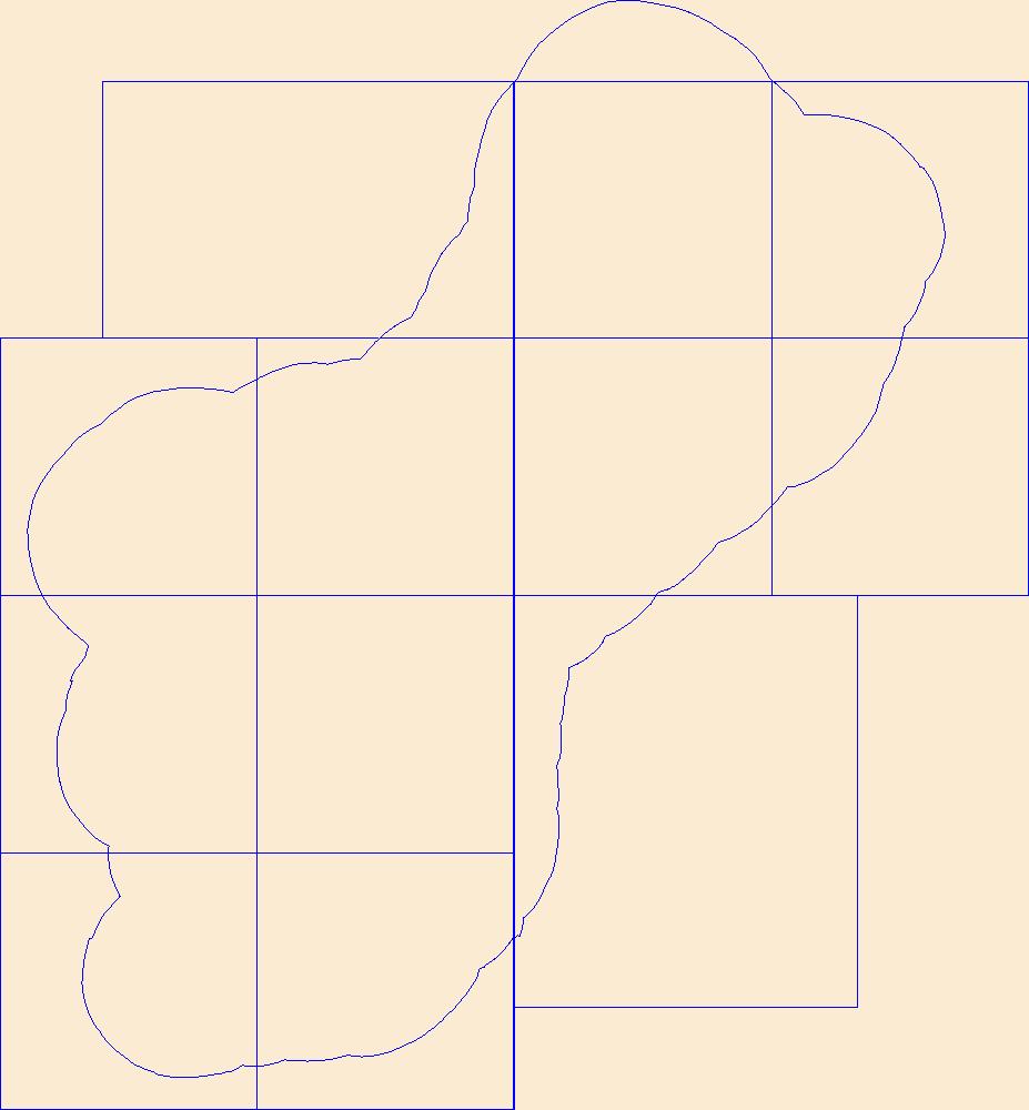
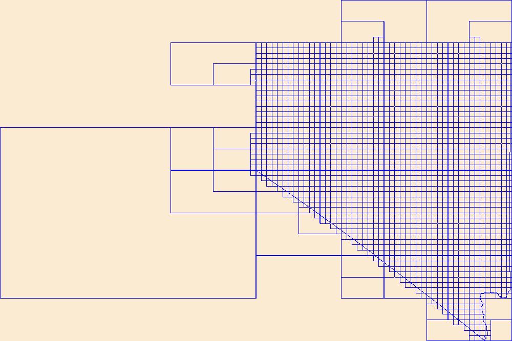
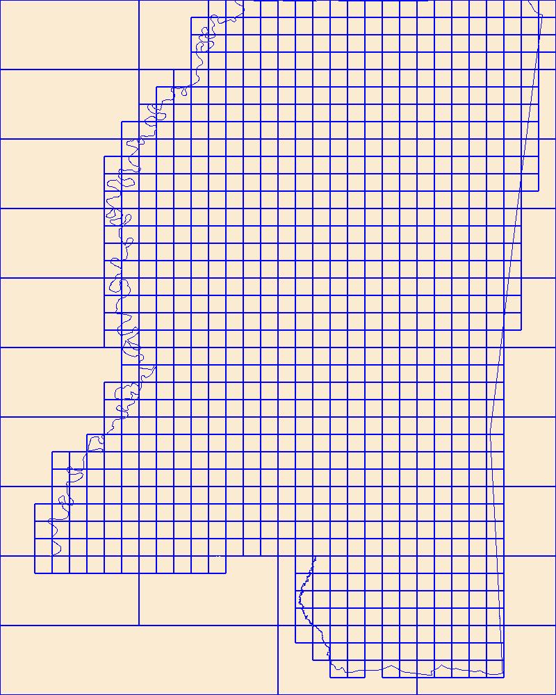
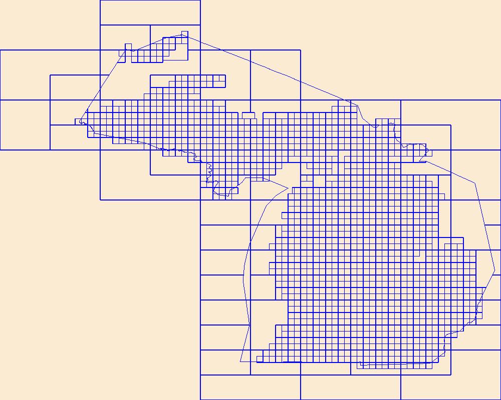
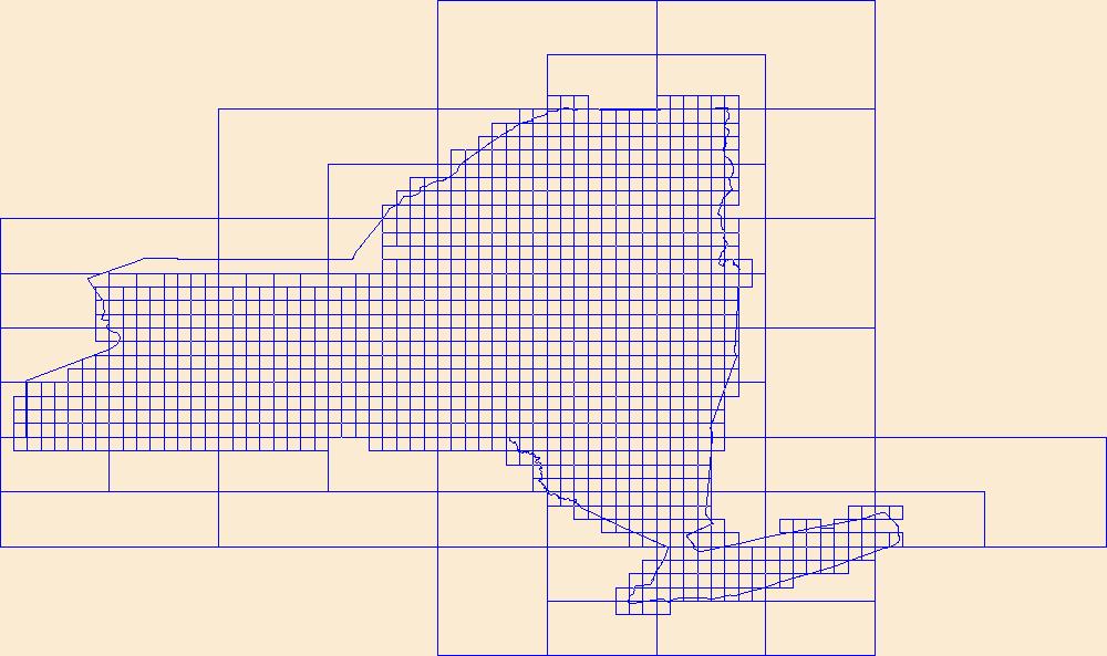
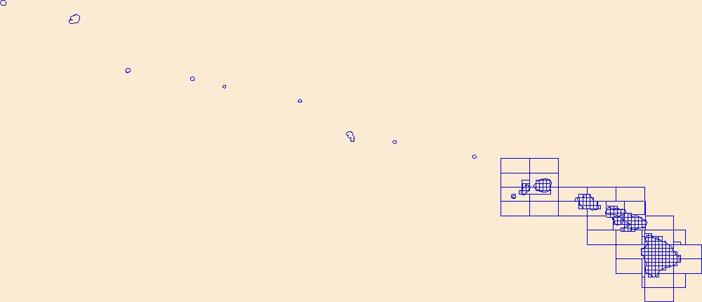
This data represents the map extent for current and historical USGS topographic maps for the United States and Territories, including 1 X 2 Degree, 1 X 1 Degree, 30 X 60 Minute, 15 X 15 Minute, 7.5 X 7.5 Minute, and 3.75 X 3.75 Minute. The grid was generated using ESRI ArcInfo GIS software.
This data represents the map extent for current and historical USGS topographic maps for the United States and Territories, including 1 X 2 Degree, 1 X 1 Degree, 30 X 60 Minute, 15 X 15 Minute, 7.5 X 7.5 Minute, and 3.75 X 3.75 Minute. The grid was generated using ESRI ArcInfo GIS software.
This data represents the map extent for current and historical USGS topographic maps for the United States and Territories, including 1 X 2 Degree, 1 X 1 Degree, 30 X 60 Minute, 15 X 15 Minute, 7.5 X 7.5 Minute, and 3.75 X 3.75 Minute. The grid was generated using ESRI ArcInfo GIS software.
Digital flood-inundation maps for a 3.4-mile reach of Fourmile Creek at Silver Grove, Kentucky (Ky.), were created by the U.S. Geological Survey (USGS) in cooperation with the City of Silver Grove and the U.S. Army Corps of Engineers Louisville District. Because the City of Silver Grove is subject to flooding from Fourmile Creek and the Ohio River (backwater flooding up Fourmile Creek), a set of flood-inundation maps was created for each flooding source independently and for combinations of possible flooding scenarios. The flood-inundation maps depict estimates of the areal extent and depth of flooding corresponding to a range of different gage heights (gage height is commonly referred to as “stage,” or the water-surface...
These data were released prior to the October 1, 2016 effective date for the USGS’s policy dictating the review, approval, and release of scientific data as referenced in USGS Survey Manual Chapter 502.8 Fundamental Science Practices: Review and Approval of Scientific Data for Release. These datasets consist of a workspace (folder) containing a collection of gridded datasets plus a personal geodatabase containing several vector datasets. These datasets are designed to be used with the ArcHydro Tools, developed by ESRI in partnership with the U.S. Geological Survey, StreamStats Development Team. The datasets, together with the ArcHydro Tools, allow users to delineate watersheds and compute several watershed characteristics....
This USGS data release documents species distribution models for 271 fluvial fish species in their native ranges of the conterminous United States. Source data, supporting code and model results are documented in this data package. Boosted Regression Tree (BRT) models were used to develop presence/absence predictions for each of the National Hydrography Dataset Plus Version 2.1 stream segments within a species' native range. The predictions provided can be linked to the NHDPlusV2.1 geospatial dataset through the COMID to create a spatial depiction of the models. The primary results are stored in the file "BRT Predictions" and are provided in comma separated value (CSV) and Parquet file formats. Parquet file format...
Categories: Data;
Tags: USGS Science Data Catalog (SDC),
United States of America,
aquatic biology,
biogeography,
biota,
Ecological models facilitate the evaluation and assessment of alternative approaches to restore the Greater Everglades ecosystem. Joint Ecosystem Modeling (JEM) provides ecological models tailored to address specific management issues. The multi-agency REstoration, COordination and VERification (RECOVER) science team uses ecological models (i.e., ecological planning tools) to evaluate the potential effects of projects in the Comprehensive Everglades Restoration Plan (CERP) on natural resources. The planning agencies and bureaus involved in CERP desire to also use these ecological planning tools for the evaluation of alternative water control plans to be performed by the Lake Okeechobee System Operating Manual (LOSOM)...
Ecological models facilitate the evaluation and assessment of alternative approaches to restore the Greater Everglades ecosystem. Joint Ecosystem Modeling (JEM) provides ecological models tailored to address specific management issues. The multi-agency REstoration, COordination and VERification (RECOVER) science team uses ecological models (i.e., ecological planning tools) to evaluate the potential effects of projects in the Comprehensive Everglades Restoration Plan (CERP) on natural resources. The planning agencies and bureaus involved in CERP desire to also use these ecological planning tools for the evaluation of alternative water control plans to be performed by the Lake Okeechobee System Operating Manual (LOSOM)...

This data represents the map extent for current and historical USGS topographic maps for the United States and Territories, including 1 X 2 Degree, 1 X 1 Degree, 30 X 60 Minute, 15 X 15 Minute, 7.5 X 7.5 Minute, and 3.75 X 3.75 Minute. The grid was generated using ESRI ArcInfo GIS software.
This data represents the map extent for current and historical USGS topographic maps for the United States and Territories, including 1 X 2 Degree, 1 X 1 Degree, 30 X 60 Minute, 15 X 15 Minute, 7.5 X 7.5 Minute, and 3.75 X 3.75 Minute. The grid was generated using ESRI ArcInfo GIS software.

This data represents the map extent for current and historical USGS topographic maps for the United States and Territories, including 1 X 2 Degree, 1 X 1 Degree, 30 X 60 Minute, 15 X 15 Minute, 7.5 X 7.5 Minute, and 3.75 X 3.75 Minute. The grid was generated using ESRI ArcInfo GIS software.
This data represents the map extent for current and historical USGS topographic maps for the United States and Territories, including 1 X 2 Degree, 1 X 1 Degree, 30 X 60 Minute, 15 X 15 Minute, 7.5 X 7.5 Minute, and 3.75 X 3.75 Minute. The grid was generated using ESRI ArcInfo GIS software.

This data represents the map extent for current and historical USGS topographic maps for the United States and Territories, including 1 X 2 Degree, 1 X 1 Degree, 30 X 60 Minute, 15 X 15 Minute, 7.5 X 7.5 Minute, and 3.75 X 3.75 Minute. The grid was generated using ESRI ArcInfo GIS software.
This data represents the map extent for current and historical USGS topographic maps for the United States and Territories, including 1 X 2 Degree, 1 X 1 Degree, 30 X 60 Minute, 15 X 15 Minute, 7.5 X 7.5 Minute, and 3.75 X 3.75 Minute. The grid was generated using ESRI ArcInfo GIS software.

This data represents the map extent for current and historical USGS topographic maps for the United States and Territories, including 1 X 2 Degree, 1 X 1 Degree, 30 X 60 Minute, 15 X 15 Minute, 7.5 X 7.5 Minute, and 3.75 X 3.75 Minute. The grid was generated using ESRI ArcInfo GIS software.
This data represents the map extent for current and historical USGS topographic maps for the United States and Territories, including 1 X 2 Degree, 1 X 1 Degree, 30 X 60 Minute, 15 X 15 Minute, 7.5 X 7.5 Minute, and 3.75 X 3.75 Minute. The grid was generated using ESRI ArcInfo GIS software.
Airborne radiometric data are provided here as part of the data release "Airborne magnetic and radiometric survey, western Arkansas, 2022." This website includes the processed radiometric data, with and without spectra, provided in ASCII .csv files and geoTIFF images showing the total count (K, U, Th), percent potassium (%K), equivalent uranium (eU), and equivalent thorium (eTh).
Categories: Data;
Types: Downloadable,
GeoTIFF,
Map Service,
Raster;
Tags: AASG,
Arkansas,
Association of State Geologists,
Dardanelle,
Dardanelle Lake,
This is an antiquated version of the North American Breeding Bird Survey (BBS) dataset that has been superseded by a more recent release. Unless visitors have a specific need for these archived data, they should return to the Main BBS Dataset Page and choose the most recent data release, as that one will include all BBS data released to date. The 1966-2021 North American Breeding Bird Survey (BBS) dataset contains avian point count data for more than 700 North American bird taxa (species, races, and unidentified species groupings). These data are collected annually during the breeding season, primarily in June, along thousands of randomly established roadside survey routes in the United States and Canada. Routes...
This data release contains one dataset and one model archive in support of the journal article, "Leveraging machine learning to automate regression model evaluations for large multi-site water-quality trend studies," by Jennifer C. Murphy and Jeffrey G. Chanat. The model archive contains scripts (run in R) to reproduce the four machine learning models (logistic regression, linear and quadratic discriminant analysis, and k-nearest neighbors) trained and tested as part of the journal article. The dataset contains the estimated probabilities for each of these models when applied to a training and test dataset.
Categories: Data;
Types: Map Service,
OGC WFS Layer,
OGC WMS Layer,
OGC WMS Service;
Tags: Delaware River Basin,
USGS Science Data Catalog (SDC),
United States of America,
Water Quality,
biota,
This data release provides digital flight line data for a high-resolution airborne radiometric survey over parts of Montana in the vicinity of the Boulder Batholith. The airborne survey was jointly funded by the Earth Mapping Resources Initiative and Kennecott Exploration Company. The survey was designed to meet complementary needs related to geologic mapping and characterization of mineral resource potential. A total of 34,041 line km of magnetic and radiometric data were acquired over an irregular-shaped area of 6178 km2. Data were collected from a helicopter flown at a nominal terrain clearance of 100 meters (m) above topography along E-W flight lines spaced at 200 m intervals. Tie lines were flown in an N-S...
Categories: Data;
Types: Downloadable,
GeoTIFF,
Map Service,
Raster;
Tags: AASG,
Aeroradiometric survey,
Airborne geophysical survey,
Association of State Geologists,
Boulder Mountains,
|

|
