Filters: Tags: Utah (X)
14,706 results (40ms)|
Filters
Date Range
Extensions Types
Contacts
Categories Tag Types
|
A one-year seismic hazard forecast for the Central and Eastern United States, based on induced and natural earthquakes, has been produced by the U.S. Geological Survey. The model assumes that earthquake rates calculated from several different time windows will remain relatively stationary and can be used to forecast earthquake hazard and damage intensity for the year 2016. This assessment is the first step in developing an operational earthquake forecast for the CEUS, and the analysis could be revised with updated seismicity and model parameters. Consensus input models consider alternative earthquake catalog durations, smoothing parameters, maximum magnitudes, and ground motion estimates, and represent uncertainties...
Categories: Data;
Types: Downloadable,
GeoTIFF,
Map Service,
Raster;
Tags: Arizona,
California,
Colorado,
Earthquake,
Hazard,
Water quality and optical absorbance data for journal article entitled, "The removal kinetics of dissolved organic matter and the optical clarity of groundwater" by Francis H. Chapelle, Yuan Shen, Eric W. Strom, and Ronald Benner. Hydrogeology Journal. In Press.
This dataset is based on U.S. Geological Survey (USGS) resource assessments for “undiscovered” oil resources, which are resources that have not yet been extensively proven by drilling (USGS 2014). Individual resource assessments describe the amount of petroleum resources in units with similar geologic features. We focused on the amount of undiscovered continuous oil because technological advances have made exploitation of continuous resources increasingly profitable and large amounts remain undeveloped in comparison with conventional resources. We quantified the density of continuous oil resources by adding together the amounts in spatially overlapping assessment units and dividing these totals by polygon areas....
Categories: Data;
Types: Downloadable,
GeoTIFF,
Map Service,
Raster;
Tags: Arizona,
Colorado,
Colorado headwaters-Plateau,
Nevada,
New Mexico,
Density of all roads within a 5-km radius developed using a circular focal moving window analysis.
Categories: Data;
Types: Downloadable,
GeoTIFF,
Map Service,
Raster;
Tags: Colorado,
Idaho,
Montana,
United States,
Utah,
Distance to the nearest road.
All roads in the western United States from the 2000 US Census Bureau 1:100,000 scale TIGER/line files.
Categories: Data;
Types: Downloadable,
Map Service,
OGC WFS Layer,
OGC WMS Layer,
Shapefile;
Tags: Arizona,
California,
Census 2000,
Colorado,
Idaho,
Proportion of all sagebrush species land cover within a 1-km radius developed using a circular focal moving window analysis.
Categories: Data;
Types: Downloadable,
GeoTIFF,
Map Service,
Raster;
Tags: Artemisia spp.,
Colorado,
Idaho,
Montana,
United States,
The 'Desert Mountain (Rockwell Claims)' file is part of the Grover Heinrichs mining collection. Grover was the Vice President of Heinrichs GEOEXploration, located in Tucson, Arizona. The collection contains over 1,400 folders including economic geology reports, maps, photos, correspondence, drill logs and other related materials. The focus of much of the information is on the western United States, particularly Arizona, but the collection also includes files on mining activity throughout the United States, foreign countries, and 82 mineral commodities.
The 'Water Resources' file is part of the Grover Heinrichs mining collection. Grover was the Vice President of Heinrichs GEOEXploration, located in Tucson, Arizona. The collection contains over 1,400 folders including economic geology reports, maps, photos, correspondence, drill logs and other related materials. The focus of much of the information is on the western United States, particularly Arizona, but the collection also includes files on mining activity throughout the United States, foreign countries, and 82 mineral commodities.
The 'Fish Springs District, Utah Mine' file is part of the Grover Heinrichs mining collection. Grover was the Vice President of Heinrichs GEOEXploration, located in Tucson, Arizona. The collection contains over 1,400 folders including economic geology reports, maps, photos, correspondence, drill logs and other related materials. The focus of much of the information is on the western United States, particularly Arizona, but the collection also includes files on mining activity throughout the United States, foreign countries, and 82 mineral commodities.
This is a model showing general habitat diversity, including both the structural and cover type diversity. See Open File Report, Rasmussen and Shafroth, Colorado River Conservation Planning for geoprocessing details.
Categories: Data;
Types: Citation,
Downloadable,
Map Service,
OGC WFS Layer,
OGC WMS Layer,
Shapefile;
Tags: Arches National Park,
Canyonlands National Park,
Colorado River,
Grand County,
Moab,
Proportion of salt desert shrub land cover within a 1-km radius developed using a circular focal moving window analysis.
Sage-grouse (Centrocercus spp.) were abundant in all of Utah's 29 counties at the time of European settlement wherever sagebrush (Artemisia spp.) occurred. Greater Sage-Grouse (G. urophasianus) inhabited areas north and west of the Colorado River, and Gunnison Sage-Grouse (G. minimus) occupied suitable habitat south and east of the Colorado River. The largest Greater Sage-Grouse populations in Utah are currently restricted to suitable habitats in Box Elder, Garfield, Rich, Uintah, and Wayne Counties. A remnant breeding population of Gunnison Sage-Grouse occurs in eastern San Juan County. We stratified Greater Sage-Grouse populations (1971-2000) by counties where the 1996 to 2000 moving average for estimated spring...
Categories: Publication;
Types: Citation,
Journal Citation;
Tags: Artemisia tridentata,
Centrocercus minimus,
Centrocercus urophasianus,
DemoAtomFeed,
Gunnison sage-grouse,
Southern Utah comprises 4 major physiographic divisions: the Great Basin, Colorado Plateau, Central Rocky Mountains, and Southern Rocky Mountains, which have been partitioned into faunal regions. We discuss the uniqueness of southern Utah and the amount of land set aside for recreation and preservation, and we encourage the study and preservation of its water resources. The stonefly (Plecoptera) fauna of 13 counties in southern Utah was surveyed. We found 58 species representing 34 genera and 8 families. Three new state records for Utah and many new county records for southern Utah are presented, along with a discussion of distribution patterns and faunal affinities of each species. Distribution patterns indicate...
This dataset depicts renewable geothermal resources identified by the Utah Renewable Energy Zone (UREZ) task force.

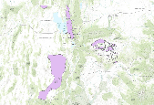
This data set represents wetland areas in Utah as delineated by the National Wetlands Inventory (NWI) conducted by the U. S. Fish and Wildlife Service (USFWS).
Future climates are simulated by general circulation models (GCM) using climate change scenarios (IPCC 2014). To project climate change for the sagebrush biome, we used 11 GCMs and two climate change scenarios from the IPCC Fifth Assessment, representative concentration pathways (RCPs) 4.5 and 8.5 (Moss et al. 2010, Van Vuuren et al. 2011). RCP4.5 scenario represents a future where climate policies limit and achieve stabilization of greenhouse gas concentrations to 4.5 W m-2 by 2100. RCP8.5 scenario might be called a business-as-usual scenario, where high emissions of greenhouse gases continue in the absence of climate change policies. The two selected time frames allow comparison of near-term (2020-2050) and longer-term...
Categories: Data;
Types: Citation,
Downloadable,
GeoTIFF,
Map Service,
Raster;
Tags: Arizona,
CRS,
California,
Climate,
Colorado,
This data set contains imagery from the National Agriculture Imagery Program (NAIP). The NAIP program is administered by USDA FSA and has been established to support two main FSA strategic goals centered on agricultural production. These are, increase stewardship of America's natural resources while enhancing the environment, and to ensure commodities are procured and distributed effectively and efficiently to increase food security. The NAIP program supports these goals by acquiring and providing ortho imagery that has been collected during the agricultural growing season in the U.S. The NAIP ortho imagery is tailored to meet FSA requirements and is a fundamental tool used to support FSA farm and conservation programs....
|

|
