|
|
Core Research Center, core F001, from well operated by GULF OIL CORPORATIONRaw Properties from download, web scrape, MapServer, and Macrostrat API{"Lib Num": "F001", "API Num": "3505100074", "Operator": "GULF OIL CORPORATION", "Well Name": "1 COSTELLO", "Field": "GOLDEN TREND", "State": "OK", "County": "GRADY", "Type": "SLABBED", "Photos": "T", "Thin Sec": "F", "Analysis": "F", "Latitude": "34.904297", "Longitude": "-97.690011", "coordinates_geohash": "9y4w940k3b81", "Source": "FROM STATE RECORDS", "Security Flag": "VIEWING ALLOWED, NO SAMPLING UNLESS APPROVED", "crc_collection_name": "core", "sb_parent_id": "4f4e49dae4b07f02db5e0486", "intervals": [{"Formation": "HUNTON", "Age": "SILU", "Min Depth": "10432", "Max...
Categories: Physical Item;
Tags: BROMIDE,
BROMIDE,
HUNTON,
Late Devonian,
MCLISH, All tags...
OIL CREEK,
ORDO,
ORDO,
ORDO,
ORDO,
ORDO,
ORDO,
ORDO,
SILU,
SYLVAN,
TULIP CREEK,
VIOLA,
Woodford Shale,
Woodford Shale,
shale, Fewer tags
This data set contains imagery from the National Agriculture Imagery Program (NAIP). The NAIP program is administered by USDA FSA and has been established to support two main FSA strategic goals centered on agricultural production. These are, increase stewardship of America's natural resources while enhancing the environment, and to ensure commodities are procured and distributed effectively and efficiently to increase food security. The NAIP program supports these goals by acquiring and providing ortho imagery that has been collected during the agricultural growing season in the U.S. The NAIP ortho imagery is tailored to meet FSA requirements and is a fundamental tool used to support FSA farm and conservation programs....
Types: Citation;
Tags: 17131,
3.75 x 3.75 minute,
4109052,
Aerial Compliance,
Compliance, All tags...
Digital Ortho rectified Image,
Downloadable Data,
IL,
IL131,
JPEG2000,
MERCER CO IL FSA,
Mercer,
NAIP,
Ortho Rectification,
Orthoimagery,
Quarter Quadrangle,
USDA National Agriculture Imagery Program (NAIP),
VIOLA,
VIOLA, SE,
farming, Fewer tags
Core Research Center, core D765, from well operated by COASTAL OIL & GASRaw Properties from download, web scrape, MapServer, and Macrostrat API{"Lib Num": "D765", "API Num": "2400520032", "Operator": "COASTAL OIL & GAS", "Well Name": "1 SCHOOLER", "Field": "RUNAMUK", "State": "MO", "County": "ATCHISON", "Type": "SLABBED", "Photos": "F", "Thin Sec": "F", "Analysis": "F", "Latitude": "40.27611", "Longitude": "-95.41007", "coordinates_geohash": "9zhjhuh925p6", "Source": "FROM STATE RECORDS", "Security Flag": "NO SPECIAL RESTRICTIONS", "crc_collection_name": "core", "sb_parent_id": "4f4e49dae4b07f02db5e0486", "intervals": [{"Formation": "VIOLA", "Age": "ORDO", "Min Depth": "2786", "Max Depth": "2798"}], "crcwc_url":...
Categories: Physical Item;
Tags: ORDO,
Pennsylvanian,
Severy Formation; Howard Formation; Scranton Formation; Bern Formation; Auburn F,
VIOLA,
Wabaunsee Group, All tags...
coal,
limestone,
sandstone,
shale,
siltstone, Fewer tags

This data set contains imagery from the National Agriculture Imagery Program (NAIP). The NAIP program is administered by USDA FSA and has been established to support two main FSA strategic goals centered on agricultural production. These are, increase stewardship of America's natural resources while enhancing the environment, and to ensure commodities are procured and distributed effectively and efficiently to increase food security. The NAIP program supports these goals by acquiring and providing ortho imagery that has been collected during the agricultural growing season in the U.S. The NAIP ortho imagery is tailored to meet FSA requirements and is a fundamental tool used to support FSA farm and conservation programs....
Types: Citation;
Tags: 05049,
3.75 x 3.75 minute,
3609133,
AR,
AR049, All tags...
Aerial Compliance,
Compliance,
Digital Ortho rectified Image,
Downloadable Data,
FULTON CO AR FSA,
Fulton,
JPEG2000,
NAIP,
Ortho Rectification,
Orthoimagery,
Quarter Quadrangle,
USDA National Agriculture Imagery Program (NAIP),
VIOLA,
VIOLA, SW,
farming, Fewer tags
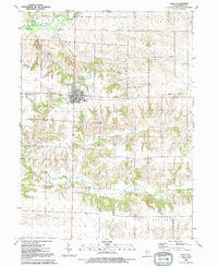
USGS Historical Quadrangle in GeoPDF.
Tags: 7.5 x 7.5 minute,
Downloadable Data,
GeoPDF,
GeoTIFF,
Historical Topographic Maps, All tags...
Historical Topographic Maps 7.5 x 7.5 Minute Map Series,
IL,
Map,
Viola,
imageryBaseMapsEarthCover, Fewer tags
This data set contains imagery from the National Agriculture Imagery Program (NAIP). The NAIP program is administered by USDA FSA and has been established to support two main FSA strategic goals centered on agricultural production. These are increase stewardship of America's natural resources while enhancing the environment, and to ensure commodities are procured and distributed effectively and efficiently to increase food security. The NAIP program supports these goals by acquiring and providing ortho imagery that has been collected during the agricultural growing season in the U.S. The NAIP ortho imagery is tailored to meet FSA requirements and is a fundamental tool used to support FSA farm and conservation programs....
Types: Citation;
Tags: 3.75 x 3.75 minute,
3508526,
47177,
Aerial Compliance,
Compliance, All tags...
Digital Ortho rectified Image,
Downloadable Data,
JPEG 2000,
JPEG2000,
NAIP,
Ortho Rectification,
Orthoimagery,
Quarter Quadrangle,
TN,
TN177,
USDA National Agriculture Imagery Program (NAIP),
VIOLA,
VIOLA, SE,
WARREN CO TN FSA,
Warren,
farming,
imageryBaseMapsEarthCover, Fewer tags
This data set contains imagery from the National Agriculture Imagery Program (NAIP). The NAIP program is administered by USDA FSA and has been established to support two main FSA strategic goals centered on agricultural production. These are, increase stewardship of America's natural resources while enhancing the environment, and to ensure commodities are procured and distributed effectively and efficiently to increase food security. The NAIP program supports these goals by acquiring and providing ortho imagery that has been collected during the agricultural growing season in the U.S. The NAIP ortho imagery is tailored to meet FSA requirements and is a fundamental tool used to support FSA farm and conservation programs....
Types: Citation;
Tags: 3.75 x 3.75 minute,
4611716,
53075,
Aerial Compliance,
Compliance, All tags...
Digital Ortho rectified Image,
Downloadable Data,
JPEG2000,
NAIP,
Ortho Rectification,
Orthoimagery,
Quarter Quadrangle,
USDA National Agriculture Imagery Program (NAIP),
VIOLA,
VIOLA, NW,
WA,
WA075,
WHITMAN CO WA FSA,
Whitman,
farming, Fewer tags

USGS Historical Quadrangle in GeoPDF.
Tags: 7.5 x 7.5 minute,
CA,
Downloadable Data,
GeoPDF,
GeoTIFF, All tags...
Historical Topographic Maps,
Historical Topographic Maps 7.5 x 7.5 Minute Map Series,
Map,
Viola,
imageryBaseMapsEarthCover, Fewer tags
This data set contains imagery from the National Agriculture Imagery Program (NAIP). The NAIP program is administered by USDA FSA and has been established to support two main FSA strategic goals centered on agricultural production. These are increase stewardship of America's natural resources while enhancing the environment, and to ensure commodities are procured and distributed effectively and efficiently to increase food security. The NAIP program supports these goals by acquiring and providing ortho imagery that has been collected during the agricultural growing season in the U.S. The NAIP ortho imagery is tailored to meet FSA requirements and is a fundamental tool used to support FSA farm and conservation programs....
Types: Citation;
Tags: 29209,
3.75 x 3.75 minute,
3609328,
Aerial Compliance,
Compliance, All tags...
Digital Ortho rectified Image,
Downloadable Data,
JPEG 2000,
JPEG2000,
MO,
MO209,
NAIP,
Ortho Rectification,
Orthoimagery,
Quarter Quadrangle,
STONE CO MO FSA,
Stone,
USDA National Agriculture Imagery Program (NAIP),
VIOLA,
VIOLA, SW,
farming,
imageryBaseMapsEarthCover, Fewer tags
This data set contains imagery from the National Agriculture Imagery Program (NAIP). The NAIP program is administered by USDA FSA and has been established to support two main FSA strategic goals centered on agricultural production. These are, increase stewardship of America's natural resources while enhancing the environment, and to ensure commodities are procured and distributed effectively and efficiently to increase food security. The NAIP program supports these goals by acquiring and providing ortho imagery that has been collected during the agricultural growing season in the U.S. The NAIP ortho imagery is tailored to meet FSA requirements and is a fundamental tool used to support FSA farm and conservation programs....
Types: Citation;
Tags: 3.75 x 3.75 minute,
4611716,
53075,
Aerial Compliance,
Compliance, All tags...
Digital Ortho rectified Image,
Downloadable Data,
JPEG2000,
NAIP,
Ortho Rectification,
Orthoimagery,
Quarter Quadrangle,
USDA National Agriculture Imagery Program (NAIP),
VIOLA,
VIOLA, SE,
WA,
WA075,
WHITMAN CO WA FSA,
Whitman,
farming, Fewer tags

This data set contains imagery from the National Agriculture Imagery Program (NAIP). The NAIP program is administered by USDA FSA and has been established to support two main FSA strategic goals centered on agricultural production. These are, increase stewardship of America's natural resources while enhancing the environment, and to ensure commodities are procured and distributed effectively and efficiently to increase food security. The NAIP program supports these goals by acquiring and providing ortho imagery that has been collected during the agricultural growing season in the U.S. The NAIP ortho imagery is tailored to meet FSA requirements and is a fundamental tool used to support FSA farm and conservation programs....
Types: Citation;
Tags: 05049,
3.75 x 3.75 minute,
3609133,
AR,
AR049, All tags...
Aerial Compliance,
Compliance,
Digital Ortho rectified Image,
Downloadable Data,
FULTON CO AR FSA,
Fulton,
JPEG2000,
NAIP,
Ortho Rectification,
Orthoimagery,
Quarter Quadrangle,
USDA National Agriculture Imagery Program (NAIP),
VIOLA,
VIOLA, SE,
farming, Fewer tags
This data set contains imagery from the National Agriculture Imagery Program (NAIP). The NAIP program is administered by USDA FSA and has been established to support two main FSA strategic goals centered on agricultural production. These are, increase stewardship of America's natural resources while enhancing the environment, and to ensure commodities are procured and distributed effectively and efficiently to increase food security. The NAIP program supports these goals by acquiring and providing ortho imagery that has been collected during the agricultural growing season in the U.S. The NAIP ortho imagery is tailored to meet FSA requirements and is a fundamental tool used to support FSA farm and conservation programs....
Types: Citation;
Tags: 16057,
3.75 x 3.75 minute,
4611716,
Aerial Compliance,
Compliance, All tags...
Digital Ortho rectified Image,
Downloadable Data,
ID,
ID057,
JPEG2000,
LATAH CO ID FSA,
Latah,
NAIP,
Ortho Rectification,
Orthoimagery,
Quarter Quadrangle,
USDA National Agriculture Imagery Program (NAIP),
VIOLA,
VIOLA, NE,
farming, Fewer tags
Core Research Center, core R267, from well operated by MOBIL OILRaw Properties from download, web scrape, MapServer, and Macrostrat API{"Lib Num": "R267", "API Num": "3505321747", "Operator": "MOBIL OIL", "Well Name": "2-B LEFORCE FARMS", "Field": "NORTH VICAR", "State": "OK", "County": "GRANT", "Type": "FULL", "Photos": "T", "Thin Sec": "F", "Analysis": "T", "Latitude": "36.710202", "Longitude": "-97.926162", "coordinates_geohash": "9yd2gduk7j9h", "Source": "FROM STATE RECORDS", "Security Flag": "NO SPECIAL RESTRICTIONS", "crc_collection_name": "core", "sb_parent_id": "4f4e49dae4b07f02db5e0486", "intervals": [{"Formation": "WOODFORD", "Age": "DEVO", "Min Depth": "5950", "Max Depth": "5971"}, {"Formation": "VIOLA",...

USGS Historical Quadrangle in GeoPDF.
Tags: 7.5 x 7.5 minute,
CA,
Downloadable Data,
GeoPDF,
GeoTIFF, All tags...
Historical Topographic Maps,
Historical Topographic Maps 7.5 x 7.5 Minute Map Series,
Map,
Provisional,
Viola,
imageryBaseMapsEarthCover, Fewer tags
This data set contains imagery from the National Agriculture Imagery Program (NAIP). The NAIP program is administered by USDA FSA and has been established to support two main FSA strategic goals centered on agricultural production. These are increase stewardship of America's natural resources while enhancing the environment, and to ensure commodities are procured and distributed effectively and efficiently to increase food security. The NAIP program supports these goals by acquiring and providing ortho imagery that has been collected during the agricultural growing season in the U.S. The NAIP ortho imagery is tailored to meet FSA requirements and is a fundamental tool used to support FSA farm and conservation programs....
Types: Citation;
Tags: 29209,
3.75 x 3.75 minute,
3609328,
Aerial Compliance,
Compliance, All tags...
Digital Ortho rectified Image,
Downloadable Data,
JPEG 2000,
JPEG2000,
MO,
MO209,
NAIP,
Ortho Rectification,
Orthoimagery,
Quarter Quadrangle,
STONE CO MO FSA,
Stone,
USDA National Agriculture Imagery Program (NAIP),
VIOLA,
VIOLA, NE,
farming,
imageryBaseMapsEarthCover, Fewer tags
This data set contains imagery from the National Agriculture Imagery Program (NAIP). The NAIP program is administered by USDA FSA and has been established to support two main FSA strategic goals centered on agricultural production. These are increase stewardship of America's natural resources while enhancing the environment, and to ensure commodities are procured and distributed effectively and efficiently to increase food security. The NAIP program supports these goals by acquiring and providing ortho imagery that has been collected during the agricultural growing season in the U.S. The NAIP ortho imagery is tailored to meet FSA requirements and is a fundamental tool used to support FSA farm and conservation programs....
Types: Citation;
Tags: 29209,
3.75 x 3.75 minute,
3609328,
Aerial Compliance,
Compliance, All tags...
Digital Ortho rectified Image,
Downloadable Data,
JPEG 2000,
JPEG2000,
MO,
MO209,
NAIP,
Ortho Rectification,
Orthoimagery,
Quarter Quadrangle,
STONE CO MO FSA,
Stone,
USDA National Agriculture Imagery Program (NAIP),
VIOLA,
VIOLA, SE,
farming,
imageryBaseMapsEarthCover, Fewer tags
This data set contains imagery from the National Agriculture Imagery Program (NAIP). The NAIP program is administered by USDA FSA and has been established to support two main FSA strategic goals centered on agricultural production. These are, increase stewardship of America's natural resources while enhancing the environment, and to ensure commodities are procured and distributed effectively and efficiently to increase food security. The NAIP program supports these goals by acquiring and providing ortho imagery that has been collected during the agricultural growing season in the U.S. The NAIP ortho imagery is tailored to meet FSA requirements and is a fundamental tool used to support FSA farm and conservation programs....
Types: Citation;
Tags: 17131,
3.75 x 3.75 minute,
4109052,
Aerial Compliance,
Compliance, All tags...
Digital Ortho rectified Image,
Downloadable Data,
IL,
IL131,
JPEG2000,
MERCER CO IL FSA,
Mercer,
NAIP,
Ortho Rectification,
Orthoimagery,
Quarter Quadrangle,
USDA National Agriculture Imagery Program (NAIP),
VIOLA,
VIOLA, NW,
farming, Fewer tags
This data set contains imagery from the National Agriculture Imagery Program (NAIP). The NAIP program is administered by USDA FSA and has been established to support two main FSA strategic goals centered on agricultural production. These are increase stewardship of America's natural resources while enhancing the environment, and to ensure commodities are procured and distributed effectively and efficiently to increase food security. The NAIP program supports these goals by acquiring and providing ortho imagery that has been collected during the agricultural growing season in the U.S. The NAIP ortho imagery is tailored to meet FSA requirements and is a fundamental tool used to support FSA farm and conservation programs....
Types: Citation;
Tags: 3.75 x 3.75 minute,
3508526,
47177,
Aerial Compliance,
Compliance, All tags...
Digital Ortho rectified Image,
Downloadable Data,
JPEG 2000,
JPEG2000,
NAIP,
Ortho Rectification,
Orthoimagery,
Quarter Quadrangle,
TN,
TN177,
USDA National Agriculture Imagery Program (NAIP),
VIOLA,
VIOLA, NE,
WARREN CO TN FSA,
Warren,
farming,
imageryBaseMapsEarthCover, Fewer tags
This data set contains imagery from the National Agriculture Imagery Program (NAIP). The NAIP program is administered by USDA FSA and has been established to support two main FSA strategic goals centered on agricultural production. These are increase stewardship of America's natural resources while enhancing the environment, and to ensure commodities are procured and distributed effectively and efficiently to increase food security. The NAIP program supports these goals by acquiring and providing ortho imagery that has been collected during the agricultural growing season in the U.S. The NAIP ortho imagery is tailored to meet FSA requirements and is a fundamental tool used to support FSA farm and conservation programs....
Types: Citation;
Tags: 3.75 x 3.75 minute,
3508526,
47177,
Aerial Compliance,
Compliance, All tags...
Digital Ortho rectified Image,
Downloadable Data,
JPEG 2000,
JPEG2000,
NAIP,
Ortho Rectification,
Orthoimagery,
Quarter Quadrangle,
TN,
TN177,
USDA National Agriculture Imagery Program (NAIP),
VIOLA,
VIOLA, NW,
WARREN CO TN FSA,
Warren,
farming,
imageryBaseMapsEarthCover, Fewer tags
This data set contains imagery from the National Agriculture Imagery Program (NAIP). The NAIP program is administered by USDA FSA and has been established to support two main FSA strategic goals centered on agricultural production. These are increase stewardship of America's natural resources while enhancing the environment, and to ensure commodities are procured and distributed effectively and efficiently to increase food security. The NAIP program supports these goals by acquiring and providing ortho imagery that has been collected during the agricultural growing season in the U.S. The NAIP ortho imagery is tailored to meet FSA requirements and is a fundamental tool used to support FSA farm and conservation programs....
Types: Citation;
Tags: 29091,
3.75 x 3.75 minute,
3609133,
Aerial Compliance,
Compliance, All tags...
Digital Ortho rectified Image,
Downloadable Data,
HOWELL CO MO FSA,
Howell,
JPEG 2000,
JPEG2000,
MO,
MO091,
NAIP,
Ortho Rectification,
Orthoimagery,
Quarter Quadrangle,
USDA National Agriculture Imagery Program (NAIP),
VIOLA,
VIOLA, NW,
farming,
imageryBaseMapsEarthCover, Fewer tags
|
|

