Filters
Date Range
Types
Contacts
Categories
Tag Types
Tag Schemes
|

A.F. Budge Mining Ltd. Maps: Vulture Mine, Cross-Section 4, Coordinate 221,750E; 1 in. to 40 feet; 17 x 11 in.
Categories: Data;
Tags: Arizona,
Astor,
Black Hawk,
Conkling,
Cook, All tags...
Copper, Sulfide,
Custer,
Dataset,
East Vulture,
Elmore,
Gold,
Gold, Lode,
Hamilton,
Iron, Hema-Magne,
Iron, Sulfide,
Jane Elmore,
Lead, Sulfide,
Lithium,
Maricopa County,
Maricopa273,
Pit Gold,
Sheridan,
Sherman,
Silver, Oxide,
T6N R6W Sec 36 C,
Talmage,
Texhoma,
Tungsten,
United States,
Van Buren,
Vulture Extension,
Vulture Mountains - 15 Min,
Vulture Mts. physiographic area,
Vulture metallic mineral dist.,
Zinc, Sulfide,
chemical analysis,
drilling and coring,
geoscientificInformation,
maps and atlases,
mineral resources,
natural resource exploration,
sections, Fewer tags

ADMMR map collection: Vulture Mine Project Composite Surface Map; 1 in. to 200 feet; 42 x 35 in.
Categories: Data;
Tags: Arizona,
Astor,
Black Hawk,
Conkling,
Cook, All tags...
Copper, Sulfide,
Custer,
Dataset,
East Vulture,
Elmore,
Gold,
Gold, Lode,
Hamilton,
Iron, Hema-Magne,
Iron, Sulfide,
Jane Elmore,
Lead, Sulfide,
Lithium,
Maricopa County,
Pit Gold,
Sheridan,
Sherman,
Silver, Oxide,
T6N R6W Sec 36 C,
Talmage,
Texhoma,
Tungsten,
United States,
Van Buren,
Vulture,
Vulture Extension,
Vulture Mountains - 15 Min,
Vulture Mts. physiographic area,
Vulture metallic mineral dist.,
Zinc, Sulfide,
geoscientificInformation,
maps and atlases,
mineral resources,
mining and quarrying,
natural resource exploration,
topographic maps,
topography, Fewer tags

ADMMR map collection: Vulture Mine Pit Sample Location Map and Underground Reserve Cross Section Index; 1 in. to 100 feet; 35 x 23 in.
Categories: Data;
Tags: 1980s,
Arizona,
Astor,
Black Hawk,
Conkling, All tags...
Cook,
Copper, Sulfide,
Custer,
Dataset,
East Vulture,
Elmore,
Gold,
Gold, Lode,
Hamilton,
Iron, Hema-Magne,
Iron, Sulfide,
Jane Elmore,
Lead, Sulfide,
Lithium,
Maricopa County,
Pit Gold,
Sheridan,
Sherman,
Silver, Oxide,
T6N R6W Sec 36 C,
Talmage,
Texhoma,
Tungsten,
United States,
Van Buren,
Vulture,
Vulture Extension,
Vulture Mountains - 15 Min,
Vulture Mts. physiographic area,
Vulture metallic mineral dist.,
Zinc, Sulfide,
chemical analysis,
geochemistry,
geoscientificInformation,
gold ores,
maps and atlases,
mine buildings,
mineral resources,
mining and quarrying,
natural resource assessment,
natural resource exploration,
plans,
sections, Fewer tags

ADMMR map collection: Vulture Mine Heap Leach Mill Wash Diversion Channel Layout; 36 x 24 in.
Categories: Data;
Tags: 1980s,
Arizona,
Astor,
Black Hawk,
Conkling, All tags...
Cook,
Copper, Sulfide,
Custer,
Dataset,
East Vulture,
Elmore,
Gold,
Gold, Lode,
Hamilton,
Iron, Hema-Magne,
Iron, Sulfide,
Jane Elmore,
Lead, Sulfide,
Lithium,
Maricopa County,
Pit Gold,
Sheridan,
Sherman,
Silver, Oxide,
T6N R6W Sec 36 C,
Talmage,
Texhoma,
Tungsten,
United States,
Van Buren,
Vulture,
Vulture Extension,
Vulture Mountains - 15 Min,
Zinc, Sulfide,
geoscientificInformation,
maps and atlases,
milling and smelting,
mining and quarrying,
mining equipment,
plans,
sections, Fewer tags

Heinrichs Geoexploration Co. Maps: Vulture Mine, Composite Drill Hole Map; 1 in. to 100 feet; 36 x 24 in.
Categories: Data;
Tags: 1980s,
Arizona,
Astor,
Black Hawk,
Conkling, All tags...
Cook,
Copper, Sulfide,
Custer,
Dataset,
East Vulture,
Elmore,
Gold,
Gold, Lode,
Hamilton,
Iron, Hema-Magne,
Iron, Sulfide,
Jane Elmore,
Lead, Sulfide,
Lithium,
Maricopa County,
Maricopa273,
Pit Gold,
Sheridan,
Sherman,
Silver, Oxide,
T6N R6W Sec 36 C,
Talmage,
Texhoma,
Tungsten,
United States,
Van Buren,
Vulture Extension,
Vulture Mountains - 15 Min,
Vulture Mts. physiographic area,
Vulture metallic mineral dist.,
Zinc, Sulfide,
drilling and coring,
geoscientificInformation,
maps and atlases,
mineral resources,
natural resource exploration, Fewer tags

Heinrichs Geoexploration Co. Maps: Vulture Mine Project, Composite Surface Map; 1 in. to 200 feet; 62 x 38 in.
Categories: Data;
Tags: Arizona,
Astor,
Black Hawk,
Conkling,
Cook, All tags...
Copper, Sulfide,
Custer,
Dataset,
East Vulture,
Elmore,
Gold,
Gold, Lode,
Hamilton,
Iron, Hema-Magne,
Iron, Sulfide,
Jane Elmore,
Lead, Sulfide,
Lithium,
Maricopa County,
Maricopa273,
Pit Gold,
Sheridan,
Sherman,
Silver, Oxide,
T6N R6W Sec 36 C,
Talmage,
Texhoma,
Tungsten,
United States,
Van Buren,
Vulture Extension,
Vulture Mountains - 15 Min,
Vulture Mts. physiographic area,
Vulture metallic mineral dist.,
Zinc, Sulfide,
geoscientificInformation,
maps and atlases,
mineral resources,
mining and quarrying,
topographic maps,
topography, Fewer tags

A.F. Budge Mining Ltd. Maps: Vulture Mine, Section 21,400E; 1 in. to 40 feet; 17 x 11 in.
Categories: Data;
Tags: Arizona,
Astor,
Black Hawk,
Conkling,
Cook, All tags...
Copper, Sulfide,
Custer,
Dataset,
East Vulture,
Elmore,
Gold,
Gold, Lode,
Hamilton,
Iron, Hema-Magne,
Iron, Sulfide,
Jane Elmore,
Lead, Sulfide,
Lithium,
Maricopa County,
Maricopa273,
Pit Gold,
Sheridan,
Sherman,
Silver, Oxide,
T6N R6W Sec 36 C,
Talmage,
Texhoma,
Tungsten,
United States,
Van Buren,
Vulture Extension,
Vulture Mountains - 15 Min,
Vulture Mts. physiographic area,
Vulture metallic mineral dist.,
Zinc, Sulfide,
drilling and coring,
geology,
geoscientificInformation,
maps and atlases,
mineral resources,
natural resource exploration,
sections, Fewer tags

Heinrichs Geoexploration Co. Maps: Vulture Mine, Drill Hole Location Map; 1 in. to 200 feet; 58 x 42 in.
Categories: Data;
Tags: 1980s,
Arizona,
Astor,
Black Hawk,
Conkling, All tags...
Cook,
Copper, Sulfide,
Custer,
Dataset,
East Vulture,
Elmore,
Gold,
Gold, Lode,
Hamilton,
Iron, Hema-Magne,
Iron, Sulfide,
Jane Elmore,
Lead, Sulfide,
Lithium,
Maricopa County,
Maricopa273,
Pit Gold,
Sheridan,
Sherman,
Silver, Oxide,
T6N R6W Sec 36 C,
Talmage,
Texhoma,
Tungsten,
United States,
Van Buren,
Vulture Extension,
Vulture Mountains - 15 Min,
Vulture Mts. physiographic area,
Vulture metallic mineral dist.,
Zinc, Sulfide,
drilling and coring,
geoscientificInformation,
maps and atlases,
mineral resources,
natural resource exploration,
plans, Fewer tags

A.F. Budge Mining Ltd. Maps: Vulture Mine, Drill Hole Map, Sheet 4-N; 1 in. to 20 feet; 37 x 24 in.
Categories: Data;
Tags: Arizona,
Astor,
Black Hawk,
Conkling,
Cook, All tags...
Copper, Sulfide,
Custer,
Dataset,
East Vulture,
Elmore,
Gold,
Gold, Lode,
Hamilton,
Iron, Hema-Magne,
Iron, Sulfide,
Jane Elmore,
Lead, Sulfide,
Lithium,
Maricopa County,
Maricopa273,
Pit Gold,
Sheridan,
Sherman,
Silver, Oxide,
T6N R6W Sec 36 C,
Talmage,
Texhoma,
Tungsten,
United States,
Van Buren,
Vulture Extension,
Vulture Mountains - 15 Min,
Vulture Mts. physiographic area,
Vulture metallic mineral dist.,
Zinc, Sulfide,
drilling and coring,
geoscientificInformation,
maps and atlases,
mineral resources,
natural resource exploration,
plans, Fewer tags

A.F. Budge Mining Ltd. Maps: Vulture Mine, 550' Level Sample Locations; 1 in. to 20 feet; 36 x 24 in.
Categories: Data;
Tags: 1980s,
Arizona,
Astor,
Black Hawk,
Conkling, All tags...
Cook,
Copper, Sulfide,
Custer,
Dataset,
East Vulture,
Elmore,
Gold,
Gold, Lode,
Hamilton,
Iron, Hema-Magne,
Iron, Sulfide,
Jane Elmore,
Lead, Sulfide,
Lithium,
Maricopa County,
Maricopa273,
Pit Gold,
Sheridan,
Sherman,
Silver, Oxide,
T6N R6W Sec 36 C,
Talmage,
Texhoma,
Tungsten,
United States,
Van Buren,
Vulture Extension,
Vulture Mountains - 15 Min,
Vulture Mts. physiographic area,
Vulture metallic mineral dist.,
Zinc, Sulfide,
chemical analysis,
geoscientificInformation,
maps and atlases,
mineral resources,
mining and quarrying,
plans,
subsurface maps, Fewer tags

Heinrichs Geoexploration Co. Maps: Vulture Mine Placer Project, Geological Cross Sections and Bedrock Contours, Map 1; 1 in. to 40 feet; 36 x 24 in.
Categories: Data;
Tags: 1980s,
Arizona,
Astor,
Black Hawk,
Conkling, All tags...
Cook,
Copper, Sulfide,
Custer,
Dataset,
East Vulture,
Elmore,
Gold,
Gold, Lode,
Hamilton,
Iron, Hema-Magne,
Iron, Sulfide,
Jane Elmore,
Lead, Sulfide,
Lithium,
Maricopa County,
Maricopa273,
Pit Gold,
Sheridan,
Sherman,
Silver, Oxide,
T6N R6W Sec 36 C,
Talmage,
Texhoma,
Tungsten,
United States,
Van Buren,
Vulture Extension,
Vulture Mountains - 15 Min,
Vulture Mts. physiographic area,
Vulture metallic mineral dist.,
Zinc, Sulfide,
geology,
geoscientificInformation,
maps and atlases,
mineral resources,
plans,
sections, Fewer tags

A.F. Budge Mining Ltd. Maps: Vulture Mine, Composite Drill Hole Map; 1 in. to 40 feet; 36 x 24 in.
Categories: Data;
Tags: Arizona,
Astor,
Black Hawk,
Conkling,
Cook, All tags...
Copper, Sulfide,
Custer,
Dataset,
East Vulture,
Elmore,
Gold,
Gold, Lode,
Hamilton,
Iron, Hema-Magne,
Iron, Sulfide,
Jane Elmore,
Lead, Sulfide,
Lithium,
Maricopa County,
Maricopa273,
Pit Gold,
Sheridan,
Sherman,
Silver, Oxide,
T6N R6W Sec 36 C,
Talmage,
Texhoma,
Tungsten,
United States,
Van Buren,
Vulture Extension,
Vulture Mountains - 15 Min,
Vulture Mts. physiographic area,
Vulture metallic mineral dist.,
Zinc, Sulfide,
drilling and coring,
geoscientificInformation,
maps and atlases,
mineral resources,
natural resource exploration,
plans, Fewer tags

A.F. Budge Mining Ltd. Maps: Vulture Mine, Drill Hole Map, Sheet 2-N; 1 in. to 20 feet; 36 x 24 in.
Categories: Data;
Tags: 1980s,
Arizona,
Astor,
Black Hawk,
Conkling, All tags...
Cook,
Copper, Sulfide,
Custer,
Dataset,
East Vulture,
Elmore,
Gold,
Gold, Lode,
Hamilton,
Iron, Hema-Magne,
Iron, Sulfide,
Jane Elmore,
Lead, Sulfide,
Lithium,
Maricopa County,
Maricopa273,
Pit Gold,
Sheridan,
Sherman,
Silver, Oxide,
T6N R6W Sec 36 C,
Talmage,
Texhoma,
Tungsten,
United States,
Van Buren,
Vulture Extension,
Vulture Mountains - 15 Min,
Vulture Mts. physiographic area,
Vulture metallic mineral dist.,
Zinc, Sulfide,
drilling and coring,
geoscientificInformation,
maps and atlases,
mineral resources,
natural resource exploration,
plans, Fewer tags

Heinrichs Geoexploration Co. Maps: Vulture Property, I.P. Line 10 Cross Section (N20W); 1 in. to 100 feet; 24 x 18 in.
Categories: Data;
Tags: Arizona,
Astor,
Black Hawk,
Conkling,
Cook, All tags...
Copper, Sulfide,
Custer,
Dataset,
East Vulture,
Elmore,
Gold,
Gold, Lode,
Hamilton,
Iron, Hema-Magne,
Iron, Sulfide,
Jane Elmore,
Lead, Sulfide,
Lithium,
Maricopa County,
Maricopa273,
Pit Gold,
Sheridan,
Sherman,
Silver, Oxide,
T6N R6W Sec 36 C,
Talmage,
Texhoma,
Tungsten,
United States,
Van Buren,
Vulture Extension,
Vulture Mountains - 15 Min,
Vulture Mts. physiographic area,
Vulture metallic mineral dist.,
Zinc, Sulfide,
geology,
geoscientificInformation,
maps and atlases,
mineral resources,
sections,
subsurface maps, Fewer tags

Heinrichs Geoexploration Co. Maps: Vulture Mine, Composite Drill Hole Map; 1 in. to 100 feet; 36 x 24 in.
Categories: Data;
Tags: 1980s,
Arizona,
Astor,
Black Hawk,
Conkling, All tags...
Cook,
Copper, Sulfide,
Custer,
Dataset,
East Vulture,
Elmore,
Gold,
Gold, Lode,
Hamilton,
Iron, Hema-Magne,
Iron, Sulfide,
Jane Elmore,
Lead, Sulfide,
Lithium,
Maricopa County,
Maricopa273,
Pit Gold,
Sheridan,
Sherman,
Silver, Oxide,
T6N R6W Sec 36 C,
Talmage,
Texhoma,
Tungsten,
United States,
Van Buren,
Vulture Extension,
Vulture Mountains - 15 Min,
Vulture Mts. physiographic area,
Vulture metallic mineral dist.,
Zinc, Sulfide,
drilling and coring,
geoscientificInformation,
maps and atlases,
mineral resources,
natural resource exploration, Fewer tags

The 'Vulture: Option and Lease Agreement' file is part of the A. F. Budge Mining Ltd. Mining collection. A. F. Budge Mining Ltd., a British company owned by Tony Budge, controlled properties across several western U. S. states and northern Mexico. The company was active in Arizona during the 1980s and into the early 1990s. The collection consists of economic geologic information including maps, logs, reports and records. A few properties make up most of the collection: Vulture, United Verde Extension and Korn Kob.
Categories: Data;
Tags: 1990s,
Arizona,
Astor,
Black Hawk,
Conkling, All tags...
Cook,
Copper, Sulfide,
Custer,
Dataset,
East Vulture,
Elmore,
Gold,
Gold, Lode,
Hamilton,
Iron, Hema-Magne,
Iron, Sulfide,
Jane Elmore,
Lead, Sulfide,
Lithium,
Maricopa County,
Maricopa273,
Pit Gold,
Sheridan,
Sherman,
Silver, Oxide,
T6N R6W Sec 36 C,
Talmage,
Texhoma,
Tungsten,
United States,
Van Buren,
Vulture Extension,
Vulture Mountains - 15 Min,
Vulture Mts. physiographic area,
Vulture metallic mineral dist.,
Zinc, Sulfide,
economic geology,
geoscientificInformation,
reports, Fewer tags
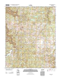
Layered GeoPDF 7.5 Minute Quadrangle Map. Layers of geospatial data include orthoimagery, roads, grids, geographic names, elevation contours, hydrography, and other selected map features.
Tags: 7.5 x 7.5 minute,
Bledsoe,
Downloadable Data,
EarthCover,
GeoPDF, All tags...
Imagery and Base Maps,
Map,
Public Land Survey System,
Sampson, TN,
Tennessee,
U.S. National Grid,
US,
US Topo,
US Topo Historical,
United States,
Van Buren,
boundary,
contour,
geographic names,
hydrography,
imageryBaseMapsEarthCover,
orthoimage,
structures,
topographic,
transportation,
woodland, Fewer tags
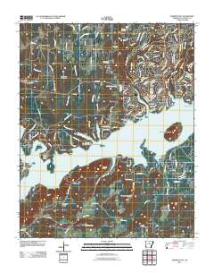
Layered GeoPDF 7.5 Minute Quadrangle Map. Layers of geospatial data include orthoimagery, roads, grids, geographic names, elevation contours, hydrography, and other selected map features.
Tags: 7.5 x 7.5 minute,
Arkansas,
Downloadable Data,
EarthCover,
Fairfield Bay, AR, All tags...
GeoPDF,
Imagery and Base Maps,
Map,
U.S. National Grid,
US,
US Topo,
US Topo Historical,
United States,
Van Buren,
contour,
geographic names,
hydrography,
imageryBaseMapsEarthCover,
orthoimage,
structures,
topographic,
transportation, Fewer tags
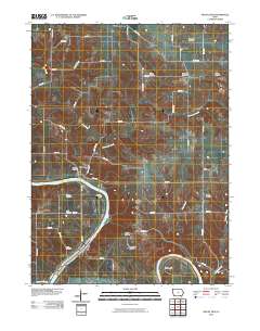
Layered GeoPDF 7.5 Minute Quadrangle Map. Layers of geospatial data include orthoimagery, roads, grids, geographic names, elevation contours, hydrography, and other selected map features.
Tags: 7.5 x 7.5 minute,
Downloadable Data,
EarthCover,
GeoPDF,
Imagery and Base Maps, All tags...
Iowa,
Map,
Mount Zion, IA,
U.S. National Grid,
US,
US Topo,
US Topo Historical,
United States,
Van Buren,
contour,
geographic names,
hydrography,
orthoimage,
topographic,
transportation, Fewer tags
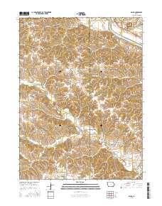
Layered GeoPDF 7.5 Minute Quadrangle Map. Layers of geospatial data include orthoimagery, roads, grids, geographic names, elevation contours, hydrography, and other selected map features.
Tags: 7.5 x 7.5 minute,
Davis,
Downloadable Data,
EarthCover,
GeoPDF, All tags...
Imagery and Base Maps,
Iowa,
Map,
Public Land Survey System,
Selma, IA,
U.S. National Grid,
US,
US Topo,
US Topo Historical,
United States,
Van Buren,
boundary,
contour,
geographic names,
hydrography,
imageryBaseMapsEarthCover,
orthoimage,
structures,
topographic,
transportation,
woodland, Fewer tags
|
|

