Filters: Tags: Vidal (X)
13 results (49ms)|
Filters
Date Range
Types Contacts
Tag Types Tag Schemes |
This data set contains imagery from the National Agriculture Imagery Program (NAIP). The NAIP program is administered by USDA FSA and has been established to support two main FSA strategic goals centered on agricultural production. These are, increase stewardship of America's natural resources while enhancing the environment, and to ensure commodities are procured and distributed effectively and efficiently to increase food security. The NAIP program supports these goals by acquiring and providing ortho imagery that has been collected during the agricultural growing season in the U.S. The NAIP ortho imagery is tailored to meet FSA requirements and is a fundamental tool used to support FSA farm and conservation programs....
This data set contains imagery from the National Agriculture Imagery Program (NAIP). The NAIP program is administered by USDA FSA and has been established to support two main FSA strategic goals centered on agricultural production. These are, increase stewardship of America's natural resources while enhancing the environment, and to ensure commodities are procured and distributed effectively and efficiently to increase food security. The NAIP program supports these goals by acquiring and providing ortho imagery that has been collected during the agricultural growing season in the U.S. The NAIP ortho imagery is tailored to meet FSA requirements and is a fundamental tool used to support FSA farm and conservation programs....
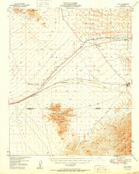
USGS Historical Quadrangle in GeoPDF.
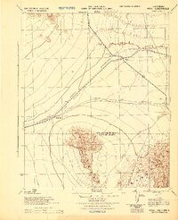
USGS Historical Quadrangle in GeoPDF.
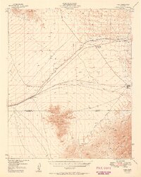
USGS Historical Quadrangle in GeoPDF.
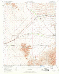
USGS Historical Quadrangle in GeoPDF.
This data set contains imagery from the National Agriculture Imagery Program (NAIP). The NAIP program is administered by USDA FSA and has been established to support two main FSA strategic goals centered on agricultural production. These are, increase stewardship of America's natural resources while enhancing the environment, and to ensure commodities are procured and distributed effectively and efficiently to increase food security. The NAIP program supports these goals by acquiring and providing ortho imagery that has been collected during the agricultural growing season in the U.S. The NAIP ortho imagery is tailored to meet FSA requirements and is a fundamental tool used to support FSA farm and conservation programs....
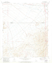
USGS Historical Quadrangle in GeoPDF.
This geologic database is a digitized version of the original 1:24,000-scale analog geologic map titled "Geologic map of the Vidal, California, and Parker SW, California-Arizona quadrangles", published by the U.S. Geological Survey (USGS) in 1980. The map area straddles the Arizona-California border, and is located approximately 9.0 km (5.6 mi) west-southwest of Parker, CA, immediately south of the unincorporated communities of Vidal and Vidal Junction, CA. The map area includes the northern Riverside Mountains, which contain a prominent suite of Permian, Mesozoic, and potentially Precambrian metamorphic and metasedimentary rocks. These rocks predominantly consist of gneisses, schists, limestones, and dolomites,...
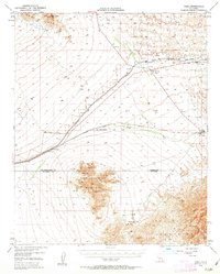
USGS Historical Quadrangle in GeoPDF.
This data set contains imagery from the National Agriculture Imagery Program (NAIP). The NAIP program is administered by USDA FSA and has been established to support two main FSA strategic goals centered on agricultural production. These are, increase stewardship of America's natural resources while enhancing the environment, and to ensure commodities are procured and distributed effectively and efficiently to increase food security. The NAIP program supports these goals by acquiring and providing ortho imagery that has been collected during the agricultural growing season in the U.S. The NAIP ortho imagery is tailored to meet FSA requirements and is a fundamental tool used to support FSA farm and conservation programs....
This map geodatabase digitally represents the general distribution of bedrock geologic map units in the Turtle Mountains area, California, as portrayed in Plate 1 of USGS Bulletin 1713-B, Mineral resources of the Turtle Mountains Wilderness Study Area, San Bernardino County, California (1988), https://doi.org/10.3133/b1713B. The map covers parts of the Rice, Turtle Mountains, and Savahia Peak 15’ quadrangles at 1:48,000 scale. Plate 1 is titled Mineral resource potential map of the Turtle Mountains Wilderness Study Area, San Bernardino County, California. The current database represents the geologic map base of Plate 1, but does not include mines, prospects, and mineral-potential evaluations that Plate 1 also portrays....
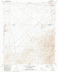
USGS Historical Quadrangle in GeoPDF.
|

|
