Filters: Tags: WHITE RIVER (X)
53 results (43ms)|
Filters
Date Range
Extensions Types Contacts
Categories Tag Types Tag Schemes |
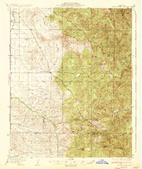
USGS Historical Quadrangle in GeoPDF.
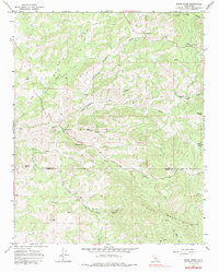
USGS Historical Quadrangle in GeoPDF.
Soil gas methane and combustible gas concentrations collected from oil and gas well pad locations in Utah. Soil gas samples were measured on site and/or collected for later analysis as described in supporting documentation. Multiple sample locations around well head and depths within the soil profile are available for select sites. Supporting documents provide information of sample collection protocol and data quality assurance.
Categories: Data;
Types: Map Service,
OGC WFS Layer,
OGC WMS Layer,
OGC WMS Service;
Tags: Big Flat,
Big Indian North,
Big Indian South,
Big Valley,
Bluebell,
In the White River basin, water demand has increased with human development. Water development projects impact White River hydrology and sediment transport which can, in turn, affect resident Colorado pikeminnow populations. The objectives for this study were: 1) to compile historical biological, hydrological and physical data for the White River, 2) to analyze physical, chemical and biological features of the White River important to endangered fishes and, 3) to identify parameters for long-term monitoring to insure these features are maintained. We examined physical, chemical and biological characteristics during three development periods in the UCRB: early (1895-1945), middle (1946-1984) and post Taylor Draw...
Categories: Publication;
Types: Citation;
Tags: Colorado pikeminnow,
Kenney Reservoir,
Taylor Draw Dam,
White River,
habitat,
This data set is a compilation of data from two sampling efforts (2010 and 2014), focused on determining the presence and distribution of organic contaminants throughout the United States portion of the Great Lakes watershed. Water-borne contaminants were monitored in 69 tributaries of the Great Lakes using semipermeable membrane devices (SPMDs), and polar organic chemical integrative samplers (POCIS). Analyses included 185 chemicals (143 detected) including polycyclic aromatic hydrocarbons (PAHs), legacy and current-use pesticides, polychlorinated biphenyls (PCBs), polybrominated diphenyl ether (PBDE) and organophosphate fire retardants, pharmaceuticals, fragrances, industrial chemicals, surfactants, and others.
Core Research Center, core S375, from well operated by ROCK WELL PETROLEUMRaw Properties from download, web scrape, MapServer, and Macrostrat API{"Lib Num": "S375", "API Num": "4900928185", "Operator": "ROCK WELL PETROLEUM", "Well Name": "5 STRAT CORE", "Field": "TABLE MOUNTAIN", "State": "WY", "County": "CONVERSE", "Type": "FULL", "Photos": "F", "Thin Sec": "F", "Analysis": "F", "Latitude": "42.73873", "Longitude": "-105.508", "coordinates_geohash": "9xsgph77jktp", "Source": "PROVIDED BY DONOR", "Security Flag": "NO SPECIAL RESTRICTIONS", "crc_collection_name": "core", "sb_parent_id": "4f4e49dae4b07f02db5e0486", "intervals": [{"Formation": "UNKNOWN", "Age": null, "Min Depth": "1199", "Max Depth": "1207"}, {"Formation":...
Categories: Physical Item;
Tags: Ogallala Formation,
Ogallala Formation,
TERTIARY,
WHITE RIVER,
claystone,
Although natal dispersal has received considerable attention from animal ecologists, the causes and consequences of breeding dispersal have remained largely unexplored. We used telemetry, direct observation, and long-term mark-recapture (9 yr) to study breeding dispersal in the North American red squirrel (Tamiasciurus hudsonicus) at Kluane, Yukon, Canada. We recorded the postbreeding behavior (keep the territory, share it with juveniles, or bequeath it to juveniles) of mothers from 485 litters, and monitored the fates of eight cohorts of weaned juveniles (680 individuals). The proportion of mothers that bequeathed their territory to one of their offspring was roughly one-third of that keeping or sharing it. Breeding...
Categories: Data,
Publication;
Types: Citation,
Downloadable,
Map Service,
OGC WFS Layer,
OGC WMS Layer,
Shapefile;
Tags: M1-Mammals,
White River
A demographic study was conducted on field populations of Lupinus arcticus S. Wats. [Arctic lupine] growing in the understory of a white spruce dominated forest, near Kluane Lake, Yukon. The relative effects of soil fertility level, neighbours, and herbivory were assessed using a factorial experiment of plus or minus fertilizer (N-P-K [nitrogen, phosphorus, potassium]), plus or minus neighbour removal, and plus or minus clipping. We monitored the dynamics of leaves and collected data on reproduction, survival, and size for two growing seasons. Fertilizing increased the incidence of disease on leaves and reduced reproductive efficiency. Clipping reduced leaf cohort survivorship, total leaf density, and the incidence...
Categories: Data,
Publication;
Types: Citation,
Downloadable,
Map Service,
OGC WFS Layer,
OGC WMS Layer,
Shapefile;
Tags: M1 Flora,
White River
Beaver Lake was constructed in 1966 on the White River in the northwest corner of Arkansas for flood control, hydroelectric power, public water supply, and recreation. The surface area of Beaver Lake is about 27,900 acres and approximately 449 miles of shoreline are at the conservation pool level (1,120 feet above the North American Vertical Datum of 1988). Sedimentation in reservoirs can result in reduced water storage capacity and a reduction in usable aquatic habitat. Therefore, accurate and up-to-date estimates of reservoir water capacity are important for managing pool levels, power generation, water supply, recreation, and downstream aquatic habitat. Many of the lakes operated by the U.S. Army Corps of Engineers...
This data set contains imagery from the National Agriculture Imagery Program (NAIP). The NAIP program is administered by USDA FSA and has been established to support two main FSA strategic goals centered on agricultural production. These are, increase stewardship of America's natural resources while enhancing the environment, and to ensure commodities are procured and distributed effectively and efficiently to increase food security. The NAIP program supports these goals by acquiring and providing ortho imagery that has been collected during the agricultural growing season in the U.S. The NAIP ortho imagery is tailored to meet FSA requirements and is a fundamental tool used to support FSA farm and conservation programs....
Core Research Center, core S374, from well operated by ROCK WELL PETROLEUMRaw Properties from download, web scrape, MapServer, and Macrostrat API{"Lib Num": "S374", "API Num": "4900928184", "Operator": "ROCK WELL PETROLEUM", "Well Name": "4 STRAT CORE", "Field": "TABLE MOUNTAIN", "State": "WY", "County": "CONVERSE", "Type": "FULL", "Photos": "F", "Thin Sec": "F", "Analysis": "F", "Latitude": "42.74355", "Longitude": "-105.516", "coordinates_geohash": "9xsgnvjx4zpz", "Source": "PROVIDED BY DONOR", "Security Flag": "NO SPECIAL RESTRICTIONS", "crc_collection_name": "core", "sb_parent_id": "4f4e49dae4b07f02db5e0486", "intervals": [{"Formation": "WHITE RIVER", "Age": "TERTIARY", "Min Depth": "966", "Max Depth": "1071"}],...
Categories: Physical Item;
Tags: Ogallala Formation,
Ogallala Formation,
TERTIARY,
WHITE RIVER,
claystone,
The Slims River was monitored for global solar radiation, air temperature, discharge, suspended sediment, and dissolved load in 1993 and 1994. Peak seasonal discharge occurred late in the summer and reflects a typical glacierized basin hydrograph, with increased bare ice surfaces contributing strongly to discharge in July and August. Air temperature, rather than global solar radiation, was most strongly correlated with discharge in both years, but during sustained ablation, air temperature becomes a poor index of meltwater production. Precipitation was infrequent and of low magnitude. The variance in suspended sediment concentration could be explained only in part by discharge; frequent clockwise hysteresis and...
Categories: Data,
Publication;
Types: Citation,
Downloadable,
Map Service,
OGC WFS Layer,
OGC WMS Layer,
Shapefile;
Tags: M2-Standardized Stream and Lake Information,
White River
This metadata is for all coverages associated with the vegetation land cover and land use geospatial database for Badlands National Park and surrounding areas. The project is authorized as part of the USGS/NPS Vegetation Mapping Program http://www.usgs.gov/core_science_systems/csas/vip/index.html. The program is being administered by the Biological Resources Division (BRD) of the United States Geological Survey (USGS). The USGS/BRD is responsible for overall management and oversight of all ongoing mapping efforts. This mapping effort was performed by the US Bureau of Reclamation's (USBR) Remote Sensing and GIS Group, Technical Service Center, Denver, CO. The vegetation mapping program is part of a larger Inventory...
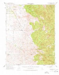
USGS Historical Quadrangle in GeoPDF.
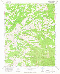
USGS Historical Quadrangle in GeoPDF.
We used radio-telemetry to monitor the survival of dispersing and philopatric juvenile snowshoe hares (Lepus americanus) in southwestern Yukon Territory, Canada, during a cyclic population increase. Neither 28-day survival nor the proportion of hares surviving to breed differed significantly between juvenile hares that dispersed and those that did not, nor was there a significant relationship between dispersal distance and fate (dead or alive). Our results indicate that the overall survival cost associated with natal dispersal is low for snowshoe hares during the early increase of the hare cycle.
In 1989, the Chisana caribou (Rangifer tarandus) herd in the northern Wrangell Mountains, Alaska, U.S.A., declined substantially in population size and productivity. Grasses, sedges, forbs, and willows (Salix spp.) are critical components of the diet of caribou in spring and summer, and the abundance and quality of forage are influenced by climate. To evaluate effects of climatic variation on caribou forage we conducted a field experiment in subarctic tundra where light, air temperature, and precipitation were manipulated. We used a plastic tarpaulin to increase air temperature and decrease precipitation. We also decreased light intensity with a shade cloth and increased precipitation by adding water to determine...
Categories: Publication;
Types: Citation;
Tags: B5-Caribou,
Chisana,
P2-Changes in Plant and Animal Species Due to Climate Change,
Projecting Future States 2,
White River
This data set contains imagery from the National Agriculture Imagery Program (NAIP). The NAIP program is administered by USDA FSA and has been established to support two main FSA strategic goals centered on agricultural production. These are, increase stewardship of America's natural resources while enhancing the environment, and to ensure commodities are procured and distributed effectively and efficiently to increase food security. The NAIP program supports these goals by acquiring and providing ortho imagery that has been collected during the agricultural growing season in the U.S. The NAIP ortho imagery is tailored to meet FSA requirements and is a fundamental tool used to support FSA farm and conservation programs....

USGS Historical Quadrangle in GeoPDF.
Data are presented in support of USGS Scientific Investigations Report, "Investigation of factors controlling benthic algae in the Upper White River watershed, Colorado, 2018-21". This dataset contains cross section, pebble count, and velocity data for the White River upstream of Meeker, Colorado; collected during 2018, 2019, and 2020.
|

|
