Filters: Tags: WILLOW CREEK (X)
59 results (110ms)|
Filters
Date Range
Types Contacts
Categories Tag Types
|
The data set contains vertical profiles of physical (water temperature, specific conductance, pH, dissolved oxygen, and turbidity) and biological measurements (chlorophyll-a and phycocyanin) that were measured hourly and then summarized on a daily basis within Willow Creek Lake during the non-winter seasons.
This data set contains imagery from the National Agriculture Imagery Program (NAIP). The NAIP program is administered by USDA FSA and has been established to support two main FSA strategic goals centered on agricultural production. These are, increase stewardship of America's natural resources while enhancing the environment, and to ensure commodities are procured and distributed effectively and efficiently to increase food security. The NAIP program supports these goals by acquiring and providing ortho imagery that has been collected during the agricultural growing season in the U.S. The NAIP ortho imagery is tailored to meet FSA requirements and is a fundamental tool used to support FSA farm and conservation programs....
This dataset includes spatial location information from 167 temperature data loggers that were installed throughout the Willow/Rock/Frazer watersheds of northern Nevada between July 30 and August 14, 2015. One hundred twelve data loggers were installed in stream channels (some of which were dry), 50 data loggers were installed outside the stream channel to measure air temperature, and 5 data loggers were installed on ridgetops to measure air temperature across the watershed.
Categories: Data;
Tags: Drought,
Drought, Fire and Extreme Weather,
Elko County,
Frazer Creek,
GNIS ID 843273,
Types: Citation;
Tags: Aquatic Biology,
Drought,
Drought, Fire and Extreme Weather,
Ecology,
GNIS ID 1129010,
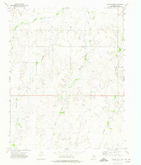
USGS Historical Quadrangle in GeoPDF.
USGS Historical Quadrangle in GeoPDF.
This data set contains imagery from the National Agriculture Imagery Program (NAIP). The NAIP program is administered by USDA FSA and has been established to support two main FSA strategic goals centered on agricultural production. These are, increase stewardship of America's natural resources while enhancing the environment, and to ensure commodities are procured and distributed effectively and efficiently to increase food security. The NAIP program supports these goals by acquiring and providing ortho imagery that has been collected during the agricultural growing season in the U.S. The NAIP ortho imagery is tailored to meet FSA requirements and is a fundamental tool used to support FSA farm and conservation programs....
As a part of the statewide Public Beach Monitoring Program–Bacteria and Microcystin, the Lower Elkhorn Natural Resources District collected weekly samples at Willow Creek Lake to monitor microcystin concentrations. The monitoring generally followed the procedures described by Graham and others (2008) for recreational areas. Sampling occurred weekly during May through September, 2006 to 2014, though data provided in this Data Release are limited to 2012 to 2014. Grab samples were collected from the water surface by wading at the south-shore swimming beach. In the laboratory, the samples underwent three freeze-thaw cycles to lyse the cells prior to analysis using the enzyme-linked immunosorbent assay technique to...
Categories: Data;
Tags: Willow Creek,
Willow Creek Lake,
harmful algal blooms,
nutrient content (water)
This dataset includes stream temperatures from a network of 112 data loggers that was installed in stream channels throughout the Willow/Rock/Frazer watersheds of northern Nevada between July 31 and August 15, 2015. Ninety-seven data loggers were recovered and downloaded in late July 2016.
Categories: Data;
Tags: Drought,
Drought, Fire and Extreme Weather,
Elko County,
Frazer Creek,
GNIS ID 843273,
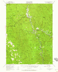
USGS Historical Quadrangle in GeoPDF.

USGS Historical Quadrangle in GeoPDF.
This data set contains imagery from the National Agriculture Imagery Program (NAIP). The NAIP program is administered by USDA FSA and has been established to support two main FSA strategic goals centered on agricultural production. These are, increase stewardship of America's natural resources while enhancing the environment, and to ensure commodities are procured and distributed effectively and efficiently to increase food security. The NAIP program supports these goals by acquiring and providing ortho imagery that has been collected during the agricultural growing season in the U.S. The NAIP ortho imagery is tailored to meet FSA requirements and is a fundamental tool used to support FSA farm and conservation programs....
This data set contains imagery from the National Agriculture Imagery Program (NAIP). The NAIP program is administered by USDA FSA and has been established to support two main FSA strategic goals centered on agricultural production. These are, increase stewardship of America's natural resources while enhancing the environment, and to ensure commodities are procured and distributed effectively and efficiently to increase food security. The NAIP program supports these goals by acquiring and providing ortho imagery that has been collected during the agricultural growing season in the U.S. The NAIP ortho imagery is tailored to meet FSA requirements and is a fundamental tool used to support FSA farm and conservation programs....
Streamflow was measured at the three largest inflows (the Foster, NT, and ST sites) of Willow Creek Lake and at the outflow of the lake. Flow data were typically available at a 15-minute frequency, but generally were summarized as daily means. Flow data for the Foster, NT, and outflow sites were provided by the Nebraska Department of Natural Resources (NDNR) and were estimated using stage-flow relations applied to measured stage following protocols described by Kennedy (1983). Flow at the ST site was measured by the U.S. Geological Survey using an indirect rating curve with water levels monitored continuously by a submersible pressure transducer and periodic streamflow measurements collected using a Parshall flume...
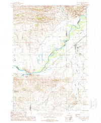
USGS Historical Quadrangle in GeoPDF.
Flow interaction between Willow Creek Lake and groundwater was calculated from a lake water balance (Healy and others, 2007) in which all of the other flow components were either measured or estimated between 2012 and 2014 (as described in Rus and others, 2018) and the interaction was the residual term. Inflow terms consisted of streamflow at three sites (Foster, NT, and ST) as well as the direct precipitation onto the lake. Measured outflow terms consisted of the streamflow at the outflow site and the direct evaporation from the lake. Increases in lake storage had the same effect on the water balance as an outflow. All components of the water balance were tabulated on a daily basis and converted to units of acre-feet...
This data set contains imagery from the National Agriculture Imagery Program (NAIP). The NAIP program is administered by USDA FSA and has been established to support two main FSA strategic goals centered on agricultural production. These are, increase stewardship of America's natural resources while enhancing the environment, and to ensure commodities are procured and distributed effectively and efficiently to increase food security. The NAIP program supports these goals by acquiring and providing ortho imagery that has been collected during the agricultural growing season in the U.S. The NAIP ortho imagery is tailored to meet FSA requirements and is a fundamental tool used to support FSA farm and conservation programs....
This data set contains imagery from the National Agriculture Imagery Program (NAIP). The NAIP program is administered by USDA FSA and has been established to support two main FSA strategic goals centered on agricultural production. These are, increase stewardship of America's natural resources while enhancing the environment, and to ensure commodities are procured and distributed effectively and efficiently to increase food security. The NAIP program supports these goals by acquiring and providing ortho imagery that has been collected during the agricultural growing season in the U.S. The NAIP ortho imagery is tailored to meet FSA requirements and is a fundamental tool used to support FSA farm and conservation programs....
This data set contains imagery from the National Agriculture Imagery Program (NAIP). The NAIP program is administered by USDA FSA and has been established to support two main FSA strategic goals centered on agricultural production. These are, increase stewardship of America's natural resources while enhancing the environment, and to ensure commodities are procured and distributed effectively and efficiently to increase food security. The NAIP program supports these goals by acquiring and providing ortho imagery that has been collected during the agricultural growing season in the U.S. The NAIP ortho imagery is tailored to meet FSA requirements and is a fundamental tool used to support FSA farm and conservation programs....

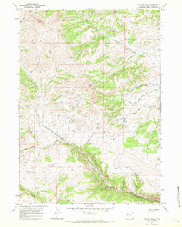
USGS Historical Quadrangle in GeoPDF.
|

|
