Filters: Tags: Walker Lake (X)
27 results (446ms)|
Filters
Date Range
Extensions Types
Contacts
Categories Tag Types Tag Schemes |
This dataset consists of points representing selected well site locations and water-level measurements used by Lopes and Allander (2009) to develop autumn 2006 groundwater-level altitude contours for Smith and Mason Valleys, and the lower Walker River basin, Nevada. Since the publication of Lopes and Allander (2009), the positional coordinates and land-surface altitudes at selected well sites used to develop autumn 2006 groundwater-level contours in that report were updated as part of a 2022 U.S. Geological Survey study (Davies and Naranjo, 2022).
Categories: Data;
Types: Downloadable,
Map Service,
OGC WFS Layer,
OGC WMS Layer,
Shapefile;
Tags: Antelope Valley,
Basin 106,
Basin 107,
Basin 108,
Basin 109,
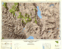
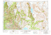
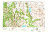
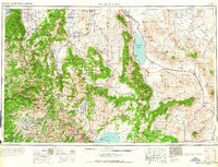
USGS Historical Quadrangle in GeoPDF.
This dataset consists of digitized 1:24,000-scale polylines and polygons representing hydrographic areas for the Walker River basin, California and Nevada.
Categories: Data;
Types: Downloadable,
Map Service,
OGC WFS Layer,
OGC WMS Layer,
Shapefile;
Tags: Antelope Valley,
Basin 106,
Basin 107,
Basin 108,
Basin 109,
This data set contains imagery from the National Agriculture Imagery Program (NAIP). The NAIP program is administered by USDA FSA and has been established to support two main FSA strategic goals centered on agricultural production. These are, increase stewardship of America's natural resources while enhancing the environment, and to ensure commodities are procured and distributed effectively and efficiently to increase food security. The NAIP program supports these goals by acquiring and providing ortho imagery that has been collected during the agricultural growing season in the U.S. The NAIP ortho imagery is tailored to meet FSA requirements and is a fundamental tool used to support FSA farm and conservation programs....
This data set contains imagery from the National Agriculture Imagery Program (NAIP). The NAIP program is administered by USDA FSA and has been established to support two main FSA strategic goals centered on agricultural production. These are, increase stewardship of America's natural resources while enhancing the environment, and to ensure commodities are procured and distributed effectively and efficiently to increase food security. The NAIP program supports these goals by acquiring and providing ortho imagery that has been collected during the agricultural growing season in the U.S. The NAIP ortho imagery is tailored to meet FSA requirements and is a fundamental tool used to support FSA farm and conservation programs....
This data set contains imagery from the National Agriculture Imagery Program (NAIP). The NAIP program is administered by USDA FSA and has been established to support two main FSA strategic goals centered on agricultural production. These are, increase stewardship of America's natural resources while enhancing the environment, and to ensure commodities are procured and distributed effectively and efficiently to increase food security. The NAIP program supports these goals by acquiring and providing ortho imagery that has been collected during the agricultural growing season in the U.S. The NAIP ortho imagery is tailored to meet FSA requirements and is a fundamental tool used to support FSA farm and conservation programs....
This data set contains imagery from the National Agriculture Imagery Program (NAIP). The NAIP program is administered by USDA FSA and has been established to support two main FSA strategic goals centered on agricultural production. These are, increase stewardship of America's natural resources while enhancing the environment, and to ensure commodities are procured and distributed effectively and efficiently to increase food security. The NAIP program supports these goals by acquiring and providing ortho imagery that has been collected during the agricultural growing season in the U.S. The NAIP ortho imagery is tailored to meet FSA requirements and is a fundamental tool used to support FSA farm and conservation programs....
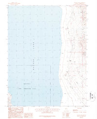
USGS Historical Quadrangle in GeoPDF.

USGS Historical Quadrangle in GeoPDF.
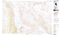
USGS Historical Quadrangle in GeoPDF.

USGS Historical Quadrangle in GeoPDF.
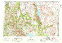
USGS Historical Quadrangle in GeoPDF.

USGS Historical Quadrangle in GeoPDF.
USGS Historical Quadrangle in GeoPDF.
USGS Historical Quadrangle in GeoPDF.
USGS Historical Quadrangle in GeoPDF.
This dataset consists of digitized 1:62,500-scale polylines representing autumn 2006 groundwater-level altitude contours for Smith and Mason Valleys, and the lower Walker River basin, Nevada.
Categories: Data;
Types: Downloadable,
Map Service,
OGC WFS Layer,
OGC WMS Layer,
Shapefile;
Tags: Antelope Valley,
Basin 106,
Basin 107,
Basin 108,
Basin 109,
This data set contains imagery from the National Agriculture Imagery Program (NAIP). The NAIP program is administered by USDA FSA and has been established to support two main FSA strategic goals centered on agricultural production. These are, increase stewardship of America's natural resources while enhancing the environment, and to ensure commodities are procured and distributed effectively and efficiently to increase food security. The NAIP program supports these goals by acquiring and providing ortho imagery that has been collected during the agricultural growing season in the U.S. The NAIP ortho imagery is tailored to meet FSA requirements and is a fundamental tool used to support FSA farm and conservation programs....
These data were released prior to the October 1, 2016 effective date for the USGS’s policy dictating the review, approval, and release of scientific data as referenced in USGS Survey Manual Chapter 502.8 Fundamental Science Practices: Review and Approval of Scientific Data for Release. Walker Lake lies within a topographically closed basin in west-central Nevada and is the terminus of the Walker River. Accurately determining the bathymetry and relations between lake-surface altitude, surface area, and storage volume are part of a study to improve the water budget for Walker Lake. Bathymetry of Walker Lake was measured using a single-beam echosounder coupled to a differentially-corrected global positioning system....
Categories: pre-SM502.8;
Tags: Churchill County,
Lidar,
Mineral County,
NSDI,
USGS Science Data Catalog (SDC),

USGS Historical Quadrangle in GeoPDF.
|

|
