Filters: Tags: Wellfleet (X)
51 results (9ms)|
Filters
Date Range
Extensions Types Contacts
Categories Tag Types Tag Schemes |
The data in this release re-map the beach and nearshore environment at Marconi Beach in Wellfleet, MA and provide updated environmental context for the 2021 CoastCam installation that looks out at the coast shared by beachgoers, shorebirds, seals, and sharks. This is related to the field activity 2022-014-FA and a collaboration with the National Park Service at Cape Cod National Seashore to monitor the region that falls within the field of view of CoastCam CACO-02, which are two video cameras aimed at the beach. In March 2023, U.S. Geological Survey and Woods Hole Oceanographic Institute (WHOI) scientists conducted field surveys to collect topographic and bathymetric data. Images of the beach for use in structure-from-motion...
Categories: Data;
Tags: ASV,
CMHRP,
Cape Cod,
Coastal and Marine Hazards and Resources Program,
Marconi Beach,
The data in this release re-map the beach and nearshore environment at Marconi Beach in Wellfleet, MA and provide updated environmental context for the 2021 CoastCam installation that looks out at the coast shared by beachgoers, shorebirds, seals, and sharks. This is related to the field activity 2022-014-FA and a collaboration with the National Park Service at Cape Cod National Seashore to monitor the region that falls within the field of view of CoastCam CACO-02, which are two video cameras aimed at the beach. In March 2023, U.S. Geological Survey and Woods Hole Oceanographic Institute (WHOI) scientists conducted field surveys to collect topographic and bathymetric data. Images of the beach for use in structure-from-motion...
Categories: Data;
Tags: AeroPoint,
CMHRP,
Cape Cod,
Coastal and Marine Hazards and Resources Program,
GPS measurement,
Management efforts of the tidally-restricted Herring River in Wellfleet, MA include research to understand pre-restoration sediment conditions. Submerged multiparameter sondes that measure optical turbidity were deployed at four sites landward and seaward of the Herring River restriction. Periodically, the sites were visited and additional turbidity measurements were collected with a handheld multiparameter sonde, and water samples were collected for determination of suspended-sediment concentration (SSC). The handheld turbidity measurements were regressed against SSC using a repeated median regression to determine a calibration curve for calibrating the turbidity time-series data to SSC. The SSC derived from the...
Categories: Data;
Tags: Cape Cod National Seashore,
Herring River,
Massachusetts,
Water Quality,
Wellfleet,
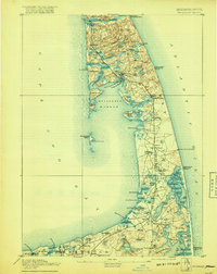
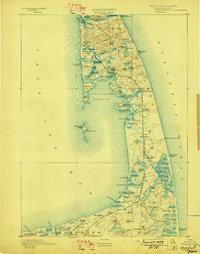
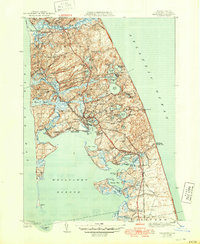
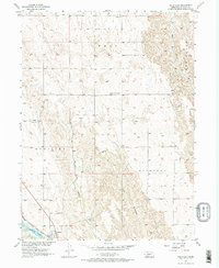
USGS Historical Quadrangle in GeoPDF.

USGS Historical Quadrangle in GeoPDF.
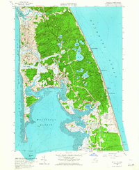
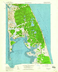
This data set contains imagery from the National Agriculture Imagery Program (NAIP). The NAIP program is administered by USDA FSA and has been established to support two main FSA strategic goals centered on agricultural production. These are, increase stewardship of America's natural resources while enhancing the environment, and to ensure commodities are procured and distributed effectively and efficiently to increase food security. The NAIP program supports these goals by acquiring and providing ortho imagery that has been collected during the agricultural growing season in the U.S. The NAIP ortho imagery is tailored to meet FSA requirements and is a fundamental tool used to support FSA farm and conservation programs....
The data in this release map the beach and nearshore environment at Marconi Beach in Wellfleet, MA and provide updated environmental context for the 2021 CoastCam installation that looks out at the coast shared by beachgoers, shorebirds, seals, and sharks. This is related to the field activity 2022-014-FA and a collaboration with the National Park Service at Cape Cod National Seashore to monitor the region that falls within the field of view of CoastCam CACO-02, which are two video cameras aimed at the beach. In March 2022, U.S Geological Survey and Woods Hole Oceanographic Institute (WHOI) scientists conducted field surveys to map the CoastCam field of view. Aerial images of the beach for use in structure from...

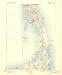
USGS Historical Quadrangle in GeoPDF.
USGS Historical Quadrangle in GeoPDF.
This data set contains imagery from the National Agriculture Imagery Program (NAIP). The NAIP program is administered by USDA FSA and has been established to support two main FSA strategic goals centered on agricultural production. These are, increase stewardship of America's natural resources while enhancing the environment, and to ensure commodities are procured and distributed effectively and efficiently to increase food security. The NAIP program supports these goals by acquiring and providing ortho imagery that has been collected during the agricultural growing season in the U.S. The NAIP ortho imagery is tailored to meet FSA requirements and is a fundamental tool used to support FSA farm and conservation programs....
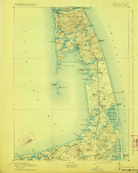
The data in this release map the beach and nearshore environment at Marconi Beach in Wellfleet, MA and provide updated environmental context for the 2021 CoastCam installation that looks out at the coast shared by beachgoers, shorebirds, seals, and sharks. This is related to the field activity 2022-014-FA and a collaboration with the National Park Service at Cape Cod National Seashore to monitor the region that falls within the field of view of CoastCam CACO-02, which are two video cameras aimed at the beach. In March 2022, U.S Geological Survey and Woods Hole Oceanographic Institute (WHOI) scientists conducted field surveys to map the CoastCam field of view. Elevation data were collected using a real time kinematic...
Categories: Data;
Tags: 3-band imagery,
CMHRP,
Cape Cod,
Coastal and Marine Hazards and Resources Program,
Helikite,
USGS Historical Quadrangle in GeoPDF.

USGS Historical Quadrangle in GeoPDF.
USGS Historical Quadrangle in GeoPDF.
USGS Historical Quadrangle in GeoPDF.
USGS Historical Quadrangle in GeoPDF.
USGS Historical Quadrangle in GeoPDF.
USGS Historical Quadrangle in GeoPDF.
|

|
