Filters: Tags: Wenatchee (X)
30 results (21ms)|
Filters
Date Range
Extensions Types
Contacts
Categories Tag Types Tag Schemes |
This data set contains imagery from the National Agriculture Imagery Program (NAIP). The NAIP program is administered by USDA FSA and has been established to support two main FSA strategic goals centered on agricultural production. These are, increase stewardship of America's natural resources while enhancing the environment, and to ensure commodities are procured and distributed effectively and efficiently to increase food security. The NAIP program supports these goals by acquiring and providing ortho imagery that has been collected during the agricultural growing season in the U.S. The NAIP ortho imagery is tailored to meet FSA requirements and is a fundamental tool used to support FSA farm and conservation programs....
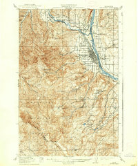
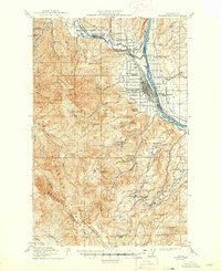
USGS Historical Quadrangle in GeoPDF.
The Chelan mule deer herd occupies a mix of private and public lands from the Columbia River to the crest of the Cascade Range in central Washington. U.S. Highway 2, northwest of Wenatchee, Washington, serves as the southern boundary for this herd and Lake Chelan bounds the northern edge. The high-use winter range includes the southeastern shore of Lake Chelan, the breaks of the Columbia River, the lower Entiat River drainage, and the foothills east of Cashmere, Washington. In the spring, migratory individuals travel northwest into the Entiat and Chelan Mountains to their summer ranges, such as regional Wilderness areas. A small sample of Chelan mule deer was captured near the Swakane Wildlife Area in January 2020...
Categories: Data;
Types: Downloadable,
Map Service,
OGC WFS Layer,
OGC WMS Layer,
Shapefile;
Tags: United States,
Washington,
Wenatchee,
animal behavior,
biota,
Along the eastern slope of the Cascade Mountains in Chelan and Kittitas counties, the Wenatchee Mountains mule deer herd inhabits a matrix of private and public lands. Historically, the Wenatchee Mountains mule deer were separated into two sub-herds, Chelan and Kittitas; however, recent movement data from GPS-collared individuals associated with Secretarial Order 3362 (Department of the Interior, 2018) revealed that the mule deer south of U.S. Highway 2 and north of Interstate 90 represent one population. Their high-use winter range extends along the foothills west and south of Wenatchee, Washington and throughout the foothills of the Kittitas Valley outside Ellensburg, Washington. The low-use winter range occurs...
Categories: Data;
Types: Downloadable,
Map Service,
OGC WFS Layer,
OGC WMS Layer,
Shapefile;
Tags: United States,
Washington,
Wenatchee,
animal behavior,
biota,
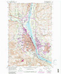
USGS Historical Quadrangle in GeoPDF.
The Wenatchee Mountains mule deer herd inhabits a matrix of private and public lands along the eastern slope of the Cascade Range in Chelan and Kittitas Counties in Washington (fig. 24). Historically, the Wenatchee Mountains mule deer herd was separated into two subherds, Chelan and Kittitas; however, recent GPS collar data indicated the mule deer south of U.S. Highway 2 and north of Interstate 90 represent one population. Their high-use winter range extends along the foothills west and south of Wenatchee, Washington and throughout the foothills of the Kittitas Valley near Ellensburg. Their low-use winter range occurs along the foothills west of the Columbia River north of Interstate 90. In the spring, migratory...
Categories: Data;
Types: Downloadable,
Map Service,
OGC WFS Layer,
OGC WMS Layer,
Shapefile;
Tags: United States,
Washington,
Wenatchee,
animal behavior,
biota,
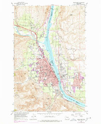
USGS Historical Quadrangle in GeoPDF.
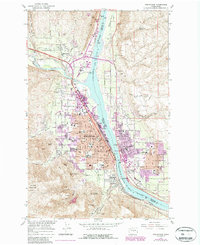
USGS Historical Quadrangle in GeoPDF.
USGS Historical Quadrangle in GeoPDF.
This data set contains imagery from the National Agriculture Imagery Program (NAIP). The NAIP program is administered by USDA FSA and has been established to support two main FSA strategic goals centered on agricultural production. These are, increase stewardship of America's natural resources while enhancing the environment, and to ensure commodities are procured and distributed effectively and efficiently to increase food security. The NAIP program supports these goals by acquiring and providing ortho imagery that has been collected during the agricultural growing season in the U.S. The NAIP ortho imagery is tailored to meet FSA requirements and is a fundamental tool used to support FSA farm and conservation programs....
Along the eastern slope of the Cascade Mountains in Chelan and Kittitas counties, the Wenatchee Mountains mule deer herd inhabits a matrix of private and public lands. Historically, the Wenatchee Mountains mule deer were separated into two sub-herds, Chelan and Kittitas; however, recent movement data from GPS-collared individuals associated with Secretarial Order 3362 (Department of the Interior, 2018) revealed that the mule deer south of U.S. Highway 2 and north of Interstate 90 represent one population. Their high-use winter range extends along the foothills west and south of Wenatchee, Washington and throughout the foothills of the Kittitas Valley outside Ellensburg, Washington. The low-use winter range occurs...
Categories: Data;
Types: Downloadable,
Map Service,
OGC WFS Layer,
OGC WMS Layer,
Shapefile;
Tags: United States,
Washington,
Wenatchee,
animal behavior,
biota,
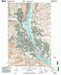
USGS Historical Quadrangle in GeoPDF.
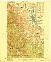
USGS Historical Quadrangle in GeoPDF.
The Chelan mule deer herd occupies a mix of private and public lands from the Columbia River to the crest of the Cascade Range in central Washington. U.S. Highway 2, northwest of Wenatchee, Washington, serves as the southern boundary for this herd and Lake Chelan bounds the northern edge. The high-use winter range includes the southeastern shore of Lake Chelan, the breaks of the Columbia River, the lower Entiat River drainage, and the foothills east of Cashmere, Washington. In the spring, migratory individuals travel northwest into the Entiat and Chelan Mountains to their summer ranges, such as regional Wilderness areas. A small sample of Chelan mule deer was captured near the Swakane Wildlife Area in January 2020...
Categories: Data;
Types: Downloadable,
Map Service,
OGC WFS Layer,
OGC WMS Layer,
Shapefile;
Tags: United States,
Washington,
Wenatchee,
animal behavior,
biota,
This data set contains imagery from the National Agriculture Imagery Program (NAIP). The NAIP program is administered by USDA FSA and has been established to support two main FSA strategic goals centered on agricultural production. These are, increase stewardship of America's natural resources while enhancing the environment, and to ensure commodities are procured and distributed effectively and efficiently to increase food security. The NAIP program supports these goals by acquiring and providing ortho imagery that has been collected during the agricultural growing season in the U.S. The NAIP ortho imagery is tailored to meet FSA requirements and is a fundamental tool used to support FSA farm and conservation programs....
The Wenatchee Mountains mule deer herd inhabits a matrix of private and public lands along the eastern slope of the Cascade Range in Chelan and Kittitas Counties in Washington (fig. 24). Historically, the Wenatchee Mountains mule deer herd was separated into two subherds, Chelan and Kittitas; however, recent GPS collar data indicated the mule deer south of U.S. Highway 2 and north of Interstate 90 represent one population. Their high-use winter range extends along the foothills west and south of Wenatchee, Washington and throughout the foothills of the Kittitas Valley near Ellensburg. Their low-use winter range occurs along the foothills west of the Columbia River north of Interstate 90. In the spring, migratory...
Categories: Data;
Types: Downloadable,
Map Service,
OGC WFS Layer,
OGC WMS Layer,
Shapefile;
Tags: United States,
Washington,
Wenatchee,
animal behavior,
biota,

USGS Historical Quadrangle in GeoPDF.

USGS Historical Quadrangle in GeoPDF.
|

|
