Filters
Date Range
Types
Contacts
Tag Types
Tag Schemes
|
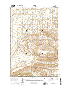
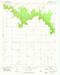
This data set contains imagery from the National Agriculture Imagery Program (NAIP). The NAIP program is administered by USDA FSA and has been established to support two main FSA strategic goals centered on agricultural production. These are, increase stewardship of America's natural resources while enhancing the environment, and to ensure commodities are procured and distributed effectively and efficiently to increase food security. The NAIP program supports these goals by acquiring and providing ortho imagery that has been collected during the agricultural growing season in the U.S. The NAIP ortho imagery is tailored to meet FSA requirements and is a fundamental tool used to support FSA farm and conservation programs....
Types: Citation;
Tags: 3.75 x 3.75 minute,
30107,
4610942,
Aerial Compliance,
Compliance, All tags...
Digital Ortho rectified Image,
Downloadable Data,
JPEG2000,
MT,
MT107,
NAIP,
Ortho Rectification,
Orthoimagery,
Quarter Quadrangle,
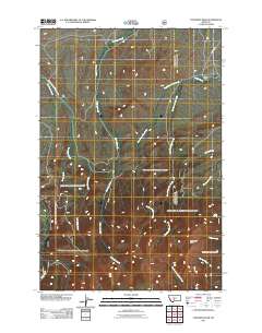
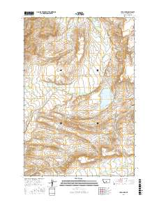
TEN O'CLOCK GATE,
TEN O'CLOCK GATE, NW,
USDA National Agriculture Imagery Program (NAIP),
WHEATLAND CO MT FSA,
Wheatland,
farming, Fewer tags
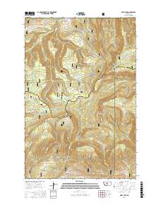
This data set contains imagery from the National Agriculture Imagery Program (NAIP). The NAIP program is administered by USDA FSA and has been established to support two main FSA strategic goals centered on agricultural production. These are, increase stewardship of America's natural resources while enhancing the environment, and to ensure commodities are procured and distributed effectively and efficiently to increase food security. The NAIP program supports these goals by acquiring and providing ortho imagery that has been collected during the agricultural growing season in the U.S. The NAIP ortho imagery is tailored to meet FSA requirements and is a fundamental tool used to support FSA farm and conservation programs....
Types: Citation;
Tags: 3.75 x 3.75 minute,
30107,
4610952,
Aerial Compliance,
Compliance, All tags...
Digital Ortho rectified Image,
Downloadable Data,
JPEG2000,
MT,
MT107,
NAIP,
Ortho Rectification,
Orthoimagery,
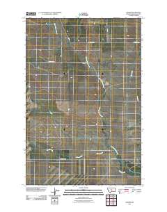
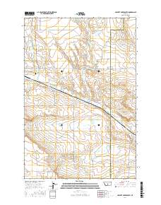
PROGRESS,
PROGRESS, NE,
Quarter Quadrangle,
USDA National Agriculture Imagery Program (NAIP),
WHEATLAND CO MT FSA,
Wheatland,
farming, Fewer tags
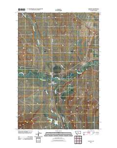
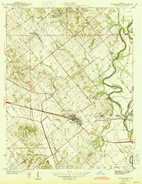
Layered GeoPDF 7.5 Minute Quadrangle Map. Layers of geospatial data include orthoimagery, roads, grids, geographic names, elevation contours, hydrography, and other selected map features.
Tags: 7.5 x 7.5 minute,
Cinnamon Peak, MT,
Downloadable Data,
EarthCover,
GeoPDF, All tags...
Imagery and Base Maps,
Map,
Meagher,
Montana,
U.S. National Grid,
US,
US Topo,
US Topo Historical,
United States,
Wheatland,
contour,
geographic names,
hydrography,
imageryBaseMapsEarthCover,
orthoimage,
structures,
topographic,
transportation, Fewer tags
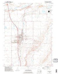
Layered GeoPDF 7.5 Minute Quadrangle Map. Layers of geospatial data include orthoimagery, roads, grids, geographic names, elevation contours, hydrography, and other selected map features.
Tags: 7.5 x 7.5 minute,
Downloadable Data,
EarthCover,
GeoPDF,
Imagery and Base Maps, All tags...
Map,
Montana,
Oxford, MT,
U.S. National Grid,
US,
US Topo,
US Topo Historical,
United States,
Wheatland,
contour,
geographic names,
hydrography,
imageryBaseMapsEarthCover,
orthoimage,
structures,
topographic,
transportation, Fewer tags
Layered GeoPDF 7.5 Minute Quadrangle Map. Layers of geospatial data include orthoimagery, roads, grids, geographic names, elevation contours, hydrography, and other selected map features.
Tags: 7.5 x 7.5 minute,
Downloadable Data,
EarthCover,
GeoPDF,
Golden Valley, All tags...
Imagery and Base Maps,
Map,
Montana,
Progress, MT,
Sweet Grass,
U.S. National Grid,
US,
US Topo,
US Topo Historical,
United States,
Wheatland,
contour,
geographic names,
hydrography,
imageryBaseMapsEarthCover,
orthoimage,
structures,
topographic,
transportation, Fewer tags
Layered geospatial PDF Map. Layers of geospatial data include orthoimagery, roads, grids, geographic names, elevation contours, hydrography, and other selected map features.
Tags: 7.5 x 7.5 minute,
Downloadable Data,
EarthCover,
GeoPDF,
Golden Valley, All tags...
Imagery and Base Maps,
Jim Creek, MT,
Map,
Montana,
Public Land Survey System,
Sweet Grass,
U.S. National Grid,
US,
US Topo,
US Topo Historical,
United States,
Wheatland,
boundary,
contour,
geographic names,
hydrography,
imageryBaseMapsEarthCover,
orthoimage,
structures,
topographic,
transportation,
woodland, Fewer tags
Layered geospatial PDF Map. Layers of geospatial data include orthoimagery, roads, grids, geographic names, elevation contours, hydrography, and other selected map features.
Tags: 7.5 x 7.5 minute,
Downloadable Data,
EarthCover,
GeoPDF,
Imagery and Base Maps, All tags...
Lebo Lake, MT,
Map,
Montana,
Public Land Survey System,
U.S. National Grid,
US,
US Topo,
US Topo Historical,
United States,
Wheatland,
boundary,
contour,
geographic names,
hydrography,
imageryBaseMapsEarthCover,
orthoimage,
structures,
topographic,
transportation,
woodland, Fewer tags
Layered geospatial PDF Map. Layers of geospatial data include orthoimagery, roads, grids, geographic names, elevation contours, hydrography, and other selected map features.
Tags: 7.5 x 7.5 minute,
Downloadable Data,
EarthCover,
GeoPDF,
Imagery and Base Maps, All tags...
Loco Mountain, MT,
Map,
Meagher,
Montana,
Park,
Public Land Survey System,
Sweet Grass,
U.S. National Grid,
US,
US Topo,
US Topo Historical,
United States,
Wheatland,
boundary,
contour,
geographic names,
hydrography,
imageryBaseMapsEarthCover,
orthoimage,
structures,
topographic,
transportation,
woodland, Fewer tags
Layered geospatial PDF Map. Layers of geospatial data include orthoimagery, roads, grids, geographic names, elevation contours, hydrography, and other selected map features.
Tags: 7.5 x 7.5 minute,
Downloadable Data,
EarthCover,
GeoPDF,
Golden Valley, All tags...
Halbert Creek South, MT,
Imagery and Base Maps,
Map,
Montana,
Public Land Survey System,
U.S. National Grid,
US,
US Topo,
US Topo Historical,
United States,
Wheatland,
boundary,
contour,
geographic names,
hydrography,
imageryBaseMapsEarthCover,
orthoimage,
structures,
topographic,
transportation,
woodland, Fewer tags
Layered GeoPDF 7.5 Minute Quadrangle Map. Layers of geospatial data include orthoimagery, roads, grids, geographic names, elevation contours, hydrography, and other selected map features.
Tags: 7.5 x 7.5 minute,
Downloadable Data,
EarthCover,
GeoPDF,
Haymaker Ranch SW, MT, All tags...
Imagery and Base Maps,
Map,
Montana,
U.S. National Grid,
US,
US Topo,
US Topo Historical,
United States,
Wheatland,
contour,
geographic names,
hydrography,
imageryBaseMapsEarthCover,
orthoimage,
structures,
topographic,
transportation, Fewer tags
Layered GeoPDF 7.5 Minute Quadrangle Map. Layers of geospatial data include orthoimagery, roads, grids, geographic names, elevation contours, hydrography, and other selected map features.
Tags: 7.5 x 7.5 minute,
Downloadable Data,
EarthCover,
GeoPDF,
Imagery and Base Maps, All tags...
Map,
Montana,
Public Land Survey System,
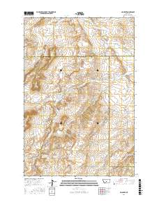
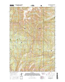
Ten O'Clock Gate, MT,
U.S. National Grid,
US,
US Topo,
US Topo Historical,
United States,
Wheatland,
boundary,
contour,
geographic names,
hydrography,
imageryBaseMapsEarthCover,
orthoimage,
structures,
topographic,
transportation,
woodland, Fewer tags
Layered geospatial PDF Map. Layers of geospatial data include orthoimagery, roads, grids, geographic names, elevation contours, hydrography, and other selected map features.
Tags: 7.5 x 7.5 minute,
Daisy Peak, MT,
Downloadable Data,
EarthCover,
GeoPDF, All tags...
Imagery and Base Maps,
Judith Basin,
Map,
Meagher,
Montana,
Public Land Survey System,
U.S. National Grid,
US,
US Topo,
US Topo Historical,
United States,
Wheatland,
boundary,
contour,
geographic names,
hydrography,
imageryBaseMapsEarthCover,
orthoimage,
structures,
topographic,
transportation,
woodland, Fewer tags
Layered GeoPDF 7.5 Minute Quadrangle Map. Layers of geospatial data include orthoimagery, roads, grids, geographic names, elevation contours, hydrography, and other selected map features.
Tags: 7.5 x 7.5 minute,
Downloadable Data,
EarthCover,
GeoPDF,
Imagery and Base Maps, All tags...
Map,
Montana,
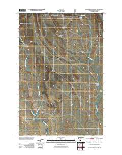
Twodot, MT,
U.S. National Grid,
US,
US Topo,
US Topo Historical,
United States,
Wheatland,
contour,
geographic names,
hydrography,
imageryBaseMapsEarthCover,
orthoimage,
structures,
topographic,
transportation, Fewer tags
USGS Historical Quadrangle in GeoPDF.
Tags: 7.5 x 7.5 minute,
Downloadable Data,
GeoPDF,
GeoTIFF,
Historical Topographic Maps, All tags...
Historical Topographic Maps 7.5 x 7.5 Minute Map Series,
Map,
WY,
Wheatland,
imageryBaseMapsEarthCover, Fewer tags
USGS Historical Quadrangle in GeoPDF.
Tags: 7.5 x 7.5 minute,
Downloadable Data,
GeoPDF,
GeoTIFF,
Historical Topographic Maps, All tags...
Historical Topographic Maps 7.5 x 7.5 Minute Map Series,
Map,
NM,
Wheatland,
imageryBaseMapsEarthCover, Fewer tags
USGS Historical Quadrangle in GeoPDF.
Tags: 7.5 x 7.5 minute,
Downloadable Data,
GeoPDF,
GeoTIFF,
Historical Topographic Maps, All tags...
Historical Topographic Maps 7.5 x 7.5 Minute Map Series,
IN,
Map,
Wheatland,
imageryBaseMapsEarthCover, Fewer tags
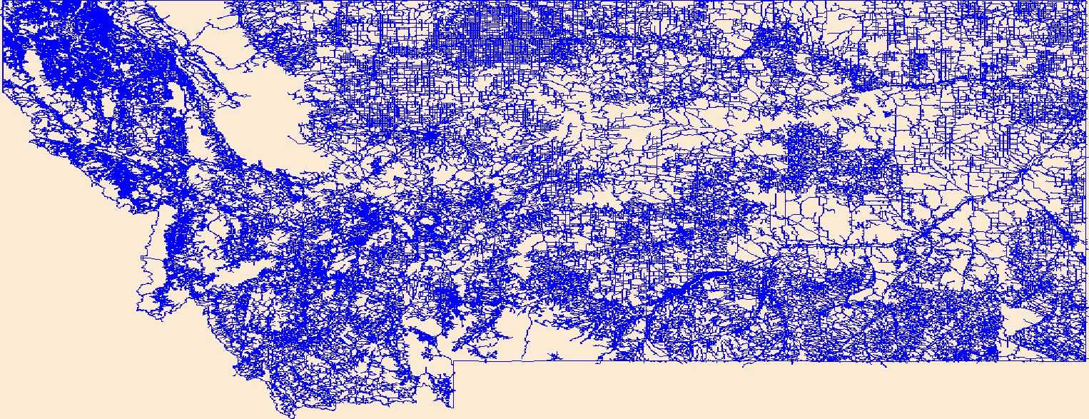
Layers of geospatial data include roads, airports, trails, and railroads.
Tags: Airport Complex,
Airport Point,
Airport Runway,
Airports,
Airstrips, All tags...
Beaverhead,
Big Horn,
Blaine,
Broadwater,
Carbon,
Carter,
Cascade,
Chouteau,
Custer,
Daniels,
Dawson,
Deer Lodge,
Downloadable Data,
Esri File GeoDatabase 10,
Fallon,
Fergus,
FileGDB,
Flathead,
Gallatin,
Garfield,
Geographic names,
Glacier,
Golden Valley,
Granite,
Hill,
Jefferson,
Judith Basin,
Lake,
Lewis and Clark,
Liberty,
Lincoln,
MT,
Madison,
McCone,
Meagher,
Mineral,
Missoula,
Montana,
Musselshell,
National Transportation Dataset (NTD),
National Transportation Dataset (NTD),
Park,
Petroleum,
Phillips,
Pondera,
Powder River,
Powell,
Prairie,
Railways,
Ravalli,
Richland,
Roads,
Roosevelt,
Rosebud,
Sanders,
Sheridan,
Silver Bow,
State,
State,
Stillwater,
Sweet Grass,
Teton,
Toole,
Trail,
Trails,
Transportation,
Transportation,
Treasure,
US,
United States,
Valley,
Waterway,
Wheatland,
Wibaux,
Yellowstone,
transportation, Fewer tags
The Geographic Names Information System (GNIS) is the Federal standard for geographic nomenclature. The U.S. Geological Survey developed the GNIS for the U.S. Board on Geographic Names, a Federal inter-agency body chartered by public law to maintain uniform feature name usage throughout the Government and to promulgate standard names to the public. The GNIS is the official repository of domestic geographic names data; the official vehicle for geographic names use by all departments of the Federal Government; and the source for applying geographic names to Federal electronic and printed products of all types.
Tags: Antarctica,
Antarctica,
BGN,
Beaverhead,
Big Horn, All tags...
Blaine,
Board on Geographic Names,
Borough,
Broadwater,
Carbon,
Carter,
Cascade,
Census Area,
Chouteau,
Commonwealth,
County,
Custer,
Daniels,
Dawson,
Deer Lodge,
District,
Downloadable Data,
Fallon,
Feature class,
Feature coordinates,
Feature county,
Feature description,
Feature designation,
Feature history,
Feature indentification,
Feature name,
Feature state,
Fergus,
Flathead,
GNIS,
Gallatin,
Garfield,
Geographic Names,
Geographic Names Domestic Names,
Geographic Names Information System,
Geographic feature,
Geographic name,
Geographical feature,
Geographical name,
Glacier,
Golden Valley,
Granite,
Hill,
Jefferson,
Judith Basin,
Lake,
Lewis and Clark,
Liberty,
Lincoln,
MT,
Madison,
McCone,
Meagher,
Mineral,
Missoula,
Montana,
Municipio,
Musselshell,
National Geographic Names Information System (GNIS),
National Geographic Names Information System (GNIS),
Official feature name,
Outlying Area,
Parish,
Park,
Petroleum,
Phillips,
Place name,
Pondera,
Populated Place,
Powder River,
Powell,
Prairie,
Ravalli,
Richland,
Roosevelt,
Rosebud,
Sanders,
Sheridan,
Silver Bow,
State,
Stillwater,
Sweet Grass,
TXT (pipes),
Territories,
Territory,
Teton,
Toole,
Topographic Map,
Treasure,
U.S. Board on Geographic Names,
U.S. Geological Survey,
US,
USA,
USBGN,
USGS,
UTF-8 Pipe Delimited Text File nan,
United States,
United States,
United States,
Valley,
Variant name,
Wheatland,
Wibaux,
Yellowstone,
antarctic,
database,
economy,
environment,
feature,
gazetteer,
geographic,
geographic names,
geographical,
geography,
geospatial,
imageryBaseMapsEarthCover,
inlandWaters,
location,
map,
name,
place,
placename,
society,
structure,
topographic map,
toponymy, Fewer tags
This data set contains imagery from the National Agriculture Imagery Program (NAIP). The NAIP program is administered by USDA FSA and has been established to support two main FSA strategic goals centered on agricultural production. These are, increase stewardship of America's natural resources while enhancing the environment, and to ensure commodities are procured and distributed effectively and efficiently to increase food security. The NAIP program supports these goals by acquiring and providing ortho imagery that has been collected during the agricultural growing season in the U.S. The NAIP ortho imagery is tailored to meet FSA requirements and is a fundamental tool used to support FSA farm and conservation programs....
Types: Citation;
Tags: 3.75 x 3.75 minute,
38017,
4609706,
Aerial Compliance,
CASS CO ND FSA, All tags...
Cass,
Compliance,
Digital Ortho rectified Image,
Downloadable Data,
JPEG2000,
NAIP,
ND,
ND017,
Ortho Rectification,
Orthoimagery,
Quarter Quadrangle,
USDA National Agriculture Imagery Program (NAIP),
WHEATLAND,
WHEATLAND, NE,
farming, Fewer tags
This data set contains imagery from the National Agriculture Imagery Program (NAIP). The NAIP program is administered by USDA FSA and has been established to support two main FSA strategic goals centered on agricultural production. These are, increase stewardship of America's natural resources while enhancing the environment, and to ensure commodities are procured and distributed effectively and efficiently to increase food security. The NAIP program supports these goals by acquiring and providing ortho imagery that has been collected during the agricultural growing season in the U.S. The NAIP ortho imagery is tailored to meet FSA requirements and is a fundamental tool used to support FSA farm and conservation programs....
Types: Citation;
Tags: 3.75 x 3.75 minute,
30107,
4610917,
Aerial Compliance,
Compliance, All tags...
Digital Ortho rectified Image,
Downloadable Data,
JPEG2000,
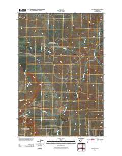
MEAD CREEK,
MEAD CREEK, SE,
MT,
MT107,
NAIP,
Ortho Rectification,
Orthoimagery,
Quarter Quadrangle,
USDA National Agriculture Imagery Program (NAIP),
WHEATLAND CO MT FSA,
Wheatland,
farming, Fewer tags
|
|

