Filters: Tags: Williston Basin (X)
96 results (12ms)|
Filters
Date Range
Extensions Types Contacts
Categories Tag Types Tag Schemes |
These data depict the Mean Estimate of Volume of Natural Gas Liquids in Gas Accumulations (non-associated gas) in Oil Accumulations in the Bakken Formation, Williston Basin Province. Measured in billions of cubic feet (BCFG) This dataset was compiled from Assessment of Undiscovered Oil Resources in the Devonian-Mississippian Bakken Formation, Williston Province, Montana and North Dakota, 2008. A single Attribute has been chosen for display: NAGASMEAN. Volume of gas below 20 units have been excluded.
This data release contains data associated with the journal article "Modeling the maturation history of the stacked petroleum systems of the Williston Basin, USA". Collectively, the data release includes 13 child items and metadata files that provide detailed descriptions of the attributes, processing steps, and original data sources. There is also a data table, "Williston_Basin_Data_Release_Overview.csv" that describes how all the child items are linked with one another.
Categories: Data;
Tags: Bakken,
Cedar Creek Anticline,
Energy Resources,
Information Sciences,
Mineral Resources,

These data were released prior to the October 1, 2016 effective date for the USGS’s policy dictating the review, approval, and release of scientific data as referenced in USGS Survey Manual Chapter 502.8 Fundamental Science Practices: Review and Approval of Scientific Data for Release. These data represent the thickness, in feet, of the glacial aquifer system in the Williston structural basin. The data are presented as ASCII text files that can be converted to continuous raster format.

These data were released prior to the October 1, 2016 effective date for the USGS’s policy dictating the review, approval, and release of scientific data as referenced in USGS Survey Manual Chapter 502.8 Fundamental Science Practices: Review and Approval of Scientific Data for Release. These data represent the extent of the Fox Hills aquifer in the Powder River and Williston structural basins.

These data were released prior to the October 1, 2016 effective date for the USGS’s policy dictating the review, approval, and release of scientific data as referenced in USGS Survey Manual Chapter 502.8 Fundamental Science Practices: Review and Approval of Scientific Data for Release. This feature class represents the southern extent of glacial deposits in the Williston Structural basin.
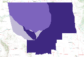
The Total Petroleum System is used in the National Assessment Project and incorporates the Assessment Unit, which is the fundamental geologic unit used for the assessment of undiscovered oil and gas resources. The Total Petroleum System is shown here as a geographic boundary defined and mapped by the geologist responsible for the province and incorporates not only the set of known or postulated oil and (or) gas accumulations, but also the geologic interpretation of the essential elements and processes within the petroleum system that relate to source, generation, migration, accumulation, and trapping of the discovered and undiscovered petroleum resource(s).
The Assessment Unit is the fundamental unit used in the National Assessment Project for the assessment of undiscovered oil and gas resources. The Assessment Unit is defined within the context of the higher-level Total Petroleum System. The Assessment Unit is shown here as a geographic boundary interpreted, defined, and mapped by the geologist responsible for the province and incorporates a set of known or postulated oil and (or) gas accumulations sharing similar geologic, geographic, and temporal properties within the Total Petroleum System, such as source rock, timing, migration pathways, trapping mechanism, and hydrocarbon type. The Assessment Unit boundary is defined geologically as the limits of the geologic...
Shallow subsurface electrical conductivity was mapped at Stateline National Wildlife Refuge (NWR) in northeast Montana using the DUALEM421 electromagnetic sensor (Dualem, Inc., ON, Canada) in the winter of 2017. Data were acquired by towing the DUALEM421 sensor on a sled behind an all-terrain vehicle or snow machine, with the sensor at a nominal height of 0.3 meters (m) above ground surface. Approximately 3 line-kilometers (km) of data were acquired over an area of approximately .2 square-kilometers. Data were manually edited to remove sensor dropouts, lag corrected for apparent offsets between recorded GPS location and data locations for each coil pair, and averaged to a sounding distance of 1m along the survey...
Categories: Data;
Types: Downloadable,
Map Service,
OGC WFS Layer,
OGC WMS Layer,
Shapefile;
Tags: GGGSC,
Geology, Geophysics, and Geochemistry Science Center,
Montana,
NOROCK,
National Wildlife Refuge,
Shallow subsurface electrical conductivity was mapped at Beaver Lake National Wildlife Refuge (NWR) in northwest North Dakota using the DUALEM421 electromagnetic sensor (Dualem, Inc., ON, Canada) in the winter of 2018. Data were acquired by towing the DUALEM421 sensor on a sled behind an all-terrain vehicle or snow machine, with the sensor at a nominal height of 0.3 meters (m) above ground surface. Approximately 127 line-kilometers (km) of data were acquired over an area of approximately 8 square-kilometers. At this survey location, the 4m transmitter-receiver horizontal co-planar and perpendicular coil orientations did not function due to equipment malfunction. Data were manually edited to remove sensor dropouts,...
Categories: Data;
Types: Downloadable,
Map Service,
OGC WFS Layer,
OGC WMS Layer,
Shapefile;
Tags: Beaver Lake,
GGGSC,
Geology, Geophysics, and Geochemistry Science Center,
NOROCK,
National Wildlife Refuge,
Shallow subsurface electrical conductivity was mapped at North Root National Wildlife Refuge (NWR) in northeast Montana using the DUALEM421 electromagnetic sensor (Dualem, Inc., ON, Canada) in the winter of 2017. Data were acquired by towing the DUALEM421 sensor on a sled behind an all-terrain vehicle or snow machine, with the sensor at a nominal height of 0.3 meters (m) above ground surface. Approximately 9 line-kilometers (km) of data were acquired over an area of approximately 1 square-kilometer. Data were manually edited to remove sensor dropouts, lag corrected for apparent offsets between recorded GPS location and data locations for each coil pair, and averaged to a sounding distance of 1m along the survey...
Categories: Data;
Types: Downloadable,
Map Service,
OGC WFS Layer,
OGC WMS Layer,
Shapefile;
Tags: GGGSC,
Geology, Geophysics, and Geochemistry Science Center,
Montana,
NOROCK,
National Wildlife Refuge,
These datasets contain aquatic macroinvertebrate and water quality data collected from 159 wetlands in Montana and North Dakota within the Prairie Pothole Region of the Williston Basin.
The organic composition of produced waters (flowback and formation waters) from the Bakken Formation and the Three Forks Formation in the Williston Basin, North Dakota were examined in this study in order to aid in the remediation of surface contamination due to spills during transport and help develop treatment methods for recycling. Twelve produced water samples were collected from wells in the Bakken and Three Forks Formations at the well head and analyzed for non-purgable dissolved organic carbon (NPDOC), acetate, and extractable hydrocarbons. NPDOC and acetate concentrations from sampled wells from ranged from 33-190 milligrams per liter (mg/L) and 16-40 mg/L, respectively. Concentrations of individual extractable...
Categories: Data;
Tags: Energy Resources,
USGS Science Data Catalog (SDC),
Williston Basin,
dissolved organic compounds,
hydraulic fracturing,
OF12-1149.pdf: The published Open File Report Table 1-1.xlsx: Water-quality data for Goose Lake study site, Montana, 1989-2009 Table 1-2.xlsx: Water-quality data for Anderson study site, Montana, 2004, 2005, 2010 Table 1-3.xlsx: Water-quality data for Fuller study site, North Dakota, 2010 Table 1-4.xlsx: Geophysical survey data for the Goose Lake study site, Montana (2004. 2009), for the Anderson study site, (2004, 2010), and for the Fuller study site (2010)
Airborne electromagnetic (AEM) and magnetic survey data were collected during October 2014 in a 553-square-kilometer area that includes the East Poplar oil field on the Fort Peck Indian Reservation in northeastern Montana, USA. Data surround the city of Poplar and extend south into the Missouri River floodplain. Data were acquired with the SkyTEM301 transient electromagnetic helicopter-borne system together with a Geometrics G-822 magnetometer. The AEM average depth of investigation is about 80 m. The survey was flown at a nominal flight height of 30 m above terrain along north-south oriented flight lines; the majority of lines had a nominal spacing of 200 m with a sub-block area in the central portion of the oil...
Categories: Data;
Types: Downloadable,
Map Service,
OGC WFS Layer,
OGC WMS Layer,
Shapefile;
Tags: CGGSC,
City of Poplar,
Crustal Geophysics and Geochemistry Science Center,
East Poplar Oil Field,
Energy Resources Program,
Shallow subsurface electrical conductivity was mapped at Gjesdal East National Wildlife Refuge (NWR) in northeast Montana using the DUALEM421 electromagnetic sensor (Dualem, Inc., ON, Canada) in the winter of 2017. Data were acquired by towing the DUALEM421 sensor on a sled behind an all-terrain vehicle or snow machine, with the sensor at a nominal height of 0.3 meters (m) above ground surface. Approximately 13 line-kilometers (km) of data were acquired over an area of approximately .7 square-kilometers. Data were manually edited to remove sensor dropouts, lag corrected for apparent offsets between recorded GPS location and data locations for each coil pair, and averaged to a sounding distance of 1m along the survey...
Categories: Data;
Types: Downloadable,
Map Service,
OGC WFS Layer,
OGC WMS Layer,
Shapefile;
Tags: GGGSC,
Geology, Geophysics, and Geochemistry Science Center,
Gjesdal East,
Montana,
NOROCK,
Shallow subsurface electrical conductivity was mapped at Hansen National Wildlife Refuge (NWR) in northeast Montana using the DUALEM421 electromagnetic sensor (Dualem, Inc., ON, Canada) in the winter of 2017. Data were acquired by towing the DUALEM421 sensor on a sled behind an all-terrain vehicle or snow machine, with the sensor at a nominal height of 0.3 meters (m) above ground surface. Approximately 10 line-kilometers (km) of data were acquired over an area of approximately .2 square-kilometers. Data were manually edited to remove sensor dropouts, lag corrected for apparent offsets between recorded GPS location and data locations for each coil pair, and averaged to a sounding distance of 1m along the survey path;...
Categories: Data;
Types: Downloadable,
Map Service,
OGC WFS Layer,
OGC WMS Layer,
Shapefile;
Tags: GGGSC,
Geology, Geophysics, and Geochemistry Science Center,
Hansen,
Montana,
NOROCK,
Groundwater samples collected from wells in eastern Sheridan County, Montana in the September, 2011.
Categories: Data;
Types: Downloadable,
Map Service,
OGC WFS Layer,
OGC WMS Layer,
Shapefile;
Tags: Bakken Formation,
Eastern Sheridan County,
Montana,
Sheridan County,
United States of America,
Under the direction and funding of the National Cooperative Geologic Mapping Program (NCGMP) with guidance and encouragement from the United States Geological Survey (USGS), there has been a decadal strategic plan in place to call for geologic mapping across the nation. This call has been increasing the need for digital data that has not yet been made available. With such a demand, physical data is being re-released as vector-based, GIS operable data, which is viable as a corporate asset to the USGS. This collection of reports is part of the compilation and synthesis efforts hampered by the distributed nature of subsurface investigations at the USGS and a general lack of cataloging and archiving of 3-D geological...
Categories: Data;
Types: Map Service,
OGC WFS Layer,
OGC WMS Layer,
OGC WMS Service;
Tags: Almond Formation,
Arizona,
Baxter Shale,
Castlegate Sandstone,
Colorado,
The Assessment Unit is the fundamental unit used in the National Assessment Project for the assessment of undiscovered oil and gas resources. The Assessment Unit is defined within the context of the higher-level Total Petroleum System. The Assessment Unit is shown here as a geographic boundary interpreted, defined, and mapped by the geologist responsible for the province and incorporates a set of known or postulated oil and (or) gas accumulations sharing similar geologic, geographic, and temporal properties within the Total Petroleum System, such as source rock, timing, migration pathways, trapping mechanism, and hydrocarbon type. The Assessment Unit boundary is defined geologically as the limits of the geologic...

These data were released prior to the October 1, 2016 effective date for the USGS’s policy dictating the review, approval, and release of scientific data as referenced in USGS Survey Manual Chapter 502.8 Fundamental Science Practices: Review and Approval of Scientific Data for Release. These data represent the altitude, in feet above North American Vertical Datum of 1988 (NAVD88), of the lower Fort Union aquifer in the Williston structural basin. The data are presented as ASCII text files that can be converted to continuous raster format.
|

|
