Filters: Tags: Willow (X)
26 results (47ms)|
Filters
Date Range
Extensions Types
Contacts
Categories Tag Types
|
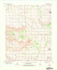
USGS Historical Quadrangle in GeoPDF.
USGS Historical Quadrangle in GeoPDF.
Categories: Publication;
Types: Citation;
Tags: Climate data,
Forests,
Landscapes,
North Central CASC,
Plants,
Yes, all data values are reasonable and within the valid range for measurement. The data release consists of 15 tabular data files (csv). These data were compiled to compare patterns and potential drivers of leaf litter decomposition in the Colorado River downstream of Glen Canyon Dam between 1998 and 2022. Objective(s) of our study were to compare the breakdown of cottonwood (Populus fremontii), willow (Salix exigua), and salt cedar (Tamarix chinensis) leaves to a previous decomposition experiment from 1998 (Pomeroy et al. 2000) that was conducted in the context of much cooler water temperatures, higher phosphorus concentrations, lower New Zealand mudsnail densities, and salt cedar litter that was unaffected by...
This data set contains imagery from the National Agriculture Imagery Program (NAIP). The NAIP program is administered by USDA FSA and has been established to support two main FSA strategic goals centered on agricultural production. These are, increase stewardship of America's natural resources while enhancing the environment, and to ensure commodities are procured and distributed effectively and efficiently to increase food security. The NAIP program supports these goals by acquiring and providing ortho imagery that has been collected during the agricultural growing season in the U.S. The NAIP ortho imagery is tailored to meet FSA requirements and is a fundamental tool used to support FSA farm and conservation programs....
Willow communities dominate mid-elevation riparian areas throughout the Rocky Mountains of North America. However, many willow stands are rapidly declining in aerial cover and individual plants in stature. A poor understanding of the processes that control willow establishment hinders identifying the causes of this decline. We analysed the processes that have facilitated or limited willow establishment over the last half of the 20th century on two large floodplains in Rocky Mountain National Park in Colorado by addressing two questions: (1) How does hydrologic regime control willow establishment on different fluvial landforms? (2) How might climate-driven variations in hydrologic regime affect future willow establishment?...
Categories: Publication;
Types: Citation,
Journal Citation;
Tags: Hydrological Processes,
RHESSys model,
Rocky Mountains,
Salix,
climate,
This data set contains imagery from the National Agriculture Imagery Program (NAIP). The NAIP program is administered by USDA FSA and has been established to support two main FSA strategic goals centered on agricultural production. These are, increase stewardship of America's natural resources while enhancing the environment, and to ensure commodities are procured and distributed effectively and efficiently to increase food security. The NAIP program supports these goals by acquiring and providing ortho imagery that has been collected during the agricultural growing season in the U.S. The NAIP ortho imagery is tailored to meet FSA requirements and is a fundamental tool used to support FSA farm and conservation programs....
Populations of beaver and willow have not thrived in riparian environments that are heavily browsed by livestock or ungulates, such as elk. The interaction of beaver and elk herbivory may be an important mechanism underlying beaver and willow declines in this competitive environment. We conducted a field experiment that compared the standing crop of willow three years after simulated beaver cutting on paired plants with and without intense elk browsing (85% utilization rate). Simulated beaver cutting with intense elk browsing produced willow that was small (biomass and diameter) and short, with far fewer, but longer, shoots and a higher percentage of dead biomass. In contrast, simulated beaver cutting without elk...
Categories: Publication;
Types: Citation,
Journal Citation;
Tags: Castor canadensis,
Ecological Applications,
Rocky Mountain National Park,
Salix monticola,
beaver,
Yukon Flats National Wildlife Refuge (YKF NWR) and Koyukuk NWR (KUK NWR), U.S. Fish and Wildlife Service (USFWS), initiated a project with the U.S. Geological Survey Earth Resources Observation and Science (EROS) Center to acquire map products needed for moose habitat assessment. The objective of this work was to create a suite of products which included: Estimated Vegetation Heights, probability of Willow Estimates, and Vegetation Type Maps. These products are based on spectral characteristics found in bands 2 through 7 of Landsat 8 OLI scenes processed to surface reflectance, acquired in summer of 2013, and late winter of 2014. Training data was collected by fixed wing aircraft and helicopter by USFWS refuge staff,...
We determined changes in willow (Salixspp.) cover in two valleys of the eastern slope of Rocky Mountain National Park,Colorado, USA, and related these changes to suspected causative factors. Changes in vegetation were inferred from digital maps generated from aerial photo-interpretation and field surveys conducted with a global positioning system. The decrease in riparian shrub cover was approximately 20% in both valleys over the period between 1937/46 and 1996, while the decline in tall willow (> 2 m tall) cover was estimated to be approximately 55%in both valleys. Suppressed willows (< 1.5 m tall) were predominantly located in areas affected by flooding and in areas where major river reductions were observed....
Categories: Publication;
Types: Citation,
Journal Citation;
Tags: Colorado,
Landscape Ecology,
Rocky Mountains,
Springer Netherlands,
beaver impoundments,
This data set contains imagery from the National Agriculture Imagery Program (NAIP). The NAIP program is administered by USDA FSA and has been established to support two main FSA strategic goals centered on agricultural production. These are, increase stewardship of America's natural resources while enhancing the environment, and to ensure commodities are procured and distributed effectively and efficiently to increase food security. The NAIP program supports these goals by acquiring and providing ortho imagery that has been collected during the agricultural growing season in the U.S. The NAIP ortho imagery is tailored to meet FSA requirements and is a fundamental tool used to support FSA farm and conservation programs....
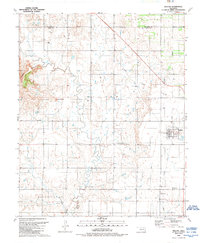
USGS Historical Quadrangle in GeoPDF.
This data set contains imagery from the National Agriculture Imagery Program (NAIP). The NAIP program is administered by USDA FSA and has been established to support two main FSA strategic goals centered on agricultural production. These are, increase stewardship of America's natural resources while enhancing the environment, and to ensure commodities are procured and distributed effectively and efficiently to increase food security. The NAIP program supports these goals by acquiring and providing ortho imagery that has been collected during the agricultural growing season in the U.S. The NAIP ortho imagery is tailored to meet FSA requirements and is a fundamental tool used to support FSA farm and conservation programs....
This data set contains imagery from the National Agriculture Imagery Program (NAIP). The NAIP program is administered by USDA FSA and has been established to support two main FSA strategic goals centered on agricultural production. These are, increase stewardship of America's natural resources while enhancing the environment, and to ensure commodities are procured and distributed effectively and efficiently to increase food security. The NAIP program supports these goals by acquiring and providing ortho imagery that has been collected during the agricultural growing season in the U.S. The NAIP ortho imagery is tailored to meet FSA requirements and is a fundamental tool used to support FSA farm and conservation programs....
Globally, spring phenology and abiotic processes are shifting earlier with warming. Differences in the magnitudes of these shifts may decouple the timing of plant resource requirements from resource availability. In riparian forests across the northern hemisphere, warming could decouple seed release from snowmelt peak streamflow, thus reducing moisture and safe sites for dominant tree recruitment. We combined field observations with climate, hydrology, and phenology models to simulate future change in synchrony of seed release and snowmelt peaks in the South Platte River Basin, Colorado, for three Salicaceae species that dominate western USA riparian forests. Chilling requirements for overcoming winter endodormancy...
Categories: Publication;
Types: Citation;
Tags: Forests,
Landscapes,
North Central CASC,
Plants,
Rivers, Streams and Lakes,
Willow Habitat current, near-term and long-term future status good and moderate habitat, quality by vegetation community, change length growing season from 2010s to 2060s in Good or Moderate Quality Willow Habitat. These data are provided by Bureau of Land Management (BLM) "as is" and may contain errors or omissions. The User assumes the entire risk associated with its use of these data and bears all responsibility in determining whether these data are fit for the User's intended use. These data may not have the accuracy, resolution, completeness, timeliness, or other characteristics appropriate for applications that potential users of the data may contemplate. The User is encouraged to carefully consider the content...
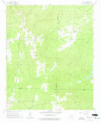
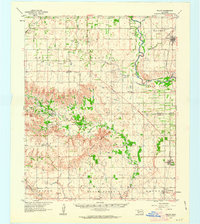
USGS Historical Quadrangle in GeoPDF.
USGS Historical Quadrangle in GeoPDF.
This data set contains imagery from the National Agriculture Imagery Program (NAIP). The NAIP program is administered by USDA FSA and has been established to support two main FSA strategic goals centered on agricultural production. These are, increase stewardship of America's natural resources while enhancing the environment, and to ensure commodities are procured and distributed effectively and efficiently to increase food security. The NAIP program supports these goals by acquiring and providing ortho imagery that has been collected during the agricultural growing season in the U.S. The NAIP ortho imagery is tailored to meet FSA requirements and is a fundamental tool used to support FSA farm and conservation programs....
This data set contains imagery from the National Agriculture Imagery Program (NAIP). The NAIP program is administered by USDA FSA and has been established to support two main FSA strategic goals centered on agricultural production. These are, increase stewardship of America's natural resources while enhancing the environment, and to ensure commodities are procured and distributed effectively and efficiently to increase food security. The NAIP program supports these goals by acquiring and providing ortho imagery that has been collected during the agricultural growing season in the U.S. The NAIP ortho imagery is tailored to meet FSA requirements and is a fundamental tool used to support FSA farm and conservation programs....
|

|
