Filters: Tags: Winston-Salem (X)
8 results (136ms)|
Filters
Date Range
Types Contacts
Tag Types Tag Schemes |

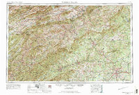
USGS Historical Quadrangle in GeoPDF.
As part of the Coastal Carolinas Focus Area Study of the U.S. Geological Survey National Water Census Program, the Soil and Water Assessment Tool (SWAT) was used to develop models for the Pee Dee River Basin, North Carolina and South Carolina, to simulate future streamflow and irrigation demand based on land use, climate, and water demand projections. SWAT is a basin-scale, process-based watershed model with the capability of simulating water-management scenarios. Model basins were divided into approximately two-square mile subbasins and subsequently divided into smaller, discrete hydrologic response units based on land use, slope, and soil type. The calibration period for the historic model was 2000 to 2014. The...
Types: Map Service,
OGC WFS Layer,
OGC WMS Layer,
OGC WMS Service;
Tags: Alexander,
Alleghany,
Anson,
Ashe,
Bladen,

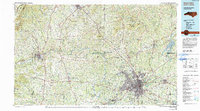
USGS Historical Quadrangle in GeoPDF.
USGS Historical Quadrangle in GeoPDF.

USGS Historical Quadrangle in GeoPDF.

USGS Historical Quadrangle in GeoPDF.
The geodatabase for the Charlotte 1 degree × 2 degrees quadrangle by Goldsmith and others (1988) was compiled in the Geologic Map Schema (GeMS). The geologic map extends across four lithotectonic belts of the Piedmont from the Coastal Plain and Wadesboro Triassic basin on the east to the Blue Ridge belt in the vicinity of the Grandfather Mountain window on the west. The Wadesboro Triassic basin contains arkosic sandstone, siltstone and conglomerate unconformably overlain by small inliers of late Cretaceous Coastal Plain sediment of the Middendorf Formation (?). The Blue Ridge, Inner Piedmont, Kings Mountain, Charlotte, and Carolina Slate belts consist of different Mesoproterozoic to Late Paleozoic metamorphosed...
USGS Historical Quadrangle in GeoPDF.
|

|
