Filters
Date Range
Types
Contacts
Tag Types
Tag Schemes
|

Mineral Resources Section personnel from the Alaska Division of Geological & Geophysical Surveys (DGGS) carried out a geologic field survey, including mapping and sampling, in the eastern part of the Bonnifield mining district in the Fairbanks A-1 and A-2 and the Healy D-1 and D-2 quadrangles, Alaska, from June 16 through July 18, 2008. The fieldwork provides basic information critical to building an understanding of Alaska's geology and is part of an integrated program of airborne geophysical surveys followed by geologic mapping. Specifically, this work provides geologic context for geophysical surveys conducted in 2006. Interpretation and synthesis of this data has been presented in professional and trade meetings....
Tags: Alaska Range,
Bedrock,
Chute Creek,
Dry Creek,
Dry Creek prospect, All tags...
Fairbanks Quadrangle,
Geologic,
Geology,
Glory Creek,
Glory Creek prospect,
Healy Quadrangle,
Igneous,
Igneous Rocks,
Kansas Creek,
Minerals,
Red Mountain Creek,
Rocks,
Rogers Creek,
STATEMAP Project,
Sedimentary Rocks,
Sheep Creek,
Slide Creek,
Snow Mountain Gulch,
WTF (Western Tundra Flats) prospect,
Wood River,
geoscientificInformation, Fewer tags
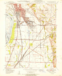
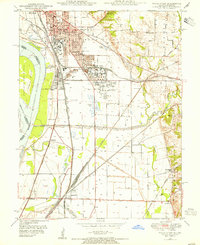
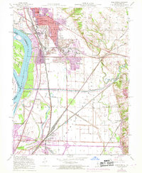
USGS Historical Quadrangle in GeoPDF.
Tags: 7.5 x 7.5 minute,
Downloadable Data,
GeoPDF,
GeoTIFF,
Historical Topographic Maps, All tags...
Historical Topographic Maps 7.5 x 7.5 Minute Map Series,
IL,
Map,
Wood River,
imageryBaseMapsEarthCover, Fewer tags
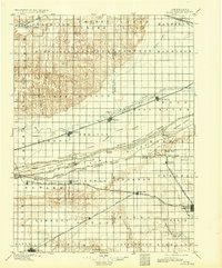
USGS Historical Quadrangle in GeoPDF.
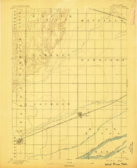
Tags: 30 x 30 minute,
Downloadable Data,
GeoPDF,
GeoTIFF,
Historical Topographic Maps, All tags...
Historical Topographic Maps 30 x 30 Minute Map Series,
Map,
NE,
Wood River,
imageryBaseMapsEarthCover, Fewer tags
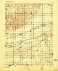
USGS Historical Quadrangle in GeoPDF.
Tags: 30 x 30 minute,
Downloadable Data,
GeoPDF,
GeoTIFF,
Historical Topographic Maps, All tags...
Historical Topographic Maps 30 x 30 Minute Map Series,
Map,
NE,
Wood River,
imageryBaseMapsEarthCover, Fewer tags
This data set contains imagery from the National Agriculture Imagery Program (NAIP). The NAIP program is administered by USDA FSA and has been established to support two main FSA strategic goals centered on agricultural production. These are, increase stewardship of America's natural resources while enhancing the environment, and to ensure commodities are procured and distributed effectively and efficiently to increase food security. The NAIP program supports these goals by acquiring and providing ortho imagery that has been collected during the agricultural growing season in the U.S. The NAIP ortho imagery is tailored to meet FSA requirements and is a fundamental tool used to support FSA farm and conservation programs....
Types: Citation;
Tags: 17119,
3.75 x 3.75 minute,
3809016,
Aerial Compliance,
Compliance, All tags...
Digital Ortho rectified Image,
Downloadable Data,
IL,
IL119,
JPEG2000,
MADISON CO IL FSA,
Madison,
NAIP,
Ortho Rectification,
Orthoimagery,
Quarter Quadrangle,
USDA National Agriculture Imagery Program (NAIP),
WOOD RIVER,
WOOD RIVER, SE,
farming, Fewer tags

This data set contains imagery from the National Agriculture Imagery Program (NAIP). The NAIP program is administered by USDA FSA and has been established to support two main FSA strategic goals centered on agricultural production. These are, increase stewardship of America's natural resources while enhancing the environment, and to ensure commodities are procured and distributed effectively and efficiently to increase food security. The NAIP program supports these goals by acquiring and providing ortho imagery that has been collected during the agricultural growing season in the U.S. The NAIP ortho imagery is tailored to meet FSA requirements and is a fundamental tool used to support FSA farm and conservation programs....
Types: Citation;
Tags: 3.75 x 3.75 minute,
31079,
4009812,
Aerial Compliance,
Compliance, All tags...
Digital Ortho rectified Image,
Downloadable Data,
HALL CO NE FSA,
Hall,
JPEG2000,
NAIP,
NE,
NE079,
Ortho Rectification,
Orthoimagery,
Quarter Quadrangle,
USDA National Agriculture Imagery Program (NAIP),
WOOD RIVER,
WOOD RIVER, SW,
farming, Fewer tags
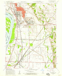
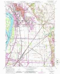
USGS Historical Quadrangle in GeoPDF.
Tags: 7.5 x 7.5 minute,
Downloadable Data,
GeoPDF,
GeoTIFF,
Historical Topographic Maps, All tags...
Historical Topographic Maps 7.5 x 7.5 Minute Map Series,
IL,
Map,
Wood River,
imageryBaseMapsEarthCover, Fewer tags
This data set contains imagery from the National Agriculture Imagery Program (NAIP). The NAIP program is administered by USDA FSA and has been established to support two main FSA strategic goals centered on agricultural production. These are, increase stewardship of America's natural resources while enhancing the environment, and to ensure commodities are procured and distributed effectively and efficiently to increase food security. The NAIP program supports these goals by acquiring and providing ortho imagery that has been collected during the agricultural growing season in the U.S. The NAIP ortho imagery is tailored to meet FSA requirements and is a fundamental tool used to support FSA farm and conservation programs....
Types: Citation;
Tags: 17119,
3.75 x 3.75 minute,
3809016,
Aerial Compliance,
Compliance, All tags...
Digital Ortho rectified Image,
Downloadable Data,
IL,
IL119,
JPEG2000,
MADISON CO IL FSA,
Madison,
NAIP,
Ortho Rectification,
Orthoimagery,
Quarter Quadrangle,
USDA National Agriculture Imagery Program (NAIP),
WOOD RIVER,
WOOD RIVER, NE,
farming, Fewer tags
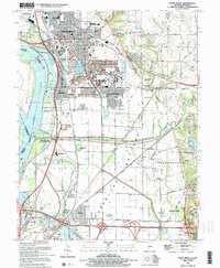
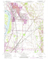
USGS Historical Quadrangle in GeoPDF.
Tags: 7.5 x 7.5 minute,
Downloadable Data,
GeoPDF,
GeoTIFF,
Historical Topographic Maps, All tags...
Historical Topographic Maps 7.5 x 7.5 Minute Map Series,
IL,
Map,
Wood River,
imageryBaseMapsEarthCover, Fewer tags
USGS Historical Quadrangle in GeoPDF.
Tags: 7.5 x 7.5 minute,
Downloadable Data,
GeoPDF,
GeoTIFF,
Historical Topographic Maps, All tags...
Historical Topographic Maps 7.5 x 7.5 Minute Map Series,
IL,
Map,
Wood River,
imageryBaseMapsEarthCover, Fewer tags
USGS Historical Quadrangle in GeoPDF.
Tags: 7.5 x 7.5 minute,
Downloadable Data,
GeoPDF,
GeoTIFF,
Historical Topographic Maps, All tags...
Historical Topographic Maps 7.5 x 7.5 Minute Map Series,
Map,
NE,
Wood River,
imageryBaseMapsEarthCover, Fewer tags
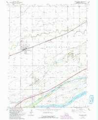
USGS Historical Quadrangle in GeoPDF.
Tags: 15 x 15 minute,
Downloadable Data,
GeoPDF,
GeoTIFF,
Historical Topographic Maps, All tags...
Historical Topographic Maps 15 x 15 Minute Map Series,
Map,
NE,
Wood River,
imageryBaseMapsEarthCover, Fewer tags
This data set contains imagery from the National Agriculture Imagery Program (NAIP). The NAIP program is administered by USDA FSA and has been established to support two main FSA strategic goals centered on agricultural production. These are, increase stewardship of America's natural resources while enhancing the environment, and to ensure commodities are procured and distributed effectively and efficiently to increase food security. The NAIP program supports these goals by acquiring and providing ortho imagery that has been collected during the agricultural growing season in the U.S. The NAIP ortho imagery is tailored to meet FSA requirements and is a fundamental tool used to support FSA farm and conservation programs....
Types: Citation;
Tags: 17119,
3.75 x 3.75 minute,
3809016,
Aerial Compliance,
Compliance, All tags...
Digital Ortho rectified Image,
Downloadable Data,
IL,
IL119,
JPEG2000,
MADISON CO IL FSA,
Madison,
NAIP,
Ortho Rectification,
Orthoimagery,
Quarter Quadrangle,
USDA National Agriculture Imagery Program (NAIP),
WOOD RIVER,
WOOD RIVER, NW,
farming, Fewer tags
USGS Historical Quadrangle in GeoPDF.
Tags: 7.5 x 7.5 minute,
Downloadable Data,
GeoPDF,
GeoTIFF,
Historical Topographic Maps, All tags...
Historical Topographic Maps 7.5 x 7.5 Minute Map Series,
IL,
Map,
Wood River,
imageryBaseMapsEarthCover, Fewer tags
USGS Historical Quadrangle in GeoPDF.
Tags: 7.5 x 7.5 minute,
Downloadable Data,
GeoPDF,
GeoTIFF,
Historical Topographic Maps, All tags...
Historical Topographic Maps 7.5 x 7.5 Minute Map Series,
IL,
Map,
Wood River,
imageryBaseMapsEarthCover, Fewer tags

40Ar/39Ar data from plutonic, dike, and alteration samples collected during geologic mapping of the eastern part of the Bonnifield mining district geologic map area in parts of Fairbanks A-1 and Fairbanks A-2 and Healy D-1 and Healy D-2 quadrangles yield results indicating the plutons, dikes, and a gold-bearing quartz vein in the Bonnifield Map area range from 85 to 95 m.y.
Tags: 40Ar/39Ar,
Age Dates,
Alaska Range,
Alaska, State of,
Buzby prospect, All tags...
Chute Creek,
Denali Borough,
Dry Creek,
Dry Creek placer mine,
Dry Creek prospect,
Fairbanks Quadrangle,
Forgotten Creek,
Geochronology,
Geology,
Glacier Creek,
Glory Creek,
Glory Creek prospect,
Healy Quadrangle,
Kansas Creek,
Kansas Creek prospect,
LEA Creek prospect,
Newman Creek,
Newman Creek placer mine,
Red Mountain Creek,
Red Mountain Creek prospect,
Rogers Creek,
STATEMAP Project,
Sheep Creek,
Slate Creek,
Slide Creek,
Smog prospect,
Snow Mountain Gulch,
Threemile Creek,
WTF (Western Tundra Flats) prospect,
West Fork Little Delta River,
Wood River,
geoscientificInformation, Fewer tags

Mineral-resources personnel from the Alaska Division of Geological & Geophysical Surveys carried out a geological field survey, including mapping and sampling in the eastern part of the Bonnifield mining district in the Fairbanks A-1, A-2, Healy D-1 and D-2 quadrangles, Alaska from June 16 to July 18, 2008. The fieldwork provides basic information critical to building an understanding of Alaska geology and is part of an integrated program of airborne geophysical surveys followed by geological mapping. During 2008, 242 rock samples were collected for geochemical trace-element analysis, 106 rock samples were collected for whole rock (major- and minor-oxide and petrogenetically important trace element) analyses, and...
Tags: Alaska Range,
Alaska, State of,
Buzby prospect,
Chute Creek,
Denali Borough, All tags...
Dry Creek,
Dry Creek placer mine,
Dry Creek prospect,
Fairbanks Quadrangle,
Forgotten Creek,
Geochemistry,
Glacier Creek,
Glory Creek,
Glory Creek prospect,
Healy Quadrangle,
Kansas Creek,
Kansas Creek prospect,
LEA Creek prospect,
Major Oxides,
Newman Creek,
Newman Creek placer mine,
Red Mountain Creek,
Red Mountain Creek prospect,
Rogers Creek,
STATEMAP Project,
Sheep Creek,
Slate Creek,
Slide Creek,
Smog prospect,
Snow Mountain Gulch,
Stream Sediments,
Threemile Creek,
Trace Metals,
WTF (Western Tundra Flats) prospect,
West Fork Little Delta River,
Wood River,
geoscientificInformation, Fewer tags
This data set contains imagery from the National Agriculture Imagery Program (NAIP). The NAIP program is administered by USDA FSA and has been established to support two main FSA strategic goals centered on agricultural production. These are increase stewardship of America's natural resources while enhancing the environment, and to ensure commodities are procured and distributed effectively and efficiently to increase food security. The NAIP program supports these goals by acquiring and providing ortho imagery that has been collected during the agricultural growing season in the U.S. The NAIP ortho imagery is tailored to meet FSA requirements and is a fundamental tool used to support FSA farm and conservation programs....
Types: Citation;
Tags: 29189,
3.75 x 3.75 minute,
3809016,
Aerial Compliance,
Compliance, All tags...
Digital Ortho rectified Image,
Downloadable Data,
JPEG 2000,
JPEG2000,
MO,
MO189,
NAIP,
Ortho Rectification,
Orthoimagery,
Quarter Quadrangle,
ST LOUIS CO MO FSA,
St. Louis,
USDA National Agriculture Imagery Program (NAIP),
WOOD RIVER,
WOOD RIVER, SW,
farming,
imageryBaseMapsEarthCover, Fewer tags
USGS Historical Quadrangle in GeoPDF.
Tags: 7.5 x 7.5 minute,
Downloadable Data,
GeoPDF,
GeoTIFF,
Historical Topographic Maps, All tags...
Historical Topographic Maps 7.5 x 7.5 Minute Map Series,
IL,
Map,
Wood River,
imageryBaseMapsEarthCover, Fewer tags
|
|

