Filters
Date Range
Types
Contacts
Categories
Tag Types
Tag Schemes
|
This data set contains imagery from the National Agriculture Imagery Program (NAIP). The NAIP program is administered by USDA FSA and has been established to support two main FSA strategic goals centered on agricultural production. These are, increase stewardship of America's natural resources while enhancing the environment, and to ensure commodities are procured and distributed effectively and efficiently to increase food security. The NAIP program supports these goals by acquiring and providing ortho imagery that has been collected during the agricultural growing season in the U.S. The NAIP ortho imagery is tailored to meet FSA requirements and is a fundamental tool used to support FSA farm and conservation programs....
Types: Citation;
Tags: 08083,
3.75 x 3.75 minute,
3710827,
Aerial Compliance,
CO, All tags...
CO083,
Compliance,
Digital Ortho rectified Image,
Downloadable Data,
JPEG2000,
MONTEZUMA CO CO FSA,
Montezuma,
NAIP,
Ortho Rectification,
Orthoimagery,
Quarter Quadrangle,
USDA National Agriculture Imagery Program (NAIP),
YELLOW JACKET,
YELLOW JACKET, NE,
farming, Fewer tags
ADMMR map collection: Sketch of Workings between Silver Thread 400 and Empire 300; 1 in. to 100 feet; 9 x 8 in.
Categories: Data;
Tags: Alps Claim,
Arizona,
Audie Claim,
Cochise County,
Contention, All tags...
Copper, Oxide,
Dataset,
Flora Morrison,
Gold, Lode,
Grand Central Group,
Head Center,
Lead,
Pump Shaft,
Silver,
T20S R22E Sec 11 SE,
Tombstone - 15 Min,
Tombstone Hills physiographic area,
Tombstone metallic mineral dist.,
Tranquility,
United States,
Yellow Jacket,
geology,
geoscientificInformation,
maps and atlases,
mineral resources,
mining and quarrying,
subsurface maps, Fewer tags
ADMMR map collection: Head Center and Grand Central Claims Map; 11 x 7 in.
Categories: Data;
Tags: Alps Claim,
Arizona,
Audie Claim,
Cochise County,
Contention, All tags...
Copper, Oxide,
Dataset,
Flora Morrison,
Gold, Lode,
Grand Central Group,
Head Center,
Lead,
Pump Shaft,
Silver,
T20S R22E Sec 11 SE,
Tombstone - 15 Min,
Tombstone Hills physiographic area,
Tombstone metallic mineral dist.,
Tranquility,
United States,
Yellow Jacket,
claim maps,
geoscientificInformation,
maps and atlases,
mining and quarrying, Fewer tags
ADMMR map collection: Map of Principal Claims and Workings in Central Part of Tombstone District; 1 in. to 500 feet; 32 x 21 in.
Categories: Data;
Tags: Alps Claim,
Arizona,
Audie Claim,
Cochise County,
Contention, All tags...
Copper, Oxide,
Dataset,
Flora Morrison,
Gold, Lode,
Grand Central Group,
Head Center,
Lead,
Pump Shaft,
Silver,
T20S R22E Sec 11 SE,
Tombstone - 15 Min,
Tombstone Hills physiographic area,
Tombstone metallic mineral dist.,
Tranquility,
United States,
Yellow Jacket,
claim maps,
geoscientificInformation,
maps and atlases,
mineral resources,
mining and quarrying,
subsurface maps, Fewer tags
ADMMR map collection: Contention, Section through West Side Shaft and Pump Shaft; 1 in. to 100 feet; 31 x 16 in.
Categories: Data;
Tags: 1900s,
Alps Claim,
Arizona,
Audie Claim,
Cochise County, All tags...
Contention,
Copper, Oxide,
Dataset,
Flora Morrison,
Gold, Lode,
Grand Central Group,
Head Center,
Lead,
Pump Shaft,
Silver,
T20S R22E Sec 11 SE,
Tombstone - 15 Min,
Tombstone Hills physiographic area,
Tombstone metallic mineral dist.,
Tranquility,
United States,
Yellow Jacket,
geoscientificInformation,
maps and atlases,
mineral resources,
mining and quarrying,
sections,
subsurface maps, Fewer tags
ADMMR map collection: Pump Shaft 1000 Level, Underground Workings; 1 in. to 200 feet; 19 x 14 in.
Categories: Data;
Tags: Alps Claim,
Arizona,
Audie Claim,
Cochise County,
Contention, All tags...
Copper, Oxide,
Dataset,
Flora Morrison,
Gold, Lode,
Grand Central Group,
Head Center,
Lead,
Pump Shaft,
Silver,
T20S R22E Sec 11 SE,
Tombstone - 15 Min,
Tombstone Hills physiographic area,
Tombstone metallic mineral dist.,
Tranquility,
United States,
Yellow Jacket,
geoscientificInformation,
maps and atlases,
mineral resources,
mining and quarrying,
subsurface maps, Fewer tags
ADMMR map collection: Pump Shaft 2nd Level, Workings and Geology; 1 in. to 50 feet; 34 x 23 in.
Categories: Data;
Tags: Alps Claim,
Arizona,
Audie Claim,
Cochise County,
Contention, All tags...
Copper, Oxide,
Dataset,
Flora Morrison,
Gold, Lode,
Grand Central Group,
Head Center,
Lead,
Pump Shaft,
Silver,
T20S R22E Sec 11 SE,
Tombstone - 15 Min,
Tombstone Hills physiographic area,
Tombstone metallic mineral dist.,
Tranquility,
United States,
Yellow Jacket,
geology,
geoscientificInformation,
maps and atlases,
mineral resources,
mining and quarrying,
subsurface maps, Fewer tags
ADMMR map collection: Head Center, Cross Section through A-A'; 1 in. to 50 feet; 14 x 12 in.
Categories: Data;
Tags: Alps Claim,
Arizona,
Audie Claim,
Cochise County,
Contention, All tags...
Copper, Oxide,
Dataset,
Flora Morrison,
Gold, Lode,
Grand Central Group,
Head Center,
Lead,
Pump Shaft,
Silver,
T20S R22E Sec 11 SE,
Tombstone - 15 Min,
Tombstone Hills physiographic area,
Tombstone metallic mineral dist.,
Tranquility,
United States,
Yellow Jacket,
geoscientificInformation,
maps and atlases,
mineral resources,
mining and quarrying,
sections,
subsurface maps, Fewer tags
ADMMR map collection: Tombstone Underground Workings Showing Silver Thread, Empire, and Tranquility Shafts; 1 in. to 20 feet; 34 x 28 in.
Categories: Data;
Tags: Alps Claim,
Arizona,
Audie Claim,
Cochise County,
Contention, All tags...
Copper, Oxide,
Dataset,
Flora Morrison,
Gold, Lode,
Grand Central Group,
Head Center,
Lead,
Pump Shaft,
Silver,
T20S R22E Sec 11 SE,
Tombstone - 15 Min,
Tombstone Hills physiographic area,
Tombstone metallic mineral dist.,
Tranquility,
United States,
Yellow Jacket,
geology,
geoscientificInformation,
maps and atlases,
mineral resources,
mining and quarrying,
subsurface maps, Fewer tags
Heinrichs Geoexploration Co. Maps: Tombstone Topographic Map Showing Southern Tombstone; 1 in. to 200 feet; 38 x 33 in.
Categories: Data;
Tags: 1990s,
Alps Claim,
Arizona,
Audie Claim,
Cochise County, All tags...
Cochise171,
Copper, Oxide,
Dataset,
Flora Morrison,
Gold, Lode,
Grand Central Group,
Head Center,
Lead,
Pump Shaft,
Silver,
T20S R22E Sec 11 SE,
Tombstone - 15 Min,
Tombstone Hills physiographic area,
Tombstone metallic mineral dist.,
Tranquility,
United States,
Yellow Jacket,
geoscientificInformation,
maps and atlases,
mineral resources,
topographic maps,
topography, Fewer tags
ADMMR map collection: Sketch of Workings between Silver Thread 400 and Empire 300; 1 in. to 50 feet; 11 x 11 in.
Categories: Data;
Tags: Alps Claim,
Arizona,
Audie Claim,
Cochise County,
Contention, All tags...
Copper, Oxide,
Dataset,
Flora Morrison,
Gold, Lode,
Grand Central Group,
Head Center,
Lead,
Pump Shaft,
Silver,
T20S R22E Sec 11 SE,
Tombstone - 15 Min,
Tombstone Hills physiographic area,
Tombstone metallic mineral dist.,
Tranquility,
United States,
Yellow Jacket,
geology,
geoscientificInformation,
maps and atlases,
mineral resources,
mining and quarrying,
subsurface maps, Fewer tags
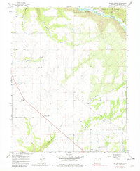
USGS Historical Quadrangle in GeoPDF.
Tags: 7.5 x 7.5 minute,
CO,
Downloadable Data,
GeoPDF,
GeoTIFF, All tags...
Historical Topographic Maps,
Historical Topographic Maps 7.5 x 7.5 Minute Map Series,
Map,
Yellow Jacket,
imageryBaseMapsEarthCover, Fewer tags
ADMMR map collection: Tranquility Shaft 100 Level; 1 in. to 50 feet; 20 x 10 in.
Categories: Data;
Tags: Alps Claim,
Arizona,
Audie Claim,
Cochise County,
Contention, All tags...
Copper, Oxide,
Dataset,
Flora Morrison,
Gold, Lode,
Grand Central Group,
Head Center,
Lead,
Pump Shaft,
Silver,
T20S R22E Sec 11 SE,
Tombstone - 15 Min,
Tombstone Hills physiographic area,
Tombstone metallic mineral dist.,
Tranquility,
United States,
Yellow Jacket,
geoscientificInformation,
maps and atlases,
mineral resources,
mining and quarrying,
subsurface maps, Fewer tags
ADMMR map collection: Contention, Pump Shaft 1000 Level; 1 in. to 50 feet; 17 x 17 in.
Categories: Data;
Tags: Alps Claim,
Arizona,
Audie Claim,
Cochise County,
Contention, All tags...
Copper, Oxide,
Dataset,
Flora Morrison,
Gold, Lode,
Grand Central Group,
Head Center,
Lead,
Pump Shaft,
Silver,
T20S R22E Sec 11 SE,
Tombstone - 15 Min,
Tombstone Hills physiographic area,
Tombstone metallic mineral dist.,
Tranquility,
United States,
Yellow Jacket,
geoscientificInformation,
maps and atlases,
mineral resources,
mining and quarrying,
subsurface maps, Fewer tags
ADMMR map collection: Geologic Map of Tombstone District; 1 in. to 500 feet; 20 x 26 in.
Categories: Data;
Tags: Alps Claim,
Arizona,
Audie Claim,
Cochise County,
Contention, All tags...
Copper, Oxide,
Dataset,
Flora Morrison,
Gold, Lode,
Grand Central Group,
Head Center,
Lead,
Pump Shaft,
Silver,
T20S R22E Sec 11 SE,
Tombstone - 15 Min,
Tombstone Hills physiographic area,
Tombstone metallic mineral dist.,
Tranquility,
United States,
Yellow Jacket,
geologic maps,
geoscientificInformation,
maps and atlases,
mineral resources,
mining and quarrying, Fewer tags
This data set contains imagery from the National Agriculture Imagery Program (NAIP). The NAIP program is administered by USDA FSA and has been established to support two main FSA strategic goals centered on agricultural production. These are, increase stewardship of America's natural resources while enhancing the environment, and to ensure commodities are procured and distributed effectively and efficiently to increase food security. The NAIP program supports these goals by acquiring and providing ortho imagery that has been collected during the agricultural growing season in the U.S. The NAIP ortho imagery is tailored to meet FSA requirements and is a fundamental tool used to support FSA farm and conservation programs....
Types: Citation;
Tags: 08083,
3.75 x 3.75 minute,
3710827,
Aerial Compliance,
CO, All tags...
CO083,
Compliance,
Digital Ortho rectified Image,
Downloadable Data,
JPEG2000,
MONTEZUMA CO CO FSA,
Montezuma,
NAIP,
Ortho Rectification,
Orthoimagery,
Quarter Quadrangle,
USDA National Agriculture Imagery Program (NAIP),
YELLOW JACKET,
YELLOW JACKET, SE,
farming, Fewer tags
ADMMR map collection: Pump Shaft Cross Section; 1 in. to 100 feet; 15 x 14 in.
Categories: Data;
Tags: 1900s,
Alps Claim,
Arizona,
Audie Claim,
Cochise County, All tags...
Contention,
Copper, Oxide,
Dataset,
Flora Morrison,
Gold, Lode,
Grand Central Group,
Head Center,
Lead,
Pump Shaft,
Silver,
T20S R22E Sec 11 SE,
Tombstone - 15 Min,
Tombstone Hills physiographic area,
Tombstone metallic mineral dist.,
Tranquility,
United States,
Yellow Jacket,
geoscientificInformation,
maps and atlases,
mineral resources,
mining and quarrying,
sections,
subsurface maps, Fewer tags
ADMMR map collection: Pump Shaft 400 Level, Underground Workings and Geology; 1 in. to 200 feet; 19 x 14 in.
Categories: Data;
Tags: Alps Claim,
Arizona,
Audie Claim,
Cochise County,
Contention, All tags...
Copper, Oxide,
Dataset,
Flora Morrison,
Gold, Lode,
Grand Central Group,
Head Center,
Lead,
Pump Shaft,
Silver,
T20S R22E Sec 11 SE,
Tombstone - 15 Min,
Tombstone Hills physiographic area,
Tombstone metallic mineral dist.,
Tranquility,
United States,
Yellow Jacket,
geology,
geoscientificInformation,
maps and atlases,
mineral resources,
mining and quarrying,
subsurface maps, Fewer tags
ADMMR map collection: Pump Shaft 600 Level, Underground Workings and Geology; 1 in. to 200 feet; 19 x 14 in.
Categories: Data;
Tags: Alps Claim,
Arizona,
Audie Claim,
Cochise County,
Contention, All tags...
Copper, Oxide,
Dataset,
Flora Morrison,
Gold, Lode,
Grand Central Group,
Head Center,
Lead,
Pump Shaft,
Silver,
T20S R22E Sec 11 SE,
Tombstone - 15 Min,
Tombstone Hills physiographic area,
Tombstone metallic mineral dist.,
Tranquility,
United States,
Yellow Jacket,
geology,
geoscientificInformation,
maps and atlases,
mineral resources,
mining and quarrying,
subsurface maps, Fewer tags
ADMMR map collection: Contention Mine Underground Plan; 74 x 38 in.
Categories: Data;
Tags: Alps Claim,
Arizona,
Audie Claim,
Cochise County,
Contention, All tags...
Copper, Oxide,
Dataset,
Flora Morrison,
Gold, Lode,
Grand Central Group,
Head Center,
Lead,
Pump Shaft,
Silver,
T20S R22E Sec 11 SE,
Tombstone - 15 Min,
Tombstone Hills physiographic area,
Tombstone metallic mineral dist.,
Tranquility,
United States,
Yellow Jacket,
geoscientificInformation,
maps and atlases,
mineral resources,
plans,
subsurface maps, Fewer tags
|
|