Filters: Tags: Yellow Pine (X)
17 results (33ms)|
Filters
Date Range
Extensions Types
Contacts
Categories Tag Types Tag Schemes |
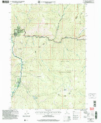
This data set contains imagery from the National Agriculture Imagery Program (NAIP). The NAIP program is administered by USDA FSA and has been established to support two main FSA strategic goals centered on agricultural production. These are, increase stewardship of America's natural resources while enhancing the environment, and to ensure commodities are procured and distributed effectively and efficiently to increase food security. The NAIP program supports these goals by acquiring and providing ortho imagery that has been collected during the agricultural growing season in the U.S. The NAIP ortho imagery is tailored to meet FSA requirements and is a fundamental tool used to support FSA farm and conservation programs....
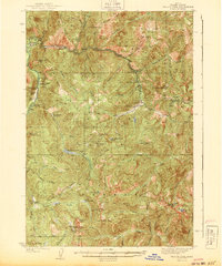
USGS Historical Quadrangle in GeoPDF.
A mineral resource assessment was performed by the U.S. Geological Survey (USGS) to assess the potential of undiscovered skarn-hosted tungsten resources in the Northern Rocky Mountain region of eastern Idaho and western Montana. This region has seen moderate tungsten trioxide (WO3) production in the past from a variety of mineralization styles including skarn, vein and replacement, and wolframite-quartz veins. The geology of the area is dominated by large plutons of Cretaceous to Tertiary age, emplaced into a belt of sedimentary rock ranging from Mesoproterozoic to Permian age, and affected by tectonism related to the Sevier and later Laramide orogenies. Known tungsten (W) skarn mineral sites are associated with...
Categories: Data;
Types: ArcGIS REST Map Service,
ArcGIS Service Definition,
Downloadable,
Map Service;
Tags: Ashton,
Bald Mountain,
Beaverhead County,
Bitterroot Range,
Boise County,
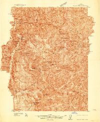
USGS Historical Quadrangle in GeoPDF.
USGS Historical Quadrangle in GeoPDF.
This data set contains imagery from the National Agriculture Imagery Program (NAIP). The NAIP program is administered by USDA FSA and has been established to support two main FSA strategic goals centered on agricultural production. These are, increase stewardship of America's natural resources while enhancing the environment, and to ensure commodities are procured and distributed effectively and efficiently to increase food security. The NAIP program supports these goals by acquiring and providing ortho imagery that has been collected during the agricultural growing season in the U.S. The NAIP ortho imagery is tailored to meet FSA requirements and is a fundamental tool used to support FSA farm and conservation programs....
This data release includes sampling location data; field-collected stream attribute data; laboratory-analyzed chemistry concentrations (total mercury, methyl mercury) and isotopic composition (total mercury, carbon, and nitrogen) for stream biota (seston, periphyton, benthic insects, emerging adult insects, riparian spiders, and fish); density, body length, and taxonomic information for benthic insects; and density, biomass, and taxonomic information for emerging adult aquatic insects for biota sampled from stream reaches up and downstream of an historical mercury mine site. Sampling took place during summer low-flow conditions in 2015 and 2016. Stream reaches were located on USFS land near the Cinnabar Mine Site...
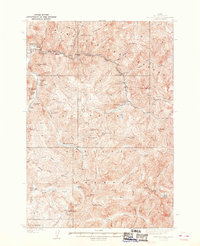
USGS Historical Quadrangle in GeoPDF.
This data release includes laser ablation inductively coupled plasma mass spectrometry (LA-ICPMS) U-Pb zircon geochronology data to determine the ages of Challis igneous rocks in the Thunder Mountain volcanic field and dikes west of the volcanic field, especially in and near the Stibnite-Yellow Pine mining district, ID. These efforts were made to help understand the stratigraphy and lithologic characteristics of the Challis igneous rocks by determining their absolute ages.
Categories: Data;
Tags: Challis,
GGGSC,
Geochronology,
Geology, Geophysics, and Geochemistry Science Center,
Idaho,
This data set contains imagery from the National Agriculture Imagery Program (NAIP). The NAIP program is administered by USDA FSA and has been established to support two main FSA strategic goals centered on agricultural production. These are, increase stewardship of America's natural resources while enhancing the environment, and to ensure commodities are procured and distributed effectively and efficiently to increase food security. The NAIP program supports these goals by acquiring and providing ortho imagery that has been collected during the agricultural growing season in the U.S. The NAIP ortho imagery is tailored to meet FSA requirements and is a fundamental tool used to support FSA farm and conservation programs....
This dataset accompanies planned publication 'Timing of Hydrothermal Alteration and Au-Sb-W Mineralization, Stibnite-Yellow Pine District, Idaho'. The Ar/Ar data is for samples that record the mineralization of the area. The geochronology provides time constraints for the mineralization studied in the manuscript. Samples were collected from the Yellow Pine region, and collection was done by numerous USGS scientists, who sent them to the USGS Denver Argon Geochronology Laboratory for Ar/Ar analysis.
Categories: Data;
Tags: 40Ar/39Ar,
Argon Geochronology Laboratory,
GGGSC,
Geochemistry,
Geology, Geophysics, and Geochemistry Science Center,
USGS Historical Quadrangle in GeoPDF.
USGS Historical Quadrangle in GeoPDF.
This data set contains imagery from the National Agriculture Imagery Program (NAIP). The NAIP program is administered by USDA FSA and has been established to support two main FSA strategic goals centered on agricultural production. These are, increase stewardship of America's natural resources while enhancing the environment, and to ensure commodities are procured and distributed effectively and efficiently to increase food security. The NAIP program supports these goals by acquiring and providing ortho imagery that has been collected during the agricultural growing season in the U.S. The NAIP ortho imagery is tailored to meet FSA requirements and is a fundamental tool used to support FSA farm and conservation programs....
This data set summarizes electrofishing effort, observations, and tissue sampling of aquatic vertebrates near Yellow Pine, Idaho. Sampling was conducted using a backpack electrofishing unit at two reference sites including Cane Creek and Sugar Creek, and at three mine impact sites including Sugar Creek and Cinnabar Creek. Juvenile Bull Trout (Salvelinus confluentus) were present at all five sites and were the primary species targeted during our sampling effort. Additional tissue samples of Sculpin, and amphibians were taken when available. Where possible, a two pass (quantitative depletion) electrofishing survey was conducted at each site for non-USGS stakeholders (Nez Perce Tribe and Idaho Department of Fish and...
Categories: Data;
Types: Citation,
Map Service,
OGC WFS Layer,
OGC WMS Layer,
OGC WMS Service;
Tags: Aquatic Biology,
Biota,
Bull Trout,
Cane Creek,
Cinnabar Creek,
The USGS examined mercury (Hg) concentrations in fish populations inhabiting impacted and reference streams as part of an investigation into the transport of trace metals in a watershed impacted by legacy mercury mining downstream from the Cinnabar mine site, Valley County, ID. Fish were sampled through an electrofishing survey utilizing a two-pass quantitative depletion approach where possible. Five reaches were selected in the Sugar Creek/Cinnabar Creek watershed, including two background reaches (ID020; ID021) with negligible mining impacts, Cinnabar Creek above the confluence with Sugar Creek (ID019), and two sites on Sugar Creek below the confluence with Cinnabar Creek (ID018 and ID010). Juvenile Bull trout...
Categories: Data;
Tags: Abandoned Mines and Quarries,
Aquatic Biology,
Aquatic Biology,
Atomic Absorption Analysis,
Bull Trout,
These geospatial files are the essential components for the Geologic Map of the Stibnite Mining Area in Valley County, Idaho, which was published by the Idaho Geological Survey in 2022. Three main file types are in this dataset: geographic, geologic, and mining. Geographic files are map extent, lidar base, topographic contours, labels for contours, waterways, and roads. Geologic files are geologic map units, faults, structural lines meaning axial traces, structural points like bedding strike and dip locations, cross section lines, and drill core sample locations. Lastly, mining files are disturbed ground features including open pit polygons or outlines, and general mining features such as the location of an adit....
|

|
