Filters: Tags: Yellowstone Lake (X)
10 results (46ms)|
Filters
Date Range
Extensions Types
Contacts
Categories Tag Types
|
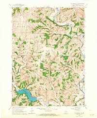
USGS Historical Quadrangle in GeoPDF.
Yellowstone National Park (YNP; Wyoming, Montana, and Idaho, USA) contains more than 10,000 hydrothermal features, several lakes, and four major watersheds. For more than 140 years, researchers at the U.S. Geological Survey and other scientific institutions have investigated the chemical compositions of hot springs, geysers, fumaroles, mud pots, streams, rivers, and lakes in YNP and surrounding areas. Water chemistry studies have revealed a range of compositions including waters with pH values ranging from about 1 to 10, surface temperatures from ambient to superheated values of 95°C, and elevated concentrations of silica, lithium, boron, fluoride, mercury, and arsenic. Hydrogeochemical data from YNP research have...
Categories: Data;
Types: Map Service,
OGC WFS Layer,
OGC WMS Layer,
OGC WMS Service;
Tags: Hydrology,
USGS Science Data Catalog (SDC),
Volcanology,
Water Quality,
Water Resources,
Airborne electromagnetic (AEM) and magnetic survey data were collected during November and December 2016 along 4,212 line-kilometers over Yellowstone National Park, Wyoming. The survey was conducted as part of a study of the subsurface geologic structure and geothermal and groundwater resources of Yellowstone National Park. The survey was designed to image the subsurface plumbing of Yellowstone's myriad thermal features by constraining the geometry of the major hydrostratigraphic contacts and mapping regional-scale geologic structures. Data were acquired by SkyTEM ApS with the SkyTEM 312M time-domain helicopter-borne electromagnetic system together with a Geometrics G822A cesium vapor magnetometer. The survey was...
This data set contains imagery from the National Agriculture Imagery Program (NAIP). The NAIP program is administered by USDA FSA and has been established to support two main FSA strategic goals centered on agricultural production. These are, increase stewardship of America's natural resources while enhancing the environment, and to ensure commodities are procured and distributed effectively and efficiently to increase food security. The NAIP program supports these goals by acquiring and providing ortho imagery that has been collected during the agricultural growing season in the U.S. The NAIP ortho imagery is tailored to meet FSA requirements and is a fundamental tool used to support FSA farm and conservation programs....
Album caption: (Kodak) Buffalo on Frank Island, Yellowstone National Park. Aug. 1897. Index card: Buffalo on Frank Island, Yellowstone Lake, Yellowstone National Park, Wyoming. August 1897.
Categories: Image;
Types: Map Service,
OGC WFS Layer,
OGC WMS Layer,
OGC WMS Service;
Tags: Buffalo,
Frank Island,
National Parks,
Photographers,
Walcott, C. D. collection,
This data set contains imagery from the National Agriculture Imagery Program (NAIP). The NAIP program is administered by USDA FSA and has been established to support two main FSA strategic goals centered on agricultural production. These are, increase stewardship of America's natural resources while enhancing the environment, and to ensure commodities are procured and distributed effectively and efficiently to increase food security. The NAIP program supports these goals by acquiring and providing ortho imagery that has been collected during the agricultural growing season in the U.S. The NAIP ortho imagery is tailored to meet FSA requirements and is a fundamental tool used to support FSA farm and conservation programs....
This data set contains imagery from the National Agriculture Imagery Program (NAIP). The NAIP program is administered by USDA FSA and has been established to support two main FSA strategic goals centered on agricultural production. These are, increase stewardship of America's natural resources while enhancing the environment, and to ensure commodities are procured and distributed effectively and efficiently to increase food security. The NAIP program supports these goals by acquiring and providing ortho imagery that has been collected during the agricultural growing season in the U.S. The NAIP ortho imagery is tailored to meet FSA requirements and is a fundamental tool used to support FSA farm and conservation programs....
Airborne electromagnetic (AEM) and magnetic survey data were collected during November and December 2016 along 4,212 line-kilometers over Yellowstone National Park, Wyoming. The survey was conducted as part of a study of the subsurface geologic structure and geothermal and groundwater resources of Yellowstone National Park. The survey was designed to image the subsurface plumbing of Yellowstone's myriad thermal features by constraining the geometry of the major hydrostratigraphic contacts and mapping regional-scale geologic structures. Data were acquired by SkyTEM ApS with the SkyTEM 312M time-domain helicopter-borne electromagnetic system together with a Geometrics G822A cesium vapor magnetometer. The survey was...
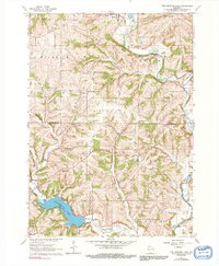
USGS Historical Quadrangle in GeoPDF.
This data set contains imagery from the National Agriculture Imagery Program (NAIP). The NAIP program is administered by USDA FSA and has been established to support two main FSA strategic goals centered on agricultural production. These are, increase stewardship of America's natural resources while enhancing the environment, and to ensure commodities are procured and distributed effectively and efficiently to increase food security. The NAIP program supports these goals by acquiring and providing ortho imagery that has been collected during the agricultural growing season in the U.S. The NAIP ortho imagery is tailored to meet FSA requirements and is a fundamental tool used to support FSA farm and conservation programs....
|

|
