Filters: Tags: Yuma County (X)
579 results (86ms)|
Filters
Date Range
Extensions (Less) Types (Less) Contacts (Less)
Categories (Less) Tag Types
|
S. Fork republican river, US Navy bridge, Yuma, CO
S. Fork republican river, US Navy bridge, Yuma, CO
S. Fork republican river, US Navy bridge, Yuma, CO
S.F. Republican river, HWY 385 bridge, Yuma, CO
ADMMR map collection: Working Sketch of Ruby Mine, Tunnel "A"; 1 in. to 20 feet; 18 x 27 in.
Categories: Data;
Tags: Arizona,
Big Jim,
Castle Dome Mts. physiographic area,
Castle Dome metallic mineral dist.,
Cleveland-Chicago Group,
ADMMR map collection: Acme Gold Mining Co. Claims, Workings and Location; 1 in. to 300 feet; 28 x 19 in.
ADMMR map collection: Castle Dome District, Topographic Map; 1 in. to 1200 feet; 11 x 24 in.
Categories: Data;
Tags: 1970s,
Arizona,
Castle Dome Mts. physiographic area,
Castle Dome metallic mineral dist.,
Colorado,
Heinrichs Geoexploration Co. Maps: Area 4, Aerial-Magnetic Location Plan and Geology; 1:24000; 38 x 52 in.
Categories: Data;
Tags: 1960s,
Arizona,
Castle Dome Mts. physiographic area,
Copper, Sulfide,
Dataset,
Heinrichs Geoexploration Co. Maps: Proposed Geological Reconnaissance of Yuma County by Heinrichs Geoexploration CO.; 1 in. to 10 miles; 27 x 34 in.
ADMMR map collection: North Star Mine, Assay Plan; 1 in. to 5 feet; 67 x 42 in.
Heinrichs Geoexploration Co. Maps: Mile High, Surface and Underground Sampling ; 1 in. to 300 feet; 36 x 45 in.
ADMMR map collection: Location of Wells, Pipe Lines, and Power Lines Sheeptanks Consolidated Mines Co.; 1 in. to 400 feet; 32 x 43 in.
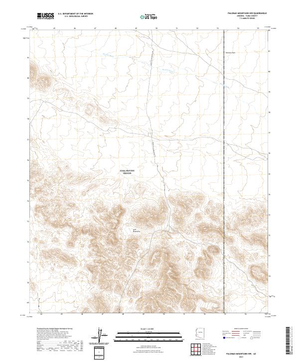
Layered geospatial PDF 7.5 Minute Quadrangle Map. Layers of geospatial data include orthoimagery, roads, grids, geographic names, elevation contours, hydrography, and other selected map features. This map is derived from GIS (geospatial information system) data. It represents a repackaging of GIS data in traditional map form, not creation of new information. The geospatial data in this map are from selected National Map data holdings and other government sources.
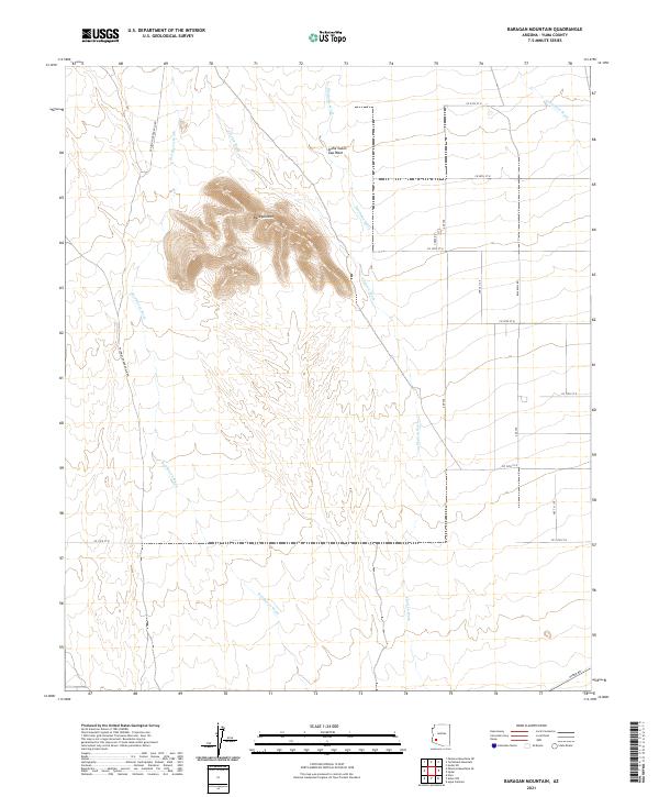
Layered geospatial PDF 7.5 Minute Quadrangle Map. Layers of geospatial data include orthoimagery, roads, grids, geographic names, elevation contours, hydrography, and other selected map features. This map is derived from GIS (geospatial information system) data. It represents a repackaging of GIS data in traditional map form, not creation of new information. The geospatial data in this map are from selected National Map data holdings and other government sources.
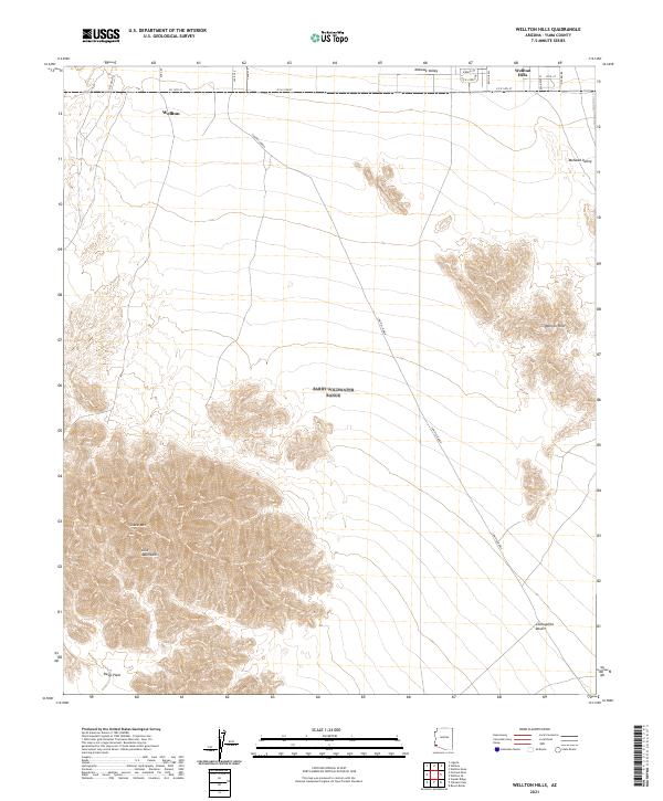
Layered geospatial PDF 7.5 Minute Quadrangle Map. Layers of geospatial data include orthoimagery, roads, grids, geographic names, elevation contours, hydrography, and other selected map features. This map is derived from GIS (geospatial information system) data. It represents a repackaging of GIS data in traditional map form, not creation of new information. The geospatial data in this map are from selected National Map data holdings and other government sources.
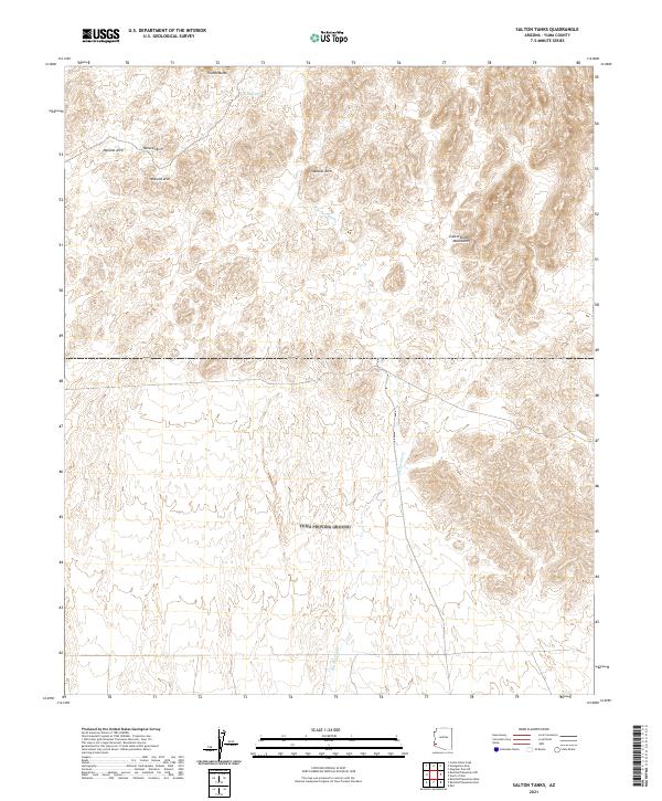
Layered geospatial PDF 7.5 Minute Quadrangle Map. Layers of geospatial data include orthoimagery, roads, grids, geographic names, elevation contours, hydrography, and other selected map features. This map is derived from GIS (geospatial information system) data. It represents a repackaging of GIS data in traditional map form, not creation of new information. The geospatial data in this map are from selected National Map data holdings and other government sources.
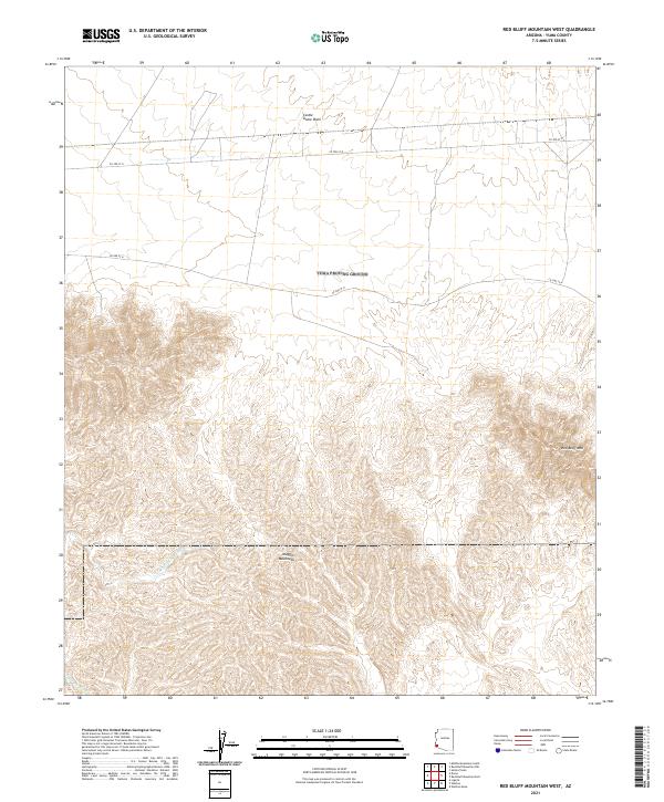
Layered geospatial PDF 7.5 Minute Quadrangle Map. Layers of geospatial data include orthoimagery, roads, grids, geographic names, elevation contours, hydrography, and other selected map features. This map is derived from GIS (geospatial information system) data. It represents a repackaging of GIS data in traditional map form, not creation of new information. The geospatial data in this map are from selected National Map data holdings and other government sources.
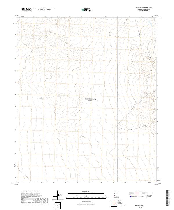
Layered geospatial PDF 7.5 Minute Quadrangle Map. Layers of geospatial data include orthoimagery, roads, grids, geographic names, elevation contours, hydrography, and other selected map features. This map is derived from GIS (geospatial information system) data. It represents a repackaging of GIS data in traditional map form, not creation of new information. The geospatial data in this map are from selected National Map data holdings and other government sources.
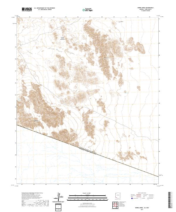
Layered geospatial PDF 7.5 Minute Quadrangle Map. Layers of geospatial data include orthoimagery, roads, grids, geographic names, elevation contours, hydrography, and other selected map features. This map is derived from GIS (geospatial information system) data. It represents a repackaging of GIS data in traditional map form, not creation of new information. The geospatial data in this map are from selected National Map data holdings and other government sources.
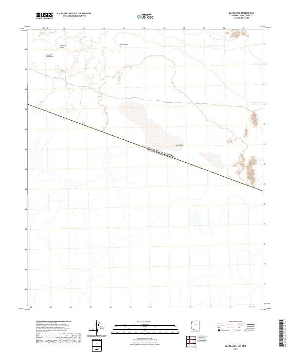
Layered geospatial PDF 7.5 Minute Quadrangle Map. Layers of geospatial data include orthoimagery, roads, grids, geographic names, elevation contours, hydrography, and other selected map features. This map is derived from GIS (geospatial information system) data. It represents a repackaging of GIS data in traditional map form, not creation of new information. The geospatial data in this map are from selected National Map data holdings and other government sources.
|

|
