Filters: Tags: abiotic (X)
45 results (30ms)|
Filters
Contacts
(Less)
|
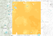
Data was digitized from original scribe sheets used to prepare the published Geologic Map of Wyoming (Love and Christiansen, 1985), consequently at a 1:500,000 scale.
Categories: Data;
Types: Downloadable,
Map Service,
OGC WFS Layer,
OGC WMS Layer,
Shapefile;
Tags: abiotic,
geologic fault,
map,
natural,
physiographic

This data was produced by MC1 version B41, using historical climate from the PRISM group at OSU.

This data was produced by MC1 version B41, under the MIROC A2 future climate scenario.
This ArcView shapefile contains a polygon representation of the overburden thickness above the uppermost coal in the Deadman coal zone in the southern part (Black Butte area) of the Point of Rocks-Black Butte coalfield, Greater Green River Basin, Wyoming. This shapefile is part of the National Coal Resource Assessment of the Northern Rocky Mountain and Great Plains Fort Union Coal Resources Assessment Area. This shapefile can be shown in relation to other relevant themes of this area. Renamed by USGS staff (original filename: bbovbg)
Categories: Data;
Types: Downloadable,
Map Service,
OGC WFS Layer,
OGC WMS Layer,
Shapefile;
Tags: abiotic,
natural,
physiographic
Decomposition of grass leaf litter was studied on a shortgrass prairie using chemicals (HgCl2 and CuSO4) to prevent microbial activity (abiotic treatment), 53??m nylon mesh to exclude mesofauna (microbial treatment), and l?mm nylon mesh to allow the access of mesofauna. After 9 months, 15.2% of the blue grama grass litter was decomposed in the microbial treatment, and 29.4% was decomposed in the microbial plus mesofaunal treatment. After 7 months, 6.2% of the litter had disappeared from the abiotic treatment. There was a general decrease in C:N ratios with the microbial treatment lowest at the end of the experiment. Total available carbohydrates generally decreased with time. Certain mite families fluctuated with...
Categories: Publication;
Types: Citation,
Journal Citation;
Tags: Colorado,
Ecology,
abiotic,
carbon:nitrogen,
decomposition,
This ArcView shapefile contains a line representation of faults in a portion of the the Green River Basin. The fault data are part of the National Coal Resource Assessment of the Northern Rocky Mountain and Great Plains Fort Union Coal Resources Assessment Area. The faults can be shown in relation to other relevant themes of the Green River Basin. Renamed by USGS staff (original filename: grbfltg)
Categories: Data;
Types: Downloadable,
Map Service,
OGC WFS Layer,
OGC WMS Layer,
Shapefile;
Tags: abiotic,
geologic fault,
natural,
physiographic

These layers each depict one suite of methodological choices for designating land facets. Scroll through them to see how different choices affect land facet patterns. Methodological choices: Resolution: 1km or 270m Categorization approach: Categorical overlay- each variable is categorized into ecologically meaningful classes. Land facets are created from unique combinations of those classes. K-means clustering- an algorithm clusters the continuous variables into a designated number of facets. The Hartigan index was used to identify the optimal number of facets. Hybrid approach- a combination of the categorical overlay and a clustering method. Topographic data were categorized, and within each topographic class...
This dataset contains 4222 point locations corresponding to 136 weather station locations in or bordering Wyoming. Each of the 136 weather stations includes 31 points, with the same latitude longitude, for different years (1970-2000). Each point contains attributes for total precipitation in inches for each month, as well as an annual precipitation for the year. The data were obtained from the Western Regional Climatic data website.
Categories: Data;
Types: Downloadable,
Map Service,
OGC WFS Layer,
OGC WMS Layer,
Shapefile;
Tags: abiotic,
atmospheric,
human,
monitoring,
precipitation,
These data are the primary data used to estimate rainbow trout abundance and survival in the Colorado River, Glen and Grand Canyons. Refer to the analyses as per the associated journal manuscript (see Larger Work Citation). Prey availability, feeding efficiency, and competition reduce somatic growth and cause the collapse of a fish population" Nighttime boat electrofishing was used to sample rainbow trout four times per year in April, July, September, and January, from April 2012 through September 2016. A total of five reaches were sampled between Glen Canyon Dam (river kilometer [rkm] 0) to below the confluence with the Little Colorado River (located at rkm 130). Reaches ranged from two to six km in length. A total...
This ArcView shapefile contains a polygon representation of generalized geology in the Green River Basin. This geology shapefile was produced as part of the National Coal Resource Assessment of the Northern Rocky Mountain and Great Plains Fort Union Coal Resources Assessment Area. This geology can be shown in relation to other relevant themes in the green River Basin. Renamed by USGS staff (original filename: grbgeolg)
Categories: Data;
Types: Downloadable,
Map Service,
OGC WFS Layer,
OGC WMS Layer,
Shapefile;
Tags: abiotic,
natural,
physiographic

This data was produced by MC1 version B41, using historical climate from the PRISM group at OSU.

This data was produced by MC1 version B41, using historical climate from the PRISM group at OSU.
This ArcView shapefile contains a polygon representation of the net coal thickness of the deadman coal zone in the northern part (Jim Bridger area) of the Point of Rocks-Black Butte coalfield in the Greater Green River Basin, Wyoming. This shapefile is a part of the National Coal Resource Assessment of the Northern Rocky Mountain and Great Plains Fort Union Coal Resources Assessment Area. This shapefile can be shown in relation to other relevant themes of this area. Renamed by USGS staff (original filename: jbcatg)
Categories: Data;
Types: Downloadable,
Map Service,
OGC WFS Layer,
OGC WMS Layer,
Shapefile;
Tags: abiotic,
energy,
natural

This map represents the percent change from 1971-2000 to 2071-2100 in the average annual amount of water contributed to the stream network, as simulated by the model MC1 under the MIROC medres future climate projection and A2 anthropogenic emissions scenario. The range of data values is from -92.2% to +67.3%. The mean value is -16.6%. Data values are calculated as (STREAMFLOW(2071-2100) minus STREAMFLOW(1971-2000)) divided by STREAMFLOW(1971-2000). STREAMFLOW data is from MC1 version B60. The dynamic global vegetation model MC1 (e.g. Bachelet et al. 2001) was used to simulate vegetation dynamics, associated carbon and nitrogen cycle, water budget, and wild fire impacts at two study sites in eastern Oregon (Deschutes...
Dataset restricted to the WLCI Area of Interest by USGS staff. This data set represents the Continental Divide in Wyoming.
Categories: Data;
Types: Downloadable,
Map Service,
OGC WFS Layer,
OGC WMS Layer,
Shapefile;
Tags: abiotic,
environment,
natural,
physiographic

This data was produced by MC1 version B41, using historical climate from the PRISM group at OSU.

This data was produced by MC1 version B41, using historical climate from the PRISM group at OSU.
This dataset was clipped to the original WLCI study area (effective 2007-May 2009) by USGS staff. This dataset represents surficial geology of Wyoming at 1:500,000-scale. The layer contains 577 separate surficial feature (landforms) and deposit descriptions present on the surface in the state. Compiled from aerial photography and existing maps this layer represents the first comprehensive surficial geology map of Wyoming.
Categories: Data;
Types: Downloadable,
Map Service,
OGC WFS Layer,
OGC WMS Layer,
Shapefile;
Tags: abiotic,
map,
natural,
physiographic

This map represents the change between 1971-2000 and 2071-2100 in the annual peak fraction of total live vegetation carbon held in herbaceous plants, as simulated by the model MC1 under the MIROC medres future climate projection and A2 anthropogenic emissions scenario. The range of data values is from -0.786 to +0.988. The mean value is +0.116. Data values are calculated as GFRAC(2071-2100) minus GFRAC(1971-2000). GFRAC data is from MC1 version B60. The dynamic global vegetation model MC1 (e.g. Bachelet et al. 2001) was used to simulate vegetation dynamics, associated carbon and nitrogen cycle, water budget, and wild fire impacts at two study sites in eastern Oregon (Deschutes and Fremont-Winema National Forests)...
This data was produced by MC1 version B41, under the CSIRO A2 future climate scenario.
|

|
