Filters: Tags: alaska (X) > Date Range: {"choice":"week"} (X)
17 results (52ms)|
Filters
Date Types (for Date Range)
Types Contacts
Categories Tag Types
|
Album caption: Aerial photograph of Redoubt Volcano, Drift River Valley, Rust Slough, Cannery Creek, and Drift River Terminal(between Rust Slough and Drift River). View to West Redoubt Volcano, Alaska. 1989-1990. Photograph by Steven R. Brantley on April 27, 1990.
Types: Map Service,
OGC WFS Layer,
OGC WMS Layer,
OGC WMS Service;
Tags: Alaska,
Redoubt Volcano,
Volcanoes and collection,
photo print
This dataset consists of one table with annual counts from population plots of Black-legged Kittiwakes and Common Murres at two seabird nesting colonies on Gull and Chisik Islands in lower Cook Inlet, Alaska.

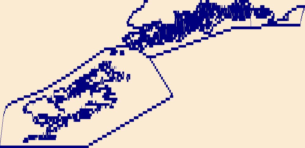
The High Resolution National Hydrography Dataset Plus (NHDPlus HR) is an integrated set of geospatial data layers, including the best available National Hydrography Dataset (NHD), the 10-meter 3D Elevation Program Digital Elevation Model (3DEP DEM), and the National Watershed Boundary Dataset (WBD). The NHDPlus HR combines the NHD, 3DEP DEMs, and WBD to create a stream network with linear referencing, feature naming, "value added attributes" (VAAs), elevation-derived catchments, and other features for hydrologic data analysis. The stream network with linear referencing is a system of data relationships applied to hydrographic systems so that one stream reach "flows" into another and "events" can be tied to and traced...
This dataset consists of one table with predator disturbance information from the Common Murre breeding season (June-August) from 2016-2020 on Gull Island, Kachemak Bay, Alaska.
This data release is composed of seven datasets regarding colonial seabirds and forage fish at two seabird nesting colonies on Gull and Chisik Islands in lower Cook Inlet, Alaska. These data were collected to detect changes in the breeding population of Black-legged Kittiwakes and Common Murres on two nesting colonies in lower Cook Inlet and to compare those counts to baseline counts from 1995-1999. They are part of an ongoing study in lower Cook Inlet, Alaska to assess the recent status of forage fish and seabirds (2000-2020).
This dataset consists of one table with annual nesting productivity estimates for Black-legged Kittiwakes and Common Murres at two seabird nesting colonies on Gull and Chisik Islands in lower Cook Inlet, Alaska.
Chronic Wasting Disease distribution in the United States by state and county (ver. 2.0, April 2024)
Chronic Wasting Disease (CWD) is a fatal, contagious, neuro-degenerative disease affecting multiple members of the Family Cervidae. First detected in 1967, the disease has, as of April 2024, been documented in free-ranging and/or captive cervid populations in 33 states, five Canadian provinces, the Republic of South Korea, Norway, Sweden, and Finland. The data provided here contains information on the known, available, documented distribution of CWD in the United States that is current as of the publication date. The USGS National Wildlife Health Center (NWHC) tracks changes to the known distribution of CWD in the form of a map (available on the NWHC website at https://www.usgs.gov/centers/nwhc/science/expanding-distribution-chronic-wasting-disease....
Categories: Data,
Data Release - Revised;
Types: Citation;
Tags: Alabama,
Alaska,
American Samoa,
Arizona,
Arkansas,
This dataset consists of one table with Area Backscattering Coefficient (ABC) data from hydroacoustic transect surveys collected around two seabird nesting colonies on Gull and Chisik Islands in lower Cook Inlet, Alaska.
Categories: Data;
Tags: Acoustic backscatter,
Alaska,
Aquatic Sciences and Fisheries,
Biota,
Coastal ecosystems,
Climate adaptation planning provides a framework for Tribes to exercise sovereignty over wild resources important for the subsistence way of life and economic and cultural activities that are being impacted by climate change. The climate adaptation planning process includes identifying key resources that are currently being impacted by climate change, or that may be impacted in the future, as well as identifying practical and strategic steps that can be taken to mitigate or adapt to the changing circumstances. Through a partnership among the Ketchikan Indian Community, the Metlakatla Indian Community, OceansAlaska, and the University of Alaska Fairbanks this project will support Tribal- and Alaska Native-led...
Categories: Project;
Types: Map Service,
OGC WFS Layer,
OGC WMS Layer,
OGC WMS Service;
Tags: 2022,
Alaska,
Alaska CASC,
Alaska Natives and Corporations,
Alaska Natives and Corporations,
Alaska Earthquake March 27, 1964. Damage to houses from landslides in Turnagain Heights in Anchorage. Photo by R.A. Page. Pages 24-25 , Earthquake Information Bulletin, v.12, no.1.
Categories: Image;
Types: Map Service,
OGC WFS Layer,
OGC WMS Layer,
OGC WMS Service;
Tags: Alaska,
Alaska Earthquake March 27, 1964,
Earthquakes,
Landslides,
Page R.A.,
This dataset consists of one table with egg predation data from Common Murres at two seabird nesting colonies on Gull and Chisik Islands in lower Cook Inlet, Alaska.
High latitude northern ecosystems are currently warming twice as fast as the global average. Over the last several decades, this has caused dramatic losses of frozen area in the Arctic and sub-Arctic. However, it is unclear how melting coastal mountain glaciers, thawing permafrost, and declines in snowpack will affect the quality of freshwater habitat for culturally and economically important salmon in Alaska. As a collaborative effort with the Alaska Department of Fish and Game, the Alaska Department of Natural Resources, and the U.S. Fish and Wildlife Service, this project aims to answer three questions: How does melting affect the freshwater habitat of Pacific salmon? How will changes to aquatic flows...
Categories: Project;
Types: Map Service,
OGC WFS Layer,
OGC WMS Layer,
OGC WMS Service;
Tags: 2022,
Alaska,
Alaska CASC,
CASC,
Data Visualization & Tools,
Migratory birds are important for recreation and tourism, contributing to a vibrant birdwatching industry in Alaska. Every spring, hundreds of birds migrate to their summer breeding grounds in Alaska and northern Canada. Their arrival is timed with the height of the spring green-up of plants, which provide the food necessary for birds to reproduce and raise their young. However, over the last fifty years, warming temperatures in Alaska as a result of climate change have prompted an earlier transition from winter to spring. The purpose of this project was to examine whether there have been changes in the timing of spring green-up in recent years (1985-2009) and, if so, whether migratory birds are adapting their migration...
Categories: Project;
Types: Map Service,
OGC WFS Layer,
OGC WMS Layer,
OGC WMS Service;
Tags: 2009,
Alaska,
Arctic,
Arctic,
Birds,
Actionable science has evolved rapidly over the last decade, and the Climate Adaptation Science Center (CASC) network has established itself as a leader in the field. The practice of actionable science is generally described as user-focused, action-oriented science that addresses pressing real-world climate adaptation challenges. It is also sometimes referred to as usable science, translational ecology, and coproduction. Successfully carrying out actionable science projects requires a range of skills, mindsets, and techniques in addition to scientific knowledge. Those skills can include mutual learning with stakeholders, attention to social and political context, iterative creative problem-solving, and interdisciplinary...
Categories: Project;
Types: Map Service,
OGC WFS Layer,
OGC WMS Layer,
OGC WMS Service;
Tags: 2021,
Alaska,
CASC,
National CASC,
National CASC,
This dataset consists of one table with annual population counts (censuses) for Black-legged Kittiwakes and Common Murres at two seabird nesting colonies on Gull and Chisik Islands in lower Cook Inlet, Alaska.
This dataset consists of two tables: 1) forage fish catch and size data from hydroacoustic trawl transects, and 2) taxonomic details of fish species collected around two seabird nesting colonies on Gull and Chisik Islands in lower Cook Inlet, Alaska.
The High Resolution National Hydrography Dataset Plus (NHDPlus HR) is an integrated set of geospatial data layers, including the best available National Hydrography Dataset (NHD), the 10-meter 3D Elevation Program Digital Elevation Model (3DEP DEM), and the National Watershed Boundary Dataset (WBD). The NHDPlus HR combines the NHD, 3DEP DEMs, and WBD to create a stream network with linear referencing, feature naming, "value added attributes" (VAAs), elevation-derived catchments, and other features for hydrologic data analysis. The stream network with linear referencing is a system of data relationships applied to hydrographic systems so that one stream reach "flows" into another and "events" can be tied to and traced...
|

|
