Filters: Tags: alberta (X)
288 results (31ms)|
Filters
Date Range
Extensions
Types Contacts
Categories Tag Types
|
ABSTRACT: Most of us are aware, or feel we are aware, of the impacts of major water resources projects on our lives. “Dam-lovers” note the life-saving flood-risk reduction and recreational benefits of a proposed reservoir, while “dam-haters” bemoan the future drowning out of the wildlife habitat of its river valley, and the recreational disbenefits to stream (as opposed to lake) fishermen. Water supply projects can often be given such a revered status, assuming the “obvious” tenet that water, air, food, and shelter are basic requirements of decent living, that the economic viability of the project may not even be assessed. Water resources planners are supposed to impartially weigh the environmental and economic...
Categories: Publication;
Types: Citation;
Tags: Alberta,
Canada,
economic analysis,
environmental impact,
water resources development
Layered GeoPDF 7.5 Minute Quadrangle Map. Layers of geospatial data include orthoimagery, roads, grids, geographic names, elevation contours, hydrography, and other selected map features.
Layered GeoPDF 7.5 Minute Quadrangle Map. Layers of geospatial data include orthoimagery, roads, grids, geographic names, elevation contours, hydrography, and other selected map features.
Layered geospatial PDF Map. Layers of geospatial data include orthoimagery, roads, grids, geographic names, elevation contours, hydrography, and other selected map features.
Layered GeoPDF 7.5 Minute Quadrangle Map. Layers of geospatial data include orthoimagery, roads, grids, geographic names, elevation contours, hydrography, and other selected map features.
Layered GeoPDF 7.5 Minute Quadrangle Map. Layers of geospatial data include orthoimagery, roads, grids, geographic names, elevation contours, hydrography, and other selected map features.
Layered geospatial PDF Map. Layers of geospatial data include orthoimagery, roads, grids, geographic names, elevation contours, hydrography, and other selected map features.
Layered geospatial PDF Map. Layers of geospatial data include orthoimagery, roads, grids, geographic names, elevation contours, hydrography, and other selected map features.

Layered GeoPDF 7.5 Minute Quadrangle Map. Layers of geospatial data include orthoimagery, roads, grids, geographic names, elevation contours, hydrography, and other selected map features.
Layered GeoPDF 7.5 Minute Quadrangle Map. Layers of geospatial data include orthoimagery, roads, grids, geographic names, elevation contours, hydrography, and other selected map features.
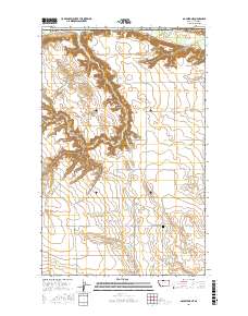
Layered geospatial PDF Map. Layers of geospatial data include orthoimagery, roads, grids, geographic names, elevation contours, hydrography, and other selected map features.
THIS IS A HISTORICAL RECORD. As of December 17, 2021, the BISON application will no longer be available online and has been replaced by https://www.gbif.us. The BISON APIs are still available at https://bison.usgs.gov/#api and the Integrated Publishing Toolkit is still available at https://bison.usgs.gov/ipt. The USGS Biodiversity Information Serving Our Nation (BISON) project is an online all-species mapping information system consisting of a large collection of species occurrence datasets (e.g., plants and animals) found in the United States, U.S. Territories, U.S. marine Exclusive Economic Zones (EEZ), and Canada, with relevant geospatial layers. Species occurrences are records of organisms at a particular...
This data release contains historical SnowModel (Liston and Elder, 2006) output for the Crown of the Continent and surrounding areas in Montana and Idaho, USA; and Alberta and British Columbia, Canada from September 1, 1981 through August 31, 2020. Fifteen daily variables were simulated or derived for this release: (1) snow water equivalent (swed), (2) liquid precipitation (rpre), (3) solid precipitation (spre), (4) albedo (albd), (5) glacial ice melt (glmt), (6) total precipitation (prec), (7) runoff (roff), (8) snow covered area (sca), (9) snow density (sden), (10) snowmelt (smlt), (11) snow depth (snod), (12) snow sublimation (ssub), (13) air temperature (tair), (14) wind speed (wspd), and (15) wind direction...
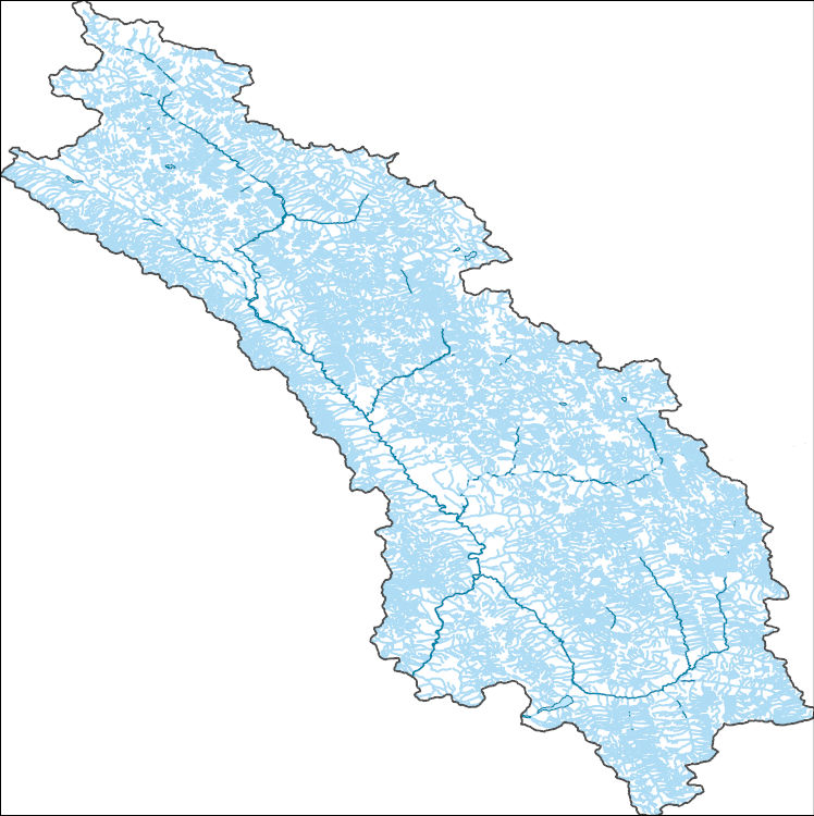
The National Hydrography Dataset (NHD) is a feature-based database that interconnects and uniquely identifies the stream segments or reaches that make up the nation's surface water drainage system. NHD data was originally developed at 1:100,000-scale and exists at that scale for the whole country. This high-resolution NHD, generally developed at 1:24,000/1:12,000 scale, adds detail to the original 1:100,000-scale NHD. (Data for Alaska, Puerto Rico and the Virgin Islands was developed at high-resolution, not 1:100,000 scale.) Local resolution NHD is being developed where partners and data exist. The NHD contains reach codes for networked features, flow direction, names, and centerline representations for areal water...
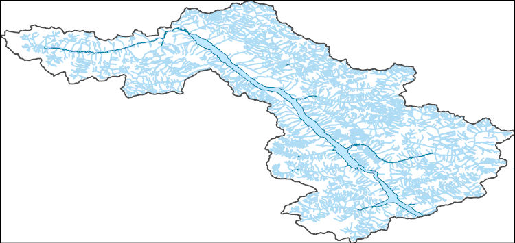
The National Hydrography Dataset (NHD) is a feature-based database that interconnects and uniquely identifies the stream segments or reaches that make up the nation's surface water drainage system. NHD data was originally developed at 1:100,000-scale and exists at that scale for the whole country. This high-resolution NHD, generally developed at 1:24,000/1:12,000 scale, adds detail to the original 1:100,000-scale NHD. (Data for Alaska, Puerto Rico and the Virgin Islands was developed at high-resolution, not 1:100,000 scale.) Local resolution NHD is being developed where partners and data exist. The NHD contains reach codes for networked features, flow direction, names, and centerline representations for areal water...
We will develop an approach to identify fire refugia in Rocky Mountain ecosystems of the U.S. and Canada then test the function of refugia for biodiversity conservation under current and future climate/fire scenarios. Our products will be designed to inform decision-making in land/easement acquisition, identification of critical areas for maintaining landscape and process connectivity/permeability, and extension of the temporal context for spatial conservation decision making. The approach will be testable for transferability to other locations and ecosystems.FY2013Objectives:The proposed project will provide a science application for focused resource conservation by developing and testing the concept of refugia...
Categories: Data,
Project;
Types: Map Service,
OGC WFS Layer,
OGC WMS Layer,
OGC WMS Service;
Tags: Alberta,
British Columbia,
Canada Lynx,
Canadian Rockies,
Canadian Rockies Greater Ecosystem,
This project aims to provide large landscape practitioners of the U.S. Northern Rockies with a decision support tool for prioritizing conservation action to mitigate road impacts on wildlife corridors. We will overlay analyses of corridor network centrality with analyses of wildlife-vehicle collision risk to identify where high-importance corridors meet high-impact road segments. Our findings will establish a rigorous, transparent basis for focusing road mitigation efforts where they will yield the greatest benefits to region-wide connectivity, and will be conveyed in the form of web-based map tools, a comprehensive written report, and a workshop for large landscape practitioners.Objectives:The primary objective...
Categories: Data,
Project;
Types: Map Service,
OGC WFS Layer,
OGC WMS Layer,
OGC WMS Service;
Tags: Alberta,
Applications and Tools,
British Columbia,
Canada Lynx,
Crown of the Continent Ecosystm,
The Great Northern Landscape Conservation Cooperative (GLNCC) has convened the Columbia Basin Partner Forum (CBPF) to help facilitate collaboration among conservation practitioners and partnerships that share landscape conservation challenges in an eco-geographic context. Through a loosely structured process, field-level managers, scientists, and conservation constituents will identify priority conservation information, scientific needs, and implementation opportunities within the scope of the Great Northern LCC Strategic Conservation Framework. The CBPF will also provide a means to engage the partnership network (a more diverse and directly knowledgeable constituency) on specific conservation needs that will inform...
Categories: Data,
Project;
Types: Map Service,
OGC WFS Layer,
OGC WMS Layer,
OGC WMS Service;
Tags: Alberta,
Aquatic Connectivity,
British Columbia,
Climate Change,
Columbia Basin,
Assemble three sets of downscaled climate data (historic) and projections (future) developed by the USGS and the Climate Impacts Group at University of Washington; evaluate data documentation and formatting, and edit or repair as needed; deliver all climate data in a userfriendly format from mirrored data servers located in Corvallis, OR and Bozeman, MT.The public purpose of this project is ultimately to provide sound scientific support that is critical for guiding planning, decisions and responses aimed at managing the ecosystems of the GNLCC and other LCCs under global change. The objectives of the project are 1) to design and establish a state-of-the-art data server that is fault tolerant and expandable to meet...
Categories: Data,
Project;
Types: Map Service,
OGC WFS Layer,
OGC WMS Layer,
OGC WMS Service;
Tags: Academics & scientific researchers,
Alberta,
Applications and Tools,
British Columbia,
CO-2,
The RCMAP (Rangeland Condition Monitoring Assessment and Projection) dataset quantifies the percent cover of rangeland components across western North America using Landsat imagery from 1985-2023. The RCMAP product suite consists of ten fractional components: annual herbaceous, bare ground, herbaceous, litter, non-sagebrush shrub, perennial herbaceous, sagebrush, shrub, tree, and shrub height in addition to the temporal trends of each component. Several enhancements were made to the RCMAP process relative to prior generations. First, high-resolution training was revised using an improved neural-net classifier and modelling approach. These data serve as foundation to the RCMAP approach. The training database was...
|

|
