Filters: Tags: aspen (X)
77 results (28ms)|
Filters
Date Range
Extensions Types Contacts
Categories Tag Types
|
FY2011Aspen populations are in decline across western North America due to altered fire regimes, herbivory, drought, pathogens, and competition with conifers. Aspen stands typically support higher avian biodiversity than surrounding habitats, and maintaining current distributions of several avian species is likely tied to persistence of aspen on the landscape. We are examining effects of climate change on aspen and associated avian communities in isolated mountain ranges of the northern Great Basin, by coupling empirical models of avian-habitat relationships with spatially-explicit landscape simulations of vegetation and disturbance dynamics (using LANDIS-II) under various climate change scenarios. We are addressing...
Categories: Data,
Project;
Types: Map Service,
OGC WFS Layer,
OGC WMS Layer,
OGC WMS Service;
Tags: Academics & scientific researchers,
Data Acquisition and Development,
Federal resource managers,
LANDIS-II,
LANDIS-II,
Quaking aspen cover 3.3 million hectares in the Upper Colorado River Basin, and these areas are gradually converting to conifer forest by the natural process of ecological succession. This change is being hastened by forest managment practices that reduce fires, destroy pests, or otherwise prevent the natural processes that previously caused conifer areas to revert to the subclimax aspen. The hydrologic consequence has been forecast to cause a runoff reduction in the Colorado River as large as one million acre-feet annually, a major blow to water availability in the Lower Basin. Understanding and dealing with the problems requires quantitative comparision of the evaportranspiration rates of conifer and aspen forests...
Categories: Publication;
Types: Citation,
ScienceBase Citation;
Tags: Chicken Creek watershed,
Colorado River Basin,
Utah,
aspen,
conifers,
Investigations of vegetation stress along non-paved roads treated with a range of magnesium chloride (MgCl2) application rates utilized 60 roadside and 79 drainage plots on 15 and 18 roads, respectively. Evaluations were completed of foliar damage, plant health, biotic and abiotic damage incidence and severity, soil and foliar chemistry and other common site and stand characteristics of Pinus contorta, Populus tremuloides, Picea engelmannii, Abies lasiocarpa, and lower elevation plots dominated by shrubs and grasses. High concentrations of soil magnesium and chloride (400?500 ppm), high foliar chloride (2,000?16,000 ppm depending on species) and high incidence of foliar damage were measured in roadside plots along...
Categories: Publication;
Types: Citation,
Journal Citation;
Tags: Aspen,
Dust abatement,
Engelmann spruce,
Gravel roads,
Lodgepole pine,
The Star Valley Front project was brought up by the Wyoming Game and Fish Department in the early 80's to help improve big game winter ranges. The project area contains mountain shrubland, big sagebrush, and aspen communities that are in less-than-suitable condition. The commumnities continue to decline due in large part to an over-representation of late-seral conditions and an insufficient frequency and extent of fire. Declining habitat conditions in the Star Valley Front project area are having negative effects on mule deer, elk, and moose due to declining forage conditions. Other wildlife species, including several migratory bird species, are being adversely impacted by the loss and decline in quality of mountain...
Categories: Data,
Project;
Types: Downloadable,
Map Service,
OGC WFS Layer,
OGC WMS Layer,
Shapefile;
Tags: Habitat,
aspen,
habitat conservation project,
sagebrush
The 2030 Western juniper viablitly was average based on the 7 climate models and clipped to the ecoregion.
Distribution of Aspen within the ecoregion based on Landfire and ReGAP. These data are provided by Bureau of Land Management (BLM) "as is" and may contain errors or omissions. The User assumes the entire risk associated with its use of these data and bears all responsibility in determining whether these data are fit for the User's intended use. These data may not have the accuracy, resolution, completeness, timeliness, or other characteristics appropriate for applications that potential users of the data may contemplate. The User is encouraged to carefully consider the content of the metadata file associated with these data. The BLM should be cited as the data source in any products derived from these data.
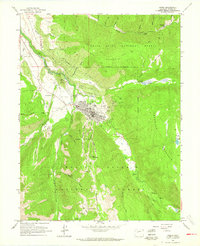
USGS Historical Quadrangle in GeoPDF.
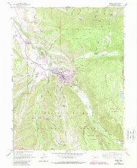
USGS Historical Quadrangle in GeoPDF.
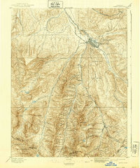
USGS Historical Quadrangle in GeoPDF.
Core Research Center, core T186, from well operated by MOUNTAIN FUEL SUPPLYRaw Properties from download, web scrape, MapServer, and Macrostrat API{"Lib Num": "T186", "API Num": "4904105097", "Operator": "MOUNTAIN FUEL SUPPLY", "Well Name": "1 GRIZZLY BUTTE", "Field": "GRIZZLY BUTTE", "State": "WY", "County": "UINTA", "Type": "FULL", "Photos": "F", "Thin Sec": "F", "Analysis": "F", "Latitude": "41.2323", "Longitude": "-110.11565", "coordinates_geohash": "9x3dw605x3u4", "Source": "FROM STATE RECORDS", "Security Flag": "NO SPECIAL RESTRICTIONS", "crc_collection_name": "core", "sb_parent_id": "4f4e49dae4b07f02db5e0486", "intervals": [{"Formation": "ASPEN", "Age": "CRET", "Min Depth": "13034", "Max Depth": "13123"}],...
Categories: Physical Item;
Tags: ASPEN,
Bridger Formation,
CRET,
Middle part, Bridger Formation,
middle Eocene
Core Research Center, core A026, from well operated by CALIFORNIA OILRaw Properties from download, web scrape, MapServer, and Macrostrat API{"Lib Num": "A026", "API Num": "4903505450", "Operator": "CALIFORNIA OIL", "Well Name": "1 BIRCH CREEK UNIT", "Field": "BIRCH CREEK", "State": "WY", "County": "SUBLETTE", "Type": "CHIPS", "Photos": "T", "Thin Sec": "T", "Analysis": "T", "Latitude": "42.33112", "Longitude": "-110.24046", "coordinates_geohash": "9x98g6jkehen", "Source": "FROM STATE RECORDS", "Security Flag": "NO SPECIAL RESTRICTIONS", "crc_collection_name": "core", "sb_parent_id": "4f4e49dae4b07f02db5e0486", "intervals": [{"Formation": "FRONTIER", "Age": "CRET", "Min Depth": "6750", "Max Depth": "7020"}, {"Formation":...
Core Research Center, core R586, from well operated by MOUNTAIN FUEL SUPPLYRaw Properties from download, web scrape, MapServer, and Macrostrat API{"Lib Num": "R586", "API Num": "4903705440", "Operator": "MOUNTAIN FUEL SUPPLY", "Well Name": "2 CR HETZLER", "Field": "BAXTER BASIN MID", "State": "WY", "County": "SWEETWATER", "Type": "FULL - DISCONTINUOUS SEGMENTS", "Photos": "T", "Thin Sec": "F", "Analysis": "F", "Latitude": "41.56071", "Longitude": "-109.06147", "coordinates_geohash": "9x6kqjzuetcu", "Source": "FROM STATE RECORDS", "Security Flag": "NO SPECIAL RESTRICTIONS", "crc_collection_name": "core", "sb_parent_id": "4f4e49dae4b07f02db5e0486", "intervals": [{"Formation": "ASPEN", "Age": null, "Min Depth": "2050",...
This data set contains imagery from the National Agriculture Imagery Program (NAIP). The NAIP program is administered by USDA FSA and has been established to support two main FSA strategic goals centered on agricultural production. These are, increase stewardship of America's natural resources while enhancing the environment, and to ensure commodities are procured and distributed effectively and efficiently to increase food security. The NAIP program supports these goals by acquiring and providing ortho imagery that has been collected during the agricultural growing season in the U.S. The NAIP ortho imagery is tailored to meet FSA requirements and is a fundamental tool used to support FSA farm and conservation programs....
This data set contains imagery from the National Agriculture Imagery Program (NAIP). The NAIP program is administered by USDA FSA and has been established to support two main FSA strategic goals centered on agricultural production. These are, increase stewardship of America's natural resources while enhancing the environment, and to ensure commodities are procured and distributed effectively and efficiently to increase food security. The NAIP program supports these goals by acquiring and providing ortho imagery that has been collected during the agricultural growing season in the U.S. The NAIP ortho imagery is tailored to meet FSA requirements and is a fundamental tool used to support FSA farm and conservation programs....
The 2030 Lodgepole pine viablitly was average based on the 7 climate models and clipped to the ecoregion.
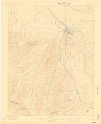
USGS Historical Quadrangle in GeoPDF.
Improving the quality of habitat for western big-game species, such as elk and mule deer, was identified as a priority by the Department of the Interior in 2018. Maintaining healthy herds not only supports the ecosystems where these species are found, but also the hunting and wildlife watching communities. For example, in Wyoming, big game hunting contributed over $300 million to the state’s economy in 2015. Yet as climate conditions change, the quantity, quality, and timing of vegetation available to mule deer, elk, and other ungulates, known as forage, could shift. It’s possible that these changes could have cascading impacts on the behavior and population sizes of many species. A key strategy used by managers...
Categories: Project;
Types: Map Service,
OGC WFS Layer,
OGC WMS Layer,
OGC WMS Service;
Tags: 2018,
CASC,
Completed,
EVI,
IRG,
|

|
