Filters
Date Range
Types
Contacts
Categories
Tag Types
Tag Schemes
|
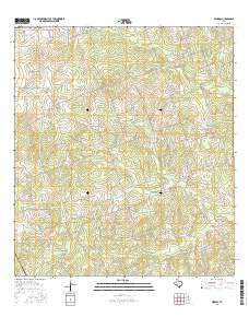
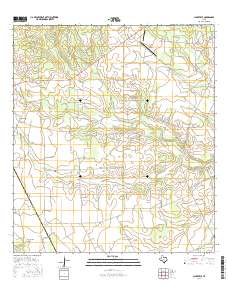
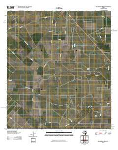
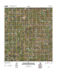
Layered GeoPDF 7.5 Minute Quadrangle Map. Layers of geospatial data include orthoimagery, roads, grids, geographic names, elevation contours, hydrography, and other selected map features.
Tags: 7.5 x 7.5 minute,
Bee,
Clareville, TX,
Downloadable Data,
EarthCover, All tags...
GeoPDF,
Imagery and Base Maps,
Live Oak,
Map,
Public Land Survey System,
Texas,
U.S. National Grid,
US,
US Topo,
US Topo Historical,
United States,
boundary,
contour,
geographic names,
hydrography,
imageryBaseMapsEarthCover,
orthoimage,
structures,
topographic,
transportation,
woodland, Fewer tags
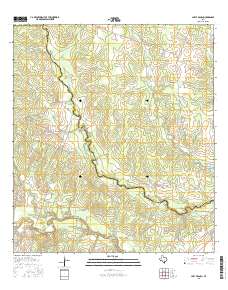
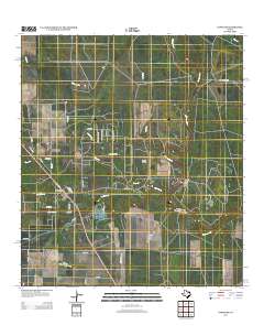
Layered GeoPDF 7.5 Minute Quadrangle Map. Layers of geospatial data include orthoimagery, roads, grids, geographic names, elevation contours, hydrography, and other selected map features.
Tags: 7.5 x 7.5 minute,
Bee,
Downloadable Data,
EarthCover,
GeoPDF, All tags...
Imagery and Base Maps,
Live Oak,
Map,
Mulos Hills, TX,
Public Land Survey System,
Texas,
U.S. National Grid,
US,
US Topo,
US Topo Historical,
United States,
boundary,
contour,
geographic names,
hydrography,
imageryBaseMapsEarthCover,
orthoimage,
structures,
topographic,
transportation,
woodland, Fewer tags
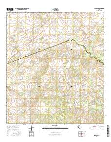
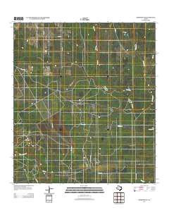
Layered GeoPDF 7.5 Minute Quadrangle Map. Layers of geospatial data include orthoimagery, roads, grids, geographic names, elevation contours, hydrography, and other selected map features.
Tags: 7.5 x 7.5 minute,
Bee,
Berclair, TX,
Downloadable Data,
EarthCover, All tags...
GeoPDF,
Goliad,
Imagery and Base Maps,
Map,
Texas,
U.S. National Grid,
US,
US Topo,
US Topo Historical,
United States,
contour,
geographic names,
hydrography,
orthoimage,
topographic,
transportation, Fewer tags
The National Hydrography Dataset (NHD) is a feature-based database that interconnects and uniquely identifies the stream segments or reaches that make up the nation's surface water drainage system. NHD data was originally developed at 1:100,000-scale and exists at that scale for the whole country. This high-resolution NHD, generally developed at 1:24,000/1:12,000 scale, adds detail to the original 1:100,000-scale NHD. (Data for Alaska, Puerto Rico and the Virgin Islands was developed at high-resolution, not 1:100,000 scale.) Local resolution NHD is being developed where partners and data exist. The NHD contains reach codes for networked features, flow direction, names, and centerline representations for areal water...
Tags: Administrative watershed units,
Administrative watershed units,
Anderson,
Andrews,
Angelina, All tags...
Aransas,
Archer,
Area of Complex Channels,
Area to be submerged,
Armstrong,
Atascosa,
Austin,
Bailey,
Bandera,
Basin,
Basin,
Bastrop,
Bay/Inlet,
Baylor,
Bee,
Bell,
Bexar,
Blanco,
Borden,
Bosque,
Boundaries,
Boundary,
Bowie,
Brazoria,
Brazos,
Brewster,
Bridge,
Briscoe,
Brooks,
Brown,
Burleson,
Burnet,
Caldwell,
Calhoun,
Callahan,
Cameron,
Camp,
Canal/Ditch,
Carson,
Cass,
Castro,
Chambers,
Cherokee,
Childress,
Clay,
Coastline,
Cochran,
Coke,
Coleman,
Collin,
Collingsworth,
Colorado,
Comal,
Comanche,
Concho,
Connector,
Cooke,
Coryell,
Cottle,
Crane,
Crockett,
Crosby,
Culberson,
Dallam,
Dallas,
Dam/Weir,
Dawson,
DeWitt,
Deaf Smith,
Delta,
Denton,
Dickens,
Dimmit,
Donley,
Downloadable Data,
Drainage areas for surface water,
Drainageway,
Duval,
Eastland,
Ector,
Edwards,
El Paso,
Ellis,
Erath,
Esri Shapefile nan,
Estuary,
Falls,
Fannin,
Fayette,
Fisher,
Flow direction network,
Floyd,
Flume,
Foard,
ForeShore,
Fort Bend,
Franklin,
Freestone,
Frio,
Gaging Station,
Gaines,
Galveston,
Garza,
Gate,
Gillespie,
Glasscock,
Goliad,
Gonzales,
Gray,
Grayson,
Gregg,
Grimes,
Guadalupe,
HU10,
HU12,
HU14,
HU16,
HU2,
HU4,
HU6,
HU8,
HUC,
Hale,
Hall,
Hamilton,
Hansford,
Hardeman,
Hardin,
Harris,
Harrison,
Hartley,
Haskell,
Hays,
Hazard Zone,
Hemphill,
Henderson,
Hidalgo,
Hill,
Hockley,
Hood,
Hopkins,
Houston,
Howard,
Hudspeth,
Hunt,
Hutchinson,
Hydrographic,
Hydrography,
Hydrography,
Hydrography,
Hydrologic Unit Code,
Hydrologic Units,
Ice mass,
Inundation Area,
Irion,
Jack,
Jackson,
Jasper,
Jeff Davis,
Jefferson,
Jim Hogg,
Jim Wells,
Johnson,
Jones,
Karnes,
Kaufman,
Kendall,
Kenedy,
Kent,
Kerr,
Kimble,
King,
Kinney,
Kleberg,
Knox,
La Salle,
Lamar,
Lamb,
Lampasas,
Lavaca,
Lee,
Leon,
Levee,
Liberty,
Limestone,
Line,
Lipscomb,
Live Oak,
Llano,
Lock Chamber,
Loving,
Lubbock,
Lynn,
Madison,
Marion,
Marsh,
Martin,
Mason,
Matagorda,
Maverick,
McCulloch,
McLennan,
McMullen,
Medina,
Menard,
Midland,
Milam,
Mills,
Mitchell,
Montague,
Montgomery,
Moore,
Morris,
Motley,
Nacogdoches,
National Hydrography Dataset (NHD),
National Hydrography Dataset (NHD) Best Resolution,
National Hydrography Dataset (NHD) Best Resolution,
Navarro,
Newton,
Nolan,
Nonearthen Shore,
Nueces,
Ochiltree,
Oldham,
Orange,
Orthoimage,
Palo Pinto,
Panola,
Parker,
Parmer,
Pecos,
Playa,
Point,
PointEvent,
Polk,
Pond,
Potter,
Presidio,
Rains,
Randall,
Rapids,
Rapids,
Reach,
Reach code,
Reagan,
Real,
Red River,
Reef,
Reeves,
Refugio,
Region,
Reservoir,
Roberts,
Robertson,
Rock,
Rockwall,
Runnels,
Rusk,
Sabine,
San Augustine,
San Jacinto,
San Patricio,
San Saba,
Schleicher,
Scurry,
Sea/Ocean,
Shackelford,
Shapefile,
Shelby,
Sherman,
Sink/Rise,
Smith,
Somervell,
Sounding Datum Line,
Special Use Zone,
Special Use Zone Limit,
Spillway,
Starr,
State,
State,
State_Texas,
Stephens,
Sterling,
Stonewall,
Stream,
Stream/River,
Sub-basin,
Sub-region,
Subbasin,
Submerged Stream,
Subregion,
Subwatershed,
Surface water systems,
Sutton,
Swamp,
Swisher,
TX,
Tarrant,
Taylor,
Terrell,
Terry,
Texas,
Throckmorton,
Titus,
Tom Green,
Topographic,
Travis,
Trinity,
Tunnel,
Tyler,
US,
Underground Conduit,
United States,
Upshur,
Upton,
Uvalde,
Val Verde,
Van Zandt,
Victoria,
WBD,
WBD,
Walker,
Wall,
Waller,
Ward,
Wash,
Washington,
Water Intake Outflow,
Waterfall,
Watershed,
Watershed Boundaries,
Watershed Boundary Dataset,
Watershed Boundary Dataset,
Webb,
Well,
Wharton,
Wheeler,
Wichita,
Wilbarger,
Willacy,
Williamson,
Wilson,
Winkler,
Wise,
Wood,
Yoakum,
Young,
Zapata,
Zavala,
artificial path,
boundaries,
dams,
drainage systems and characteristics,
inlandWaters,
lakes,
ngda,
rivers, Fewer tags

The National Hydrography Dataset (NHD) is a feature-based database that interconnects and uniquely identifies the stream segments or reaches that make up the nation's surface water drainage system. NHD data was originally developed at 1:100,000-scale and exists at that scale for the whole country. This high-resolution NHD, generally developed at 1:24,000/1:12,000 scale, adds detail to the original 1:100,000-scale NHD. (Data for Alaska, Puerto Rico and the Virgin Islands was developed at high-resolution, not 1:100,000 scale.) Local resolution NHD is being developed where partners and data exist. The NHD contains reach codes for networked features, flow direction, names, and centerline representations for areal water...
Tags: Administrative watershed units,
Administrative watershed units,
Anderson,
Andrews,
Angelina, All tags...
Aransas,
Archer,
Area of Complex Channels,
Area to be submerged,
Armstrong,
Atascosa,
Austin,
Bailey,
Bandera,
Basin,
Basin,
Bastrop,
Bay/Inlet,
Baylor,
Bee,
Bell,
Bexar,
Blanco,
Borden,
Bosque,
Boundaries,
Boundary,
Bowie,
Brazoria,
Brazos,
Brewster,
Bridge,
Briscoe,
Brooks,
Brown,
Burleson,
Burnet,
Caldwell,
Calhoun,
Callahan,
Cameron,
Camp,
Canal/Ditch,
Carson,
Cass,
Castro,
Chambers,
Cherokee,
Childress,
Clay,
Coastline,
Cochran,
Coke,
Coleman,
Collin,
Collingsworth,
Colorado,
Comal,
Comanche,
Concho,
Connector,
Cooke,
Coryell,
Cottle,
Crane,
Crockett,
Crosby,
Culberson,
Dallam,
Dallas,
Dam/Weir,
Dawson,
DeWitt,
Deaf Smith,
Delta,
Denton,
Dickens,
Dimmit,
Donley,
Downloadable Data,
Drainage areas for surface water,
Drainageway,
Duval,
Eastland,
Ector,
Edwards,
El Paso,
Ellis,
Erath,
Estuary,
Falls,
Fannin,
Fayette,
Fisher,
Flow direction network,
Floyd,
Flume,
Foard,
ForeShore,
Fort Bend,
Franklin,
Freestone,
Frio,
Gaging Station,
Gaines,
Galveston,
Garza,
Gate,
GeoPackage,
Gillespie,
Glasscock,
Goliad,
Gonzales,
Gray,
Grayson,
Gregg,
Grimes,
Guadalupe,
HU10,
HU12,
HU14,
HU16,
HU2,
HU4,
HU6,
HU8,
HUC,
Hale,
Hall,
Hamilton,
Hansford,
Hardeman,
Hardin,
Harris,
Harrison,
Hartley,
Haskell,
Hays,
Hazard Zone,
Hemphill,
Henderson,
Hidalgo,
Hill,
Hockley,
Hood,
Hopkins,
Houston,
Howard,
Hudspeth,
Hunt,
Hutchinson,
Hydrographic,
Hydrography,
Hydrography,
Hydrography,
Hydrologic Unit Code,
Hydrologic Units,
Ice mass,
Inundation Area,
Irion,
Jack,
Jackson,
Jasper,
Jeff Davis,
Jefferson,
Jim Hogg,
Jim Wells,
Johnson,
Jones,
Karnes,
Kaufman,
Kendall,
Kenedy,
Kent,
Kerr,
Kimble,
King,
Kinney,
Kleberg,
Knox,
La Salle,
Lamar,
Lamb,
Lampasas,
Lavaca,
Lee,
Leon,
Levee,
Liberty,
Limestone,
Line,
Lipscomb,
Live Oak,
Llano,
Lock Chamber,
Loving,
Lubbock,
Lynn,
Madison,
Marion,
Marsh,
Martin,
Mason,
Matagorda,
Maverick,
McCulloch,
McLennan,
McMullen,
Medina,
Menard,
Midland,
Milam,
Mills,
Mitchell,
Montague,
Montgomery,
Moore,
Morris,
Motley,
Nacogdoches,
National Hydrography Dataset (NHD),
National Hydrography Dataset (NHD) Best Resolution,
National Hydrography Dataset (NHD) Best Resolution,
Navarro,
Newton,
Nolan,
Nonearthen Shore,
Nueces,
Ochiltree,
Oldham,
Open Geospatial Consortium GeoPackage 1.2,
Orange,
Orthoimage,
Palo Pinto,
Panola,
Parker,
Parmer,
Pecos,
Playa,
Point,
PointEvent,
Polk,
Pond,
Potter,
Presidio,
Rains,
Randall,
Rapids,
Rapids,
Reach,
Reach code,
Reagan,
Real,
Red River,
Reef,
Reeves,
Refugio,
Region,
Reservoir,
Roberts,
Robertson,
Rock,
Rockwall,
Runnels,
Rusk,
Sabine,
San Augustine,
San Jacinto,
San Patricio,
San Saba,
Schleicher,
Scurry,
Sea/Ocean,
Shackelford,
Shelby,
Sherman,
Sink/Rise,
Smith,
Somervell,
Sounding Datum Line,
Special Use Zone,
Special Use Zone Limit,
Spillway,
Starr,
State,
State,
State_Texas,
Stephens,
Sterling,
Stonewall,
Stream,
Stream/River,
Sub-basin,
Sub-region,
Subbasin,
Submerged Stream,
Subregion,
Subwatershed,
Surface water systems,
Sutton,
Swamp,
Swisher,
TX,
Tarrant,
Taylor,
Terrell,
Terry,
Texas,
Throckmorton,
Titus,
Tom Green,
Topographic,
Travis,
Trinity,
Tunnel,
Tyler,
US,
Underground Conduit,
United States,
Upshur,
Upton,
Uvalde,
Val Verde,
Van Zandt,
Victoria,
WBD,
WBD,
Walker,
Wall,
Waller,
Ward,
Wash,
Washington,
Water Intake Outflow,
Waterfall,
Watershed,
Watershed Boundaries,
Watershed Boundary Dataset,
Watershed Boundary Dataset,
Webb,
Well,
Wharton,
Wheeler,
Wichita,
Wilbarger,
Willacy,
Williamson,
Wilson,
Winkler,
Wise,
Wood,
Yoakum,
Young,
Zapata,
Zavala,
artificial path,
boundaries,
dams,
drainage systems and characteristics,
inlandWaters,
lakes,
ngda,
rivers, Fewer tags
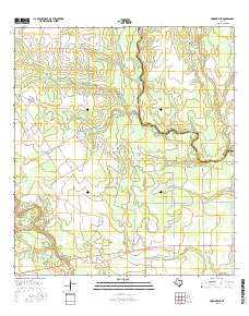
Layered GeoPDF 7.5 Minute Quadrangle Map. Layers of geospatial data include orthoimagery, roads, grids, geographic names, elevation contours, hydrography, and other selected map features.
Tags: 7.5 x 7.5 minute,
Bee,
Downloadable Data,
EarthCover,
GeoPDF, All tags...
Imagery and Base Maps,
Live Oak,
Map,
Mineral, TX,
Public Land Survey System,
Texas,
U.S. National Grid,
US,
US Topo,
US Topo Historical,
United States,
boundary,
contour,
geographic names,
hydrography,
imageryBaseMapsEarthCover,
orthoimage,
structures,
topographic,
transportation,
woodland, Fewer tags
Layered GeoPDF 7.5 Minute Quadrangle Map. Layers of geospatial data include orthoimagery, roads, grids, geographic names, elevation contours, hydrography, and other selected map features.
Tags: 7.5 x 7.5 minute,
Bee,
Downloadable Data,
EarthCover,
GeoPDF, All tags...
Goliad,
Imagery and Base Maps,
Lazy F Ranch, TX,
Map,
Public Land Survey System,
Texas,
U.S. National Grid,
US,
US Topo,
US Topo Historical,
United States,
boundary,
contour,
geographic names,
hydrography,
imageryBaseMapsEarthCover,
orthoimage,
structures,
topographic,
transportation,
woodland, Fewer tags
Layered GeoPDF 7.5 Minute Quadrangle Map. Layers of geospatial data include orthoimagery, roads, grids, geographic names, elevation contours, hydrography, and other selected map features.
Tags: 7.5 x 7.5 minute,
Bee,
Downloadable Data,
EarthCover,
GeoPDF, All tags...
Imagery and Base Maps,
Karnes,
Map,
Monteola, TX,
Public Land Survey System,
Texas,
U.S. National Grid,
US,
US Topo,
US Topo Historical,
United States,
boundary,
contour,
geographic names,
hydrography,
imageryBaseMapsEarthCover,
orthoimage,
structures,
topographic,
transportation,
woodland, Fewer tags
Layered GeoPDF 7.5 Minute Quadrangle Map. Layers of geospatial data include orthoimagery, roads, grids, geographic names, elevation contours, hydrography, and other selected map features.
Tags: 7.5 x 7.5 minute,
Bee,
Cranell, TX,
Downloadable Data,
EarthCover, All tags...
GeoPDF,
Imagery and Base Maps,
Map,
Public Land Survey System,
Refugio,
San Patricio,
Texas,
U.S. National Grid,
US,
US Topo,
US Topo Historical,
United States,
boundary,
contour,
geographic names,
hydrography,
imageryBaseMapsEarthCover,
orthoimage,
structures,
topographic,
transportation,
woodland, Fewer tags
Layered GeoPDF 7.5 Minute Quadrangle Map. Layers of geospatial data include orthoimagery, roads, grids, geographic names, elevation contours, hydrography, and other selected map features.
Tags: 7.5 x 7.5 minute,
Bee,
Clareville, TX,
Downloadable Data,
EarthCover, All tags...
GeoPDF,
Imagery and Base Maps,
Live Oak,
Map,
Public Land Survey System,
Texas,
U.S. National Grid,
US,
US Topo,
US Topo Historical,
United States,
boundary,
contour,
geographic names,
hydrography,
imageryBaseMapsEarthCover,
orthoimage,
structures,
topographic,
transportation,
woodland, Fewer tags
Layered GeoPDF 7.5 Minute Quadrangle Map. Layers of geospatial data include orthoimagery, roads, grids, geographic names, elevation contours, hydrography, and other selected map features.
Tags: 7.5 x 7.5 minute,
Bee,
Downloadable Data,
EarthCover,
GeoPDF, All tags...
Imagery and Base Maps,
Map,
Papalote, TX,
Public Land Survey System,
Refugio,
San Patricio,
Texas,
U.S. National Grid,
US,
US Topo,
US Topo Historical,
United States,
boundary,
contour,
geographic names,
hydrography,
imageryBaseMapsEarthCover,
orthoimage,
structures,
topographic,
transportation,
woodland, Fewer tags
Layered GeoPDF 7.5 Minute Quadrangle Map. Layers of geospatial data include orthoimagery, roads, grids, geographic names, elevation contours, hydrography, and other selected map features.
Tags: 7.5 x 7.5 minute,
Bee,
Downloadable Data,
EarthCover,
GeoPDF, All tags...
Goliad,
Imagery and Base Maps,
Map,
Public Land Survey System,
Skidmore NE, TX,
Texas,
U.S. National Grid,
US,
US Topo,
US Topo Historical,
United States,
boundary,
contour,
geographic names,
hydrography,
imageryBaseMapsEarthCover,
orthoimage,
structures,
topographic,
transportation,
woodland, Fewer tags
Layered GeoPDF 7.5 Minute Quadrangle Map. Layers of geospatial data include orthoimagery, roads, grids, geographic names, elevation contours, hydrography, and other selected map features.
Tags: 7.5 x 7.5 minute,
Bee,
Bullshead Creek, TX,
Downloadable Data,
EarthCover, All tags...
GeoPDF,
Imagery and Base Maps,
Map,
San Patricio,
Texas,
U.S. National Grid,
US,
US Topo,
US Topo Historical,
United States,
contour,
geographic names,
hydrography,
orthoimage,
topographic,
transportation, Fewer tags
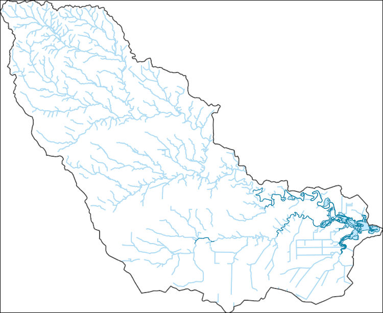
The National Hydrography Dataset (NHD) is a feature-based database that interconnects and uniquely identifies the stream segments or reaches that make up the nation's surface water drainage system. NHD data was originally developed at 1:100,000-scale and exists at that scale for the whole country. This high-resolution NHD, generally developed at 1:24,000/1:12,000 scale, adds detail to the original 1:100,000-scale NHD. (Data for Alaska, Puerto Rico and the Virgin Islands was developed at high-resolution, not 1:100,000 scale.) Local resolution NHD is being developed where partners and data exist. The NHD contains reach codes for networked features, flow direction, names, and centerline representations for areal water...
Tags: Administrative watershed units,
Administrative watershed units,
Aransas,
Area of Complex Channels,
Area to be submerged, All tags...
Basin,
Basin,
Bay/Inlet,
Bee,
Boundaries,
Boundary,
Bridge,
Canal/Ditch,
Coastline,
Connector,
Dam/Weir,
Downloadable Data,
Drainage areas for surface water,
Drainageway,
Estuary,
Flow direction network,
Flume,
ForeShore,
Gaging Station,
Gate,
GeoPackage,
HU-8,
HU-8 Subbasin,
HU10,
HU12,
HU14,
HU16,
HU2,
HU4,
HU6,
HU8,
HU8_12100407,
HUC,
Hazard Zone,
Hydrographic,
Hydrography,
Hydrography,
Hydrography,
Hydrologic Unit Code,
Hydrologic Units,
Ice mass,
Inundation Area,
Levee,
Line,
Live Oak,
Lock Chamber,
Marsh,
National Hydrography Dataset (NHD),
National Hydrography Dataset (NHD) Best Resolution,
National Hydrography Dataset (NHD) Best Resolution,
Nonearthen Shore,
Open Geospatial Consortium GeoPackage 1.2,
Orthoimage,
Playa,
Point,
PointEvent,
Pond,
Rapids,
Rapids,
Reach,
Reach code,
Reef,
Refugio,
Region,
Reservoir,
Rock,
San Patricio,
Sea/Ocean,
Sink/Rise,
Sounding Datum Line,
Special Use Zone,
Special Use Zone Limit,
Spillway,
Stream,
Stream/River,
Sub-basin,
Sub-region,
Subbasin,
Submerged Stream,
Subregion,
Subwatershed,
Surface water systems,
Swamp,
TX,
Texas,
Topographic,
Tunnel,
US,
Underground Conduit,
United States,
WBD,
WBD,
Wall,
Wash,
Water Intake Outflow,
Waterfall,
Watershed,
Watershed Boundaries,
Watershed Boundary Dataset,
Watershed Boundary Dataset,
Well,
artificial path,
boundaries,
dams,
drainage systems and characteristics,
inlandWaters,
lakes,
ngda,
rivers, Fewer tags
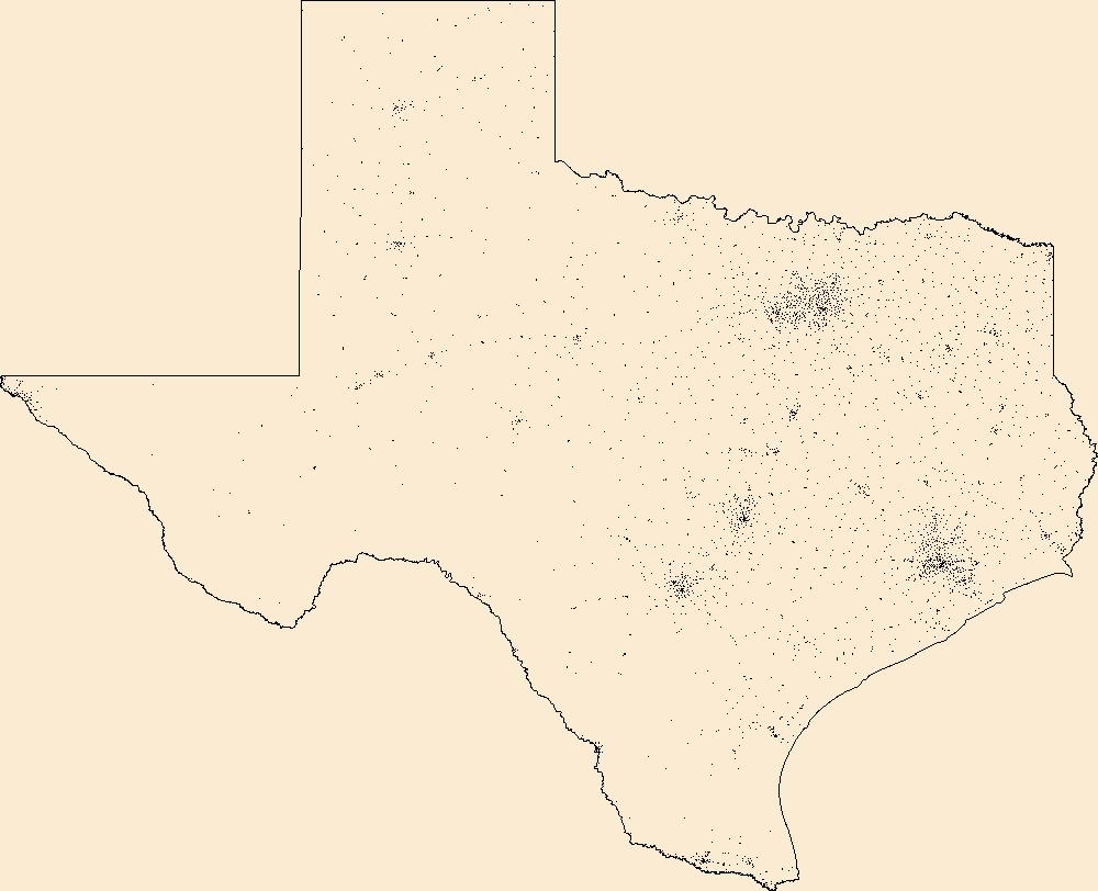
Geospatial data includes structures and other selected map features.
Tags: Anderson,
Andrews,
Angelina,
Aransas,
Archer, All tags...
Armstrong,
Atascosa,
Austin,
Bailey,
Bandera,
Bastrop,
Baylor,
Bee,
Bell,
Bexar,
Blanco,
Borden,
Bosque,
Bowie,
Brazoria,
Brazos,
Brewster,
Briscoe,
Brooks,
Brown,
Burleson,
Burnet,
Caldwell,
Calhoun,
Callahan,
Cameron,
Camp,
Campground,
Carson,
Cass,
Castro,
Chambers,
Cherokee,
Childress,
Clay,
Cochran,
Coke,
Coleman,
College / University,
Collin,
Collingsworth,
Colorado,
Comal,
Comanche,
Concho,
Cooke,
Coryell,
Cottle,
Courthouse,
Crane,
Crockett,
Crosby,
Culberson,
Dallam,
Dallas,
Dawson,
DeWitt,
Deaf Smith,
Delta,
Denton,
Dickens,
Dimmit,
Donley,
Downloadable Data,
Duval,
Eastland,
Ector,
Edwards,
El Paso,
Ellis,
Erath,
Esri Shapefile nan,
Falls,
Fannin,
Fayette,
Fire Station/ EMS Station,
Fisher,
Floyd,
Foard,
Fort Bend,
Franklin,
Freestone,
Frio,
Gaines,
Galveston,
Garza,
Gillespie,
Glasscock,
Goliad,
Gonzales,
Gray,
Grayson,
Gregg,
Grimes,
Guadalupe,
Hale,
Hall,
Hamilton,
Hansford,
Hardeman,
Hardin,
Harris,
Harrison,
Hartley,
Haskell,
Hays,
Hemphill,
Henderson,
Hidalgo,
Hill,
Hockley,
Hood,
Hopkins,
Hospital/Medical Center,
Houston,
Howard,
Hudspeth,
Hunt,
Hutchinson,
Information Center,
Irion,
Jack,
Jackson,
Jasper,
Jeff Davis,
Jefferson,
Jim Hogg,
Jim Wells,
Johnson,
Jones,
Karnes,
Kaufman,
Kendall,
Kenedy,
Kent,
Kerr,
Kimble,
King,
Kinney,
Kleberg,
Knox,
La Salle,
Lamar,
Lamb,
Lampasas,
Lavaca,
Law Enforcement,
Lee,
Leon,
Liberty,
Limestone,
Lipscomb,
Live Oak,
Llano,
Loving,
Lubbock,
Lynn,
Madison,
Marion,
Martin,
Mason,
Matagorda,
Maverick,
McCulloch,
McLennan,
McMullen,
Medina,
Menard,
Midland,
Milam,
Mills,
Mitchell,
Montague,
Montgomery,
Moore,
Morris,
Motley,
Nacogdoches,
National Structures Dataset (NSD),
National Structures Dataset (NSD),
Navarro,
Newton,
Nolan,
Nueces,
Ochiltree,
Oldham,
Orange,
Palo Pinto,
Panola,
Parker,
Parmer,
Pecos,
Polk,
Post Office,
Potter,
Presidio,
Prison/ Correctional Facility,
Rains,
Randall,
Reagan,
Real,
Red River,
Reeves,
Refugio,
Roberts,
Robertson,
Rockwall,
Runnels,
Rusk,
Sabine,
San Augustine,
San Jacinto,
San Patricio,
San Saba,
Schleicher,
School,
School:Elementary,
School:High School,
School:Middle School,
Scurry,
Shackelford,
Shapefile,
Shelby,
Sherman,
Smith,
Somervell,
Starr,
State,
State,
State Capitol,
Stephens,
Sterling,
Stonewall,
Structures,
Sutton,
Swisher,
TX,
Tarrant,
Taylor,
Technical School,
Terrell,
Terry,
Texas,
Throckmorton,
Titus,
Tom Green,
Town Hall,
Trade School,
Trailhead,
Travis,
Trinity,
Tyler,
US,
United States,
Upshur,
Upton,
Uvalde,
Val Verde,
Van Zandt,
Victoria,
Visitor Center,
Walker,
Waller,
Ward,
Washington,
Webb,
Wharton,
Wheeler,
Wichita,
Wilbarger,
Willacy,
Williamson,
Wilson,
Winkler,
Wise,
Wood,
Yoakum,
Young,
Zapata,
Zavala,
structure, Fewer tags
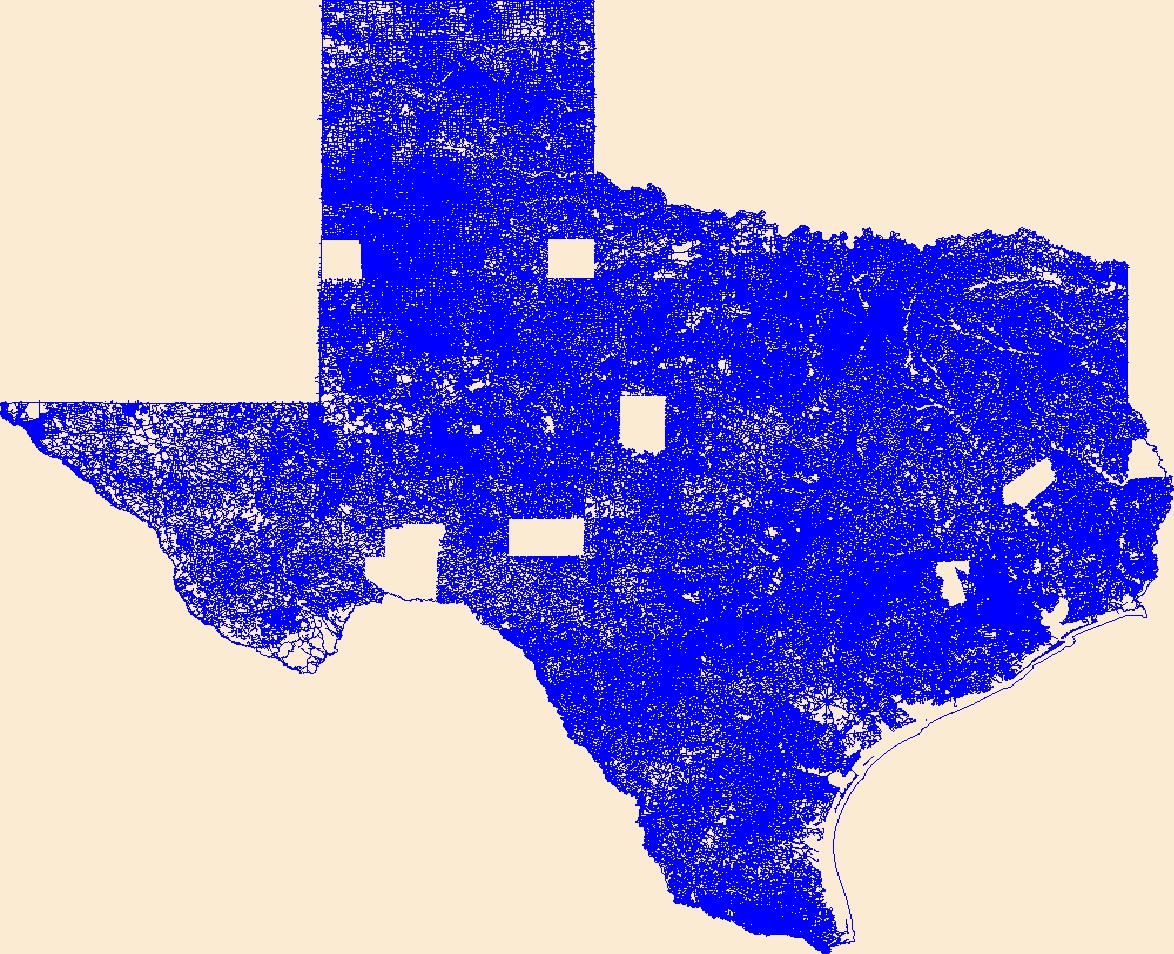
Layers of geospatial data include roads, airports, trails, and railroads.
Tags: Airport Complex,
Airport Point,
Airport Runway,
Airports,
Airstrips, All tags...
Anderson,
Andrews,
Angelina,
Aransas,
Archer,
Armstrong,
Atascosa,
Austin,
Bailey,
Bandera,
Bastrop,
Baylor,
Bee,
Bell,
Bexar,
Blanco,
Borden,
Bosque,
Bowie,
Brazoria,
Brazos,
Brewster,
Briscoe,
Brooks,
Brown,
Burleson,
Burnet,
Caldwell,
Calhoun,
Callahan,
Cameron,
Camp,
Carson,
Cass,
Castro,
Chambers,
Cherokee,
Childress,
Clay,
Cochran,
Coke,
Coleman,
Collin,
Collingsworth,
Colorado,
Comal,
Comanche,
Concho,
Cooke,
Coryell,
Cottle,
Crane,
Crockett,
Crosby,
Culberson,
Dallam,
Dallas,
Dawson,
DeWitt,
Deaf Smith,
Delta,
Denton,
Dickens,
Dimmit,
Donley,
Downloadable Data,
Duval,
Eastland,
Ector,
Edwards,
El Paso,
Ellis,
Erath,
Esri Shapefile nan,
Falls,
Fannin,
Fayette,
Fisher,
Floyd,
Foard,
Fort Bend,
Franklin,
Freestone,
Frio,
Gaines,
Galveston,
Garza,
Geographic names,
Gillespie,
Glasscock,
Goliad,
Gonzales,
Gray,
Grayson,
Gregg,
Grimes,
Guadalupe,
Hale,
Hall,
Hamilton,
Hansford,
Hardeman,
Hardin,
Harris,
Harrison,
Hartley,
Haskell,
Hays,
Hemphill,
Henderson,
Hidalgo,
Hill,
Hockley,
Hood,
Hopkins,
Houston,
Howard,
Hudspeth,
Hunt,
Hutchinson,
Irion,
Jack,
Jackson,
Jasper,
Jeff Davis,
Jefferson,
Jim Hogg,
Jim Wells,
Johnson,
Jones,
Karnes,
Kaufman,
Kendall,
Kenedy,
Kent,
Kerr,
Kimble,
King,
Kinney,
Kleberg,
Knox,
La Salle,
Lamar,
Lamb,
Lampasas,
Lavaca,
Lee,
Leon,
Liberty,
Limestone,
Lipscomb,
Live Oak,
Llano,
Loving,
Lubbock,
Lynn,
Madison,
Marion,
Martin,
Mason,
Matagorda,
Maverick,
McCulloch,
McLennan,
McMullen,
Medina,
Menard,
Midland,
Milam,
Mills,
Mitchell,
Montague,
Montgomery,
Moore,
Morris,
Motley,
Nacogdoches,
National Transportation Dataset (NTD),
National Transportation Dataset (NTD),
Navarro,
Newton,
Nolan,
Nueces,
Ochiltree,
Oldham,
Orange,
Palo Pinto,
Panola,
Parker,
Parmer,
Pecos,
Polk,
Potter,
Presidio,
Railways,
Rains,
Randall,
Reagan,
Real,
Red River,
Reeves,
Refugio,
Roads,
Roberts,
Robertson,
Rockwall,
Runnels,
Rusk,
Sabine,
San Augustine,
San Jacinto,
San Patricio,
San Saba,
Schleicher,
Scurry,
Shackelford,
Shapefile,
Shelby,
Sherman,
Smith,
Somervell,
Starr,
State,
State,
Stephens,
Sterling,
Stonewall,
Sutton,
Swisher,
TX,
Tarrant,
Taylor,
Terrell,
Terry,
Texas,
Throckmorton,
Titus,
Tom Green,
Trail,
Trails,
Transportation,
Transportation,
Travis,
Trinity,
Tyler,
US,
United States,
Upshur,
Upton,
Uvalde,
Val Verde,
Van Zandt,
Victoria,
Walker,
Waller,
Ward,
Washington,
Waterway,
Webb,
Wharton,
Wheeler,
Wichita,
Wilbarger,
Willacy,
Williamson,
Wilson,
Winkler,
Wise,
Wood,
Yoakum,
Young,
Zapata,
Zavala,
transportation, Fewer tags

In this study US Geological Survey scientists collected pollen samples from honey bee (Apis mellifera) colonies distributed across North Dakota, South Dakota, and Minnesota, in 2015 and 2016. Sequencing of nuclear ribosomal loci was used to determine the number and abundance of flowering plant taxa. The data contain counts of Operational Taxonomic Unit (OTU) reads of honey bee collected pollen from apiary locations throughout the growing season.
Categories: Data;
Types: Map Service,
OGC WFS Layer,
OGC WMS Layer,
OGC WMS Service;
Tags: DNA,
Northern Great Plains,
Prairie Pothole Region,
apis,
bee, All tags...
environment,
molecular,
pollen,
pollinator, Fewer tags

Layered GeoPDF 7.5 Minute Quadrangle Map. Layers of geospatial data include orthoimagery, roads, grids, geographic names, elevation contours, hydrography, and other selected map features.
Tags: 7.5 x 7.5 minute,
Bee,
Burkes Ridge, TX,
Downloadable Data,
EarthCover, All tags...
GeoPDF,
Imagery and Base Maps,
Map,
Public Land Survey System,
Texas,
U.S. National Grid,
US,
US Topo,
US Topo Historical,
United States,
boundary,
contour,
geographic names,
hydrography,
imageryBaseMapsEarthCover,
orthoimage,
structures,
topographic,
transportation,
woodland, Fewer tags
Layered GeoPDF 7.5 Minute Quadrangle Map. Layers of geospatial data include orthoimagery, roads, grids, geographic names, elevation contours, hydrography, and other selected map features.
Tags: 7.5 x 7.5 minute,
Bee,
Cadiz, TX,
Downloadable Data,
EarthCover, All tags...
GeoPDF,
Imagery and Base Maps,
Live Oak,
Map,
Public Land Survey System,
Texas,
U.S. National Grid,
US,
US Topo,
US Topo Historical,
United States,
boundary,
contour,
geographic names,
hydrography,
imageryBaseMapsEarthCover,
orthoimage,
structures,
topographic,
transportation,
woodland, Fewer tags
|
|

