Filters: Tags: bismuth (X)
169 results (109ms)|
Filters
Date Range
Extensions Types
Contacts
Categories Tag Types
|
ADMMR map collection: San Juan Mines Assay Map and Main Workings; 1 in. to 30 feet; 16 x 12 in.
ADMMR map collection: Central Copper Co. Topographical Map; 1 in. to 100 feet; 44 x 36 in.
ADMMR map collection: Superior & Pittsburgh Co. Junction Geologic Map Level 1500 Floor 5 Sec 2; 1 in. to 50 feet; 48 x 32 in.
ADMMR map collection: Claim Map of Tout Mines, Dos Cabezas; 1 in. to 300 feet; 37 x 64 in.
ADMMR map collection: Section G-H Republic Incline; 15 x 5 in.
ADMMR map collection: Superior & Pittsburgh Co. Junction Geologic Map Level 1500 Floor 11; 1 in. to 50 feet; 48 x 32 in.
Compilation of Geospatial Data (GIS) for the Mineral Industries and Related Infrastructure of Africa
This geodatabase reflects the U.S. Geological Survey’s (USGS) ongoing commitment to its mission of understanding the nature and distribution of global mineral commodity supply chains by updating and publishing the georeferenced locations of mineral commodity production and processing facilities, mineral exploration and development sites, and mineral commodity exporting ports in Africa. The geodatabase and geospatial data layers serve to create a new geographic information product in the form of a geospatial portable document format (PDF) map. The geodatabase contains data layers from USGS, foreign governmental, and open-source sources as follows: (1) mineral production and processing facilities, (2) mineral exploration...
This data release contains the U.S. salient statistics and world production data extracted from the BISMUTH data sheet of the USGS Mineral Commodity Summaries 2022.
ADMMR map collection: Superior & Pittsburgh Co. Junction Geologic Map Level 1400 Floor 7; 1 in. to 50 feet; 48 x 32 in.
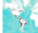
This data set consists of records for over 900 mineral facilities in Latin America and Canada. The mineral facilities include mines, plants, smelters, or refineries of aluminum, cement, coal, copper, diamond, gold, iron and steel, nickel, platinum-group metals, salt, and silver, among others. Records include attributes such as commodity, country, location, company name, facility type and capacity if applicable, and generalized coordinates. The data were compiled from multiple sources, including the 2003 and 2004 USGS Minerals Yearbooks (Latin America and Candada volume), data to be published in the 2005 Minerals Yearbook Latin America and Canada Volume, minerals statistics and information from the USGS minerals...
ADMMR map collection: Superior & Pittsburgh Co. Junction Geologic Map Level 1400 Floor 6; 1 in. to 50 feet; 48 x 32 in.
ADMMR map collection: Sections Through Drill Holes 3 & 4, Antler Mine; 1 in. to 100 feet; 21 x 27 in.
ADMMR map collection: Method of Mining This Ore Body, Coronado Copper Company and Zinc; 8 x 11 in.
Categories: Data;
Tags: Arizona,
Bismuth,
Cochise County,
Cochise metallic mineral dist.,
Copper, Oxide,
ADMMR map collection: Workings From Upper Adit, Antler Mine; 1 in. to 20 feet; 14 x 16 in.
ADMMR map collection: Superior & Pittsburgh Co. Junction Geologic Map Level 1400 Floor 9; 1 in. to 50 feet; 48 x 32 in.
This location is part of the Arizona Mineral Industry Location System (AzMILS), an inventory of mineral occurences, prospects and mine locations in Arizona. Cochise104 is located in T18S R23E Sec 10 NW in the Pearce - 15 Min quad. This collection consists of various reports, maps, records and related materials acquired by the Arizona Department of Mines and Mineral Resources regarding mining properties in Arizona. Information was obtained by various means, including the property owners, exploration companies, consultants, verbal interviews, field visits, newspapers and publications. Some sections may be redacted for copyright. Please see the access statement.
ADMMR map collection: Superior & Pittsburgh Co. Junction Geologic Map Level 1400 Floor 4; 1 in. to 50 feet; 48 x 32 in.
ADMMR map collection: Antler Mine - 5th Level Plan; 1 in. to 50 feet; 23 x 11 in.
ADMMR map collection: San Juan Group of Mines Claim Map; 1 in. to 600 feet; 17 x 19 in.
ADMMR map collection: Superior & Pittsburgh Co. Junction Geologic Map Level 1400 Floor 10; 1 in. to 50 feet; 48 x 32 in.
|

|
