Filters: Tags: cascadia (X)
43 results (27ms)|
Filters
Date Range
Extensions Types
Contacts
Categories Tag Types
|

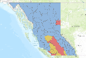
This map service and the attached downloadable layer package represent OpenStreetMap (OSM) road data clipped to the Cascadia Partner Forum geography (with a 10km buffer). The data were obtained from WeoGeo, which converts OSM data from its native format to Esri formats (and others).  They last updated their database on May 1st, 2014. "OpenStreetMap is dedicated to created and providing geographic data, such as street maps, worldwide, for free. Most maps considered "free" actually have legal or technical restrictions on their use. These restrictions hold back anyone from using them in creative, productive or unexpected ways, and make every map a silo of data and effort. OSM's open license gives users the freedom...
This data set contains imagery from the National Agriculture Imagery Program (NAIP). The NAIP program is administered by USDA FSA and has been established to support two main FSA strategic goals centered on agricultural production. These are, increase stewardship of America's natural resources while enhancing the environment, and to ensure commodities are procured and distributed effectively and efficiently to increase food security. The NAIP program supports these goals by acquiring and providing ortho imagery that has been collected during the agricultural growing season in the U.S. The NAIP ortho imagery is tailored to meet FSA requirements and is a fundamental tool used to support FSA farm and conservation programs....
This data release provides access to a low-altitude aeromagnetic survey flown over a part of the Cascade Range of the US Pacific Northwest, approximately centered over the town of Cascade Locks, Oregon. The Cascade Locks magnetic survey encompasses two large stratovolcanoes of the Cascade Range: Mt. Hood (3426 m) in Oregon and Mt. Adams (3742 m) in Washington. Data were acquired between October 17, 2021, and February 26, 2022, by KBM Resources Group, Thunder Bay, Ontario, Canada, working under contract to the U.S. Geological Survey. The survey is underlain by a diverse magnetic terrane, including Miocene flood basalts of the Columbia River Basalt Group and Tertiary to Quaternary volcanic and intrusive rocks of the...
Categories: Data;
Tags: Cascade Range,
Cascadia,
Clackamas County,
Clark County,
Columbia River Gorge National Scenic Area,
USGS Historical Quadrangle in GeoPDF.
Hall Mountain Big horn Sheep Collar data
Connecting with Kettle population
In May 2014, the GNLCC Steering Committee approved two pilot projects explore approaches to landscape-scale coordination to enhance science-based management across the GNLCC. The two ‘Shared Landscape Outcomes’ pilots were designed to assess and focus on specific pairs of a GNLCC Goal and a priority landscape stressor (as defined in the Strategic Conservation Framework) and focus the approach at the entire GNLCC scale. The two pilot projects focused on (1) the Connectivity goal and Land Use Change stressor (described here) and (2) the Aquatic Integrity goal and Invasives stressor and (see: https://www.fws.gov/science/catalog )Connectivity Pilot:Wildlife species are becoming increasingly isolated in patches of habitat,...
Categories: Data,
Project;
Types: Map Service,
OGC WFS Layer,
OGC WMS Layer,
OGC WMS Service;
Tags: Alberta,
Aquatic Connectivity,
British Columbia,
Bull Trout,
Cascadia,
These data are from a 3-month long deployment of nodal seismometers that ran from December 22th, 2022 until March 1st, 2023 as part of a Distributed Acoustic Sensing (DAS) experiment above the Gorda plate. The deployment was done in response to the 2022/12/20 M6.4 Ferndale earthquake. The sensors were deployed at 46 locations along Old Arcata Rd between Arcata and Eureka California (Figure 1); these locations track the approximate location of the fiber optic cable used as part of the DAS experiment. The instruments have a battery recording life of approximately one month and were swapped out in the same locations in Mid-to-late January, and late February-Early march. Exceptions are that only 29 were deployed for...
Geochemical analysis of authigenic carbonates from the Cascadia Subduction Zone. Powdered carbonate samples for stable carbon (delta-C-13) and oxygen (delta-O-18) isotopes and carbonate phase were analyzed as a proxy for potential fluid sources, and to better understand how process, such as mixing, and oxidation, can alter the initial fluid isotopic composition and the archived fluid-source signature in the authigenic carbonates.
Categories: Data;
Tags: CMHRP,
Cascadia,
Coastal and Marine Hazards and Resources Program,
Geochemistry,
Marine Geology,
The Cascadia Partner Forum will complete conservation design for four Great Northern Landscape Conservation Cooperative conservation targets with significance to the transboundary Cascadia landscape to inform sound, data-driven management planning and action. This project aims to complete conservation design at the Cascadia-wide scale for grizzly bear, salmon, aquatic, and terrestrial connectivity to contribute to the Great Northern LCC Science Plan, while providing input and integration to the coarser-scale GNLCC-wide Science Plans established objectives, threats, metrics, and conservation actions for each target. Additionally, the Forum will conduct analyses on a common Great Northern LCC landscape stressor roads...
Categories: Data,
Project;
Types: Map Service,
OGC WFS Layer,
OGC WMS Layer,
OGC WMS Service;
Tags: Aquatic Connectivity,
British Columbia,
Bull Trout,
Canada Lynx,
Cascadia,
In May 2014, the GNLCC Steering Committee approved two pilot projects explore approaches to landscape-scale coordination to enhance science-based management across the GNLCC. The two ‘Shared Landscape Outcomes’ pilots were designed to assess and focus on specific pairs of a GNLCC Goal and a priority landscape stressor as defined in the Strategic Conservation Framework and focus the approach at the entire GNLCC scale. The two pilot projects focused on (1) the Aquatic Integrity goal and Invasives stressor (described here) and (2) the Connectivity goal and Land Use Change stressor (see: https://www.fws.gov/science/catalog)AIS Pilot:The challenge of managing for invasive species creates an opportunity for the GNLCC...
Categories: Data,
Project;
Types: Map Service,
OGC WFS Layer,
OGC WMS Layer,
OGC WMS Service;
Tags: Alpine Lakes,
Aquatic Connectivity,
Cascadia,
Columbia Basin,
Decision Support,
The Cascadia Parner Forum fosters a network of natural resource practitioners working with the NPLCC and GNLCC to guild the adaptive capacity of the landscape and species living within it. This project supported three complementary transboundary climate adaptation and habitat connectivity activities in the Cascadia region: 1) Transboundary Climate Analysis by the Washington Wildlife Habitat Connectivity Working Group, 2) WildLinks workshop, and 3) Cascadia Partner Forum.
Categories: Data;
Types: Map Service,
OGC WFS Layer,
OGC WMS Layer,
OGC WMS Service;
Tags: Academics & scientific researchers,
Adaptation planning,
B.C. North Cascades,
Cascadia,
Conservation Design,
2012 BC Grizzly Bear Planning Units. These are boundaries identifying similar behavioural ecotypes and sub-populations of Grizzly bears
This data set contains imagery from the National Agriculture Imagery Program (NAIP). The NAIP program is administered by USDA FSA and has been established to support two main FSA strategic goals centered on agricultural production. These are, increase stewardship of America's natural resources while enhancing the environment, and to ensure commodities are procured and distributed effectively and efficiently to increase food security. The NAIP program supports these goals by acquiring and providing ortho imagery that has been collected during the agricultural growing season in the U.S. The NAIP ortho imagery is tailored to meet FSA requirements and is a fundamental tool used to support FSA farm and conservation programs....
Grizzly Habitat
Across Washington/ Idaho border
Hwy 6 Crossings East of Kelowna
USGS Historical Quadrangle in GeoPDF.
Untouched area. Mule Deer winter range and Grizzly bear habitat.

The Canadian Aboriginal Lands product consists of polygon entities that depict the administrative boundaries (extent) of lands where the title has been vested in specific Aboriginal Groups of Canada or lands which were set aside for their exclusive benefit. More specifically it includes the following lands:Indian ReservesLands that include:Surrendered lands or a reserve, as defined in the Indian Act. This definition excludes Indian Settlements and Indian Communities.Sechelt lands, as defined in the Sechelt Indian Band Self-Government Act, chapter 27 of the Statutes of Canada, 1986.Land Claim Settlement LandsLands created under Comprehensive Land Claims Process that do not or will not have Indian Reserve status under...
|

|
