Filters: Tags: cemetery (X) > partyWithName: U.S. Geological Survey, National Geospatial Technical Operations Center (X)
8 results (35ms)|
Filters
Date Range
Extensions Types Contacts Categories Tag Types Tag Schemes |

USGS developed The National Map (TNM) Gazetteer as the Federal and national standard (ANSI INCITS 446-2008) for geographic nomenclature based on the Geographic Names Information System (GNIS). The National Map Gazetteer contains information about physical and cultural geographic features, geographic areas, and locational entities that are generally recognizable and locatable by name (have achieved some landmark status) and are of interest to any level of government or to the public for any purpose that would lead to the representation of the feature in printed or electronic maps and/or geographic information systems. The dataset includes features of all types in the United States, its associated areas, and Antarctica,...

The USGS Structures service from The National Map (TNM) consists of data to include the name, function, location, and other core information and characteristics of selected manmade facilities. The types of structures collected are largely determined by the needs of disaster planning and emergency response, and homeland security organizations. Structures data are designed to be used in general mapping and in the analysis of structure related activities using geographic information system technology. The National Map structures data is commonly combined with other data themes, such as boundaries, elevation, hydrography, and transportation, to produce general reference base maps. The National Map viewer allows free...
Categories: Data;
Types: ArcGIS REST Map Service,
Map Service;
Tags: NGP-TNM,
Overlay Map Service,
REST,
Structures,
US,
U.S. Geological Survey, Department of the Interior - The annual Geographic Names acquisition plan is to collect geographic name data over the United States and its territories through the Board on Geographic Names processes. The U.S. Board on Geographic Names is a Federal body created in 1890 and established in its present form by Public Law in 1947 to maintain uniform geographic name usage throughout the Federal Government. The Board comprises representatives of Federal agencies concerned with geographic information, population, ecology, and management of public lands. Sharing its responsibilities with the Secretary of the Interior, the Board promulgates official geographic feature names with locative attributes...
Types: Citation;
Tags: BGN,
Board on Geographic Names,
Cultural Resources Theme,
GNIS,
Geographic Names,
USGS developed The National Map (TNM) Gazetteer as the Federal and national standard (ANSI INCITS 446-2008) for geographic nomenclature based on the Geographic Names Information System (GNIS). The National Map Gazetteer contains information about physical and cultural geographic features, geographic areas, and locational entities that are generally recognizable and locatable by name (have achieved some landmark status) and are of interest to any level of government or to the public for any purpose that would lead to the representation of the feature in printed or electronic maps and/or geographic information systems. The dataset includes features of all types in the United States, its associated areas, and Antarctica,...
Categories: Data;
Types: ArcGIS REST Map Service,
Map Service,
OGC WFS Layer,
OGC WMS Layer;
Tags: BGN,
Cultural Resources,
GNIS,
Geographic Names,
NGP-TNM,
U.S. Geological Survey, Department of the Interior - The annual Geographic Names acquisition plan is to collect geographic name data over the United States and its territories through the Board on Geographic Names processes. The U.S. Board on Geographic Names is a Federal body created in 1890 and established in its present form by Public Law in 1947 to maintain uniform geographic name usage throughout the Federal Government. The Board comprises representatives of Federal agencies concerned with geographic information, population, ecology, and management of public lands. Sharing its responsibilities with the Secretary of the Interior, the Board promulgates official geographic feature names with locative attributes...
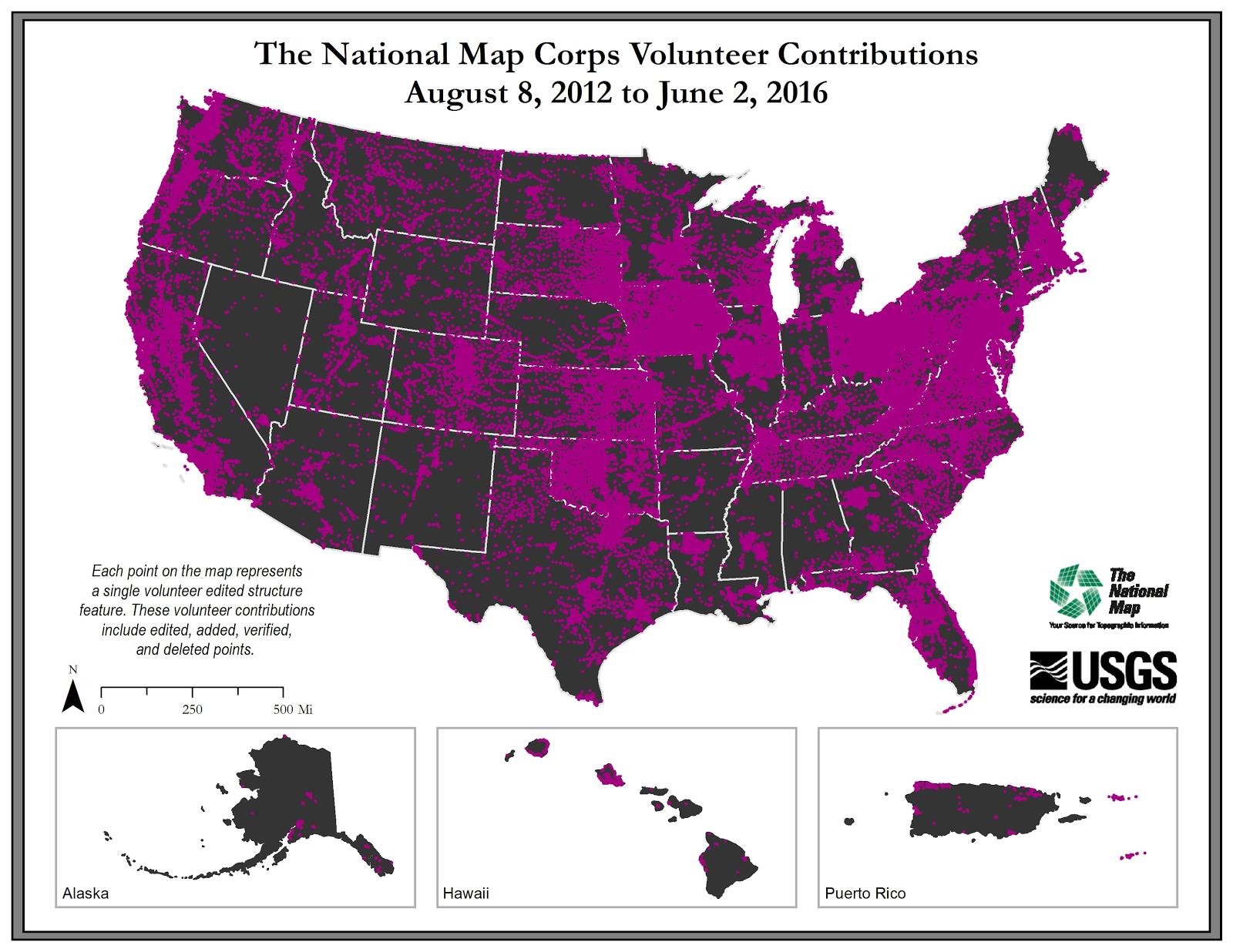
U.S. Geological Survey, Department of the Interior - The annual National Map Corps Volunteered Geographic Information (VGI) structures acquisition plan is to add new structures data and remove or edit obsolete structures data points over the United States. The FY14 acquisition plan allows data contributions by volunteers for all 50 states. Interested parties who wish to become a volunteer data acquisition partner with the USGS in FY14 or in future years should contact a USGS Geospatial Liaison - http://liaisons.usgs.gov/geospatial/documents/TNM_Partnership_User_ContactList.pdf. To find out more about the National Map Corps VGI structures program go to https://my.usgs.gov/confluence/display/nationalmapcorps/Home.
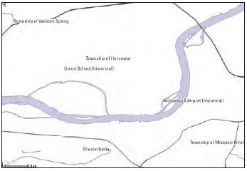
USGS Structures from The National Map (TNM) consists of data to include the name, function, location, and other core information and characteristics of selected manmade facilities across all US states and territories. The types of structures collected are largely determined by the needs of disaster planning and emergency response, and homeland security organizations. Structures currently included are: School, School:Elementary, School:Middle, School:High, College/University, Technical/Trade School, Ambulance Service, Fire Station/EMS Station, Law Enforcement, Prison/Correctional Facility, Post Office, Hospital/Medical Center, Cabin, Campground, Cemetery, Historic Site/Point of Interest, Picnic Area, Trailhead, Vistor/Information...
U.S. Geological Survey, Department of the Interior - The annual National Map Corps Volunteered Geographic Information (VGI) structures acquisition plan is to add new structures data and remove or edit obsolete structures data points over the United States. The FY17 acquisition plan allows data contributions by volunteers for all 50 states. Interested parties who wish to become a volunteer data acquisition partner with the USGS in FY17 or in future years should contact a USGS Geospatial Liaison - http://liaisons.usgs.gov/geospatial/documents/TNM_Partnership_User_ContactList.pdf. To find out more about the National Map Corps VGI structures program go to https://my.usgs.gov/confluence/display/nationalmapcorps/Home.
Types: Citation;
Tags: EMS station,
NGDA,
National Geospatial Data Asset,
Real Property Theme,
Structures,
|

|
