Filters
Date Range
Extensions
Types
Contacts
Categories
Tag Types
Tag Schemes
|

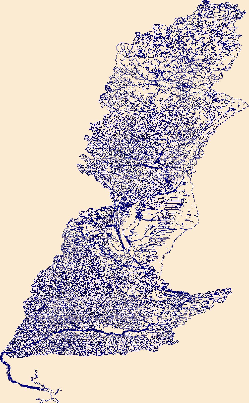
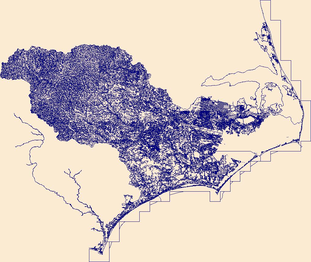
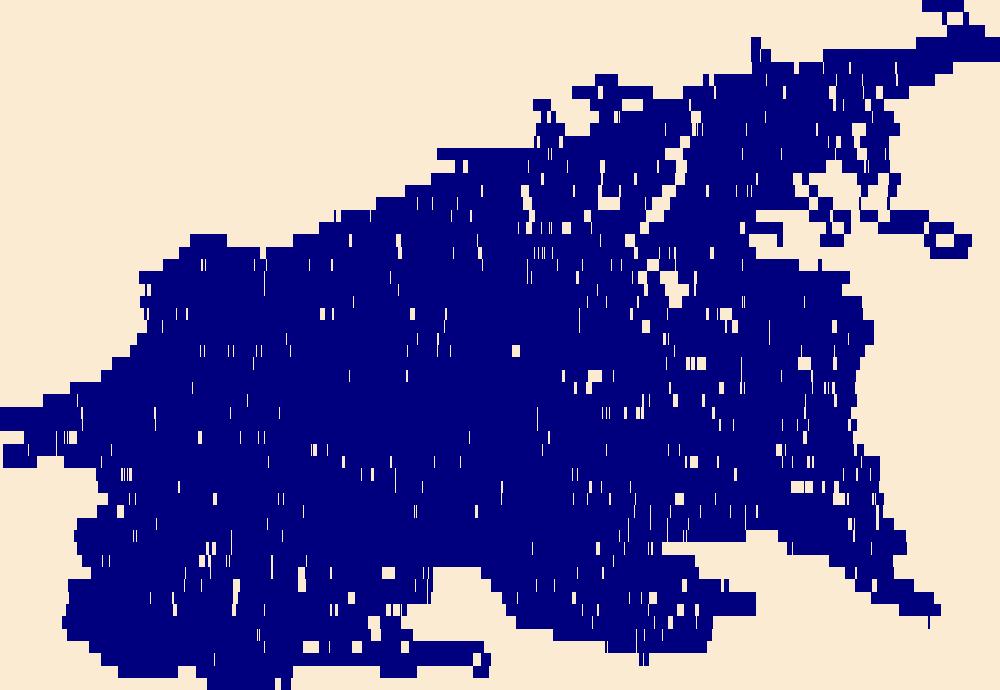
The High Resolution National Hydrography Dataset Plus (NHDPlus HR) is an integrated set of geospatial data layers, including the best available National Hydrography Dataset (NHD), the 10-meter 3D Elevation Program Digital Elevation Model (3DEP DEM), and the National Watershed Boundary Dataset (WBD). The NHDPlus HR combines the NHD, 3DEP DEMs, and WBD to create a stream network with linear referencing, feature naming, "value added attributes" (VAAs), elevation-derived catchments, and other features for hydrologic data analysis. The stream network with linear referencing is a system of data relationships applied to hydrographic systems so that one stream reach "flows" into another and "events" can be tied to and traced...
Tags: Downloadable Data,
FileGDB,
FileGDB 10.1,
HU-4 Subregion,
HU-4 Subregion, All tags...
HU4_2102,
Hydrography,
NHDPlus HR Rasters,
NHDPlus High Resolution (NHDPlus HR),
National Hydrography Dataset (NHD),
National Hydrography Dataset Plus High Resolution (NHDPlus HR),
National Hydrography Dataset Plus High Resolution (NHDPlus HR) Current,
St. Croix County,
St. John County,
St. Thomas County,
US,
United States,
United States Virgin Islands,
VI,
base maps,
cartography,
catchments,
channels,
digital elevation models,
drainage basins,
earth sciences,
elevation,
environment,
geographic information systems,
geoscientific,
geospatial analysis,
hydrographic datasets,
hydrographic features,
hydrology,
imagery,
inland waters,
lakes,
land surface characteristics,
reservoirs,
river reaches,
rivers,
streamflow,
streamflow data,
streams,
topography,
water bodies,
water quality,
water resources,
watersheds, Fewer tags

The High Resolution National Hydrography Dataset Plus (NHDPlus HR) is an integrated set of geospatial data layers, including the best available National Hydrography Dataset (NHD), the 10-meter 3D Elevation Program Digital Elevation Model (3DEP DEM), and the National Watershed Boundary Dataset (WBD). The NHDPlus HR combines the NHD, 3DEP DEMs, and WBD to create a stream network with linear referencing, feature naming, "value added attributes" (VAAs), elevation-derived catchments, and other features for hydrologic data analysis. The stream network with linear referencing is a system of data relationships applied to hydrographic systems so that one stream reach "flows" into another and "events" can be tied to and traced...
Tags: Downloadable Data,
FileGDB,
FileGDB 10.1,
HU-4 Subregion,
HU-4 Subregion, All tags...
HU4_0416,
Hydrography,
NHDPlus HR Rasters,
NHDPlus High Resolution (NHDPlus HR),
National Hydrography Dataset (NHD),
National Hydrography Dataset Plus High Resolution (NHDPlus HR),
National Hydrography Dataset Plus High Resolution (NHDPlus HR) Current,
US,
United States,
base maps,
cartography,
catchments,
channels,
digital elevation models,
drainage basins,
earth sciences,
elevation,
environment,
geographic information systems,
geoscientific,
geospatial analysis,
hydrographic datasets,
hydrographic features,
hydrology,
imagery,
inland waters,
lakes,
land surface characteristics,
reservoirs,
river reaches,
rivers,
streamflow,
streamflow data,
streams,
topography,
water bodies,
water quality,
water resources,
watersheds, Fewer tags

The High Resolution National Hydrography Dataset Plus (NHDPlus HR) is an integrated set of geospatial data layers, including the best available National Hydrography Dataset (NHD), the 10-meter 3D Elevation Program Digital Elevation Model (3DEP DEM), and the National Watershed Boundary Dataset (WBD). The NHDPlus HR combines the NHD, 3DEP DEMs, and WBD to create a stream network with linear referencing, feature naming, "value added attributes" (VAAs), elevation-derived catchments, and other features for hydrologic data analysis. The stream network with linear referencing is a system of data relationships applied to hydrographic systems so that one stream reach "flows" into another and "events" can be tied to and traced...
Tags: Ashtabula County,
Chautauqua County,
Cuyahoga County,
Downloadable Data,
Erie County, All tags...
Erie County,
Erie County,
FileGDB,
FileGDB 10.1,
HU-4 Subregion,
HU-4 Subregion,
HU4_0426i,
Hydrography,
Lake County,
Lorain County,
Lucas County,
MI,
Michigan,
Monroe County,
NHDPlus HR Rasters,
NHDPlus High Resolution (NHDPlus HR),
NY,
National Hydrography Dataset (NHD),
National Hydrography Dataset Plus High Resolution (NHDPlus HR),
National Hydrography Dataset Plus High Resolution (NHDPlus HR) Current,
New York,
OH,
Ohio,
Ottawa County,
PA,
Pennsylvania,
Sandusky County,
US,
United States,
Wayne County,
base maps,
cartography,
catchments,
channels,
digital elevation models,
drainage basins,
earth sciences,
elevation,
environment,
geographic information systems,
geoscientific,
geospatial analysis,
hydrographic datasets,
hydrographic features,
hydrology,
imagery,
inland waters,
lakes,
land surface characteristics,
reservoirs,
river reaches,
rivers,
streamflow,
streamflow data,
streams,
topography,
water bodies,
water quality,
water resources,
watersheds, Fewer tags

The High Resolution National Hydrography Dataset Plus (NHDPlus HR) is an integrated set of geospatial data layers, including the best available National Hydrography Dataset (NHD), the 10-meter 3D Elevation Program Digital Elevation Model (3DEP DEM), and the National Watershed Boundary Dataset (WBD). The NHDPlus HR combines the NHD, 3DEP DEMs, and WBD to create a stream network with linear referencing, feature naming, "value added attributes" (VAAs), elevation-derived catchments, and other features for hydrologic data analysis. The stream network with linear referencing is a system of data relationships applied to hydrographic systems so that one stream reach "flows" into another and "events" can be tied to and traced...
Tags: Anderson County,
Archer County,
Chambers County,
Clay County,
Collin County, All tags...
Cooke County,
Dallas County,
Denton County,
Downloadable Data,
Ellis County,
Fannin County,
FileGDB,
FileGDB 10.1,
Freestone County,
Grayson County,
Grimes County,
HU-4 Subregion,
HU-4 Subregion,
HU4_1203,
Hardin County,
Henderson County,
Hill County,
Hood County,
Houston County,
Hunt County,
Hydrography,
Jack County,
Johnson County,
Kaufman County,
Leon County,
Liberty County,
Limestone County,
Madison County,
Montague County,
NHDPlus HR Rasters,
NHDPlus High Resolution (NHDPlus HR),
National Hydrography Dataset (NHD),
National Hydrography Dataset Plus High Resolution (NHDPlus HR),
National Hydrography Dataset Plus High Resolution (NHDPlus HR) Current,
Navarro County,
Parker County,
Polk County,
Rockwall County,
San Jacinto County,
TX,
Tarrant County,
Texas,
Trinity County,
US,
United States,
Van Zandt County,
Walker County,
Wise County,
Young County,
base maps,
cartography,
catchments,
channels,
digital elevation models,
drainage basins,
earth sciences,
elevation,
environment,
geographic information systems,
geoscientific,
geospatial analysis,
hydrographic datasets,
hydrographic features,
hydrology,
imagery,
inland waters,
lakes,
land surface characteristics,
reservoirs,
river reaches,
rivers,
streamflow,
streamflow data,
streams,
topography,
water bodies,
water quality,
water resources,
watersheds, Fewer tags

The High Resolution National Hydrography Dataset Plus (NHDPlus HR) is an integrated set of geospatial data layers, including the best available National Hydrography Dataset (NHD), the 10-meter 3D Elevation Program Digital Elevation Model (3DEP DEM), and the National Watershed Boundary Dataset (WBD). The NHDPlus HR combines the NHD, 3DEP DEMs, and WBD to create a stream network with linear referencing, feature naming, "value added attributes" (VAAs), elevation-derived catchments, and other features for hydrologic data analysis. The stream network with linear referencing is a system of data relationships applied to hydrographic systems so that one stream reach "flows" into another and "events" can be tied to and traced...
Tags: AR,
Arkansas,
Arkansas County,
Bolivar County,
Bollinger County, All tags...
Butler County,
Cape Girardeau County,
Clay County,
Coahoma County,
Craighead County,
Crittenden County,
Cross County,
DeSoto County,
Desha County,
Downloadable Data,
Dunklin County,
Faulkner County,
FileGDB,
FileGDB 10.1,
Greene County,
HU-4 Subregion,
HU-4 Subregion,
HU4_0802,
Hydrography,
Iron County,
Jackson County,
Jefferson County,
Lawrence County,
Lee County,
Lincoln County,
Lonoke County,
MO,
MS,
Madison County,
Mississippi,
Mississippi County,
Missouri,
Monroe County,
NHDPlus HR Rasters,
NHDPlus High Resolution (NHDPlus HR),
National Hydrography Dataset (NHD),
National Hydrography Dataset Plus High Resolution (NHDPlus HR),
National Hydrography Dataset Plus High Resolution (NHDPlus HR) Current,
New Madrid County,
Pemiscot County,
Phillips County,
Poinsett County,
Prairie County,
Pulaski County,
Randolph County,
Reynolds County,
Scott County,
St. Francis County,
St. Francois County,
Ste. Genevieve County,
Stoddard County,
Tunica County,
US,
United States,
Washington County,
Wayne County,
White County,
Woodruff County,
base maps,
cartography,
catchments,
channels,
digital elevation models,
drainage basins,
earth sciences,
elevation,
environment,
geographic information systems,
geoscientific,
geospatial analysis,
hydrographic datasets,
hydrographic features,
hydrology,
imagery,
inland waters,
lakes,
land surface characteristics,
reservoirs,
river reaches,
rivers,
streamflow,
streamflow data,
streams,
topography,
water bodies,
water quality,
water resources,
watersheds, Fewer tags

The High Resolution National Hydrography Dataset Plus (NHDPlus HR) is an integrated set of geospatial data layers, including the best available National Hydrography Dataset (NHD), the 10-meter 3D Elevation Program Digital Elevation Model (3DEP DEM), and the National Watershed Boundary Dataset (WBD). The NHDPlus HR combines the NHD, 3DEP DEMs, and WBD to create a stream network with linear referencing, feature naming, "value added attributes" (VAAs), elevation-derived catchments, and other features for hydrologic data analysis. The stream network with linear referencing is a system of data relationships applied to hydrographic systems so that one stream reach "flows" into another and "events" can be tied to and traced...
Tags: Amite County,
Ascension County,
Assumption County,
Concordia County,
Downloadable Data, All tags...
East Baton Rouge County,
East Feliciana County,
FileGDB,
FileGDB 10.1,
Franklin County,
HU-4 Subregion,
HU-4 Subregion,
HU4_0807,
Hydrography,
Iberia County,
Iberville County,
LA,
Lincoln County,
Livingston County,
Louisiana,
MS,
Mississippi,
NHDPlus HR Rasters,
NHDPlus High Resolution (NHDPlus HR),
National Hydrography Dataset (NHD),
National Hydrography Dataset Plus High Resolution (NHDPlus HR),
National Hydrography Dataset Plus High Resolution (NHDPlus HR) Current,
Pike County,
Pointe Coupee County,
St. Charles County,
St. Helena County,
St. James County,
St. John the Baptist County,
St. Tammany County,
Tangipahoa County,
US,
United States,
West Baton Rouge County,
West Feliciana County,
Wilkinson County,
base maps,
cartography,
catchments,
channels,
digital elevation models,
drainage basins,
earth sciences,
elevation,
environment,
geographic information systems,
geoscientific,
geospatial analysis,
hydrographic datasets,
hydrographic features,
hydrology,
imagery,
inland waters,
lakes,
land surface characteristics,
reservoirs,
river reaches,
rivers,
streamflow,
streamflow data,
streams,
topography,
water bodies,
water quality,
water resources,
watersheds, Fewer tags

The High Resolution National Hydrography Dataset Plus (NHDPlus HR) is an integrated set of geospatial data layers, including the best available National Hydrography Dataset (NHD), the 10-meter 3D Elevation Program Digital Elevation Model (3DEP DEM), and the National Watershed Boundary Dataset (WBD). The NHDPlus HR combines the NHD, 3DEP DEMs, and WBD to create a stream network with linear referencing, feature naming, "value added attributes" (VAAs), elevation-derived catchments, and other features for hydrologic data analysis. The stream network with linear referencing is a system of data relationships applied to hydrographic systems so that one stream reach "flows" into another and "events" can be tied to and traced...
Tags: Aitkin County,
Ashland County,
Bayfield County,
Carlton County,
Cook County, All tags...
Douglas County,
Downloadable Data,
FileGDB,
FileGDB 10.1,
Gogebic County,
HU-4 Subregion,
HU-4 Subregion,
HU4_0401,
Hydrography,
Iron County,
Itasca County,
Lake County,
MI,
MN,
Michigan,
Minnesota,
NHDPlus HR Rasters,
NHDPlus High Resolution (NHDPlus HR),
National Hydrography Dataset (NHD),
National Hydrography Dataset Plus High Resolution (NHDPlus HR),
National Hydrography Dataset Plus High Resolution (NHDPlus HR) Current,
Pine County,
St. Louis County,
US,
United States,
WI,
Wisconsin,
base maps,
cartography,
catchments,
channels,
digital elevation models,
drainage basins,
earth sciences,
elevation,
environment,
geographic information systems,
geoscientific,
geospatial analysis,
hydrographic datasets,
hydrographic features,
hydrology,
imagery,
inland waters,
lakes,
land surface characteristics,
reservoirs,
river reaches,
rivers,
streamflow,
streamflow data,
streams,
topography,
water bodies,
water quality,
water resources,
watersheds, Fewer tags

The High Resolution National Hydrography Dataset Plus (NHDPlus HR) is an integrated set of geospatial data layers, including the National Hydrography Dataset (NHD), National Watershed Boundary Dataset (WBD), and 3D Elevation Program Digital Elevation Model (3DEP DEM). The NHDPlus HR combines the NHD, 3DEP DEMs, and WBD to a data suite that includes the NHD stream network with linear referencing functionality, the WBD hydrologic units, elevation-derived catchment areas for each stream segment, "value added attributes" (VAAs), and other features that enhance hydrologic data analysis and routing.
Tags: 4-digit hydrologic unit,
Alpine County,
CA,
California,
Carson City County, All tags...
Churchill County,
Douglas County,
Downloadable Data,
El Dorado County,
FileGDB,
HU-4 Subregion,
HU4,
HU4_1605,
Hydrography,
Lyon County,
Mineral County,
Mono County,
NHDPlus HR Rasters,
NHDPlus High Resolution (NHDPlus HR),
NV,
National Hydrography Dataset (NHD),
National Hydrography Dataset Plus High Resolution (NHDPlus HR),
National Hydrography Dataset Plus High Resolution (NHDPlus HR) Current,
Nevada,
Nevada County,
Pershing County,
Placer County,
Sierra County,
Storey County,
Tuolumne County,
US,
United States,
Washoe County,
base maps,
cartography,
catchments,
channels,
digital elevation models,
drainage basins,
earthsciences,
environment,
geographic information systems,
geoscientificInformation,
geospatial analysis,
hydrographic datasets,
hydrographic features,
hydrology,
inlandWaters,
lakes,
land surface characteristics,
reservoirs,
river reaches,
rivers,
streamflow,
streamflow data,
streams,
surface water quality,
topography,
water resources,
waterbodies,
watersheds, Fewer tags

The High Resolution National Hydrography Dataset Plus (NHDPlus HR) is an integrated set of geospatial data layers, including the National Hydrography Dataset (NHD), National Watershed Boundary Dataset (WBD), and 3D Elevation Program Digital Elevation Model (3DEP DEM). The NHDPlus HR combines the NHD, 3DEP DEMs, and WBD to a data suite that includes the NHD stream network with linear referencing functionality, the WBD hydrologic units, elevation-derived catchment areas for each stream segment, "value added attributes" (VAAs), and other features that enhance hydrologic data analysis and routing.
Tags: Beaver County,
Downloadable Data,
Esri File GeoDatabase 10,
FileGDB,
Garfield County, All tags...
HU-4,
HU-4 Subregion,
HU4_1603,
Hydrography,
Iron County,
Juab County,
Kane County,
Lincoln County,
Millard County,
NHDPlus HR Rasters,
NHDPlus High Resolution (NHDPlus HR),
NV,
National Hydrography Dataset (NHD),
National Hydrography Dataset Plus High Resolution (NHDPlus HR),
National Hydrography Dataset Plus High Resolution (NHDPlus HR) Current,
Nevada,
Piute County,
Sanpete County,
Sevier County,
Tooele County,
US,
UT,
United States,
Utah,
Utah County,
Washington County,
Wayne County,
base maps,
cartography,
catchments,
channels,
digital elevation models,
drainage basins,
earthsciences,
environment,
geographic information systems,
geoscientificInformation,
geospatial analysis,
hydrographic datasets,
hydrographic features,
hydrology,
inlandWaters,
lakes,
land surface characteristics,
reservoirs,
river reaches,
rivers,
streamflow,
streamflow data,
streams,
surface water quality,
topography,
water resources,
waterbodies,
watersheds, Fewer tags

The High Resolution National Hydrography Dataset Plus (NHDPlus HR) is an integrated set of geospatial data layers, including the National Hydrography Dataset (NHD), National Watershed Boundary Dataset (WBD), and 3D Elevation Program Digital Elevation Model (3DEP DEM). The NHDPlus HR combines the NHD, 3DEP DEMs, and WBD to a data suite that includes the NHD stream network with linear referencing functionality, the WBD hydrologic units, elevation-derived catchment areas for each stream segment, "value added attributes" (VAAs), and other features that enhance hydrologic data analysis and routing.
Tags: AZ,
Arizona,
Coconino County,
Downloadable Data,
Emery County, All tags...
Esri File GeoDatabase 10,
FileGDB,
Garfield County,
HU-4,
HU-4 Subregion,
HU4_1407,
Hydrography,
Kane County,
NHDPlus HR Rasters,
NHDPlus High Resolution (NHDPlus HR),
National Hydrography Dataset (NHD),
National Hydrography Dataset Plus High Resolution (NHDPlus HR),
National Hydrography Dataset Plus High Resolution (NHDPlus HR) Current,
Navajo County,
Piute County,
San Juan County,
Sanpete County,
Sevier County,
US,
UT,
United States,
Utah,
Wayne County,
base maps,
cartography,
catchments,
channels,
digital elevation models,
drainage basins,
earthsciences,
environment,
geographic information systems,
geoscientificInformation,
geospatial analysis,
hydrographic datasets,
hydrographic features,
hydrology,
inlandWaters,
lakes,
land surface characteristics,
reservoirs,
river reaches,
rivers,
streamflow,
streamflow data,
streams,
surface water quality,
topography,
water resources,
waterbodies,
watersheds, Fewer tags

The High Resolution National Hydrography Dataset Plus (NHDPlus HR) is an integrated set of geospatial data layers, including the best available National Hydrography Dataset (NHD), the 10-meter 3D Elevation Program Digital Elevation Model (3DEP DEM), and the National Watershed Boundary Dataset (WBD). The NHDPlus HR combines the NHD, 3DEP DEMs, and WBD to create a stream network with linear referencing, feature naming, "value added attributes" (VAAs), elevation-derived catchments, and other features for hydrologic data analysis. The stream network with linear referencing is a system of data relationships applied to hydrographic systems so that one stream reach "flows" into another and "events" can be tied to and traced...
Tags: Alamosa County,
Baca County,
Bent County,
CO,
Chaffee County, All tags...
Cheyenne County,
Colfax County,
Colorado,
Costilla County,
Crowley County,
Custer County,
Douglas County,
Downloadable Data,
Eagle County,
El Paso County,
Elbert County,
FileGDB,
FileGDB 10.1,
Fremont County,
Greeley County,
Gunnison County,
HU-4 Subregion,
HU-4 Subregion,
HU4_1102,
Hamilton County,
Huerfano County,
Hydrography,
KS,
Kansas,
Kiowa County,
Kit Carson County,
Lake County,
Las Animas County,
Lincoln County,
NHDPlus HR Rasters,
NHDPlus High Resolution (NHDPlus HR),
NM,
National Hydrography Dataset (NHD),
National Hydrography Dataset Plus High Resolution (NHDPlus HR),
National Hydrography Dataset Plus High Resolution (NHDPlus HR) Current,
New Mexico,
Otero County,
Park County,
Pitkin County,
Prowers County,
Pueblo County,
Saguache County,
Summit County,
Teller County,
US,
Union County,
United States,
base maps,
cartography,
catchments,
channels,
digital elevation models,
drainage basins,
earth sciences,
elevation,
environment,
geographic information systems,
geoscientific,
geospatial analysis,
hydrographic datasets,
hydrographic features,
hydrology,
imagery,
inland waters,
lakes,
land surface characteristics,
reservoirs,
river reaches,
rivers,
streamflow,
streamflow data,
streams,
topography,
water bodies,
water quality,
water resources,
watersheds, Fewer tags

The High Resolution National Hydrography Dataset Plus (NHDPlus HR) is an integrated set of geospatial data layers, including the best available National Hydrography Dataset (NHD), the 10-meter 3D Elevation Program Digital Elevation Model (3DEP DEM), and the National Watershed Boundary Dataset (WBD). The NHDPlus HR combines the NHD, 3DEP DEMs, and WBD to create a stream network with linear referencing, feature naming, "value added attributes" (VAAs), elevation-derived catchments, and other features for hydrologic data analysis. The stream network with linear referencing is a system of data relationships applied to hydrographic systems so that one stream reach "flows" into another and "events" can be tied to and traced...
Tags: Bailey County,
Borden County,
Castro County,
Chaves County,
Cochran County, All tags...
Crosby County,
Curry County,
Dawson County,
Dickens County,
Downloadable Data,
FileGDB,
FileGDB 10.1,
Fisher County,
Floyd County,
Garza County,
HU-4 Subregion,
HU-4 Subregion,
HU4_1205,
Hale County,
Haskell County,
Hockley County,
Hydrography,
Jones County,
Kent County,
King County,
Lamb County,
Lubbock County,
Lynn County,
NHDPlus HR Rasters,
NHDPlus High Resolution (NHDPlus HR),
NM,
National Hydrography Dataset (NHD),
National Hydrography Dataset Plus High Resolution (NHDPlus HR),
National Hydrography Dataset Plus High Resolution (NHDPlus HR) Current,
New Mexico,
Parmer County,
Roosevelt County,
Scurry County,
Stonewall County,
Swisher County,
TX,
Terry County,
Texas,
US,
United States,
base maps,
cartography,
catchments,
channels,
digital elevation models,
drainage basins,
earth sciences,
elevation,
environment,
geographic information systems,
geoscientific,
geospatial analysis,
hydrographic datasets,
hydrographic features,
hydrology,
imagery,
inland waters,
lakes,
land surface characteristics,
reservoirs,
river reaches,
rivers,
streamflow,
streamflow data,
streams,
topography,
water bodies,
water quality,
water resources,
watersheds, Fewer tags
The High Resolution National Hydrography Dataset Plus (NHDPlus HR) is an integrated set of geospatial data layers, including the best available National Hydrography Dataset (NHD), the 10-meter 3D Elevation Program Digital Elevation Model (3DEP DEM), and the National Watershed Boundary Dataset (WBD). The NHDPlus HR combines the NHD, 3DEP DEMs, and WBD to create a stream network with linear referencing, feature naming, "value added attributes" (VAAs), elevation-derived catchments, and other features for hydrologic data analysis. The stream network with linear referencing is a system of data relationships applied to hydrographic systems so that one stream reach "flows" into another and "events" can be tied to and traced...
Tags: AdamsCounty,
ClarkCounty,
ColumbiaCounty,
CrawfordCounty,
DaneCounty, All tags...
Downloadable Data,
FileGDB,
FileGDB 10.1,
ForestCounty,
GogebicCounty,
GrantCounty,
HU-4 Subregion,
HU-4 Subregion,
Hydrography,
IowaCounty,
IronCounty,
JacksonCounty,
JuneauCounty,
LangladeCounty,
LincolnCounty,
MarathonCounty,
MarquetteCounty,
MonroeCounty,
NHDPlus HR Rasters,
NHDPlus High Resolution (NHDPlus HR),
National Hydrography Dataset (NHD),
National Hydrography Dataset Plus High Resolution (NHDPlus HR),
National Hydrography Dataset Plus High Resolution (NHDPlus HR) Current,
OneidaCounty,
PortageCounty,
PriceCounty,
RichlandCounty,
SaukCounty,
ShawanoCounty,
TaylorCounty,
US,
United States,
VernonCounty,
VilasCounty,
WI,
WausharaCounty,
Wisconsin,
WoodCounty,
base maps,
cartography,
catchments,
channels,
digital elevation models,
drainage basins,
earth sciences,
elevation,
environment,
geographic information systems,
geoscientific,
geospatial analysis,
hydrographic datasets,
hydrographic features,
hydrology,
imagery,
inland waters,
lakes,
land surface characteristics,
reservoirs,
river reaches,
rivers,
streamflow,
streamflow data,
streams,
topography,
water bodies,
water quality,
water resources,
watersheds, Fewer tags

The High Resolution National Hydrography Dataset Plus (NHDPlus HR) is an integrated set of geospatial data layers, including the National Hydrography Dataset (NHD), National Watershed Boundary Dataset (WBD), and 3D Elevation Program Digital Elevation Model (3DEP DEM). The NHDPlus HR combines the NHD, 3DEP DEMs, and WBD to a data suite that includes the NHD stream network with linear referencing functionality, the WBD hydrologic units, elevation-derived catchment areas for each stream segment, "value added attributes" (VAAs), and other features that enhance hydrologic data analysis and routing.
Tags: Bannock County,
Bear Lake County,
Box Elder County,
Cache County,
Caribou County, All tags...
Downloadable Data,
Duchesne County,
Esri File GeoDatabase 10,
FileGDB,
Franklin County,
HU-4,
HU-4 Subregion,
HU4_1601,
Hydrography,
ID,
Idaho,
Lincoln County,
Morgan County,
NHDPlus HR Rasters,
NHDPlus High Resolution (NHDPlus HR),
National Hydrography Dataset (NHD),
National Hydrography Dataset Plus High Resolution (NHDPlus HR),
National Hydrography Dataset Plus High Resolution (NHDPlus HR) Current,
Oneida County,
Power County,
Rich County,
Summit County,
US,
UT,
Uinta County,
United States,
Utah,
WY,
Weber County,
Wyoming,
base maps,
cartography,
catchments,
channels,
digital elevation models,
drainage basins,
earthsciences,
environment,
geographic information systems,
geoscientificInformation,
geospatial analysis,
hydrographic datasets,
hydrographic features,
hydrology,
inlandWaters,
lakes,
land surface characteristics,
reservoirs,
river reaches,
rivers,
streamflow,
streamflow data,
streams,
surface water quality,
topography,
water resources,
waterbodies,
watersheds, Fewer tags
The High Resolution National Hydrography Dataset Plus (NHDPlus HR) is an integrated set of geospatial data layers, including the best available National Hydrography Dataset (NHD), the 10-meter 3D Elevation Program Digital Elevation Model (3DEP DEM), and the National Watershed Boundary Dataset (WBD). The NHDPlus HR combines the NHD, 3DEP DEMs, and WBD to create a stream network with linear referencing, feature naming, "value added attributes" (VAAs), elevation-derived catchments, and other features for hydrologic data analysis. The stream network with linear referencing is a system of data relationships applied to hydrographic systems so that one stream reach "flows" into another and "events" can be tied to and traced...
Tags: BeaufortCounty,
BrunswickCounty,
CarteretCounty,
CravenCounty,
DareCounty, All tags...
Downloadable Data,
DuplinCounty,
DurhamCounty,
EdgecombeCounty,
FileGDB,
FileGDB 10.1,
FranklinCounty,
GranvilleCounty,
GreeneCounty,
HU-4 Subregion,
HU-4 Subregion,
HalifaxCounty,
HarnettCounty,
HydeCounty,
Hydrography,
JohnstonCounty,
JonesCounty,
LenoirCounty,
MartinCounty,
NC,
NHDPlus HR Rasters,
NHDPlus High Resolution (NHDPlus HR),
NashCounty,
National Hydrography Dataset (NHD),
National Hydrography Dataset Plus High Resolution (NHDPlus HR),
National Hydrography Dataset Plus High Resolution (NHDPlus HR) Current,
New HanoverCounty,
North Carolina,
OnslowCounty,
OrangeCounty,
PamlicoCounty,
PenderCounty,
PersonCounty,
PittCounty,
SampsonCounty,
TyrrellCounty,
US,
United States,
VanceCounty,
WakeCounty,
WarrenCounty,
WashingtonCounty,
WayneCounty,
WilsonCounty,
base maps,
cartography,
catchments,
channels,
digital elevation models,
drainage basins,
earth sciences,
elevation,
environment,
geographic information systems,
geoscientific,
geospatial analysis,
hydrographic datasets,
hydrographic features,
hydrology,
imagery,
inland waters,
lakes,
land surface characteristics,
reservoirs,
river reaches,
rivers,
streamflow,
streamflow data,
streams,
topography,
water bodies,
water quality,
water resources,
watersheds, Fewer tags
The High Resolution National Hydrography Dataset Plus (NHDPlus HR) is an integrated set of geospatial data layers, including the best available National Hydrography Dataset (NHD), the 10-meter 3D Elevation Program Digital Elevation Model (3DEP DEM), and the National Watershed Boundary Dataset (WBD). The NHDPlus HR combines the NHD, 3DEP DEMs, and WBD to create a stream network with linear referencing, feature naming, "value added attributes" (VAAs), elevation-derived catchments, and other features for hydrologic data analysis. The stream network with linear referencing is a system of data relationships applied to hydrographic systems so that one stream reach "flows" into another and "events" can be tied to and traced...
Tags: AK,
Alaska,
Bethel County,
Denali County,
Downloadable Data, All tags...
FileGDB,
FileGDB 10.1,
HU-8 Subbasin,
HU-8 Subbasin,
HU8_19020504,
Hydrography,
Kenai Peninsula County,
Matanuska-Susitna County,
NHDPlus HR Rasters,
NHDPlus High Resolution (NHDPlus HR),
National Hydrography Dataset (NHD),
National Hydrography Dataset Plus High Resolution (NHDPlus HR),
National Hydrography Dataset Plus High Resolution (NHDPlus HR) Current,
US,
United States,
Yukon-Koyukuk County,
base maps,
cartography,
catchments,
channels,
digital elevation models,
drainage basins,
earth sciences,
elevation,
environment,
geographic information systems,
geoscientific,
geospatial analysis,
hydrographic datasets,
hydrographic features,
hydrology,
imagery,
inland waters,
lakes,
land surface characteristics,
reservoirs,
river reaches,
rivers,
streamflow,
streamflow data,
streams,
topography,
water bodies,
water quality,
water resources,
watersheds, Fewer tags

The High Resolution National Hydrography Dataset Plus (NHDPlus HR) is an integrated set of geospatial data layers, including the National Hydrography Dataset (NHD), National Watershed Boundary Dataset (WBD), and 3D Elevation Program Digital Elevation Model (3DEP DEM). The NHDPlus HR combines the NHD, 3DEP DEMs, and WBD to a data suite that includes the NHD stream network with linear referencing functionality, the WBD hydrologic units, elevation-derived catchment areas for each stream segment, "value added attributes" (VAAs), and other features that enhance hydrologic data analysis and routing.
Tags: 4-digit hydrologic unit,
Berkshire County,
CT,
Columbia County,
Connecticut, All tags...
Downloadable Data,
Dutchess County,
Fairfield County,
FileGDB,
HU-4 Subregion,
HU4,
HU4_0110,
Hampden County,
Hartford County,
Hydrography,
Kent County,
Litchfield County,
MA,
Massachusetts,
Middlesex County,
NHDPlus HR Rasters,
NHDPlus High Resolution (NHDPlus HR),
NY,
National Hydrography Dataset (NHD),
National Hydrography Dataset Plus High Resolution (NHDPlus HR),
National Hydrography Dataset Plus High Resolution (NHDPlus HR) Current,
New Haven County,
New London County,
New York,
Providence County,
Putnam County,
RI,
Rhode Island,
Tolland County,
US,
United States,
Washington County,
Westchester County,
Windham County,
Worcester County,
base maps,
cartography,
catchments,
channels,
digital elevation models,
drainage basins,
earthsciences,
environment,
geographic information systems,
geoscientificInformation,
geospatial analysis,
hydrographic datasets,
hydrographic features,
hydrology,
inlandWaters,
lakes,
land surface characteristics,
reservoirs,
river reaches,
rivers,
streamflow,
streamflow data,
streams,
surface water quality,
topography,
water resources,
waterbodies,
watersheds, Fewer tags

The High Resolution National Hydrography Dataset Plus (NHDPlus HR) is an integrated set of geospatial data layers, including the National Hydrography Dataset (NHD), National Watershed Boundary Dataset (WBD), and 3D Elevation Program Digital Elevation Model (3DEP DEM). The NHDPlus HR combines the NHD, 3DEP DEMs, and WBD to a data suite that includes the NHD stream network with linear referencing functionality, the WBD hydrologic units, elevation-derived catchment areas for each stream segment, "value added attributes" (VAAs), and other features that enhance hydrologic data analysis and routing.
Tags: 4-digit hydrologic unit,
Accomack County,
Albemarle County,
Alleghany County,
Amelia County, All tags...
Amherst County,
Appomattox County,
Augusta County,
Bath County,
Bedford County,
Botetourt County,
Buckingham County,
Buena Vista County,
Campbell County,
Caroline County,
Charles City County,
Charlotte County,
Charlottesville County,
Chesapeake County,
Chesterfield County,
Colonial Heights County,
Covington County,
Craig County,
Culpeper County,
Cumberland County,
DE,
Delaware,
Dinwiddie County,
Dorchester County,
Downloadable Data,
Essex County,
Fauquier County,
FileGDB,
Fluvanna County,
Fredericksburg County,
Giles County,
Gloucester County,
Goochland County,
Greenbrier County,
Greene County,
HU-4 Subregion,
HU4,
HU4_0208,
Hampton County,
Hanover County,
Henrico County,
Highland County,
Hopewell County,
Hydrography,
Isle of Wight County,
James City County,
Kent County,
King George County,
King William County,
King and Queen County,
Lancaster County,
Lexington County,
Louisa County,
Lunenburg County,
Lynchburg County,
MD,
Madison County,
Maryland,
Mathews County,
Middlesex County,
Monroe County,
Montgomery County,
NHDPlus HR Rasters,
NHDPlus High Resolution (NHDPlus HR),
National Hydrography Dataset (NHD),
National Hydrography Dataset Plus High Resolution (NHDPlus HR),
National Hydrography Dataset Plus High Resolution (NHDPlus HR) Current,
Nelson County,
New Kent County,
Newport News County,
Norfolk County,
Northampton County,
Northumberland County,
Nottoway County,
Orange County,
Page County,
Pendleton County,
Petersburg County,
Pocahontas County,
Poquoson County,
Portsmouth County,
Powhatan County,
Prince Edward County,
Prince George County,
Rappahannock County,
Richmond County,
Roanoke County,
Rockbridge County,
Rockingham County,
Somerset County,
Spotsylvania County,
St. Mary's County,
Stafford County,
Suffolk County,
Surry County,
Sussex County,
US,
United States,
VA,
Virginia,
Virginia Beach County,
WV,
Warren County,
West Virginia,
Westmoreland County,
Wicomico County,
Williamsburg County,
Worcester County,
York County,
base maps,
cartography,
catchments,
channels,
digital elevation models,
drainage basins,
earthsciences,
environment,
geographic information systems,
geoscientificInformation,
geospatial analysis,
hydrographic datasets,
hydrographic features,
hydrology,
inlandWaters,
lakes,
land surface characteristics,
reservoirs,
river reaches,
rivers,
streamflow,
streamflow data,
streams,
surface water quality,
topography,
water resources,
waterbodies,
watersheds, Fewer tags

The High Resolution National Hydrography Dataset Plus (NHDPlus HR) is an integrated set of geospatial data layers, including the National Hydrography Dataset (NHD), National Watershed Boundary Dataset (WBD), and 3D Elevation Program Digital Elevation Model (3DEP DEM). The NHDPlus HR combines the NHD, 3DEP DEMs, and WBD to a data suite that includes the NHD stream network with linear referencing functionality, the WBD hydrologic units, elevation-derived catchment areas for each stream segment, "value added attributes" (VAAs), and other features that enhance hydrologic data analysis and routing.
Tags: AK,
Alaska,
Downloadable Data,
Esri File GeoDatabase 10,
FileGDB, All tags...
HU-8,
HU-8 Subbasin,
HU8_19050401,
Hydrography,
NHDPlus HR Rasters,
NHDPlus High Resolution (NHDPlus HR),
National Hydrography Dataset (NHD),
National Hydrography Dataset Plus High Resolution (NHDPlus HR),
National Hydrography Dataset Plus High Resolution (NHDPlus HR) Current,
North Slope County,
Northwest Arctic County,
US,
United States,
Yukon-Koyukuk County,
base maps,
cartography,
catchments,
channels,
digital elevation models,
drainage basins,
earthsciences,
environment,
geographic information systems,
geoscientificInformation,
geospatial analysis,
hydrographic datasets,
hydrographic features,
hydrology,
inlandWaters,
lakes,
land surface characteristics,
reservoirs,
river reaches,
rivers,
streamflow,
streamflow data,
streams,
surface water quality,
topography,
water resources,
waterbodies,
watersheds, Fewer tags

The High Resolution National Hydrography Dataset Plus (NHDPlus HR) is an integrated set of geospatial data layers, including the best available National Hydrography Dataset (NHD), the 10-meter 3D Elevation Program Digital Elevation Model (3DEP DEM), and the National Watershed Boundary Dataset (WBD). The NHDPlus HR combines the NHD, 3DEP DEMs, and WBD to create a stream network with linear referencing, feature naming, "value added attributes" (VAAs), elevation-derived catchments, and other features for hydrologic data analysis. The stream network with linear referencing is a system of data relationships applied to hydrographic systems so that one stream reach "flows" into another and "events" can be tied to and traced...
Tags: AK,
Alaska,
Downloadable Data,
FileGDB,
FileGDB 10.1, All tags...
HU-8 Subbasin,
HU-8 Subbasin,
HU8_19020503,
Hydrography,
Matanuska-Susitna County,
NHDPlus HR Rasters,
NHDPlus High Resolution (NHDPlus HR),
National Hydrography Dataset (NHD),
National Hydrography Dataset Plus High Resolution (NHDPlus HR),
National Hydrography Dataset Plus High Resolution (NHDPlus HR) Current,
US,
United States,
base maps,
cartography,
catchments,
channels,
digital elevation models,
drainage basins,
earth sciences,
elevation,
environment,
geographic information systems,
geoscientific,
geospatial analysis,
hydrographic datasets,
hydrographic features,
hydrology,
imagery,
inland waters,
lakes,
land surface characteristics,
reservoirs,
river reaches,
rivers,
streamflow,
streamflow data,
streams,
topography,
water bodies,
water quality,
water resources,
watersheds, Fewer tags
|
|

