Filters: Tags: coal (X)
7,174 results (37ms)|
Filters
|
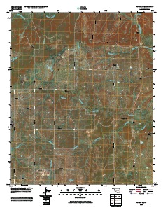
This data set contains imagery from the National Agriculture Imagery Program (NAIP). The NAIP program is administered by USDA FSA and has been established to support two main FSA strategic goals centered on agricultural production. These are, increase stewardship of America's natural resources while enhancing the environment, and to ensure commodities are procured and distributed effectively and efficiently to increase food security. The NAIP program supports these goals by acquiring and providing ortho imagery that has been collected during the agricultural growing season in the U.S. The NAIP ortho imagery is tailored to meet FSA requirements and is a fundamental tool used to support FSA farm and conservation programs....
This data set contains imagery from the National Agriculture Imagery Program (NAIP). The NAIP program is administered by USDA FSA and has been established to support two main FSA strategic goals centered on agricultural production. These are, increase stewardship of America's natural resources while enhancing the environment, and to ensure commodities are procured and distributed effectively and efficiently to increase food security. The NAIP program supports these goals by acquiring and providing ortho imagery that has been collected during the agricultural growing season in the U.S. The NAIP ortho imagery is tailored to meet FSA requirements and is a fundamental tool used to support FSA farm and conservation programs....
This data set contains imagery from the National Agriculture Imagery Program (NAIP). The NAIP program is administered by USDA FSA and has been established to support two main FSA strategic goals centered on agricultural production. These are, increase stewardship of America's natural resources while enhancing the environment, and to ensure commodities are procured and distributed effectively and efficiently to increase food security. The NAIP program supports these goals by acquiring and providing ortho imagery that has been collected during the agricultural growing season in the U.S. The NAIP ortho imagery is tailored to meet FSA requirements and is a fundamental tool used to support FSA farm and conservation programs....
Models that treat innovations to the price of energy as predetermined with respect to U.S. macroeconomic aggregates are widely used in the literature. For example, it is common to order energy prices first in recursively identified VAR models of the transmission of energy price shocks. Because exactly identifying assumptions are inherently untestable, this approach in practice has required an act of faith in the empirical plausibility of the delay restriction used for identification. An alternative view that would invalidate such models is that energy prices respond instantaneously to macroeconomic news, implying that energy prices should be ordered last in recursively identified VAR models. In this paper, we propose...
Categories: Publication;
Types: Citation;
Tags: Powder River Basin,
Wyoming,
analysis,
coal,
development,
Coalbed methane development has proliferated across much of the western United States. Campbell County, Wyoming, in the Powder River Basin is one area that has seem some of the highest amounts of this development, most of it occurring on land where the surface use is livestock grazing, resulting in conflicts over resource use. This thesis takes a grounded theory approach to understanding the meaning that the ranchers that operate on this land have attached to this development. In doing so, this paper argues that these ranchers form opinions and attitudes based on how CBM has affected “the ranching way of life” and not simply on the perceived opportunity for economic gain. It also argues that although objections...
Categories: Publication;
Types: Citation;
Tags: Coal,
Modelling,
documentation,
market,
national energy modeling system
Joseph A. Dammel, Jeffrey M. Bielicki, Melisa F. Pollak, and Elizabeth J. Wilson at the University of Minnesota Center for Science, Technology, and Public Policy have published a feature article titled “A Tale of Two Technologies: Hydraulic Fracturing and Geologic Carbon Sequestration” that appears in the online version of the science journal, Environmental Science & Technology [subscription required]. In comparing, contrasting, and analyzing the regulatory landscape governing the use of hydraulic fracturing and geologic carbon sequestration, they conclude that “A shift toward a 21st Century vision of regulation is required. Hydraulic fracturing and geologic sequestration are both technologies that could reduce...
One unconfined compressive strength (UCS) test and four high-pressure triaxial stress tests were conducted on coal cores in order to best emulate the key issues regarding horizontal wellbore stability, coal strength, permeability change, and coal fines generation during the life cycle of a coalbed methane reservoir. The four non-trivial stress paths were: Loading Compression (LC), where the axial stress is increased while the confining stress is held constant; Loading Extension (LE), where the axial stress is held constant while the confining stress is increased; Unloading Compression (ULC), in which the axial stress is held constant while the confining stress is decreased; and Unloading Extension (ULE), during...
Categories: Publication;
Types: Citation;
Tags: Coal,
Failure envelope,
Geological Strength Index,
Liner design,
Permeability,

Historic image LS_0666 is part of the 'UVA lantern slides' collection; the topic area is 'Coal'. Location is PA (imprecise). The image has the following description: 'R. Anthracite field, Broad Top Mt. .' The image was scanned from a lantern slide as part of the USGS NGGDPP deliverable for 2017-2018. The physical location is 900 Natural Resources Dr., Ste 400, Charlottesville, VA 22903. Library. The author is unknown. The image is dated unknown.
This study deals with modeling and analyzing the performance of greenhouses from the power plant through the heating system to the greenhouse envelope using exergy analysis method, the so-called low exergy or LowEx approach, which has been and still being successfully used in sustainable buildings design, for the first time to the best of the author’s knowledge. For the heating applications, three options are studied with (i) a solar assisted vertical ground-source heat pump greenhouse heating system, (ii) a wood biomass boiler, and (iii) a natural gas boiler, which are driven by renewable and non-renewable energy sources. In this regard, two various greenhouses, the so-called small greenhouse and large greenhouse,...

A coal/CBM database was implemented by the Alberta Geological Survey to capture and manage information related to coalbed methane (CBM). The database is a compilation of data from many different sources and contains information on 7923 wells (15,200 formation picks; 37,357 coal picks; 495 coal analyses; and 363 vitrinite reflectance measurements). This is a subset of those wells that fall inside the coal zone.
One binder of drilling records.
Categories: Physical Item;
Types: Map Service,
OGC WFS Layer,
OGC WMS Layer,
OGC WMS Service;
Tags: Drilling/completion report,
coal
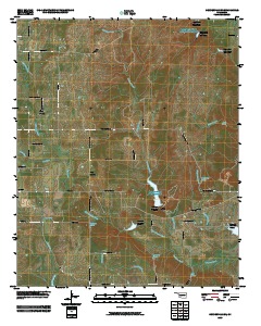
Layered GeoPFD 7.5 Minute Quadrangle Map. Layers of geospatial data include orthoimagery, roads, grids, geographic names, elevation contours, hydrography, and other selected map features.
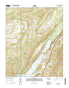
Layered GeoPDF 7.5 Minute Quadrangle Map. Layers of geospatial data include orthoimagery, roads, grids, geographic names, elevation contours, hydrography, and other selected map features.
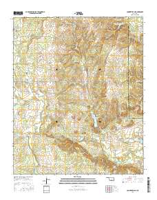
Layered GeoPDF 7.5 Minute Quadrangle Map. Layers of geospatial data include orthoimagery, roads, grids, geographic names, elevation contours, hydrography, and other selected map features.
Layered GeoPFD 7.5 Minute Quadrangle Map. Layers of geospatial data include orthoimagery, roads, grids, geographic names, elevation contours, hydrography, and other selected map features.
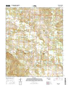
Layered GeoPDF 7.5 Minute Quadrangle Map. Layers of geospatial data include orthoimagery, roads, grids, geographic names, elevation contours, hydrography, and other selected map features.
Geospatial data includes structures and other selected map features.

Geospatial data is comprised of government boundaries.

The Geographic Names Information System (GNIS) is the Federal standard for geographic nomenclature. The U.S. Geological Survey developed the GNIS for the U.S. Board on Geographic Names, a Federal inter-agency body chartered by public law to maintain uniform feature name usage throughout the Government and to promulgate standard names to the public. The GNIS is the official repository of domestic geographic names data; the official vehicle for geographic names use by all departments of the Federal Government; and the source for applying geographic names to Federal electronic and printed products of all types.
The Geographic Names Information System (GNIS) is the Federal standard for geographic nomenclature. The U.S. Geological Survey developed the GNIS for the U.S. Board on Geographic Names, a Federal inter-agency body chartered by public law to maintain uniform feature name usage throughout the Government and to promulgate standard names to the public. The GNIS is the official repository of domestic geographic names data; the official vehicle for geographic names use by all departments of the Federal Government; and the source for applying geographic names to Federal electronic and printed products of all types.
|

|
