Filters: Tags: coastal california gnatcatcher (X)
2 results (41ms)|
Filters
Date Range
Extensions Types Contacts
Categories Tag Types Tag Schemes |
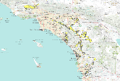
These data identify, in general, the areas where final critical habitat for the coastal California gnatcatcher (Polioptila californica californica) occur.
This habitat model was developed to delineate a sampling frame for regional monitoring of coastal California gnatcatchers (Polioptila californica californica) to determine: 1) percent area occupied (PAO) in high and very high suitability habitat across conserved lands and participating military lands in the U.S. range in southern California; 2) changes in PAO over time; and 3) extinction and colonization rates. One purpose of the model is to identify areas recovering from disturbance, such as wildfire, that may not currently support coastal sage scrub vegetation used by coastal California gnatcatchers, but are otherwise highly suitable. In this way, we can monitor gnatcatcher occupancy associated with habitat changes...
Categories: Data;
Types: Downloadable,
GeoTIFF,
Map Service,
Raster;
Tags: California,
Life sciences,
Los Angeles County,
Orange County,
Partitioned Mahalanobis D2,
|

|
