Filters: Tags: community composition (X)
14 results (74ms)|
Filters
Contacts
(Less)
|
These datasets provide information on plant alpha, beta, and gamma diversity, and plant species abundance at several spatial scales for tidal wetlands along a salinity gradient in the San Francisco Bay-Delta and an impounded brackish wetland complex in Suisun Marsh, California. Files include diversity metrics calculated at the patch, site, and region scales, average percent cover of wetland dominant plants at the patch scale, and average percent cover of all wetland plants at the site scale. These data support the following paper: Jones, S.F., Janousek, C.N., Casazza, M.L., Takekawa, J.Y. and Thorne, K.M., 2021. Seasonal impoundment alters patterns of tidal wetland plant diversity across spatial scales. Ecosphere,...
Categories: Data;
Tags: Botany,
California,
San Francisco Bay-Delta Estuary,
USGS Science Data Catalog (SDC),
biodiversity,
Here we archive data collected during a nitrogen addition field experiment in the Sacramento River Deep Water Ship Channel. Calcium nitrate was added on 8 dates to a segment of the ship channel centered at Navigation Light 74. Prior to and following the nutrient additions, we collected water samples and sensor-based measurements at 7 sites between Navigation Light 70 and 76. Water samples for nutrient analyses were collected in 500 mL High Density Poly Ethylene (HDPE) amber containers from 1 m and 8 m depths using a peristaltic pump. Whole water samples for phytoplankton analysis were collected from 1 m depth in 500 mL clear HDPE containers and immediately preserved with 20 mL of Lugol’s iodine solution (Lugol’s,...
Categories: Data;
Tags: Sacramento River,
Sacramento River Deep Water Ship Channel,
Sacramento–San Joaquin Delta,
Temperature,
West Sacramento,
These data were compiled to evaluate pinyon-juniper regeneration dynamics following stand-replacing wildfire and thinning treatments. Objectives of our study were to investigate vegetation community composition and tree recruitment in post-fire and post-thinning environments. These data represent plant and biological soil crust community composition and climatological records among intact, thinned, and burned pinyon–juniper woodlands. These data were collected in Mesa Verde National Park and Ute Mountain Ute Tribal Park from 6/1/2021 to 6/10/2021 and from 03/1/2022 to 11/30/2022 at two burned and two intact pinyon-juniper ecosystems in Mesa Verde National Park only. These data were collected by the U.S. Geological...
Yes, all data values are reasonable and within the valid range for measurement. The data release consists of 15 tabular data files (csv). These data were compiled to compare patterns and potential drivers of leaf litter decomposition in the Colorado River downstream of Glen Canyon Dam between 1998 and 2022. Objective(s) of our study were to compare the breakdown of cottonwood (Populus fremontii), willow (Salix exigua), and salt cedar (Tamarix chinensis) leaves to a previous decomposition experiment from 1998 (Pomeroy et al. 2000) that was conducted in the context of much cooler water temperatures, higher phosphorus concentrations, lower New Zealand mudsnail densities, and salt cedar litter that was unaffected by...
This dataset contains macroinvertebrate sampling data (weights) for wetlands in the Cottonwood Lake Study Area, Stutsman County, North Dakota.
Categories: Data;
Tags: Aquatic Biology,
Biota,
Community composition,
Cottonwood Lake Study Area,
Ecology,
This dataset contains macroinvertebrate sampling data for the wetlands in the Cottonwood Lake Study Area, Stutsman County, North Dakota.
Categories: Data;
Tags: Aquatic Biology,
Biota,
Community composition,
Cottonwood Lake Study Area,
Ecology,
This dataset contains macroinvertebrate sampling data (weights) for wetlands in the Cottonwood Lake Study Area, Stutsman County, North Dakota.
Categories: Data;
Tags: Aquatic Biology,
Biota,
Community composition,
Cottonwood Lake Study Area,
Ecology,
This dataset presents observations and measurements of riparian plant invasion, community composition, and environmental conditions at 238 bridge crossings in four western USA river basins: the Colorado Headwaters, upper/middle Rio Grande, upper Arkansas River, and South Platte River (281,946 square kilometers). The 238 sites are a stratified random sample of all bridge crossings in the river basins, with roughly equal numbers of sites in landscapes dominated by (1) urban and residential (developed) land-use, (2) agricultural (cultivated) land-use, and (3) undeveloped land cover. The dataset includes field observations of stem counts for three non-native riparian woody plant taxa (Tamarix ramosissima x T. chinensis...
Categories: Data;
Tags: Colorado,
USGS Science Data Catalog (SDC),
biological invasion,
biota,
community composition,
We examined plant community responses to interactions between arbuscular mycorrhizal (AM) fungi and availability of atmospheric CO2 and soil N. Communities of 14 plant species were grown in mesocosms containing living or killed AM fungal inoculum, ambient or elevated atmospheric CO2 and low or enriched soil N. After one growing season, significantly different plant communities existed in the different treatments. Plant species richness was lowest in +N mesocosms and highest in +AM + CO2 mesocosms. At ambient CO2, AM fungi reduced richness but at elevated CO2 they increased it. This was caused by changes in mortality rates of several C3 forbs and may suggest that CO2 enrichment ameliorates the carbon cost of some...
Categories: Publication;
Types: Citation,
Journal Citation;
Tags: Arbuscular mycorrhizae,
CO2 enrichment,
Ecology Letters,
community composition,
evapotranspiration,
This dataset contains macroinvertebrate sampling data for the wetlands in the Cottonwood Lake Study Area, Stutsman County, North Dakota.
Categories: Data;
Tags: Aquatic Biology,
Biota,
Community composition,
Cottonwood Lake Study Area,
Ecology,
Note: this data release has been superseded by version 2.0, available here: https://doi.org/10.5066/P92IJREV This dataset contains macroinvertebrate sampling data (weights) for wetlands in the Cottonwood Lake Study Area, Stutsman County, North Dakota.
Categories: Data;
Tags: Biota,
Community composition,
Cottonwood Lake Study Area,
Freshwater ecosystems,
Macroinvertebrates,
Dams create barriers to fish migration and dispersal in drainage basins, and the removal of dams is often viewed as a means of increasing habitat availability and restoring migratory routes of several fish species. However, these barriers can also isolate and protect native taxa from aggressive downstream invaders.We examined fish community composition two years prior to and two years after the removal of a pair of low-head dams from Boulder Creek,Wisconsin, U.S.A. in 2003 to determine if removal of these potential barriers affected the resident population of native brook trout (Salvelinus fontinalis). Despite the presence of other taxa in the downstream reaches, and in other similar streams adjacent to the Boulder...
Categories: Publication;
Types: Citation;
Tags: Barrier,
Brook trout,
Brown trout fish,
Coldwater,
Colonization,
Note: this data release has been superseded by version 2.0, available here: https://doi.org/10.5066/P99GXVSV This dataset contains macroinvertebrate sampling data for the wetlands in the Cottonwood Lake Study Area, Stutsman County, North Dakota.
Categories: Data;
Tags: Biota,
Community composition,
Cottonwood Lake Study Area,
Freshwater ecosystems,
Macroinvertebrates,
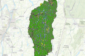
Comprehensive ecological community patch map for the Rensselaer Plateau. One of two companion layers along with community line features. Ecological communities are basic ecological units representing an assemblage of specific plants and animals that repeat across a landscape.
|

|
