Filters: Tags: deposit (X) > partyWithName: U.S. Geological Survey (X)
12 results (47ms)|
Filters
Date Range
Extensions Types Contacts Categories Tag Types Tag Schemes
|

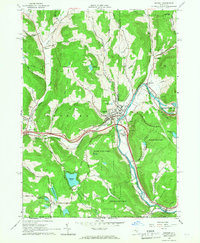
USGS Historical Quadrangle in GeoPDF.
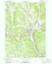
USGS Historical Quadrangle in GeoPDF.

These data were released prior to the October 1, 2016 effective date for the USGS’s policy dictating the review, approval, and release of scientific data as referenced in USGS Survey Manual Chapter 502.8 Fundamental Science Practices: Review and Approval of Scientific Data for Release. This digital dataset contains the categories used to classify the basin-fill deposits in the Central Valley as either coarse-grained or fine-grained deposits. This classification was used to develop the texture model which was used as input data for the hydraulic properties portion of the Central Valley Hydrologic Model (CVHM). The Central Valley encompasses an approximate 50,000 square-kilometer region of California. The complex...

These data were released prior to the October 1, 2016 effective date for the USGS’s policy dictating the review, approval, and release of scientific data as referenced in USGS Survey Manual Chapter 502.8 Fundamental Science Practices: Review and Approval of Scientific Data for Release. This digital dataset contains the percentage of coarse-grained deposits in wells in 15 meter increments and the percentage of coarse-grained deposits in texture model lattice points interpolated from the well data for the Central Valley. The texture model was used as input data for the hydraulic properties portion of the Central Valley Hydrologic Model (CVHM). The Central Valley encompasses an approximate 50,000 square-kilometer...
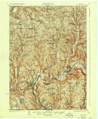
USGS Historical Quadrangle in GeoPDF.

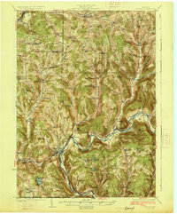
USGS Historical Quadrangle in GeoPDF.
USGS Historical Quadrangle in GeoPDF.

USGS Historical Quadrangle in GeoPDF.

These data were released prior to the October 1, 2016 effective date for the USGS’s policy dictating the review, approval, and release of scientific data as referenced in USGS Survey Manual Chapter 502.8 Fundamental Science Practices: Review and Approval of Scientific Data for Release. This digital dataset defines the SUB package arrays for the model grid, critical head, thickness of fine-grained deposits, and skeletal-elastic-storage used in the transient hydrologic model of the Central Valley flow system. The Central Valley encompasses an approximate 50,000 square-kilometer region of California. The complex hydrologic system of the Central Valley is simulated using the USGS numerical modeling code MODFLOW-FMP...
Categories: pre-SM502.8;
Tags: Alameda County,
Amador County,
Butte County,
CV-RASA,
Calaveras County,
This U.S. Geological Survey (USGS) data release provides the descriptions of the only U.S. sites—including mineral regions, mineral occurrences, and mine features—that have reported production and (or) resources of tantalum (Ta). The sites in this data release have contained resource and (or) past production of more than 900 metric tons Ta metal, which was the approximate average annual consumption of Ta in the U.S. from 2016 through 2020. This dataset contains the Bokan Mountain deposit in Alaska and the Round Top deposit in Texas. Tantalum primarily occurs in the mineral tantalite, which may be found in carbonatites, alkaline granite-syenite complexes, and lithium-cesium-tantalum (LCT) pegmatites. The largest...
Categories: Data;
Types: ArcGIS REST Map Service,
ArcGIS Service Definition,
Downloadable,
Map Service;
Tags: Alaska,
BLM,
Bokan Mountain,
Bureau of Land Management,
DOI,
USGS Historical Quadrangle in GeoPDF.
USGS Historical Quadrangle in GeoPDF.
|

|
