Filters: Tags: deposit (X)
27 results (8ms)|
Filters
Date Range
Extensions (Less) Types (Less)
Contacts (Less)
Categories (Less) Tag Types Tag Schemes
|
This data set contains imagery from the National Agriculture Imagery Program (NAIP). The NAIP program is administered by USDA FSA and has been established to support two main FSA strategic goals centered on agricultural production. These are, increase stewardship of America's natural resources while enhancing the environment, and to ensure commodities are procured and distributed effectively and efficiently to increase food security. The NAIP program supports these goals by acquiring and providing ortho imagery that has been collected during the agricultural growing season in the U.S. The NAIP ortho imagery is tailored to meet FSA requirements and is a fundamental tool used to support FSA farm and conservation programs....

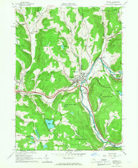
USGS Historical Quadrangle in GeoPDF.
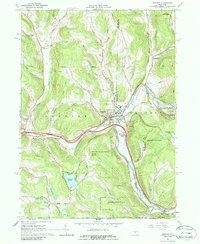
USGS Historical Quadrangle in GeoPDF.
This is version 2.0 of Tungsten Deposits in the United States. This data release provides the descriptions of approximately 100 U.S. sites that include mineral regions, mineral occurrences (deposits), and mine features that contain enrichments of tungsten (W). This data release reports on U.S. mines and deposits with greater than or equal to 215 metric tons of tungsten metal (30,000 short ton units of tungsten trioxide). Sites in this database occur in Alaska, Arizona, California, Colorado, Idaho, Montana, North Carolina, New Mexico, Nevada, Texas, Utah and Washington. As a part of the process set forth by Executive Order 13817, the USGS National Minerals Information Center (NMIC) identified W as a critical mineral...
Categories: Data,
Data Release - Revised;
Types: ArcGIS REST Map Service,
ArcGIS Service Definition,
Downloadable,
Map Service;
Tags: Adit,
Alaska,
Alluvial placer Sn,
Arc-related porphyry Mo,
Area,
This U.S. Geological Survey (USGS) data release provides the descriptions of 11 U.S. sites that include mineral regions, mines, and mineral occurrences that contain enrichments of niobium (Nb). To be included in this data release, a site must have a contained resource and (or) past production of Nb metal greater than 10,000 metric tons, which was the approximate consumption of Nb in the U.S. in 2019 (U.S. Geological Survey, 2020). Sites in this dataset occur in Alaska, Arkansas, Colorado, Nebraska, and Texas. Niobium primarily occurs in oxide minerals of the pyrochlore group, which are most commonly found in carbonatites and alkaline granite-syenite complexes. Globally, the largest Nb deposits occur in Brazil and...
Categories: Data;
Types: ArcGIS REST Map Service,
ArcGIS Service Definition,
Downloadable,
Map Service;
Tags: Alaska,
Arkansas,
BLM,
Bureau of Land Management,
Colorado,
The U.S. Geological Survey (USGS) has compiled a geodatabase containing mineral-related geospatial data for the People's Republic of China. The data can be used in analyses of the extractive fuel and nonfuel mineral industries and related economic and physical infrastructure integral for the successful operation of the mineral industries within the area of study as well as the movement of mineral products across domestic and global markets. This geodatabase reflects the USGS ongoing commitment to its mission of understanding the nature and distribution of global mineral commodity supply chains by updating and publishing the georeferenced locations of mineral commodity production and processing facilities, mineral...
The article describes the hydrogeological problems related to water influx to the mine and water sulphate content association with underground oil shale mining in an environmentally sensitive area of Estonia. The water balance method was used to calculate the ratio of mine water outflow/inflow. Water balance calculations are needed for estimating the groundwater transversal flow into closed mines. Before oil shale mining groundwater geochemical processes are characterised by low sulphate content. Dewatering of oil shale mines lowered groundwater level in the Keila?Kukruse aquifer, and caused an about 50-fold increase in sulphate by intensive oxidation of pyrite of natural origin. The mobile sulphate ion may serve...
The U.S. Geological Survey (USGS) has compiled a geodatabase containing mineral-related geospatial data for 10 countries of interest in Southwest Asia (area of study): Afghanistan, Cambodia, Laos, India, Indonesia, Iran, Nepal, North Korea, Pakistan, and Thailand. The data can be used in analyses of the extractive fuel and nonfuel mineral industries and related economic and physical infrastructure integral for the successful operation of the mineral industries within the area of study as well as the movement of mineral products across domestic and global markets. This geodatabase reflects the USGS ongoing commitment to its mission of understanding the nature and distribution of global mineral commodity supply chains...

These data were released prior to the October 1, 2016 effective date for the USGS’s policy dictating the review, approval, and release of scientific data as referenced in USGS Survey Manual Chapter 502.8 Fundamental Science Practices: Review and Approval of Scientific Data for Release. This digital dataset contains the categories used to classify the basin-fill deposits in the Central Valley as either coarse-grained or fine-grained deposits. This classification was used to develop the texture model which was used as input data for the hydraulic properties portion of the Central Valley Hydrologic Model (CVHM). The Central Valley encompasses an approximate 50,000 square-kilometer region of California. The complex...

These data were released prior to the October 1, 2016 effective date for the USGS’s policy dictating the review, approval, and release of scientific data as referenced in USGS Survey Manual Chapter 502.8 Fundamental Science Practices: Review and Approval of Scientific Data for Release. This digital dataset contains the percentage of coarse-grained deposits in wells in 15 meter increments and the percentage of coarse-grained deposits in texture model lattice points interpolated from the well data for the Central Valley. The texture model was used as input data for the hydraulic properties portion of the Central Valley Hydrologic Model (CVHM). The Central Valley encompasses an approximate 50,000 square-kilometer...
This U.S. Geological Survey (USGS) data release provides the descriptions of the only U.S. sites—including mineral regions, mineral occurrences, and mine features—that have reported production and (or) resources of gallium (Ga). The sites in this data release have contained resource and (or) past production of more than 16 metric tons Ga metal, which was the approximate average annual consumption of Ga in the U.S. from 2016 through 2020. This dataset contains the Round Top deposit in Texas and the Apex deposit in Utah. Gallium occurs in many different minerals and rocks where substitution takes place with elements of similar size, such as zinc, or similar charge, such as aluminum. Therefore, Ga is primarily recovered...
Categories: Data;
Types: ArcGIS REST Map Service,
ArcGIS Service Definition,
Downloadable,
Map Service;
Tags: Apex,
BLM,
Bureau of Land Management,
DOI,
Department of the Interior,
This U.S. Geological Survey (USGS) data release provides the descriptions of the only U.S. sites-including mining districts, mineral occurrences, and mine features-that have reported production and (or) resources of indium (In). This dataset contains the Bingham and West Desert deposits in Utah, and the Chino site in New Mexico. Indium is considered a critical and strategic mineral because of its use in the aerospace, defense, energy, and telecommunications sectors. The primary applications are flat-panel displays, and specialty alloys (Fortier and others, 2018). In 2021, the U.S. was 100 percent net import reliant on indium from China, Canada, Republic of Korea, and France (U.S. Geological Survey, 2022). Indium...
Categories: Data;
Types: ArcGIS REST Map Service,
ArcGIS Service Definition,
Downloadable,
Map Service;
Tags: BLM,
Bureau of Land Management,
DOI,
Department of the Interior,
Earth MRI,
This data set contains imagery from the National Agriculture Imagery Program (NAIP). The NAIP program is administered by USDA FSA and has been established to support two main FSA strategic goals centered on agricultural production. These are, increase stewardship of America's natural resources while enhancing the environment, and to ensure commodities are procured and distributed effectively and efficiently to increase food security. The NAIP program supports these goals by acquiring and providing ortho imagery that has been collected during the agricultural growing season in the U.S. The NAIP ortho imagery is tailored to meet FSA requirements and is a fundamental tool used to support FSA farm and conservation programs....
Cumulatively, headwater streams contribute to maintaining hydrologic connectivity and ecosystem integrity at regional scales. Hydrologic connectivity is the water-mediated transport of matter, energy and organisms within or between elements of the hydrologic cycle. Headwater streams compose over two-thirds of total stream length in a typical river drainage and directly connect the upland and riparian landscape to the rest of the stream ecosystem. Altering headwater streams, e.g., by channelization, diversion through pipes, impoundment and burial, modifies fluxes between uplands and downstream river segments and eliminates distinctive habitats. The large-scale ecological effects of altering headwaters are amplified...
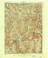
USGS Historical Quadrangle in GeoPDF.
This U.S. Geological Survey (USGS) data release provides the descriptions of 10 U.S. sites that include mineral regions, mineral occurrences, and mine features that contain enrichments of graphite. To be included in this data release, sites must have a contained resource and (or) past production of more than 1,000 metric tons of graphite, which is approximately 3 percent of the average annual U.S. consumption of graphite from 2016 through 2020. Sites in this dataset occur in Alaska, Alabama, Colorado, Montana, New York, Pennsylvania, and Texas. There are known graphite occurrences in California, Connecticut, Georgia, Michigan, New Hampshire, New Jersey, North Carolina, Rhode Island, and Wyoming that have not been...
Categories: Data;
Types: ArcGIS REST Map Service,
ArcGIS Service Definition,
Downloadable,
Map Service;
Tags: 37f - Disseminated flake graphite,
37g - Graphite veins,
Alabama,
Alaska,
BLM,
This data set contains imagery from the National Agriculture Imagery Program (NAIP). The NAIP program is administered by USDA FSA and has been established to support two main FSA strategic goals centered on agricultural production. These are, increase stewardship of America's natural resources while enhancing the environment, and to ensure commodities are procured and distributed effectively and efficiently to increase food security. The NAIP program supports these goals by acquiring and providing ortho imagery that has been collected during the agricultural growing season in the U.S. The NAIP ortho imagery is tailored to meet FSA requirements and is a fundamental tool used to support FSA farm and conservation programs....

USGS Historical Quadrangle in GeoPDF.
USGS Historical Quadrangle in GeoPDF.

USGS Historical Quadrangle in GeoPDF.
|

|
