Filters: Tags: diamond (X)
20 results (28ms)|
Filters
Date Range
Extensions Types Contacts
Categories Tag Types Tag Schemes |
This data set contains imagery from the National Agriculture Imagery Program (NAIP). The NAIP program is administered by USDA FSA and has been established to support two main FSA strategic goals centered on agricultural production. These are, increase stewardship of America's natural resources while enhancing the environment, and to ensure commodities are procured and distributed effectively and efficiently to increase food security. The NAIP program supports these goals by acquiring and providing ortho imagery that has been collected during the agricultural growing season in the U.S. The NAIP ortho imagery is tailored to meet FSA requirements and is a fundamental tool used to support FSA farm and conservation programs....
Coalbed methane is one of the most important and valuable natural resources in the Western United States. The natural gas that results from CBM development is the cleanest burning fossil fuel, and the extensive domestic supply makes it a central element of the national goal of a secure supply of energy. Demand for natural gas will continue to grow and CBM will play an increasingly larger role in meeting that demand. CBM production has expanded tremendously over the past decade, and the rapidity with which development has expanded has resulted in stresses and tension in affected communities. Development of this important energy resource must be balanced with a number of other important goals of protecting water,...
Categories: Publication;
Types: Citation;
Tags: Canada,
Commentary,
Information,
considerations,
diamond,
This data set contains imagery from the National Agriculture Imagery Program (NAIP). The NAIP program is administered by USDA FSA and has been established to support two main FSA strategic goals centered on agricultural production. These are, increase stewardship of America's natural resources while enhancing the environment, and to ensure commodities are procured and distributed effectively and efficiently to increase food security. The NAIP program supports these goals by acquiring and providing ortho imagery that has been collected during the agricultural growing season in the U.S. The NAIP ortho imagery is tailored to meet FSA requirements and is a fundamental tool used to support FSA farm and conservation programs....
This data set contains imagery from the National Agriculture Imagery Program (NAIP). The NAIP program is administered by USDA FSA and has been established to support two main FSA strategic goals centered on agricultural production. These are, increase stewardship of America's natural resources while enhancing the environment, and to ensure commodities are procured and distributed effectively and efficiently to increase food security. The NAIP program supports these goals by acquiring and providing ortho imagery that has been collected during the agricultural growing season in the U.S. The NAIP ortho imagery is tailored to meet FSA requirements and is a fundamental tool used to support FSA farm and conservation programs....
The U.S. Geological Survey (USGS) has compiled a geodatabase containing mineral-related geospatial data for the People's Republic of China. The data can be used in analyses of the extractive fuel and nonfuel mineral industries and related economic and physical infrastructure integral for the successful operation of the mineral industries within the area of study as well as the movement of mineral products across domestic and global markets. This geodatabase reflects the USGS ongoing commitment to its mission of understanding the nature and distribution of global mineral commodity supply chains by updating and publishing the georeferenced locations of mineral commodity production and processing facilities, mineral...
This data set contains imagery from the National Agriculture Imagery Program (NAIP). The NAIP program is administered by USDA FSA and has been established to support two main FSA strategic goals centered on agricultural production. These are, increase stewardship of America's natural resources while enhancing the environment, and to ensure commodities are procured and distributed effectively and efficiently to increase food security. The NAIP program supports these goals by acquiring and providing ortho imagery that has been collected during the agricultural growing season in the U.S. The NAIP ortho imagery is tailored to meet FSA requirements and is a fundamental tool used to support FSA farm and conservation programs....
This data set contains imagery from the National Agriculture Imagery Program (NAIP). The NAIP program is administered by USDA FSA and has been established to support two main FSA strategic goals centered on agricultural production. These are, increase stewardship of America's natural resources while enhancing the environment, and to ensure commodities are procured and distributed effectively and efficiently to increase food security. The NAIP program supports these goals by acquiring and providing ortho imagery that has been collected during the agricultural growing season in the U.S. The NAIP ortho imagery is tailored to meet FSA requirements and is a fundamental tool used to support FSA farm and conservation programs....
The U.S. Geological Survey (USGS) has compiled a geodatabase containing mineral-related geospatial data for 10 countries of interest in Southwest Asia (area of study): Afghanistan, Cambodia, Laos, India, Indonesia, Iran, Nepal, North Korea, Pakistan, and Thailand. The data can be used in analyses of the extractive fuel and nonfuel mineral industries and related economic and physical infrastructure integral for the successful operation of the mineral industries within the area of study as well as the movement of mineral products across domestic and global markets. This geodatabase reflects the USGS ongoing commitment to its mission of understanding the nature and distribution of global mineral commodity supply chains...
Coalbed methane is one of the most important and valuable natural resources in the Western United States. The natural gas that results from CBM development is the cleanest burning fossil fuel, and the extensive domestic supply makes it a central element of the national goal of a secure supply of energy. Demand for natural gas will continue to grow and CBM will play an increasingly larger role in meeting that demand. CBM production has expanded tremendously over the past decade, and the rapidity with which development has expanded has resulted in stresses and tension in affected communities. Development of this important energy resource must be balanced with a number of other important goals of protecting water,...
Categories: Publication;
Types: Citation;
Tags: Canada,
Commentary,
Information,
considerations,
diamond,
This data release contains the U.S. salient statistics and world production data extracted from the GEMSTONES data sheet of the USGS Mineral Commodity Summaries 2022.
This data set contains imagery from the National Agriculture Imagery Program (NAIP). The NAIP program is administered by USDA FSA and has been established to support two main FSA strategic goals centered on agricultural production. These are, increase stewardship of America's natural resources while enhancing the environment, and to ensure commodities are procured and distributed effectively and efficiently to increase food security. The NAIP program supports these goals by acquiring and providing ortho imagery that has been collected during the agricultural growing season in the U.S. The NAIP ortho imagery is tailored to meet FSA requirements and is a fundamental tool used to support FSA farm and conservation programs....
This data set contains imagery from the National Agriculture Imagery Program (NAIP). The NAIP program is administered by USDA FSA and has been established to support two main FSA strategic goals centered on agricultural production. These are, increase stewardship of America's natural resources while enhancing the environment, and to ensure commodities are procured and distributed effectively and efficiently to increase food security. The NAIP program supports these goals by acquiring and providing ortho imagery that has been collected during the agricultural growing season in the U.S. The NAIP ortho imagery is tailored to meet FSA requirements and is a fundamental tool used to support FSA farm and conservation programs....
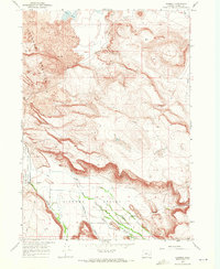
USGS Historical Quadrangle in GeoPDF.
The mission of the USGS National Minerals Information Center (formerly the Minerals Information Team) is to collect, analyze, and disseminate information on the domestic and international supply of and demand for minerals and mineral materials essential to the U.S. economy and national security. About 90 mineral commodities are covered.The Center's goal is to provide decision makers with the information required to ensure that the Nation has an adequate and dependable supply of minerals and materials to meet its defense and economic needs at acceptable costs related to environment, energy, and economics. In addition to special data releases available through ScienceBase, annual and monthly or quarterly statistical...
This data release contains the U.S. salient statistics and world production data extracted from the GEMSTONES data sheet of the USGS Mineral Commodity Summaries 2024.
Coalbed methane is one of the most important and valuable natural resources in the Western United States. The natural gas that results from CBM development is the cleanest burning fossil fuel, and the extensive domestic supply makes it a central element of the national goal of a secure supply of energy. Demand for natural gas will continue to grow and CBM will play an increasingly larger role in meeting that demand. CBM production has expanded tremendously over the past decade, and the rapidity with which development has expanded has resulted in stresses and tension in affected communities. Development of this important energy resource must be balanced with a number of other important goals of protecting water,...
Categories: Publication;
Types: Citation;
Tags: Canada,
Commentary,
Information,
considerations,
diamond,
This data release contains the U.S. salient statistics and world production data extracted from the GEMSTONES data sheet of the USGS Mineral Commodity Summaries 2023.
|

|
