Filters: Tags: digital spatial data (X) > Date Range: {"choice":"year"} (X)
25 results (22ms)|
Filters
Date Types (for Date Range)
Contacts
Categories Tag Types Tag Schemes
|
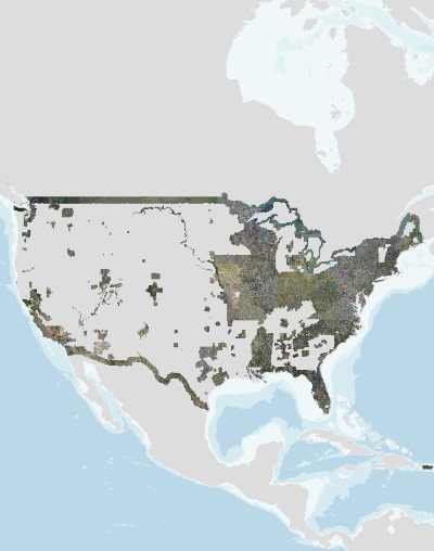
The U.S. Geological Survey (USGS), in partnership with several federal agencies, has developed and released five National Land Cover Database (NLCD) products over the past two decades: NLCD 1992, 2001, 2006, 2011, and 2016. The 2016 release saw landcover created for additional years of 2003, 2008, and 2013. These products provide spatially explicit and reliable information on the Nation’s land cover and land cover change. To continue the legacy of NLCD and further establish a long-term monitoring capability for the Nation’s land resources, the USGS has designed a new generation of NLCD products named NLCD 2019. The NLCD 2019 design aims to provide innovative, consistent, and robust methodologies for production of...
As part of the next generation NLCD 2016 mapping process, the NLCD research team developed a suite of intermediate products that were used to generate the final NLCD Land Cover products. Some of those products also have value as independent products and are provided here. Please read the product descriptions to understand what the product represents. Questions about the NLCD 2016 land cover product can be directed to the NLCD 2016 land cover mapping team at USGS EROS, Sioux Falls, SD (605) 594-6151 or mrlc@usgs.gov. See included spatial metadata for more details.
Types: Map Service,
OGC WFS Layer,
OGC WMS Layer,
OGC WMS Service;
Tags: GIS,
Image processing,
Land Use Land Cover Theme,
Land cover,
N.L.C.D.,
The U.S. Geological Survey (USGS), in partnership with several federal agencies, has now developed and released seven National Land Cover Database (NLCD) products: NLCD 1992, 2001, 2006, 2011, 2016, 2019, and 2021. Beginning with the 2016 release, land cover products were created for two-to-three-year intervals between 2001 and the most recent year. These products provide spatially explicit and reliable information on the Nation’s land cover and land cover change. NLCD continues to provide innovative, consistent, and robust methodologies for production of a multi-temporal land cover and land cover change database. The NLCD 2021 release is update based, so the Land Cover and Impervious Surface products released in...
The U.S. Geological Survey (USGS), in partnership with several federal agencies, has developed and released four National Land Cover Database (NLCD) products over the past two decades: NLCD 1992, 2001, 2006, and 2011. These products provide spatially explicit and reliable information on the Nation’s land cover and land cover change. To continue the legacy of NLCD and further establish a long-term monitoring capability for the Nation’s land resources, the USGS has designed a new generation of NLCD products named NLCD 2016. The NLCD 2016 design aims to provide innovative, consistent, and robust methodologies for production of a multi-temporal land cover and land cover change database from 2001 to 2016 at 2–3-year...
Categories: Data Release - Revised;
Types: Map Service,
OGC WFS Layer,
OGC WMS Layer,
OGC WMS Service;
Tags: GIS,
Image processing,
Land Use Land Cover Theme,
Land cover,
NGDA,
This update to the Alaska National Land Cover Database (NLCD) 2016 replaces the files dated 20200213. In this update the landcover footprint was extended along the northern coast to include the islands that were missed in previous versions, and several duplicate roads (offset by 1 or 2 pixels) were removed on the Aleutian Islands. The Alaska National Land Cover Database 2016 was created using change detection between the nominal dates of 2011 and 2016 utilizing Google Earth engine composites of Landsat imagery. Traditionally, previous classifications of Alaska used path row data and spectral comparisons between path rows along with ancillary data to derive areas of change. Alaska has many challenges for land cover...
The U.S. Geological Survey (USGS), in partnership with several federal agencies, has developed and released four National Land Cover Database (NLCD) products over the past two decades: NLCD 1992, 2001, 2006, and 2011. These products provide spatially explicit and reliable information on the Nation’s land cover and land cover change. To continue the legacy of NLCD and further establish a long-term monitoring capability for the Nation’s land resources, the USGS has designed a new generation of NLCD products named NLCD 2016. The NLCD 2016 design aims to provide innovative, consistent, and robust methodologies for production of a multi-temporal land cover and land cover change database from 2001 to 2016 at 2–3-year...
Types: Map Service,
OGC WFS Layer,
OGC WMS Layer,
OGC WMS Service;
Tags: GIS,
Image processing,
Land Use Land Cover Theme,
Land cover,
NGDA,
The U.S. Geological Survey (USGS), in partnership with several federal agencies, has now developed and released seven National Land Cover Database (NLCD) products: NLCD 1992, 2001, 2006, 2011, 2016, 2019, and 2021. Beginning with the 2016 release, land cover products were created for two-to-three-year intervals between 2001 and the most recent year. These products provide spatially explicit and reliable information on the Nation’s land cover and land cover change. NLCD continues to provide innovative, consistent, and robust methodologies for production of a multi-temporal land cover and land cover change database. The NLCD 2021 release is update based, so the Land Cover and Impervious Surface products released in...
The U.S. Geological Survey (USGS), in partnership with several federal agencies, has developed and released five National Land Cover Database (NLCD) products over the past two decades: NLCD 1992, 2001, 2006, 2011, and 2016. The 2016 release saw landcover created for additional years of 2003, 2008, and 2013. These products provide spatially explicit and reliable information on the Nation’s land cover and land cover change. To continue the legacy of NLCD and further establish a long-term monitoring capability for the Nation’s land resources, the USGS has designed a new generation of NLCD products named NLCD 2019. The NLCD 2019 design aims to provide innovative, consistent, and robust methodologies for production of...
As part of the next generation NLCD 2016 mapping process, the NLCD research team developed a suite of intermediate products that were used to generate the final NLCD Land Cover products. Some of those products also have value as independent products and are provided here. Please read the product descriptions to understand what the product represents.
Types: Map Service,
OGC WFS Layer,
OGC WMS Layer,
OGC WMS Service;
Tags: GIS,
Image processing,
Land Use Land Cover Theme,
Land cover,
N.L.C.D.,
The U.S. Geological Survey (USGS), in partnership with several federal agencies, has developed and released four National Land Cover Database (NLCD) products over the past two decades: NLCD 1992, 2001, 2006, and 2011. These products provide spatially explicit and reliable information on the Nation’s land cover and land cover change. To continue the legacy of NLCD and further establish a long-term monitoring capability for the Nation’s land resources, the USGS has designed a new generation of NLCD products named NLCD 2016. The NLCD 2016 design aims to provide innovative, consistent, and robust methodologies for production of a multi-temporal land cover and land cover change database from 2001 to 2016 at 2–3-year...
Types: Map Service,
OGC WFS Layer,
OGC WMS Layer,
OGC WMS Service;
Tags: GIS,
Image processing,
Land Use Land Cover Theme,
Land cover,
NGDA,
USGS high resolution orthorectified images from The National Map combine the image characteristics of an aerial photograph with the geometric qualities of a map. An orthoimage is a uniform-scale image where corrections have been made for feature displacement such as building tilt and for scale variations caused by terrain relief, sensor geometry, and camera tilt. A mathematical equation based on ground control points, sensor calibration information, and a digital elevation model is applied to each pixel to rectify the image to obtain the geometric qualities of a map. A digital orthoimage may be created from several photographs mosaicked to form the final image. The source imagery may be black-and-white, natural...
Monthly 30-year "normal" dataset covering the conterminous U.S., including the Russian River watershed, averaged over the climatological period 1981-2010. Contains spatially gridded average monthly and average annual precipitation, maximum temperature, and minimum temperature at 800m grid cell resolution. Distribution of the point measurements to the spatial grid was accomplished using the PRISM model, developed and applied by Dr. Christopher Daly of the PRISM Climate Group at Oregon State University. This dataset was heavily peer reviewed, and is available free-of-charge on the PRISM website. The dataset was downloaded from the PRISM website in 2019
As part of the next generation NLCD 2016 mapping process, the NLCD research team developed a suite of intermediate products that were used to generate the final NLCD Land Cover products. Some of those products also have value as independent products and are provided here. Please read the product descriptions to understand what the product represents. Questions about the NLCD 2016 land cover product can be directed to the NLCD 2016 land cover mapping team at USGS EROS, Sioux Falls, SD (605) 594-6151 or mrlc@usgs.gov. See included spatial metadata for more details.
Types: Map Service,
OGC WFS Layer,
OGC WMS Layer,
OGC WMS Service;
Tags: GIS,
Image processing,
Land Use Land Cover Theme,
Land cover,
N.L.C.D.,
The U.S. Geological Survey (USGS), in partnership with several federal agencies, has developed and released five National Land Cover Database (NLCD) products over the past two decades: NLCD 1992, 2001, 2006, 2011, and 2016. The 2016 release saw landcover created for additional years of 2003, 2008, and 2013. These products provide spatially explicit and reliable information on the Nation’s land cover and land cover change. To continue the legacy of NLCD and further establish a long-term monitoring capability for the Nation’s land resources, the USGS has designed a new generation of NLCD products named NLCD 2019. The NLCD 2019 design aims to provide innovative, consistent, and robust methodologies for production of...
The U.S. Geological Survey (USGS), in partnership with several federal agencies, has developed and released five National Land Cover Database (NLCD) products over the past two decades: NLCD 1992, 2001, 2006, 2011, and 2016. The 2016 release saw landcover created for additional years of 2003, 2008, and 2013. These products provide spatially explicit and reliable information on the Nation’s land cover and land cover change. To continue the legacy of NLCD and further establish a long-term monitoring capability for the Nation’s land resources, the USGS has designed a new generation of NLCD products named NLCD 2019. The NLCD 2019 design aims to provide innovative, consistent, and robust methodologies for production of...
The U.S. Geological Survey (USGS), in partnership with several federal agencies, has developed and released five National Land Cover Database (NLCD) products over the past two decades: NLCD 1992, 2001, 2006, 2011, and 2016. The 2016 release saw landcover created for additional years of 2003, 2008, and 2013. These products provide spatially explicit and reliable information on the Nation’s land cover and land cover change. To continue the legacy of NLCD and further establish a long-term monitoring capability for the Nation’s land resources, the USGS has designed a new generation of NLCD products named NLCD 2019. The NLCD 2019 design aims to provide innovative, consistent, and robust methodologies for production of...
Categories: Data,
Data Release - Revised;
Tags: GIS,
Image processing,
Land Use Land Cover Theme,
Land cover,
NGDA,
As part of the next generation NLCD 2016 mapping process, the NLCD research team developed a suite of intermediate products that were used to generate the final NLCD Land Cover products. Some of those products also have value as independent products and are provided here. Please read the product descriptions to understand what the product represents.
Types: Map Service,
OGC WFS Layer,
OGC WMS Layer,
OGC WMS Service;
Tags: GIS,
Image processing,
Land Use Land Cover Theme,
Land cover,
N.L.C.D.,
The U.S. Geological Survey (USGS), in partnership with several federal agencies, has now developed and released seven National Land Cover Database (NLCD) products: NLCD 1992, 2001, 2006, 2011, 2016, 2019, and 2021. Beginning with the 2016 release, land cover products were created for two-to-three-year intervals between 2001 and the most recent year. These products provide spatially explicit and reliable information on the Nation’s land cover and land cover change. NLCD continues to provide innovative, consistent, and robust methodologies for production of a multi-temporal land cover and land cover change database. The NLCD 2021 release is update based, so the Land Cover and Impervious Surface products released in...
Categories: Collection;
Tags: GIS,
Land Use Land Cover Theme,
NGDA,
NLCD,
National Geospatial Data Asset,
This data release is a raster dataset from of the National Land Cover Database (NLCD) 2011 Percent Developed Imperviousness (2011 Edition). The NLCD 2011 data was downloaded from the Multi-Resolution Land Characteristics Consortium (MRLC) in 2014. Below is the abstract from the NLCD metadata: The National Land Cover Database products are created through a cooperative project conducted by the Multi-Resolution Land Characteristics (MRLC) Consortium. The MRLC Consortium is a partnership of federal agencies (www.mrlc.gov), consisting of the U.S. Geological Survey (USGS), the National Oceanic and Atmospheric Administration (NOAA), the U.S. Environmental Protection Agency (EPA), the U.S. Department of Agriculture -Forest...
The U.S. Geological Survey (USGS), in partnership with several federal agencies, has developed and released five National Land Cover Database (NLCD) products over the past two decades: NLCD 1992, 2001, 2006, 2011, and 2016. The 2016 release saw landcover created for additional years of 2003, 2008, and 2013. These products provide spatially explicit and reliable information on the Nation’s land cover and land cover change. To continue the legacy of NLCD and further establish a long-term monitoring capability for the Nation’s land resources, the USGS has designed a new generation of NLCD products named NLCD 2019. The NLCD 2019 design aims to provide innovative, consistent, and robust methodologies for production of...
|

|
