Filters: Tags: dinosaur (X)
11 results (36ms)|
Filters
Date Range
Extensions Types Contacts
Categories Tag Types Tag Schemes |
This data set contains imagery from the National Agriculture Imagery Program (NAIP). The NAIP program is administered by USDA FSA and has been established to support two main FSA strategic goals centered on agricultural production. These are, increase stewardship of America's natural resources while enhancing the environment, and to ensure commodities are procured and distributed effectively and efficiently to increase food security. The NAIP program supports these goals by acquiring and providing ortho imagery that has been collected during the agricultural growing season in the U.S. The NAIP ortho imagery is tailored to meet FSA requirements and is a fundamental tool used to support FSA farm and conservation programs....
This data set contains imagery from the National Agriculture Imagery Program (NAIP). The NAIP program is administered by USDA FSA and has been established to support two main FSA strategic goals centered on agricultural production. These are, increase stewardship of America's natural resources while enhancing the environment, and to ensure commodities are procured and distributed effectively and efficiently to increase food security. The NAIP program supports these goals by acquiring and providing ortho imagery that has been collected during the agricultural growing season in the U.S. The NAIP ortho imagery is tailored to meet FSA requirements and is a fundamental tool used to support FSA farm and conservation programs....
This data set contains imagery from the National Agriculture Imagery Program (NAIP). The NAIP program is administered by USDA FSA and has been established to support two main FSA strategic goals centered on agricultural production. These are, increase stewardship of America's natural resources while enhancing the environment, and to ensure commodities are procured and distributed effectively and efficiently to increase food security. The NAIP program supports these goals by acquiring and providing ortho imagery that has been collected during the agricultural growing season in the U.S. The NAIP ortho imagery is tailored to meet FSA requirements and is a fundamental tool used to support FSA farm and conservation programs....
This study investigated local distribution and foraging behavior of the spotted bat (Euderma maculatum) in Dinosaur National Monument, Colorado-Utah, by monitoring audible echolocation calls. The occurrence of this species was verified in a variety of habitat types in canyon bottoms and other relatively low elevation sites, indicating that the animals were widely distributed and locally common in the area. Foraging spotted bats concentrated flight activity in the open-air space above meadows occasionally exploited near-canopy habitat (within 8 m of foliage). Bats began to forage shortly after dark, and activity levels were relatively constant throughout the night. Foraging spotted bats attacked airborne prey every...
Categories: Publication;
Types: Citation,
Journal Citation;
Tags: Colorado,
Dinosaur,
Euderma maculatum,
National Monument,
Utah,
This data set contains imagery from the National Agriculture Imagery Program (NAIP). The NAIP program is administered by USDA FSA and has been established to support two main FSA strategic goals centered on agricultural production. These are, increase stewardship of America's natural resources while enhancing the environment, and to ensure commodities are procured and distributed effectively and efficiently to increase food security. The NAIP program supports these goals by acquiring and providing ortho imagery that has been collected during the agricultural growing season in the U.S. The NAIP ortho imagery is tailored to meet FSA requirements and is a fundamental tool used to support FSA farm and conservation programs....
This data set contains imagery from the National Agriculture Imagery Program (NAIP). The NAIP program is administered by USDA FSA and has been established to support two main FSA strategic goals centered on agricultural production. These are, increase stewardship of America's natural resources while enhancing the environment, and to ensure commodities are procured and distributed effectively and efficiently to increase food security. The NAIP program supports these goals by acquiring and providing ortho imagery that has been collected during the agricultural growing season in the U.S. The NAIP ortho imagery is tailored to meet FSA requirements and is a fundamental tool used to support FSA farm and conservation programs....
A taphonomic study of the Lower Cretaceous, Dalton Wells (DW) dinosaur bonebeds near Moab, Utah, provides insight into the origins, preservational biases, and paleobiological significance of one of the richest and most diverse Early Cretaceous dinosaur sites known. The bonebeds occur in a stacked succession of debris flows at the base of the Yellow Cat Member of the Cedar Mountain Formation, which was deposited in a seasonally-dry, alluvial-lacustrine setting. Although only 5% of the locality has been collected, more than 4200 bones were recovered, representing an assemblage overwhelmingly dominated by dinosaurs — with a minimum of 67 individuals that represent at least eight genera. The assemblage also includes...
Categories: Publication;
Types: Citation,
Journal Citation;
Tags: Palaeogeography, Palaeoclimatology, Palaeoecology,
bonebed,
cedar mountain formation,
debris flow,
dinosaur,
This data set contains imagery from the National Agriculture Imagery Program (NAIP). The NAIP program is administered by USDA FSA and has been established to support two main FSA strategic goals centered on agricultural production. These are, increase stewardship of America's natural resources while enhancing the environment, and to ensure commodities are procured and distributed effectively and efficiently to increase food security. The NAIP program supports these goals by acquiring and providing ortho imagery that has been collected during the agricultural growing season in the U.S. The NAIP ortho imagery is tailored to meet FSA requirements and is a fundamental tool used to support FSA farm and conservation programs....
Paleogastroliths, as defined in this study, are stomach stones associated exclusively with extinct animals. Definitive recognition of paleogastroliths is problematic and controversial. Polished, rounded stones found within skeletal remains of dinosaurs and plesiosaurs are the strongest evidence. This study examined intraskeletal and proposed paleogastroliths using a scanning electron microscope (SEM) to determine if any defining surface textures occur. Paleogastroliths associated with the skeletal remains of Seismosaurus hallorum, possible paleogastroliths from the Lower Cretaceous Cedar Mountain Formation, and other well-polished stones were obtained. Most stones were composed of either quartzite or chert and were...
Categories: Publication;
Types: Citation,
Journal Citation;
Tags: Cedar Mountain Formation,
Ichnos,
dinosaur,
gastrolith,
paleogastrolith,
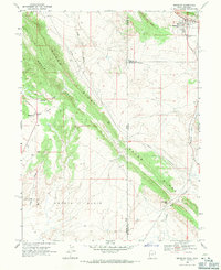
USGS Historical Quadrangle in GeoPDF.
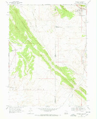
USGS Historical Quadrangle in GeoPDF.
|

|
