Filters: Tags: diorite (X)
23 results (53ms)|
Filters
Date Range
Extensions (Less) Types (Less) Contacts (Less)
Categories (Less) Tag Types Tag Schemes
|
This is a geochemical data set from the reanalysis of 44 rock samples collected between 1966 and 1970, and 107 sediment samples collected in 1966 and 1967. These samples were collected by the U.S. Geological Survey for a study investigating the mineral resources of the Idaho Primitive Area (Cater et al., 1973). The samples are from the Lower Middle Fork of the Salmon River, including the tributaries of Big Creek, Camas Creek, Brush Creek, Wilson Creek, Waterfall Creek, Ship Island Creek, Reese Creek, Stoddard Creek, and Papoose Creek. The overall objective of this study is to characterize the regional impact of legacy mining for the Frank Church River of No Return Wilderness Area. Mary P. Rossillon (1981) explored...
Categories: Data;
Tags: Annie Creek,
Atomic absorption analysis,
Atomic emission spectroscopy,
Beaver Creek,
Big Creek,
Core Research Center, cutting BZ01397, from well operated by SHORELINE PETRaw Properties from download, web scrape, MapServer, and Macrostrat API{"Lib Num": "BZ01397", "API Num": "2509505026", "Operator": "SHORELINE PET", "Well Name": "1 FEDERAL (90-278)", "Field": "WILDCAT STILLWATER", "State": "MT", "County": "STILLWATER", "Thin Sec": "F", "Analysis": "F", "Latitude": "45.5416902", "Longitude": "-109.7773419", "coordinates_geohash": "c81gjfwedd35", "Source": "FROM STATE RECORDS", "Min": "0", "Max": "6705", "Security Flag": null, "crc_collection_name": "cutting", "sb_parent_id": "4f4e49d8e4b07f02db5df2d2", "intervals": [{"Formation": null, "Age": null, "Min Depth": null, "Max Depth": null}], "crcwc_url": "https://my.usgs.gov/crcwc/cutting/report/1681",...
Categories: Physical Item;
Tags: Cretaceous,
Livingston Group,
Livingston Group, volcanic rocks of Sliderock Mountain,
andesite,
breccia,
Core Research Center, cutting CZ17490, from well operated by GULF OIL CO./CHEVRON USARaw Properties from download, web scrape, MapServer, and Macrostrat API{"Lib Num": "CZ17490", "API Num": "4903320176", "Operator": "GULF OIL CO./CHEVRON USA", "Well Name": "1-9-2D GRANITE RIDGE", "Field": "WC", "State": "WY", "County": "SHERIDAN", "Thin Sec": "F", "Analysis": "T", "Latitude": "44.58269", "Longitude": "-106.98021", "coordinates_geohash": "9xgvts52urv8", "Source": "FROM STATE RECORDS", "Min": "586", "Max": "15585", "Security Flag": null, "crc_collection_name": "cutting", "sb_parent_id": "4f4e49d8e4b07f02db5df2d2", "intervals": [{"Formation": null, "Age": null, "Min Depth": null, "Max Depth": null}], "crcwc_url": "https://my.usgs.gov/crcwc/cutting/report/29146",...
Core Research Center, cutting FC01952, from well operated by MONSANTORaw Properties from download, web scrape, MapServer, and Macrostrat API{"Lib Num": "FC01952", "API Num": "0200120103", "Operator": "MONSANTO", "Well Name": "1 CARRIZO", "Field": null, "State": "AZ", "County": "APACHE", "Thin Sec": "F", "Analysis": "F", "Latitude": "36.8116061", "Longitude": "-109.177088", "coordinates_geohash": "9wd37t7ejkwz", "Source": "FROM STATE RECORDS", "Min": "535", "Max": "8460", "Security Flag": null, "crc_collection_name": "cutting", "sb_parent_id": "4f4e49d8e4b07f02db5df2d2", "intervals": [{"Formation": null, "Age": null, "Min Depth": null, "Max Depth": null}], "crcwc_url": "https://my.usgs.gov/crcwc/cutting/report/48854",...
Categories: Physical Item;
Tags: Campanian - Ypresian,
Early Tertiary to Late Cretaceous granitic rocks,
diorite,
granite,
granodiorite
Core Research Center, core F172, from well operated by USBMRaw Properties from download, web scrape, MapServer, and Macrostrat API{"Lib Num": "F172", "API Num": null, "Operator": "USBM", "Well Name": "CEBOLLA CREEK #1", "Field": "IRON HILLS", "State": "CO", "County": "GUNNISON", "Type": "SLABBED", "Photos": "T", "Thin Sec": "F", "Analysis": "T", "Latitude": "38.267033", "Longitude": "-107.042346", "coordinates_geohash": "9wgcsnq1secz", "Source": "DERIVED FROM MAPPED LOCATION", "Security Flag": "NO SPECIAL RESTRICTIONS", "crc_collection_name": "core", "sb_parent_id": "4f4e49dae4b07f02db5e0486", "intervals": [{"Formation": "UNKNOWN", "Age": "UNKNOWN", "Min Depth": "30", "Max Depth": "212"}, {"Formation": "UNKNOWN",...
This data set contains imagery from the National Agriculture Imagery Program (NAIP). The NAIP program is administered by USDA FSA and has been established to support two main FSA strategic goals centered on agricultural production. These are increase stewardship of America's natural resources while enhancing the environment, and to ensure commodities are procured and distributed effectively and efficiently to increase food security. The NAIP program supports these goals by acquiring and providing ortho imagery that has been collected during the agricultural growing season in the U.S. The NAIP ortho imagery is tailored to meet FSA requirements and is a fundamental tool used to support FSA farm and conservation programs....
Core Research Center, cutting FC02161, from well operated by CITIES SERVICERaw Properties from download, web scrape, MapServer, and Macrostrat API{"Lib Num": "FC02161", "API Num": "0200120151", "Operator": "CITIES SERVICE", "Well Name": "1 MONSANTO-NAV-\"B\"", "Field": null, "State": "AZ", "County": "APACHE", "Thin Sec": "F", "Analysis": "F", "Latitude": "36.84772971", "Longitude": "-109.218131", "coordinates_geohash": "9wd3devv94dv", "Source": "FROM STATE RECORDS", "Min": "0", "Max": "7150", "Security Flag": null, "crc_collection_name": "cutting", "sb_parent_id": "4f4e49d8e4b07f02db5df2d2", "intervals": [{"Formation": null, "Age": null, "Min Depth": null, "Max Depth": null}], "crcwc_url": "https://my.usgs.gov/crcwc/cutting/report/49606",...
Categories: Physical Item;
Tags: Campanian - Ypresian,
Early Tertiary to Late Cretaceous granitic rocks,
diorite,
granite,
granodiorite
Core Research Center, core F171, from well operated by USBMRaw Properties from download, web scrape, MapServer, and Macrostrat API{"Lib Num": "F171", "API Num": null, "Operator": "USBM", "Well Name": "CEBOLLA CREEK #2", "Field": "IRON HILLS", "State": "CO", "County": "GUNNISON", "Type": "SLABBED", "Photos": "T", "Thin Sec": "F", "Analysis": "T", "Latitude": "38.256291", "Longitude": "-107.04976", "coordinates_geohash": "9wgcsh2epc92", "Source": "DERIVED FROM MAPPED LOCATION", "Security Flag": "NO SPECIAL RESTRICTIONS", "crc_collection_name": "core", "sb_parent_id": "4f4e49dae4b07f02db5e0486", "intervals": [{"Formation": "UNKNOWN", "Age": "UNKNOWN", "Min Depth": "50", "Max Depth": "246"}], "crcwc_url": "https://my.usgs.gov/crcwc/core/report/73249",...
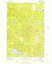
USGS Historical Quadrangle in GeoPDF.
Core Research Center, core F170, from well operated by USBMRaw Properties from download, web scrape, MapServer, and Macrostrat API{"Lib Num": "F170", "API Num": null, "Operator": "USBM", "Well Name": "CEBOLLA CREEK #3", "Field": "IRON HILLS", "State": "CO", "County": "GUNNISON", "Type": "SLABBED", "Photos": "T", "Thin Sec": "F", "Analysis": "T", "Latitude": "38.2588", "Longitude": "-107.050192", "coordinates_geohash": "9wgcshb3ttpr", "Source": "DERIVED FROM MAPPED LOCATION", "Security Flag": "NO SPECIAL RESTRICTIONS", "crc_collection_name": "core", "sb_parent_id": "4f4e49dae4b07f02db5e0486", "intervals": [{"Formation": "UNKNOWN", "Age": "UNKNOWN", "Min Depth": "31", "Max Depth": "102"}, {"Formation": "UNKNOWN",...
This data set contains imagery from the National Agriculture Imagery Program (NAIP). The NAIP program is administered by USDA FSA and has been established to support two main FSA strategic goals centered on agricultural production. These are increase stewardship of America's natural resources while enhancing the environment, and to ensure commodities are procured and distributed effectively and efficiently to increase food security. The NAIP program supports these goals by acquiring and providing ortho imagery that has been collected during the agricultural growing season in the U.S. The NAIP ortho imagery is tailored to meet FSA requirements and is a fundamental tool used to support FSA farm and conservation programs....
This data set contains imagery from the National Agriculture Imagery Program (NAIP). The NAIP program is administered by USDA FSA and has been established to support two main FSA strategic goals centered on agricultural production. These are increase stewardship of America's natural resources while enhancing the environment, and to ensure commodities are procured and distributed effectively and efficiently to increase food security. The NAIP program supports these goals by acquiring and providing ortho imagery that has been collected during the agricultural growing season in the U.S. The NAIP ortho imagery is tailored to meet FSA requirements and is a fundamental tool used to support FSA farm and conservation programs....
Chemical weathering of silicate minerals has long been known as a sink for atmospheric CO2, and feedbacks between weathering and climate are believed to affect global climate. While warmer temperatures are believed to increase rates of weathering, weathering in cool climates can be accelerated by increased mineral exposure due to mechanical weathering by ice. In this study, chemical weathering of silicate minerals is investigated in a small temperate watershed. The Jamieson Creek watershed is covered by mature coniferous forest and receives high annual precipitation (4000 mm), mostly in the form of rainfall, and is underlain by quartz diorite bedrock and glacial till. Analysis of pore water concentration gradients...
Categories: Publication;
Types: Citation;
Tags: Diorite,
Glacial till,
Silicates,
chemical weathering
Core Research Center, cutting BZ00438, from well operated by SHORELINE PETRaw Properties from download, web scrape, MapServer, and Macrostrat API{"Lib Num": "BZ00438", "API Num": "2509560003", "Operator": "SHORELINE PET", "Well Name": "1 GOVT", "Field": "WILDCAT STILLWATER", "State": "MT", "County": "STILLWATER", "Thin Sec": "F", "Analysis": "F", "Latitude": "45.5101853592", "Longitude": "-109.859732782", "coordinates_geohash": "c81fuhfs49my", "Source": "FROM STATE RECORDS", "Min": "0", "Max": "5980", "Security Flag": null, "crc_collection_name": "cutting", "sb_parent_id": "4f4e49d8e4b07f02db5df2d2", "intervals": [{"Formation": null, "Age": null, "Min Depth": null, "Max Depth": null}], "crcwc_url": "https://my.usgs.gov/crcwc/cutting/report/729",...
Categories: Physical Item;
Tags: Cretaceous,
Livingston Group,
Livingston Group, volcanic rocks of Sliderock Mountain,
andesite,
breccia,
This data set contains imagery from the National Agriculture Imagery Program (NAIP). The NAIP program is administered by USDA FSA and has been established to support two main FSA strategic goals centered on agricultural production. These are increase stewardship of America's natural resources while enhancing the environment, and to ensure commodities are procured and distributed effectively and efficiently to increase food security. The NAIP program supports these goals by acquiring and providing ortho imagery that has been collected during the agricultural growing season in the U.S. The NAIP ortho imagery is tailored to meet FSA requirements and is a fundamental tool used to support FSA farm and conservation programs....
The geodatabase for the Charlotte 1 degree × 2 degrees quadrangle by Goldsmith and others (1988) was compiled in the Geologic Map Schema (GeMS). The geologic map extends across four lithotectonic belts of the Piedmont from the Coastal Plain and Wadesboro Triassic basin on the east to the Blue Ridge belt in the vicinity of the Grandfather Mountain window on the west. The Wadesboro Triassic basin contains arkosic sandstone, siltstone and conglomerate unconformably overlain by small inliers of late Cretaceous Coastal Plain sediment of the Middendorf Formation (?). The Blue Ridge, Inner Piedmont, Kings Mountain, Charlotte, and Carolina Slate belts consist of different Mesoproterozoic to Late Paleozoic metamorphosed...
Core Research Center, cutting BZ02194, from well operated by FREEMONTRaw Properties from download, web scrape, MapServer, and Macrostrat API{"Lib Num": "BZ02194", "API Num": "2510107417", "Operator": "FREEMONT", "Well Name": "1 JENSEN", "Field": "WEST BUTTE SHALLOW GAS", "State": "MT", "County": "TOOLE", "Thin Sec": "F", "Analysis": "F", "Latitude": "48.9421436", "Longitude": "-111.5034882", "coordinates_geohash": "c88wqttsskv4", "Source": "FROM STATE RECORDS", "Min": "240", "Max": "2250", "Security Flag": null, "crc_collection_name": "cutting", "sb_parent_id": "4f4e49d8e4b07f02db5df2d2", "intervals": [{"Formation": null, "Age": null, "Min Depth": null, "Max Depth": null}], "crcwc_url": "https://my.usgs.gov/crcwc/cutting/report/2598",...
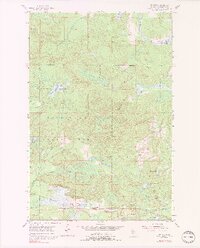
USGS Historical Quadrangle in GeoPDF.
The 1:100,000-scale geologic map database of the South Boston 30' × 60' quadrangle, Virginia and North Carolina, provides geologic information for the Piedmont along the I-85 and U.S. Route 58 corridors and in the Roanoke River watershed, which includes the John H. Kerr Reservoir and Lake Gaston. The Raleigh terrane (located on the eastern side of the map) contains Neoproterozoic to early Paleozoic(?) polydeformed, amphibolite-facies gneisses and schists. The Carolina slate belt of the Carolina terrane (located in the central part of the map) contains Neoproterozoic metavolcanic and metasedimentary rocks at greenschist facies. Although locally complicated, the slate-belt structure mapped across the South Boston...
Core Research Center, cutting HH00966, from well operated by UNION OIL OF CALRaw Properties from download, web scrape, MapServer, and Macrostrat API{"Lib Num": "HH00966", "API Num": "2504921013", "Operator": "UNION OIL OF CAL", "Well Name": "1-133- FEDERAL", "Field": "WILDCAT LEWIS & CLARK", "State": "MT", "County": "LEWIS AND CLARK", "Thin Sec": "F", "Analysis": "F", "Latitude": "46.9464593", "Longitude": "-112.28091", "coordinates_geohash": "c825hfrdcnm3", "Source": "FROM STATE RECORDS", "Min": "7000", "Max": "17880", "Security Flag": null, "crc_collection_name": "cutting", "sb_parent_id": "4f4e49d8e4b07f02db5df2d2", "intervals": [{"Formation": null, "Age": null, "Min Depth": null, "Max Depth": null}], "crcwc_url":...
Categories: Physical Item;
Tags: Late Proterozoic-Middle Proterozoic,
Purcell sills,
diorite,
gabbro
|

|
