Filters: Tags: dod (X)
15 results (36ms)|
Filters
Date Range
Types Contacts
Tag Types Tag Schemes
|

This map layer consists of federally owned or administered lands of the United States, Puerto Rico, and the U.S. Virgin Islands. For the most part, only areas of 320 acres or more are included; some smaller areas deemed to be important or significant are also included. There may be private inholdings within the boundaries of Federal lands in this map layer. Some established Federal lands which are larger than 320 acres are not included in this map layer, because their boundaries were not available from the owning or administering agency.

Description and data downloaded from DRECP Website: http://www.drecp.org/meetings/2012-07-25-26_workshop/background/Department_of_Defense_Materials/This information and data is provided in support of the Desert Renewable Energy Conservation Plan. Attachment 1 provides a Department of Defense (DoD) comprehensive matrix detailing potential military operational constraints by Development Focus Area. Attachment 2 provides associated conflict maps by renewable energy technology. Regarding the color coding:·        The red areas represent locations where there is a high likelihood of unacceptable risk to national security, and then technology identified might impact military operations, testing and training.Â...

Wood Thrush (Midwest) results from Midwest MAPS stations
This is a dynamic service of the Surface Management Agency (SMA) Geographic Information System (GIS) dataset. The service depicts Federal land for the United States and classifies this land by its active Federal surface managing agency below the scale scheme level 14 (~1:36K) for efficiency. The SMA feature class currently covers all of the BLM Western State Offices including Alaska. The SMA data contained in this dataset are extracted from Federal land status records. The official Federal land status records of the appropriate surface land managing agency should be consulted concerning ownership details including interest in the federal subsurface mineral estate. The GIS data contained in this dataset depict the...

Description and data downloaded from DRECP Website: http://www.drecp.org/meetings/2012-07-25-26_workshop/background/Department_of_Defense_Materials/This information and data is provided in support of the Desert Renewable Energy Conservation Plan. Attachment 1 provides a Department of Defense (DoD) comprehensive matrix detailing potential military operational constraints by Development Focus Area. Attachment 2 provides associated conflict maps by renewable energy technology. Regarding the color coding:·        The red areas represent locations where there is a high likelihood of unacceptable risk to national security, and then technology identified might impact military operations, testing and training.Â...
Description and data downloaded from DRECP Website: http://www.drecp.org/meetings/2012-07-25-26_workshop/background/Department_of_Defense_Materials/This information and data is provided in support of the Desert Renewable Energy Conservation Plan. Attachment 1 provides a Department of Defense (DoD) comprehensive matrix detailing potential military operational constraints by Development Focus Area. Attachment 2 provides associated conflict maps by renewable energy technology. Regarding the color coding:·        The red areas represent locations where there is a high likelihood of unacceptable risk to national security, and then technology identified might impact military operations, testing and training.Â...

Description and data downloaded from DRECP Website: http://www.drecp.org/meetings/2012-07-25-26_workshop/background/Department_of_Defense_Materials/This information and data is provided in support of the Desert Renewable Energy Conservation Plan. Attachment 1 provides a Department of Defense (DoD) comprehensive matrix detailing potential military operational constraints by Development Focus Area. Attachment 2 provides associated conflict maps by renewable energy technology. Regarding the color coding:·        The red areas represent locations where there is a high likelihood of unacceptable risk to national security, and then technology identified might impact military operations, testing and training.Â...

Description and data downloaded from DRECP Website: http://www.drecp.org/meetings/2012-07-25-26_workshop/background/Department_of_Defense_Materials/This information and data is provided in support of the Desert Renewable Energy Conservation Plan. Attachment 1 provides a Department of Defense (DoD) comprehensive matrix detailing potential military operational constraints by Development Focus Area. Attachment 2 provides associated conflict maps by renewable energy technology. Regarding the color coding:·        The red areas represent locations where there is a high likelihood of unacceptable risk to national security, and then technology identified might impact military operations, testing and training.Â...

Description and data downloaded from DRECP Website: http://www.drecp.org/meetings/2012-07-25-26_workshop/background/Department_of_Defense_Materials/This information and data is provided in support of the Desert Renewable Energy Conservation Plan. Attachment 1 provides a Department of Defense (DoD) comprehensive matrix detailing potential military operational constraints by Development Focus Area. Attachment 2 provides associated conflict maps by renewable energy technology. Regarding the color coding:·        The red areas represent locations where there is a high likelihood of unacceptable risk to national security, and then technology identified might impact military operations, testing and training.Â...

Description and data downloaded from DRECP Website: http://www.drecp.org/meetings/2012-07-25-26_workshop/background/Department_of_Defense_Materials/This information and data is provided in support of the Desert Renewable Energy Conservation Plan. Attachment 1 provides a Department of Defense (DoD) comprehensive matrix detailing potential military operational constraints by Development Focus Area. Attachment 2 provides associated conflict maps by renewable energy technology. Regarding the color coding:·        The red areas represent locations where there is a high likelihood of unacceptable risk to national security, and then technology identified might impact military operations, testing and training.Â...

Description and data downloaded from DRECP Website: http://www.drecp.org/meetings/2012-07-25-26_workshop/background/Department_of_Defense_Materials/This information and data is provided in support of the Desert Renewable Energy Conservation Plan. Attachment 1 provides a Department of Defense (DoD) comprehensive matrix detailing potential military operational constraints by Development Focus Area. Attachment 2 provides associated conflict maps by renewable energy technology. Regarding the color coding:·        The red areas represent locations where there is a high likelihood of unacceptable risk to national security, and then technology identified might impact military operations, testing and training.Â...
This map layer consists of federally owned or administered lands of the United States, Puerto Rico, and the U.S. Virgin Islands. For the most part, only areas of 320 acres or more are included; some smaller areas deemed to be important or significant are also included. There may be private inholdings within the boundaries of Federal lands in this map layer. Some established Federal lands which are larger than 320 acres are not included in this map layer, because their boundaries were not available from the owning or administering agency.
This service is a subset of the Surface Management Agency (SMA) Geographic Information System (GIS) dataset. The service depicts the SMA land for the United States not including Private or Unknown lands. The Cached service is available to the ArcGIS.com tiling scheme level 14 (~1:36K). The SMA feature class currently covers all of the BLM Western State Offices including Alaska. The SMA data contained in this dataset are extracted from Federal land status records. The official Federal land status records of the appropriate surface land managing agency should be consulted concerning ownership details including interest in the federal subsurface mineral estate. The GIS data contained in this dataset depict the surface...
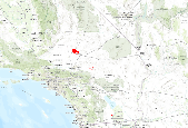
Department of Defense and Department of Energy Land Use within the ecoregion. These data are provided by Bureau of Land Management (BLM) "as is" and may contain errors or omissions. The User assumes the entire risk associated with its use of these data and bears all responsibility in determining whether these data are fit for the User's intended use. These data may not have the accuracy, resolution, completeness, timeliness, or other characteristics appropriate for applications that potential users of the data may contemplate. The User is encouraged to carefully consider the content of the metadata file associated with these data. The BLM should be cited as the data source in any products derived from these data.

Description and data downloaded from DRECP Website: http://www.drecp.org/meetings/2012-07-25-26_workshop/background/Department_of_Defense_Materials/This information and data is provided in support of the Desert Renewable Energy Conservation Plan. Attachment 1 provides a Department of Defense (DoD) comprehensive matrix detailing potential military operational constraints by Development Focus Area. Attachment 2 provides associated conflict maps by renewable energy technology. Regarding the color coding:·        The red areas represent locations where there is a high likelihood of unacceptable risk to national security, and then technology identified might impact military operations, testing and training.Â...
|

|
