Filters: Tags: energy (X)
1,727 results (67ms)|
Filters
Date Range
Extensions Types Contacts
Categories Tag Types
|
The United States decided to develop a nuclear power industry in part to justify the continued development of its nuclear weapons program. One result of this decision was the repression of solar energy technology. This paper examines the technical, economical, and political factors which have affected the use of solar energy tech- nology in the United States. I look at how solar and nuclear technologies have devel- oped in the light of competing theories about autonomous and dependent tech- nology. I also outline a strategy for the development of solar photovoltaic technology as an alternative to nuclear power plants.
We have developed a state-scale version of the MARKAL energy optimization model, commonly used to model energy policy at the US national scale and internationally. We apply the model to address state-scale impacts of a renewable electricity standard (RES) and a carbon tax in one southeastern state, Georgia. Biomass is the lowest cost option for large-scale renewable generation in Georgia; we find that electricity can be generated from biomass co-firing at existing coal plants for a marginal cost above baseline of 0.2-2.2 cents/kWh and from dedicated biomass facilities for 3.0-5.5 cents/kWh above baseline. We evaluate the cost and amount of renewable electricity that would be produced in-state and the amount of out-of-state...
Energy subsidies are widespread around the world but they vary greatly in importance and type of fuel and country. The fossil fuel consumption rate is growing every year and in about 50 years we will have depleted most of our fossil fuel reserves, so it is necessary to find alternative sources of energy before that happens. However, the only solution to this challenge is through investment on energy conservation programmes and renewable energy source. In line with this challenge and confusion on fund appropriate for energy. This paper is aimed at examining the effect of energy subsidy on energy conservation and renewable energy in developing countries. The study intends to quantify and analysis a case study of Trinidad...
Categories: Publication;
Types: Citation;
Tags: Conservation,
Consumption,
Energy,
Subsidy,
Sustainability
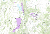
This dataset depicts renewable geothermal resources identified by the Utah Renewable Energy Zone (UREZ) task force.
Wind power forecasting is becoming an important tool in electricity markets as the amount of wind power rapidly increases. However, the use of wind power forecasting in market operations and among market participants is still at an early stage. We discuss the current use of wind power forecasting in U.S. ISO/RTO markets, and give recommendations for how to make efficient use of the information in state-of-the-art wind power forecasts.
Categories: Publication;
Types: Citation;
Tags: Wind power,
changing,
comparison,
energy,
implementation,
As wind power development continues at a rapid pace in the United States, there is increasing interest in its economic impacts. Because good wind resources are typically far from electrical loads, wind power plants are often built in rural areas. The economic impacts that arise from building and operating a power plant can be significant but are often not considered by public utility commission processes. Although these impacts vary from state to state because of the differences in wind resource and state infrastructure, economic development from new wind provides important impacts from necessary power system expansion and should play a more prominent role in decision-making processes. This paper uses the National...
This paper estimates the extra costs of drilling for oil and gas on federal land as compared to private land in the Wyoming Checkerboard. The Checkerboard is a center of U.S. oil and gas activity in which square-mile sections of property alternate between federal and private ownership as originally established by the Pacific Railway Acts of 1862 and 1864. This land ownership pattern is used as an experimental control that may be used to identify differences in drilling cost on federal and private land. Estimates presented suggest that average drilling costs per well are about $200,000 higher on federal property than on private property. This difference is attributed to more stringent enforcement of environmental...
Categories: Publication;
Types: Citation;
Tags: Electricity,
deployment,
energy,
large-scale,
limitations,
Policymakers and managers in the U.S. energy sector will face complex multidimensional challenges as they confront potential supply shortfalls, infrastructure constraints, and environmental limitations in the years ahead. Using a technique known as scenario analysis, this paper investigates key energy issues and decisions that could improve or reduce the ability of the United States to deal with the uncertainties that may challenge the U.S. economy during the next fifty years. Four scenarios have been developed representing a diverse range of future worlds to explore the driving forces and critical uncertainties that may shape U.S. energy markets and the economy for the next fifty years. Each scenario has been quantified...
Developing an energy policy from a collection of programs is made more complicated because there is no single value that can be used as a best estimate of the contribution of a single policy, despite the ability to estimate the impact Of the complete suite. In this paper we illustrate the problem and use cooperative game theory to show one way to estimate individual effects of a policy goal in the context of collective estimates. Using an economic equilibrium model, we illustrate the behavior of four policies, namely, a gasoline tax, CAFE standards, a carbon tax, and drilling the Arctic National Wildlife Reserve, through their Shapley value contributions in measuring the impact of each in the context of a suite...
Categories: Publication;
Types: Citation;
Tags: Air,
comparison,
energy,
environmental,
terrestrial,
Ecological and economic systems are open systems that require energy to change the thermodynamic states of materials from naturally occurring to more valued forms. These changes are accompanied by information flows and changes in the order of systems and their surroundings. In this paper, thermodynamics is used to assess these system changes and relate them to the knowledge present in a system. Particular emphasis is given to (1) the fundamental relationships among material, energy and information flows, and changes in order and knowledge, (2) the role of equilibrium and non-equilibrium thermodynamics in assessing system change, (3) the increasing role of material and energy flows through economic systems, and (4)...
These raster data represent the results of a case study in Arizona on how vertebrate richness metrics can be used with existing state and federal guidance in wind and solar energy facility siting. Each of the four geodatabases (see Cross References) contain eight native terrestrial wildlife group models in Arizona: 1) all vertebrates, 2) amphibians, 3) reptiles, 4) birds, 5) mammals, 6) bats, 7) raptors and 8) long-distant migratory birds. An XML workbook is included that lists all terrestrial native vertebrate species in Arizona which cross-walks these species to the name of the National Gap Analysis Project species distribution model.
This data set includes the relative production scenarios for eight (8) grass species based on linear models from Epstein, et al. (1998). We selected two indicator species for each community: shortgrass prairie: blue grama (Bouteloua gracilis; BOGR) and buffalo grass (Bouteloua dactyloides; BODA); mixedgrass prairie: sideoats grama (Bouteloua curtipendula; BOCU) and little bluestem (Schizachyrium scoparium; SCSC); tallgrass prairie: big bluestem (Andropogon gerardii; ANGE) and Indiangrass (Sorghastrum nutans; SONU); and semiarid grasslands: black grama (Bouteloua eriopoda; BOER) and tobosagrass (Pleuraphis mutica; PLMU). Soil texture (percent by weight) came from the Earth Systems Science Center (2008) which provided...
The Utah Well & Spring database contains data of 2981 wells, springs, and miscellaneous sites such as collector wells and mines. It is available from the Utah Geological Survey at:http://geology.utah.gov/emp/geothermal/wells_springs_database.htmThe Conservation Biology Institute selected geothermal wells from this database. The geothermal well layer was then used in further analysis and modeling.
Average January temperature for 2016-2030 projected by the GFDL2.1 GCM run 1 driven by the A2 emissions scenario at 1/8 degree latitude-longitude (approximately 12km by 12 km) over the Wyoming Basin and surrounding areas. BCSD data downloaded the "Downscaled CMIP3 and CMIP5 Climate and Hydrology Projections," archived at http://gdo-dcp.ucllnl.org/downscaled_cmip_projections/.
Developed Landcover used in Biome Analysis. Developed landcover reclassified from Landfire EVT.
Average annual temperature for 2016-2030 projected by the ECHAM5 GCM run 1 driven by the A2 emissions scenario at 1/8 degree latitude-longitude (approximately 12km by 12 km) from a 36-member GCM ensemble (16 GCMs with multiple runs of some GCMs, all the runs available for BCSD) over the Wyoming Basin and surrounding areas. BCSD data downloaded from the "Downscaled CMIP3 and CMIP5 Climate and Hydrology Projections" archived at http://gdo-dcp.ucllnl.org/downscaled_cmip_projections/.
To assess fire frequency and extent, the perimeters of fires overlapping the distribution of pygmy rabbit. Fire occurrences since 1980 were compiled from fire occurrence data sets from U.S. Forest Service, U.S. Geological Survey (GeoMAC), National Park Service, Monitoring Trends in Burn Severity, Western Fires Database, Bureau of Land Management, and National Fire and Aviation Management Web applications.
Low risk of SAD equals current aspen distribution coincident with the 2030 SAD climatic envelope classes, Potential aspen climatic envelope expansion, or No expected change in aspen climatic envelope.
Compliation of Wyoming Bureau of Land Management field office data of Russian olive and tamarisk occurrence expressed as point locations.
Geospatial data sets for the Wyoming Basin REA spatially quantify explicit cumulative effects and provide a broad-scale ecological context for decision-making and planning that cannot be determined using local-level information.
|

|
