Filters: Tags: eros (X)
19 results (58ms)|
Filters
Date Range
Types
Contacts
Categories Tag Types
|
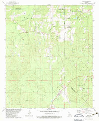
USGS Historical Quadrangle in GeoPDF.
These data can be used in a geographic information system (GIS) for any number of purposes such as assessing wildlife habitat, water quality, pesticide runoff, land use change, etc. The State data sets are provided with a 300 meter buffer beyond the State border to faciliate combining the State files into larger regions. The user must have a firm understanding of how the datasets were compiled and the resulting limitations of these data. The National Land Cover Dataset was compiled from Landsat satellite TM imagery (circa 1992) with a spatial resolution of 30 meters and supplemented by various ancillary data (where available). The analysis and interpretation of the satellite imagery was conducted using very large,...
This data set contains imagery from the National Agriculture Imagery Program (NAIP). The NAIP program is administered by USDA FSA and has been established to support two main FSA strategic goals centered on agricultural production. These are, increase stewardship of America's natural resources while enhancing the environment, and to ensure commodities are procured and distributed effectively and efficiently to increase food security. The NAIP program supports these goals by acquiring and providing ortho imagery that has been collected during the agricultural growing season in the U.S. The NAIP ortho imagery is tailored to meet FSA requirements and is a fundamental tool used to support FSA farm and conservation programs....
This data set contains imagery from the National Agriculture Imagery Program (NAIP). The NAIP program is administered by USDA FSA and has been established to support two main FSA strategic goals centered on agricultural production. These are, increase stewardship of America's natural resources while enhancing the environment, and to ensure commodities are procured and distributed effectively and efficiently to increase food security. The NAIP program supports these goals by acquiring and providing ortho imagery that has been collected during the agricultural growing season in the U.S. The NAIP ortho imagery is tailored to meet FSA requirements and is a fundamental tool used to support FSA farm and conservation programs....
U.S. Geological Survey (USGS) and Virginia Institute of Marine Science (VIMS) scientists conducted field data collection efforts during June 11th - 16th, 2020, using a combination of remote sensing technologies to map riverbank and wetland topography and vegetation at five sites in the Chesapeake Bay Region of Virginia. The five sites are located along the James, Severn, and York Rivers. The work was initiated to evaluate the utility of different remote sensing technologies in mapping river bluff and wetland topography and vegetation for change detection and sediment transport modeling. The USGS team collected Global Navigation Satellite System (GNSS), total station, and ground based lidar (GBL) data while the VIMS...
U.S Geological Survey (USGS) scientists conducted field data collection efforts during the time periods of September 5 - 14, 2018, November 8 - 13, 2018, June 18 - 27, 2019, July 30 - August 8, 2019, September 13 - 19, 2019, and June 23 - July 1, 2020. These efforts used a combination of technologies to map twenty burned and twelve unburned forest plots at eleven sites in the Black Hills of South Dakota. Twelve burned plots at five sites and nine unburned plots at two sites are located within Custer State Park, five burned plots are located on private land adjacent to Custer State Park at two sites, three unburned plots are located at one site near Hazelrodt Picnic Area in the Black Hills National Forest, and three...
This data set contains imagery from the National Agriculture Imagery Program (NAIP). The NAIP program is administered by USDA FSA and has been established to support two main FSA strategic goals centered on agricultural production. These are, increase stewardship of America's natural resources while enhancing the environment, and to ensure commodities are procured and distributed effectively and efficiently to increase food security. The NAIP program supports these goals by acquiring and providing ortho imagery that has been collected during the agricultural growing season in the U.S. The NAIP ortho imagery is tailored to meet FSA requirements and is a fundamental tool used to support FSA farm and conservation programs....
The National Elevation Dataset (NED) is the primary elevation data product produced and distributed by the USGS. The NED provides the best available public domain raster elevation data of the conterminous United States, Alaska, Hawaii, and territorial islands in a seamless format. The NED is derived from diverse source data, processed to a common coordinate system and unit of vertical measure. All NED data are distributed in geographic coordinates in units of decimal degrees, and in conformance with the North American Datum of 1983 (NAD 83). All elevation values are provided in units of meters, and are referenced to the North American Vertical Datum of 1988 (NAVD 88) over the conterminous United States. The vertical...
Types: Downloadable;
Tags: 1-DEGREE DEM,
2-ARC-SECOND DEM,
7.5-MINUTE DEM,
BLM,
Bureau of Land Management,
The U.S. Geological Survey has developed a National Elevation Dataset (NED). The NED is a seamless mosaic of best-available elevation data. The 7.5-minute elevation data for the conterminous United States are the primary initial source data. In addition to the availability of complete 7.5-minute data, efficient processing methods were developed to filter production artifacts in the existing data, convert to the NAD83 datum, edge-match, and fill slivers of missing data at quadrangle seams. One of the effects of the NED processing steps is a much-improved base of elevation data for calculating slope and hydrologic derivatives. The specifications for the NED 1 arc second and 1/3 arc second data are: Geographic coordinate...
Types: Downloadable;
Tags: 1-DEGREE DEM,
2-ARC-SECOND DEM,
7.5-MINUTE DEM,
BLM,
Bureau of Land Management,
The Chesapeake Bay Estuary is the largest estuary in the United States and provides habitats for diverse wildlife and aquatic species, protects communities against flooding, reduces pollution to waterways, and supports local economies through commercial and recreational activities. In the Spring of 2018, the U.S. Geological Survey (USGS) Coastal National Elevation Database (CoNED) Applications Project at the USGS Earth Resources Observation and Science (EROS) Center and the Virginia Institute of Marine Science (VIMS) Center for Coastal Resources Management (CCRM) initiated collaborative work. The goal of this collaboration is to evaluate how various remote sensing technologies can be employed to model estuarine...
The National Elevation Dataset (NED) is the primary elevation data product produced and distributed by the USGS. The NED provides the best available public domain raster elevation data of the conterminous United States, Alaska, Hawaii, and territorial islands in a seamless format. The NED is derived from diverse source data, processed to a common coordinate system and unit of vertical measure. All NED data are distributed in geographic coordinates in units of decimal degrees, and in conformance with the North American Datum of 1983 (NAD 83). All elevation values are provided in units of meters, and are referenced to the North American Vertical Datum of 1988 (NAVD 88) over the conterminous United States. The vertical...
Types: Downloadable;
Tags: 1-DEGREE DEM,
2-ARC-SECOND DEM,
7.5-MINUTE DEM,
BLM,
Bureau of Land Management,
Indiana Dunes National Lakeshore, Indiana. This color infrared aerial photograph shows a major part of the lakeshore. Vegetation is shown in red. Page 13 (top), U.S. Geological Survey Circular 1085.
Categories: Image;
Types: Map Service,
OGC WFS Layer,
OGC WMS Layer,
OGC WMS Service;
Tags: EROS,
Indiana Dunes National Lakeshore,
National parks,
Photo color print,
Photographers,
U.S. Geological Survey (USGS) scientists conducted field data collection efforts during the time periods of April 25 - 26, 2017, October 24 - 28, 2017, and July 25 - 26, 2018, using a combination of surveying technologies to map and validate topography, structures, and other features at five sites in central South Dakota. The five sites included the Chamberlain Explorers Athletic Complex and the Chamberlain High School in Chamberlain, SD, Hanson Lake State Public Shooting Area near Corsica, SD, the State Capital Grounds in Pierre, SD, and Platte Creek State Recreation Area near Platte, SD. The work was initiated as an effort to evaluate airborne Geiger-Mode and Single Photon light detection and ranging (lidar) data...
U.S. Geological Survey (USGS) and University of Hawaii - Mānoa (UH) scientists conducted field data collection efforts from August 19th - 27th, 2019 at Pu‘uhonua O Hōnaunau National Historical Park on the Big Island of Hawaii. The data collection efforts utilized a combination of remote sensing technologies to map the topography, critical infrastructure, and most importantly, the cultural assets of Pu‘uhonua O Hōnaunau National Historical Park. The USGS and UH team collected Global Navigation Satellite System (GNSS), total station, and ground based lidar (GBL) data, along with utilizing Uncrewed Aerial Systems (UAS) to collect imagery and UAS lidar to map these features. This data release contains shapefiles of...
USGS EROS Cheatgrass study using data from 2010 within the NGB Ecoregion. These data are provided by Bureau of Land Management (BLM) "as is" and may contain errors or omissions. The User assumes the entire risk associated with its use of these data and bears all responsibility in determining whether these data are fit for the User's intended use. These data may not have the accuracy, resolution, completeness, timeliness, or other characteristics appropriate for applications that potential users of the data may contemplate. The User is encouraged to carefully consider the content of the metadata file associated with these data. The BLM should be cited as the data source in any products derived from these data.
U.S. Geological Survey (USGS) scientists conducted field data collection efforts during the weeks of September 9-13 and November 18-22, 2019, using a combination of technologies to map and validate topography, vegetation, and features in two areas of interest (AOI's) in north central Colorado. The western AOI included land managed by the Bureau of Land Management and the U.S. Forest Service. The eastern AOI included agricultural and urban areas. The work was initiated as an effort to test and evaluate the Leica Geosystems CountryMapper sensor. The CountryMapper is a hybrid sensor that collects imagery and light detection and ranging (lidar) data simultaneously. The CountryMapper has the potential to collect data...
This data set contains imagery from the National Agriculture Imagery Program (NAIP). The NAIP program is administered by USDA FSA and has been established to support two main FSA strategic goals centered on agricultural production. These are, increase stewardship of America's natural resources while enhancing the environment, and to ensure commodities are procured and distributed effectively and efficiently to increase food security. The NAIP program supports these goals by acquiring and providing ortho imagery that has been collected during the agricultural growing season in the U.S. The NAIP ortho imagery is tailored to meet FSA requirements and is a fundamental tool used to support FSA farm and conservation programs....
U.S. Geological Survey (USGS) and Virginia Institute of Marine Science (VIMS) scientists conducted field data collection efforts during the week of April 8th - 14th, 2018, using a combination of remote sensing technologies to map riverbank and wetland topography and vegetation at four sites in the Chesapeake Bay Region of Virginia. The four sites are located along the James, Severn, and York Rivers. The work was initiated to evaluate the utility of different remote sensing technologies in mapping river bluff and wetland topography and vegetation for change detection and sediment transport modeling. The USGS team collected Global Navigation Satellite System (GNSS), total station, and ground based lidar (GBL) data...
The U.S. Geological Survey has developed a National Elevation Dataset (NED). The NED is a seamless mosaic of best-available elevation data. The 7.5-minute elevation data for the conterminous United States are the primary initial source data. In addition to the availability of complete 7.5-minute data, efficient processing methods were developed to filter production artifacts in the existing data, convert to the NAD83 datum, edge-match, and fill slivers of missing data at quadrangle seams. One of the effects of the NED processing steps is a much-improved base of elevation data for calculating slope and hydrologic derivatives. The specifications for the NED 1 arc second and 1/3 arc second data are: Geographic coordinate...
Types: Downloadable;
Tags: 1-DEGREE DEM,
2-ARC-SECOND DEM,
7.5-MINUTE DEM,
BLM,
Bureau of Land Management,
|

|
