Filters: Tags: forest (X)
1,189 results (14ms)|
Filters
Date Range
Extensions Types Contacts
Categories Tag Types
|
The Forest and Rangeland Ecosystem Science Center 's mission is to provide scientific understanding and the technology needed to support sound management and conservation of our nation's natural resources, with emphasis on western ecosystems. The scientists from FRESC capitalize on their diverse expertise to answer critically important scientific questions shaped by the equally diverse environments of the western United States. FRESC scientists collaborate with each other and with partners to provide rigorous, objective, and timely information and guidance for the management and conservation of biological systems in the West and worldwide. Research activities are concentrated in Washington, Oregon, Idaho, Nevada,...
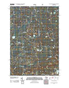
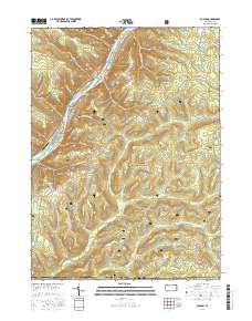
Layered GeoPDF 7.5 Minute Quadrangle Map. Layers of geospatial data include orthoimagery, roads, grids, geographic names, elevation contours, hydrography, and other selected map features.
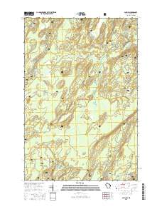
Layered GeoPDF 7.5 Minute Quadrangle Map. Layers of geospatial data include orthoimagery, roads, grids, geographic names, elevation contours, hydrography, and other selected map features.
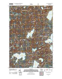
Layered GeoPDF 7.5 Minute Quadrangle Map. Layers of geospatial data include orthoimagery, roads, grids, geographic names, elevation contours, hydrography, and other selected map features.
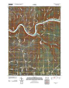
Layered GeoPDF 7.5 Minute Quadrangle Map. Layers of geospatial data include orthoimagery, roads, grids, geographic names, elevation contours, hydrography, and other selected map features.
Layered geospatial PDF Map. Layers of geospatial data include orthoimagery, roads, grids, geographic names, elevation contours, hydrography, and other selected map features.
2010 USDA Forest Service, Rocky Mountain Region Aerial Detection Survey Data. This data depicts the occurrence and location of forest insect, disease, and other biotic and abiotic causes of tree mortality and tree damage. Aerial survey data is collected by observing areas of tree damage or tree mortality from an aircraft and manually recording the information onto a map. Due to the nature of aerial surveys, this data will only provide rough estimates of location, intensity and the resulting trend information for agents detectable from the air. Many of the most destructive diseases are not represented in the data because these agents are not detectable from aerial surveys. The data presented should only be used as...
The potential effect of development on patch size was used as an index of fragmentation. Patch size was quantified for baseline conditions for Greater Sage Grouse. This provides a reference for comparing patch size for relatively undeveloped patches (Terrestrial Development Index scores less than or equal to 1 percent).
This dataset presents current and future change agent models and combined future potential for change (PFC) within the pinyon-juniper woodland system Conservation Element.The pinyon-juniper woodland system extent was determined by querying the LANDFIRE existing vegetation dataset for Pinyon-Juniper Woodland and clipping the data to the ecoregion boundary.This dataset presents current and future change agent models and combined future potential for change (PFC). Potential for change (PFC) was determined by calculating the maximum potential for change among all change agents within each 1 km reporting unit. Current and future landscape intactness (LCM_C_FZ and LCM_N_FZ) are based on measures of landscape development...
Boreal Black Spruce Dwarf Tree Peatland current modeled distribution, and status. These data are provided by Bureau of Land Management (BLM) "as is" and may contain errors or omissions. The User assumes the entire risk associated with its use of these data and bears all responsibility in determining whether these data are fit for the User's intended use. These data may not have the accuracy, resolution, completeness, timeliness, or other characteristics appropriate for applications that potential users of the data may contemplate. The User is encouraged to carefully consider the content of the metadata file associated with these data. The BLM should be cited as the data source in any products derived from these...
Types: Live Data;
Tags: BLM,
Boreal Black Spruce Dwarf Tree Peatland,
Bureau of Land Management,
DOI,
Forest,
Boreal Black or White Spruce Forest current distribution, and landscape condition in a woodland. These data are provided by Bureau of Land Management (BLM) "as is" and may contain errors or omissions. The User assumes the entire risk associated with its use of these data and bears all responsibility in determining whether these data are fit for the User's intended use. These data may not have the accuracy, resolution, completeness, timeliness, or other characteristics appropriate for applications that potential users of the data may contemplate. The User is encouraged to carefully consider the content of the metadata file associated with these data. The BLM should be cited as the data source in any products derived...
Types: Live Data;
Tags: BLM,
Boreal Black Spruce,
Boreal White spruce,
Bureau of Land Management,
DOI,
This dataset presents current and future change agent models and combined future potential for change (PFC) within the montane and subalpine conifer forest Conservation Element.The montane and subalpine conifer forest extent was determined by querying the LANDFIRE existing vegetation dataset for montane and subalpine confer forest and clipping the data to the ecoregion boundary.This dataset presents current and future change agent models and combined future potential for change (PFC). Potential for change (PFC) was determined by calculating the maximum potential for change among all change agents within each 1 km reporting unit. Current and future landscape intactness (LCM_C_FZ and LCM_N_FZ) are based on measures...
Aerial Insect and Disease Detection Survey(ADS) for insect and disease activity in 2005. The ADS data was obtained to be used for BLMs REA Process for the Middle Rockies ecoregion. The original data was combined from USFS regions within the ecoregion then clipped to the Middle Rockies Level III ecoregion plus a buffer that consists of the 5th level Hydrologic Unit Code (HUC) watersheds that intersect the ecoregion.
This dataset contains mountain pine beetle infestations from aerial detection survey and five needle pine distribution. Categorical values were assigned based on proximity of five needle pine affected by mountain pine beetle infestations for the Middle Rockies Ecoregion.Categorical values were assigned based on key ecological attributes table.
Aerial Insect and Disease Detection Survey(ADS) for insect and disease activity in 2003. The ADS data was obtained to be used for BLMs REA Process for the Middle Rockies ecoregion. The original data was combined from USFS regions within the ecoregion then clipped to the Middle Rockies Level III ecoregion plus a buffer that consists of the 5th level Hydrologic Unit Code (HUC) watersheds that intersect the ecoregion.
This data set is comprised of a current status analysis based on input layers of deciduous forests within the Middle Rockies Ecoregion.
For Greater Sage Grouse connectivity we assessed development levels based on the regional Terrestrial Development Index (TDI) map, and then used the resulting output to calculate patch size and structural connectivity metrics. We mapped the structural connectivity of relatively undeveloped areas (TDI less than or equal to 1 percent) at three inter patch distances based on connectivity analysis; local (0.27 km), landscape (2.97 km), and regional (3.78 km) scales. See Chapter 2 Assessment Framework and Appendix of the Wyoming Basin REA Open File Report for additional details.
Aerial Insect and Disease Detection Survey(ADS) for insect and disease activity in 2004. The ADS data was obtained to be used for BLMs REA Process for the Middle Rockies ecoregion. The original data was combined from USFS regions within the ecoregion then clipped to the Middle Rockies Level III ecoregion plus a buffer that consists of the 5th level Hydrologic Unit Code (HUC) watersheds that intersect the ecoregion.
Aerial Insect and Disease Detection Survey(ADS) for insect and disease activity in 2002. The ADS data was obtained to be used for BLMs REA Process for the Middle Rockies ecoregion. The original data was combined from USFS regions within the ecoregion then clipped to the Middle Rockies Level III ecoregion plus a buffer that consists of the 5th level Hydrologic Unit Code (HUC) watersheds that intersect the ecoregion.
This map shows timber harvests within the CYR study region. These data are provided by Bureau of Land Management (BLM) "as is" and may contain errors or omissions. The User assumes the entire risk associated with its use of these data and bears all responsibility in determining whether these data are fit for the User's intended use. These data may not have the accuracy, resolution, completeness, timeliness, or other characteristics appropriate for applications that potential users of the data may contemplate. The User is encouraged to carefully consider the content of the metadata file associated with these data. The BLM should be cited as the data source in any products derived from these data.
|

|
