Filters: Tags: forest (X)
1,188 results (214ms)|
Filters
Date Range
Extensions Types Contacts
Categories Tag Types
|
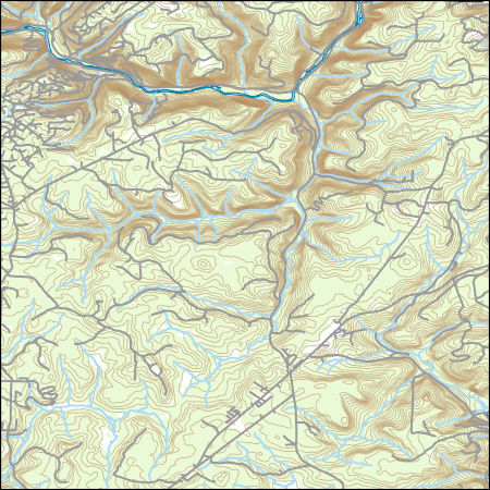
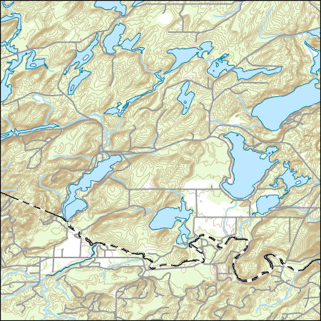
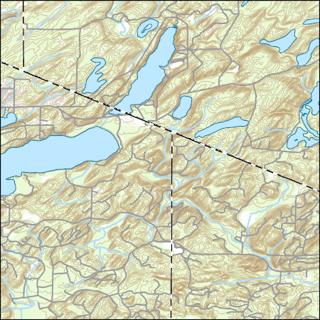
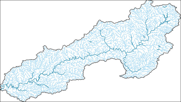
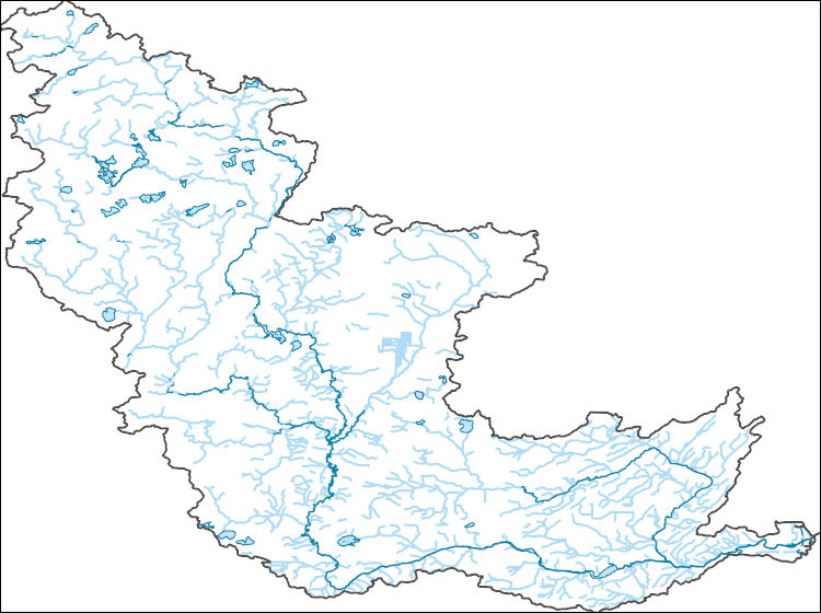
The National Hydrography Dataset (NHD) is a feature-based database that interconnects and uniquely identifies the stream segments or reaches that make up the nation's surface water drainage system. NHD data was originally developed at 1:100,000-scale and exists at that scale for the whole country. This high-resolution NHD, generally developed at 1:24,000/1:12,000 scale, adds detail to the original 1:100,000-scale NHD. (Data for Alaska, Puerto Rico and the Virgin Islands was developed at high-resolution, not 1:100,000 scale.) Local resolution NHD is being developed where partners and data exist. The NHD contains reach codes for networked features, flow direction, names, and centerline representations for areal water...
Layers of geospatial data include contours, boundaries, land cover, hydrography, roads, transportation, geographic names, structures, and other selected map features.
Layers of geospatial data include contours, boundaries, land cover, hydrography, roads, transportation, geographic names, structures, and other selected map features.

This data represents the map extent for current and historical USGS topographic maps for the United States and Territories, including 1 X 2 Degree, 1 X 1 Degree, 30 X 60 Minute, 15 X 15 Minute, 7.5 X 7.5 Minute, and 3.75 X 3.75 Minute. The grid was generated using ESRI ArcInfo GIS software.
This dataset contains all National Forest Inventoried Roadless Areas (IRAs) for the Alaska Region (R10). The IRA data was originally submitted to GSTC by all national forests through their Regional Offices for the Forest Service's Roadless Area Conservation Initiative. The data was consolidated at the GSTC and used in the Draft Environment Impact Statement. Between the draft and final stages of the Environmental Impact Statement, the data was updated by the forests to reflect any corrections to Inventoried Roadless Areas that were based on their existing forest plan. The data was also supplemented to include Special Designated Area information and to include Inventoried Roadless Areas within Special Designated...
Synopsis: Using multi-scale seasonal models, this study explored how broad scale landscape context and local resource heterogeneity influenced local resource selection among threatened forest-dwelling woodland caribou in southern Quebec. Caribou consistently avoided roads, however researchers identified thresholds in road proximity effects. The threshold distance at which caribou avoid roads is 1.25 km for active roads and 0.75 km from derelict roads. Open lichen woodlands were an important cover type for caribou during winter and spring, whereas deciduous forests, wetlands, and even young disturbed stands became important during calving and summer. Landscape cover type and amount explained more variation in habitat...
Categories: Publication;
Types: Citation,
Map Service,
OGC WFS Layer,
OGC WMS Layer,
OGC WMS Service;
Tags: Caribou,
Forest-dwelling woodland cairbou,
Land use configuration,
Landscape context,
Landscape fragmentation,
Layers of geospatial data include contours, boundaries, land cover, hydrography, roads, transportation, geographic names, structures, and other selected map features.
Final Report - Executive Summary: This final project report is prepared to summarize the research project titled “Assessing evapotranspiration rate changes for proposed restoration of the forested uplands of the Desert Landscape Conservation Cooperatives (LCC)” for the Desert LCC of the Bureau of Reclamation as a requirement for closing out the project. This report includes the scope of work, summary of research project, results, and conclusions.Among all of the components of the terrestrial water cycle, evapotranspiration (ET) consumes the largest amount of water. Accurate estimation of ET is very important to understand the influence of ET to the hydrologic response of recharge and runoff processes in the water...
Categories: Data,
Publication;
Types: Citation,
Map Service,
OGC WFS Layer,
OGC WMS Layer,
OGC WMS Service;
Tags: 2012,
ATMOSPHERE,
ATMOSPHERE,
ATMOSPHERIC WATER VAPOR,
ATMOSPHERIC WATER VAPOR,
In the late 1880's and early 1900's the Mississippi River Commission (MRC) conducted an extensive high-resolution survey of the Mississippi River from Cairo, Illinois to Minneapolis, Minnesota. These data were published as a series of 89 survey maps and index. In the 1990's, the Upper Midwest Environmental Sciences Center (UMESC) in conjunction with the US Army Corps of Engineers Upper Mississippi River Restoration- Environmental Management Program -- Long Term Resource Monitoring Program element (LTRMP) for the Upper Mississippi River automated the maps' land cover/use symbology to create a turn of the century/pre-impoundment land cover/use data set. Other data on the maps that were not automated include; elevation...
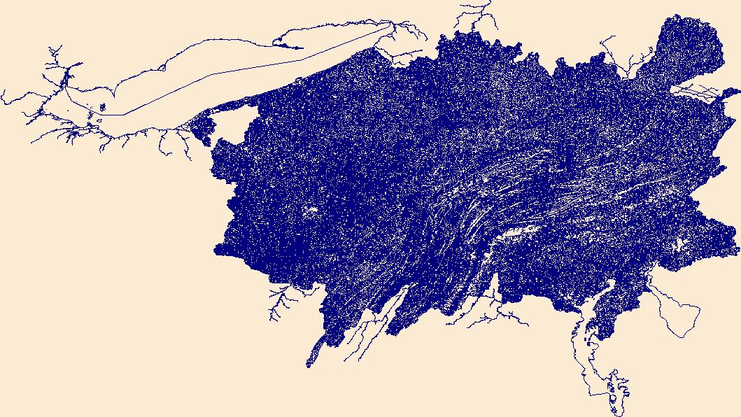
As part of Upper Mississippi River Restoration (UMRR), the U.S. Army Corps of Engineers (USACE) is conducting a study to understand what environmental factors are contributing to the failure of floodplain forests to regenerate. This dataset uses lidar derivatives to identify broken forest canopy along the Mississippi River and Illinois River. A broken forest refers to an area that has a canopy height of greater than or equal to 10 meters. From this layer, forest canopy gaps can be identified by locating areas within the broken forest that have at least a 9.144 meter radius, or a 1-tree gap.
Categories: Data;
Types: Downloadable,
Map Service,
OGC WFS Layer,
OGC WMS Layer,
Shapefile;
Tags: Illinois,
Missouri,
Navigational Pool 24,
canopy gap,
canopy height model,
As part of Upper Mississippi River Restoration (UMRR), the U.S. Army Corps of Engineers (USACE) is conducting a study to understand what environmental factors are contributing to the regeneration of floodplain forest. This dataset uses lidar derivatives to identify forest canopy gaps along select portions of the Mississippi River and Illinois River. USACE will use this dataset to select field sites to collect data in forest canopy gaps. This will also serve as the baseline for long-term forest canopy gap study.
Categories: Data;
Types: Downloadable,
Map Service,
OGC WFS Layer,
OGC WMS Layer,
Shapefile;
Tags: Iowa,
Minnesota,
Navigational Pool 8,
Wisconsin,
canopy gap,
As part of Upper Mississippi River Restoration (UMRR), the U.S. Army Corps of Engineers (USACE) is conducting a study to understand what environmental factors are contributing to the failure of floodplain forests to regenerate. This dataset uses lidar derivatives to identify broken forest canopy along the Mississippi River and Illinois River. A broken forest refers to an area that has a canopy height of greater than or equal to 10 meters. From this layer, forest canopy gaps can be identified by locating areas within the broken forest that have at least a 9.144 meter radius, or a 1-tree gap.
Categories: Data;
Types: Downloadable,
Map Service,
OGC WFS Layer,
OGC WMS Layer,
Shapefile;
Tags: Illinois,
Iowa,
Navigational Pool 13,
Wisconsin,
canopy gap,
In the late 1880's and early 1900's the Mississippi River Commission (MRC) conducted an extensive high-resolution survey of the Mississippi River from Cairo, Illinois to Minneapolis, Minnesota. These data were published as a series of 89 survey maps and index. In the 1990's, the Upper Midwest Environmental Sciences Center (UMESC) in conjunction with the US Army Corps of Engineers Upper Mississippi River Restoration- Environmental Management Program -- Long Term Resource Monitoring Program element (LTRMP) for the Upper Mississippi River automated the maps' land cover/use symbology to create a turn of the century/pre-impoundment land cover/use data set. Other data on the maps that were not automated include; elevation...
In the late 1880's and early 1900's the Mississippi River Commission (MRC) conducted an extensive high-resolution survey of the Mississippi River from Cairo, Illinois to Minneapolis, Minnesota. These data were published as a series of 89 survey maps and index. In the 1990's, the Upper Midwest Environmental Sciences Center (UMESC) in conjunction with the US Army Corps of Engineers Upper Mississippi River Restoration- Environmental Management Program -- Long Term Resource Monitoring Program element (LTRMP) for the Upper Mississippi River automated the maps' land cover/use symbology to create a turn of the century/pre-impoundment land cover/use data set. Other data on the maps that were not automated include; elevation...
In the late 1880's and early 1900's the Mississippi River Commission (MRC) conducted an extensive high-resolution survey of the Mississippi River from Cairo, Illinois to Minneapolis, Minnesota. These data were published as a series of 89 survey maps and index. In the 1990's, the Upper Midwest Environmental Sciences Center (UMESC) in conjunction with the US Army Corps of Engineers Upper Mississippi River Restoration- Environmental Management Program -- Long Term Resource Monitoring Program element (LTRMP) for the Upper Mississippi River automated the maps' land cover/use symbology to create a turn of the century/pre-impoundment land cover/use data set. Other data on the maps that were not automated include; elevation...
USGS Historical Quadrangle in GeoPDF.
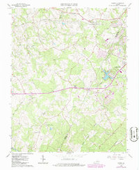
The National Hydrography Dataset (NHD) is a feature-based database that interconnects and uniquely identifies the stream segments or reaches that make up the nation's surface water drainage system. NHD data was originally developed at 1:100,000-scale and exists at that scale for the whole country. This high-resolution NHD, generally developed at 1:24,000/1:12,000 scale, adds detail to the original 1:100,000-scale NHD. (Data for Alaska, Puerto Rico and the Virgin Islands was developed at high-resolution, not 1:100,000 scale.) Local resolution NHD is being developed where partners and data exist. The NHD contains reach codes for networked features, flow direction, names, and centerline representations for areal water...
The National Hydrography Dataset (NHD) is a feature-based database that interconnects and uniquely identifies the stream segments or reaches that make up the nation's surface water drainage system. NHD data was originally developed at 1:100,000-scale and exists at that scale for the whole country. This high-resolution NHD, generally developed at 1:24,000/1:12,000 scale, adds detail to the original 1:100,000-scale NHD. (Data for Alaska, Puerto Rico and the Virgin Islands was developed at high-resolution, not 1:100,000 scale.) Local resolution NHD is being developed where partners and data exist. The NHD contains reach codes for networked features, flow direction, names, and centerline representations for areal water...
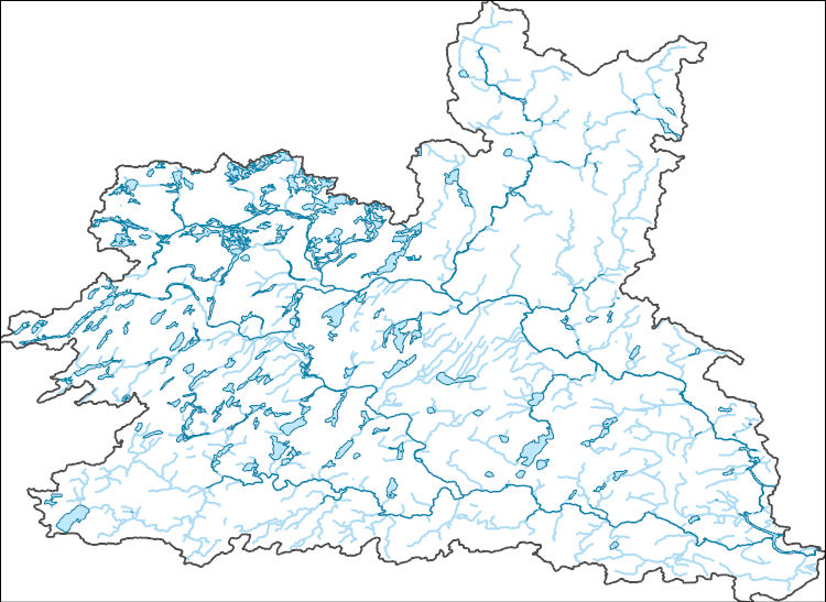
The National Hydrography Dataset (NHD) is a feature-based database that interconnects and uniquely identifies the stream segments or reaches that make up the nation's surface water drainage system. NHD data was originally developed at 1:100,000-scale and exists at that scale for the whole country. This high-resolution NHD, generally developed at 1:24,000/1:12,000 scale, adds detail to the original 1:100,000-scale NHD. (Data for Alaska, Puerto Rico and the Virgin Islands was developed at high-resolution, not 1:100,000 scale.) Local resolution NHD is being developed where partners and data exist. The NHD contains reach codes for networked features, flow direction, names, and centerline representations for areal water...
The National Hydrography Dataset (NHD) is a feature-based database that interconnects and uniquely identifies the stream segments or reaches that make up the nation's surface water drainage system. NHD data was originally developed at 1:100,000-scale and exists at that scale for the whole country. This high-resolution NHD, generally developed at 1:24,000/1:12,000 scale, adds detail to the original 1:100,000-scale NHD. (Data for Alaska, Puerto Rico and the Virgin Islands was developed at high-resolution, not 1:100,000 scale.) Local resolution NHD is being developed where partners and data exist. The NHD contains reach codes for networked features, flow direction, names, and centerline representations for areal water...
|

|
