Filters: Tags: geyser (X)
10 results (41ms)|
Filters
Date Range
Extensions Types
Contacts
Categories Tag Types Tag Schemes |
This data set contains imagery from the National Agriculture Imagery Program (NAIP). The NAIP program is administered by USDA FSA and has been established to support two main FSA strategic goals centered on agricultural production. These are, increase stewardship of America's natural resources while enhancing the environment, and to ensure commodities are procured and distributed effectively and efficiently to increase food security. The NAIP program supports these goals by acquiring and providing ortho imagery that has been collected during the agricultural growing season in the U.S. The NAIP ortho imagery is tailored to meet FSA requirements and is a fundamental tool used to support FSA farm and conservation programs....
This data set contains imagery from the National Agriculture Imagery Program (NAIP). The NAIP program is administered by USDA FSA and has been established to support two main FSA strategic goals centered on agricultural production. These are, increase stewardship of America's natural resources while enhancing the environment, and to ensure commodities are procured and distributed effectively and efficiently to increase food security. The NAIP program supports these goals by acquiring and providing ortho imagery that has been collected during the agricultural growing season in the U.S. The NAIP ortho imagery is tailored to meet FSA requirements and is a fundamental tool used to support FSA farm and conservation programs....
This data release contains digital GIS files digitized from 'Geologic map of Lower Geyser Basin, Yellowstone National Park, Wyoming' by L.J.P. Muffler, D.E. White, A.H. Truesdell, and R.O. Fournier, Miscellaneous Investigations Series Map I-1373.
Categories: Data;
Types: ArcGIS Map Package,
ArcGIS REST Map Service,
ArcGIS Service Definition,
Downloadable,
Map Service;
Tags: Geyser,
Hot spring,
Hydrothermal Deposits,
Lower Geyser Basin,
Spring,
In the past century, eruptions of Steamboat Geyser in Yellowstone’s Norris Geyser Basin were mainly clustered in three episodes: between 1961 and 1969, between 1982 and 1984, and in a sequence of eruptions that began in 2018 (Reed et al., 2021) and resulted in extensive damage to, and mortality of the surrounding trees. To characterize tree response to geyser activity over time, and the response of geyser activity to climate variability, aerial and ground imagery were analyzed to document changes in tree coverage around the geyser since 1954. Twenty samples of silicified tree remnants were collected from near the geyser vent for radiocarbon (14C) dating to determine if trees grew during periods when the geyser was...
The geysers of Yellowstone National Park, United States, attract millions of visitors each year, and their eruption dynamics have been the subject of extensive research for more than a century. Although many of the fundamental aspects associated with the dynamics of geyser eruptions have been elucidated, the relationship between external forcing (Earth tides, barometric pressure, and precipitation) and geyser eruption intervals (GEIs) remains a matter of ongoing debate. We present new instrumental GEI data and demonstrate, through detailed time-series analysis, that geysers respond to both long-term precipitation trends and to the seasonal hydrologic cycle. Responsiveness to long-term trends is reflected by a negative...
Categories: Publication;
Types: Citation;
Tags: Climate,
Old Faithful,
geyser,
hydrothermal processes
This data set contains imagery from the National Agriculture Imagery Program (NAIP). The NAIP program is administered by USDA FSA and has been established to support two main FSA strategic goals centered on agricultural production. These are, increase stewardship of America's natural resources while enhancing the environment, and to ensure commodities are procured and distributed effectively and efficiently to increase food security. The NAIP program supports these goals by acquiring and providing ortho imagery that has been collected during the agricultural growing season in the U.S. The NAIP ortho imagery is tailored to meet FSA requirements and is a fundamental tool used to support FSA farm and conservation programs....
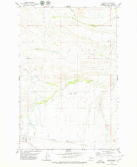
USGS Historical Quadrangle in GeoPDF.
A supset of geysers from an automated inventory of the names and locations of physical and cultural geographic features located throughout the United States.
This data set contains imagery from the National Agriculture Imagery Program (NAIP). The NAIP program is administered by USDA FSA and has been established to support two main FSA strategic goals centered on agricultural production. These are, increase stewardship of America's natural resources while enhancing the environment, and to ensure commodities are procured and distributed effectively and efficiently to increase food security. The NAIP program supports these goals by acquiring and providing ortho imagery that has been collected during the agricultural growing season in the U.S. The NAIP ortho imagery is tailored to meet FSA requirements and is a fundamental tool used to support FSA farm and conservation programs....
Sample Collection: Field work was conducted in November 2018 in the Upper Geyser Basin. Three sinter samples were collected from Castle Geyser and one sinter sample was collected from Solitary Geyser. At Castle Geyser, an effort was made to identify stable surfaces associated with the oldest exposed stratigraphic levels of sinter deposition, in order to target material emplaced during early stages of hydrothermal activity in the basin. At Solitary Geyser, material was collected from an exposure on the upper surface of a sinter deposit. All four sinter sample locations were selected to coincide with collection sites for material dated by radiocarbon methods, to enable a cross-comparison of results. Sinter was collected...
Categories: Data;
Tags: Upper Geyser Basin,
Yellowstone National Park,
Yellowstone National Park,
beryllium,
geyser,
|

|
