Filters: Tags: glc2000 (X)
9 results (12ms)|
Filters
Date Range
Contacts Tag Schemes |

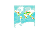
Six geographic datasets were used for the compilation of an inventory of seven major land cover/land use categories at 5 degree resolution. The datasets used are: 1. GLC2000 land cover database at 30 arc-sec (http://www-gvm.jrc.it/glc2000), using regional and global legends; 2. an IFPRI global land cover categorization providing 17 land cover classes at 30 arc-sec. (IFPRI, 2002), based on a reinterpretation of the Global Land Cover Characteristics Database (GLCC ver. 2.0), EROS Data Centre (EDC, 2000); 3. FAOs Global Forest Resources Assessment 2000 (FAO, 2001) at 30 arc-sec. resolution; 4. digital Global Map of Irrigated Areas (GMIA) version 4.0 of (FAO/University of Frankfurt) at 5 by 5 latitude/longitude resolution,...
Tags: forested land,
glc2000

Six geographic datasets were used for the compilation of an inventory of seven major land cover/land use categories at 5 degree resolution. The datasets used are: 1. GLC2000 land cover database at 30 arc-sec (http://www-gvm.jrc.it/glc2000), using regional and global legends; 2. an IFPRI global land cover categorization providing 17 land cover classes at 30 arc-sec. (IFPRI, 2002), based on a reinterpretation of the Global Land Cover Characteristics Database (GLCC ver. 2.0), EROS Data Centre (EDC, 2000); 3. FAOs Global Forest Resources Assessment 2000 (FAO, 2001) at 30 arc-sec. resolution; 4. digital Global Map of Irrigated Areas (GMIA) version 4.0 of (FAO/University of Frankfurt) at 5 by 5 latitude/longitude resolution,...

Six geographic datasets were used for the compilation of an inventory of seven major land cover/land use categories at 5 degree resolution. The datasets used are: 1. GLC2000 land cover database at 30 arc-sec (http://www-gvm.jrc.it/glc2000), using regional and global legends; 2. an IFPRI global land cover categorization providing 17 land cover classes at 30 arc-sec. (IFPRI, 2002), based on a reinterpretation of the Global Land Cover Characteristics Database (GLCC ver. 2.0), EROS Data Centre (EDC, 2000); 3. FAOs Global Forest Resources Assessment 2000 (FAO, 2001) at 30 arc-sec. resolution; 4. digital Global Map of Irrigated Areas (GMIA) version 4.0 of (FAO/University of Frankfurt) at 5 by 5 latitude/longitude resolution,...
Tags: glc2000,
global forest cover

Six geographic datasets were used for the compilation of an inventory of seven major land cover/land use categories at 5 degree resolution. The datasets used are: 1. GLC2000 land cover database at 30 arc-sec (http://www-gvm.jrc.it/glc2000), using regional and global legends; 2. an IFPRI global land cover categorization providing 17 land cover classes at 30 arc-sec. (IFPRI, 2002), based on a reinterpretation of the Global Land Cover Characteristics Database (GLCC ver. 2.0), EROS Data Centre (EDC, 2000); 3. FAOs Global Forest Resources Assessment 2000 (FAO, 2001) at 30 arc-sec. resolution; 4. digital Global Map of Irrigated Areas (GMIA) version 4.0 of (FAO/University of Frankfurt) at 5 by 5 latitude/longitude resolution,...

Six geographic datasets were used for the compilation of an inventory of seven major land cover/land use categories at 5 degree resolution. The datasets used are: 1. GLC2000 land cover database at 30 arc-sec (http://www-gvm.jrc.it/glc2000), using regional and global legends; 2. an IFPRI global land cover categorization providing 17 land cover classes at 30 arc-sec. (IFPRI, 2002), based on a reinterpretation of the Global Land Cover Characteristics Database (GLCC ver. 2.0), EROS Data Centre (EDC, 2000); 3. FAOs Global Forest Resources Assessment 2000 (FAO, 2001) at 30 arc-sec. resolution; 4. digital Global Map of Irrigated Areas (GMIA) version 4.0 of (FAO/University of Frankfurt) at 5 by 5 latitude/longitude resolution,...
Tags: glc2000,
non-vegetated land
Six geographic datasets were used for the compilation of an inventory of seven major land cover/land use categories at 5 degree resolution. The datasets used are: 1. GLC2000 land cover database at 30 arc-sec (http://www-gvm.jrc.it/glc2000), using regional and global legends; 2. an IFPRI global land cover categorization providing 17 land cover classes at 30 arc-sec. (IFPRI, 2002), based on a reinterpretation of the Global Land Cover Characteristics Database (GLCC ver. 2.0), EROS Data Centre (EDC, 2000); 3. FAOs Global Forest Resources Assessment 2000 (FAO, 2001) at 30 arc-sec. resolution; 4. digital Global Map of Irrigated Areas (GMIA) version 4.0 of (FAO/University of Frankfurt) at 5 by 5 latitude/longitude resolution,...

Six geographic datasets were used for the compilation of an inventory of seven major land cover/land use categories at 5 degree resolution. The datasets used are: 1. GLC2000 land cover database at 30 arc-sec (http://www-gvm.jrc.it/glc2000), using regional and global legends; 2. an IFPRI global land cover categorization providing 17 land cover classes at 30 arc-sec. (IFPRI, 2002), based on a reinterpretation of the Global Land Cover Characteristics Database (GLCC ver. 2.0), EROS Data Centre (EDC, 2000); 3. FAOs Global Forest Resources Assessment 2000 (FAO, 2001) at 30 arc-sec. resolution; 4. digital Global Map of Irrigated Areas (GMIA) version 4.0 of (FAO/University of Frankfurt) at 5 by 5 latitude/longitude resolution,...

Six geographic datasets were used for the compilation of an inventory of seven major land cover/land use categories at 5 degree resolution. The datasets used are: 1. GLC2000 land cover database at 30 arc-sec (http://www-gvm.jrc.it/glc2000), using regional and global legends; 2. an IFPRI global land cover categorization providing 17 land cover classes at 30 arc-sec. (IFPRI, 2002), based on a reinterpretation of the Global Land Cover Characteristics Database (GLCC ver. 2.0), EROS Data Centre (EDC, 2000); 3. FAOs Global Forest Resources Assessment 2000 (FAO, 2001) at 30 arc-sec. resolution; 4. digital Global Map of Irrigated Areas (GMIA) version 4.0 of (FAO/University of Frankfurt) at 5 by 5 latitude/longitude resolution,...

Six geographic datasets were used for the compilation of an inventory of seven major land cover/land use categories at 5 degree resolution. The datasets used are: 1. GLC2000 land cover database at 30 arc-sec (http://www-gvm.jrc.it/glc2000), using regional and global legends; 2. an IFPRI global land cover categorization providing 17 land cover classes at 30 arc-sec. (IFPRI, 2002), based on a reinterpretation of the Global Land Cover Characteristics Database (GLCC ver. 2.0), EROS Data Centre (EDC, 2000); 3. FAOs Global Forest Resources Assessment 2000 (FAO, 2001) at 30 arc-sec. resolution; 4. digital Global Map of Irrigated Areas (GMIA) version 4.0 of (FAO/University of Frankfurt) at 5 by 5 latitude/longitude resolution,...
|

|
