Filters: Tags: grouse (X)
21 results (41ms)|
Filters
Date Range
Extensions Types
Contacts
Categories Tag Types Tag Schemes |
Sage-grouse core areas are habitats associated with 1) Montana's highest densities of sage-grouse (25% quartile), based on male counts and/or 2) sage-grouse lek complexes and associated habitat important to sage-grouse distribution. The data are intended for display of sage grouse core areas in Montana. The data are intended for initial resource review and conservation planning. For evaluating or reviewing site specific applications Montana Fish, Wildlife & Parks (FWP) recommends contacting the appropriate FWP Regional office. These are the Montana SageGrouse Core Areas 2010 polygons for Idaho-SW Montana Greater Sage Grouse Subregion. Areas that overlap into Idaho do not apply to Idaho and may represent difference...
Categories: Data;
Types: Downloadable,
Map Service,
OGC WFS Layer,
OGC WMS Layer,
Shapefile;
Tags: Biota,
Grouse,
Montana,
Planning,
Sage-grouse,
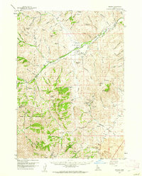
USGS Historical Quadrangle in GeoPDF.
This polygon feature class describes areas used for subsistence harvesting of ptarmigan and grouse in 2011 by surveyed households in Grayling, Alaska. This is a partial representation of areas used for resource harvesting in 2011.
Policymakers and managers in the U.S. energy sector will face complex multidimensional challenges as they confront potential supply shortfalls, infrastructure constraints, and environmental limitations in the years ahead. Using a technique known as scenario analysis, this paper investigates key energy issues and decisions that could improve or reduce the ability of the United States to deal with the uncertainties that may challenge the U.S. economy during the next fifty years. Four scenarios have been developed representing a diverse range of future worlds to explore the driving forces and critical uncertainties that may shape U.S. energy markets and the economy for the next fifty years. Each scenario has been quantified...
Categories: Publication;
Types: Citation;
Tags: Adaptive management,
Wildlife,
grouse,
prairie grouse
This feature class describes areas used for subsistence harvesting of ptarmigan and grouse by surveyed households in Galena, Alaska. This is a partial representation of areas used for resource harvesting.
This data set contains imagery from the National Agriculture Imagery Program (NAIP). The NAIP program is administered by USDA FSA and has been established to support two main FSA strategic goals centered on agricultural production. These are, increase stewardship of America's natural resources while enhancing the environment, and to ensure commodities are procured and distributed effectively and efficiently to increase food security. The NAIP program supports these goals by acquiring and providing ortho imagery that has been collected during the agricultural growing season in the U.S. The NAIP ortho imagery is tailored to meet FSA requirements and is a fundamental tool used to support FSA farm and conservation programs....
With the decline of many lekking species, the need to develop a rigorous population estimation technique is critical for successful conservation and management. We employed mark?resight methods to estimate population size for 2 lekking species: greater sage-grouse (Centrocercus urophasianus) and Gunnison sage-grouse (Centrocercus minimus). We evaluated 2 different estimators: Bowden's estimator and the mixed logit-normal mark?resight model. We captured and marked 75 greater sage-grouse. We counted marked and unmarked birds as they attended 15 known leks. We used 36 and 37 marked Gunnison sage-grouse to estimate population size in 2003 and 2004, respectively. We observed marked and unmarked Gunnison sage-grouse daily...
Categories: Publication;
Types: Citation,
Journal Citation;
Tags: Bowden?s estimator,
Journal of Wildlife Management,
The Wildlife Society,
grouse,
lekking species,
Policymakers and managers in the U.S. energy sector will face complex multidimensional challenges as they confront potential supply shortfalls, infrastructure constraints, and environmental limitations in the years ahead. Using a technique known as scenario analysis, this paper investigates key energy issues and decisions that could improve or reduce the ability of the United States to deal with the uncertainties that may challenge the U.S. economy during the next fifty years. Four scenarios have been developed representing a diverse range of future worlds to explore the driving forces and critical uncertainties that may shape U.S. energy markets and the economy for the next fifty years. Each scenario has been quantified...
Categories: Publication;
Types: Citation;
Tags: Adaptive management,
Wildlife,
grouse,
prairie grouse
This feature class describes areas used for subsistence harvesting of ptarmigan and grouse by surveyed households in Nulato, Alaska. This is a partial representation of areas used for resource harvesting.
This polygon feature class describes areas used for subsistence harvesting of ptarmigan and grouse in 2011 by surveyed households in McGrath, Alaska. This is a partial representation of areas used for resource harvesting in 2011.
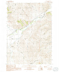
USGS Historical Quadrangle in GeoPDF.
The Greater Sage Grouse Focal Area represents an area of interest pertaining to the greater sage grouse under the U.S. Department of Agriculture (USDA), Natural Resources Conservation Service (NRCS) Working Lands for Wildlife (WLFW) Wildlife Habitat Incentive Program (WHIP).Working Lands for Wildlife is a partnership between NRCS and the U.S. Fish and Wildlife Service (FWS) to use agency technical expertise and financial assistance from the Wildlife Habitat Incentive Program to combat the decline of seven specific wildlife species whose decline can be reversed and will benefit other species with similar habitat needs. The WLFW project will target species whose decline can be reversed and will benefit other species...
Categories: Data,
Publication;
Types: Citation,
Downloadable,
Map Service,
OGC WFS Layer,
OGC WMS Layer,
Shapefile;
Tags: Focal Area,
Greater Sage Grouse,
Grouse,
LCC,
NRCS,
This data set contains imagery from the National Agriculture Imagery Program (NAIP). The NAIP program is administered by USDA FSA and has been established to support two main FSA strategic goals centered on agricultural production. These are, increase stewardship of America's natural resources while enhancing the environment, and to ensure commodities are procured and distributed effectively and efficiently to increase food security. The NAIP program supports these goals by acquiring and providing ortho imagery that has been collected during the agricultural growing season in the U.S. The NAIP ortho imagery is tailored to meet FSA requirements and is a fundamental tool used to support FSA farm and conservation programs....
This data set contains imagery from the National Agriculture Imagery Program (NAIP). The NAIP program is administered by USDA FSA and has been established to support two main FSA strategic goals centered on agricultural production. These are, increase stewardship of America's natural resources while enhancing the environment, and to ensure commodities are procured and distributed effectively and efficiently to increase food security. The NAIP program supports these goals by acquiring and providing ortho imagery that has been collected during the agricultural growing season in the U.S. The NAIP ortho imagery is tailored to meet FSA requirements and is a fundamental tool used to support FSA farm and conservation programs....
These data indicate the modeled density of greater sage grouse for 75% of birds in 26.9% of their overall range. This dataset was provided by BLM with minimal metadata.
This feature class describes areas used for subsistence harvesting of ptarmigan and grouse by surveyed households in Ruby, Alaska. This is a partial representation of areas used for resource harvesting.
This polygon feature class describes areas used for subsistence harvesting of ptarmigan and grouse in 2011 by surveyed households in Anvik, Alaska. This is a partial representation of areas used for resource harvesting in 2011.
This data set contains imagery from the National Agriculture Imagery Program (NAIP). The NAIP program is administered by USDA FSA and has been established to support two main FSA strategic goals centered on agricultural production. These are, increase stewardship of America's natural resources while enhancing the environment, and to ensure commodities are procured and distributed effectively and efficiently to increase food security. The NAIP program supports these goals by acquiring and providing ortho imagery that has been collected during the agricultural growing season in the U.S. The NAIP ortho imagery is tailored to meet FSA requirements and is a fundamental tool used to support FSA farm and conservation programs....
This polgyon feature class describes areas used for subsistence harvesting of ptarmigan and grouse in 2011 by surveyed households in Takotna, Alaska. This is a partial representation of areas used for resource harvesting in 2011.
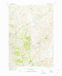
USGS Historical Quadrangle in GeoPDF.
|

|
